


It was another early start on this penultimate day of my Dales High Way walk, and another warm start too. The main feature of the day would be The Howgill Fells, an area I had never walked before but one that I had read about often. I was expecting less rocky terrain than previously but rather, more grass covered high hills with great views. I left Dent hoping that that would be the case.
The early part of this walk was a flat and picturesque stroll along the banks of the River Dee before climbing up onto Longstone Moor, passing Lunds Farm on the way. I though how nice it must be to live in that farmhouse with its views over Dentdale. The cattle and chickens didn’t seem impressed with the views though 🙂 !

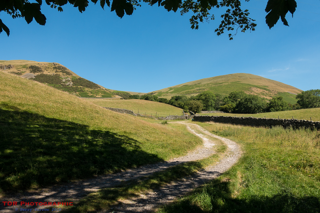
The day was already getting hot despite the early hour as I made my way along a delightful grassy lane. After the climb up out of Dent, this was pleasant and easy walking with lovely views onwards towards Sedbergh.

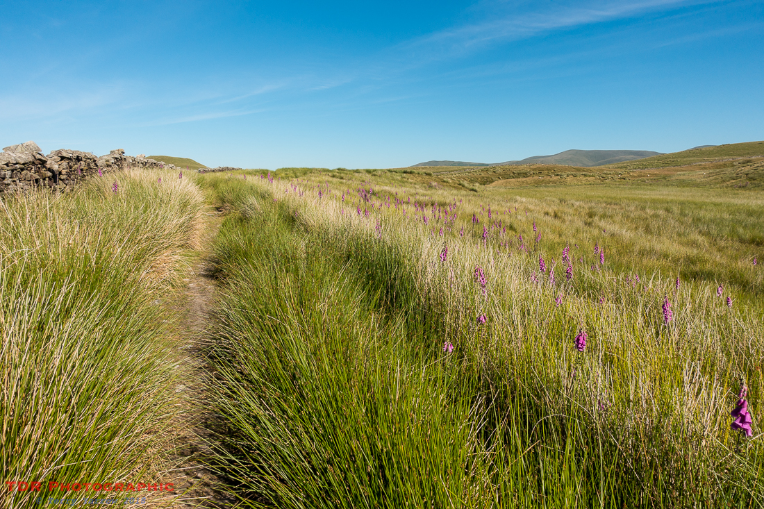
Every day it seems, my way was lined with foxgloves, and this was no exception. They just add a lovely splash of colour, lit up by the sunshine, on fell tops that are usually much more bleak. But then, this was an exceptional year for weather – almost too much so because the heat was energy draining!
It wasn’t long before I had crossed the top of Longstone Fell towards Frostrow when The Howgill Fells came into view. With a highest point of 676 meters, these would provide a stiff climb later but once on top, they would provide an undulating high level ridge walk across the grassy tops.

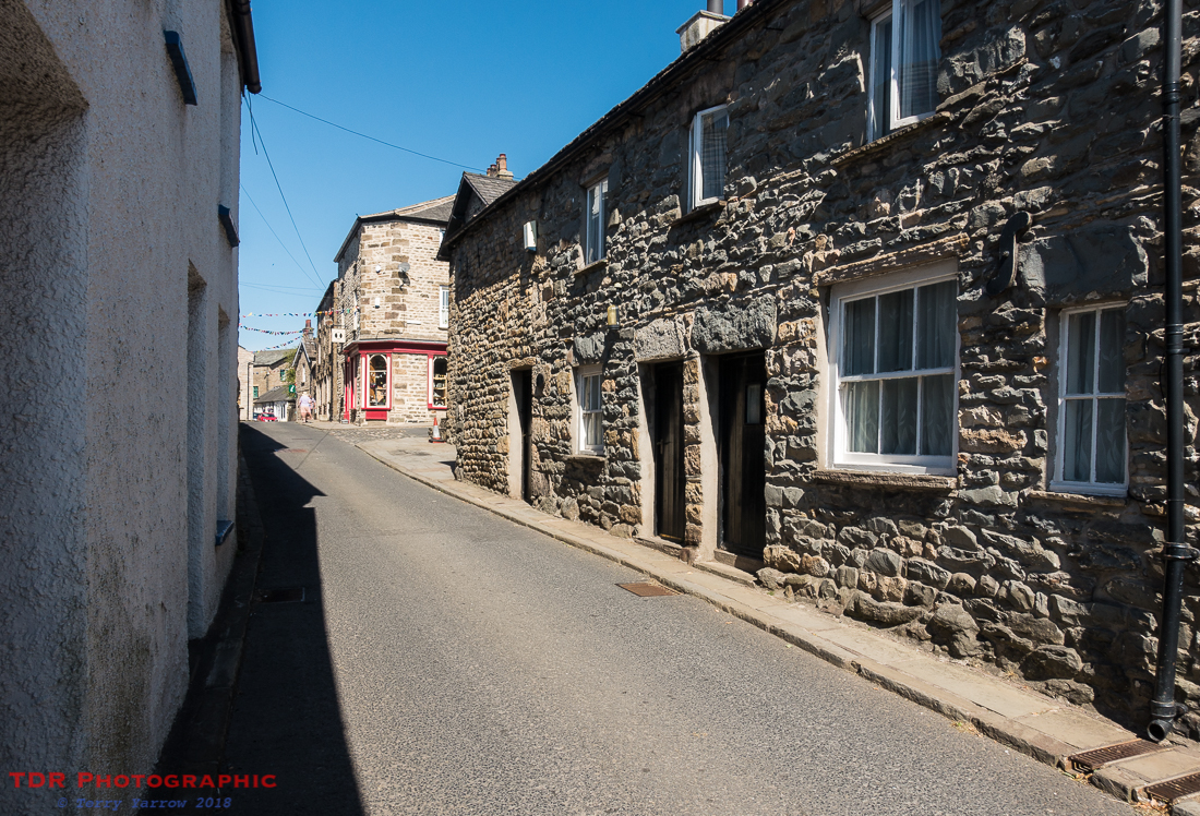
Before that though, I had to pass through the town of Sedbergh which provided me with an opportunity to resupply with food and drink. Being Sunday, not much was open in the town but it was an interesting place to wander round. Like Dent, this is a town where knitting played its part historically with garments often being made for miners but perhaps its main claim to fame is that it is recognised as England’s official book town. Not that any of the book shops were open on this day.
Having explored a little, I left the town to begin my climb up onto the Howgills, stopping part way up for elevenses, and to take opportunity of some shade!
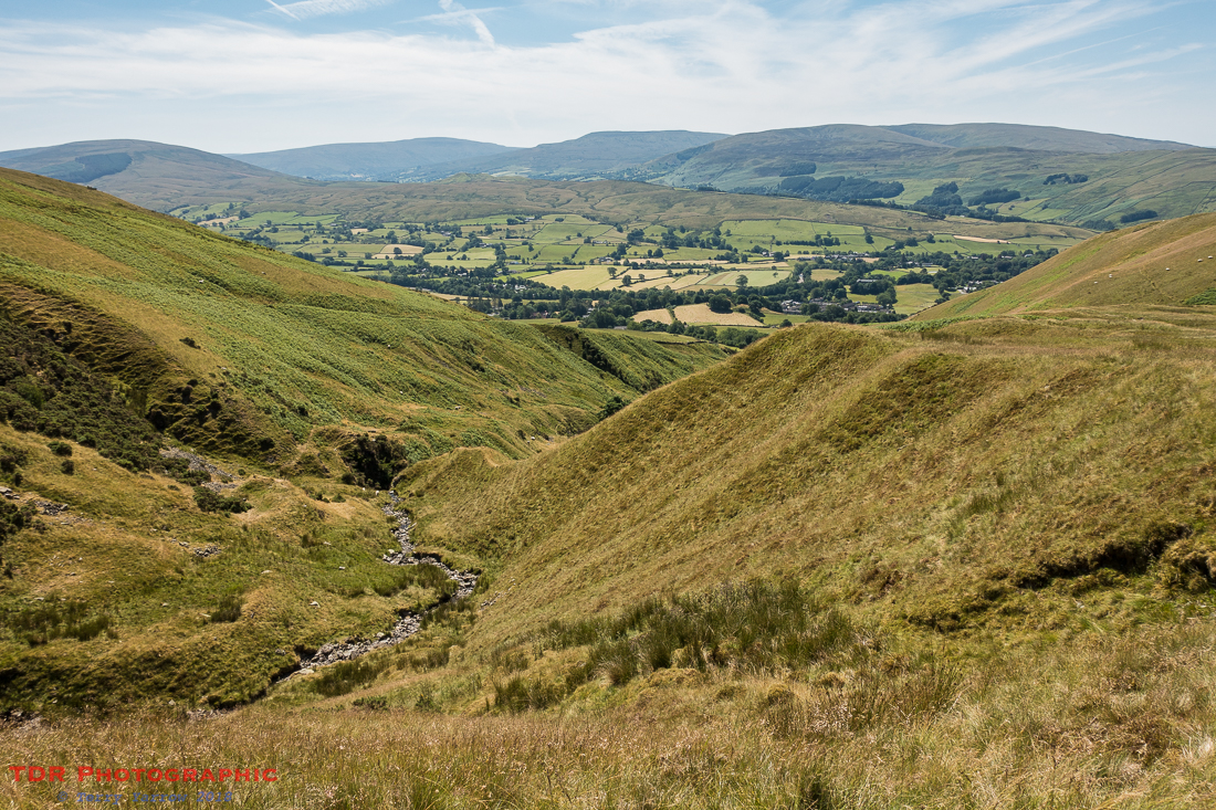
The path upwards followed the Settlebeck Gill and each step seemed to provide a better view. I lost count of the number of times I stopped and just said to myself ‘WOW’ as I looked back across the valley that I had left earlier. It was almost as if all the awesome views that I had experience over the last week just overflowed and in my mind I ran out of superlatives. To be honest, I felt quite emotional with the splendour of it all, and just the fact that I was there and able to enjoy it when my walk almost ended prematurely.

It was just an amazing experience and I drank in the views which again I will say, the camera just does not do justice to at all. On this trip I was using a little pocket sized Sony camera and all the time I kept wishing I had my DSLR with me, but that would have been much too heavy for a backpacking trip.
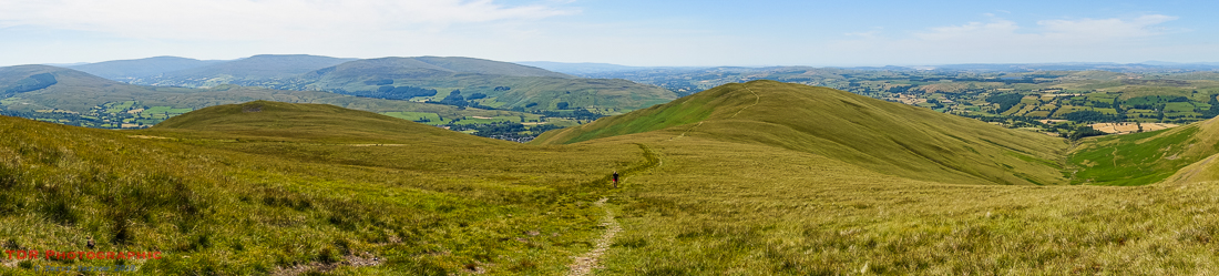
What this little camera does have though is a panorama facility which is of course ideal for these circumstances. It hopefully gives a feel for the expansive views that just took my breath away. If you have never walked, or are not a regular walker, or if you feel you are too old to walk any distance, I would encourage you to get out into the countryside for as long as you are able – you will be amazingly rewarded. It might even change your life!
I took a slight detour at this point because I wanted to climb over the summit of Arant Haw – the main track skirts round this. On the way up, I passed a runner…..well actually he passed me…….three times! When I reached the top, he was there taking a short break before running down again. We chatted for a while and he told me he was running up and down six times carrying no water although he had a store at the bottom so that he could rehydrate before running back up again. At over 600 meters, and in this heat, it was hard enough walking up once……!
Leaving him to continue his training, which I gather was for an event in Snowdonia, I went over the top and dropped down the other side into Rowantree Grains, a col between Arant Haw and Calders. Where this gets its name from I am not sure as there was no sign of any trees anywhere on these fells. Calders, when I reached it, would mark the start of my 6 mile high level ridge walk that would end at West Fell, above Newbiggin on Lune.

As I dropped into the col, a number of mountain bikers passed me and I wondered if they were going to be able to ride the steep climb up to Calders – they didn’t, having to resort to pushing their bikes up the climb.
At the base of the climb sits Rowantree Grains Fold, an old sheep fold that has fallen into disrepair. From here, there were more amazing views, this time down Bram Rigg Beck, with the Cumbrian mountains in the far distance.

I chatted to a couple who were sat gazing at the view over the sheep fold. They had walked up from Sedbergh like myself but they were just enjoying the views before heading back down the way they had come. We passed the time of day before I left them to continue my climb.
Finally I reached the top of Calders and felt immediately refreshed by the breeze that was blowing across the top. It had a welcome cooling effect after the heat of the climb 🙂 ! Before me was the distinctive rounded, grassy hilltops that form The Howgills, and the ridge that would be my walk for the next 6 miles. I wasn’t at my high point yet, that honour goes to The Calf which at 676 meters was some two meters higher than I was at the moment. I could see The Calf in the distance.

I stopped at The Calf for lunch before continuing along the ridge top, passing two high level tarns on the way. Normally tarns are useful for confirming your position but on this ridge, I needed no confirmation 🙂 !

As ridge walks go, this must be one of the best. With great views, just slightly undulating walking, good, often grassy, paths, what could be better. And all the while, there was a lovely cooling breeze!

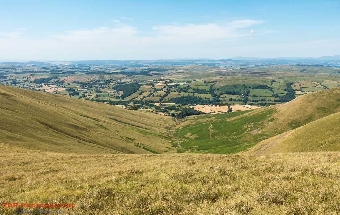
The only downside was that as soon as I reached West Fell, the end of my long ridge walk, and I started my long and slow descent off the fells, the breeze disappeared, the Howgills sheltering me. On a cold day, this shelter might be welcome, but not on this day!
Every cloud has a silver lining though; the cooling breeze might have gone, but the views certainly hadn’t. All the way down from the fells, there were expansive views northwards across the Lune Valley and beyond. Finally, I made it into that valley and onto a narrow lane where I looked back at the Howgills that I had just crossed.

On my way to find my campsite, a farmer passed me on a quad bike with his very young son on the back, clinging tightly to him. The lad was bouncing about as the bike crossed the rough ground, but he seemed to be thoroughly enjoying himself. It made me think that being brought up on a farm must make for a great life.
Newbiggin on Lune came into view but I didn’t stop there but continued onwards to find my camp. I pitched my tent in a nice shady spot so that I could get out of the still hot sun, but in a short time, the sun had moved round and I found myself ‘in the spotlight’ again 🙂 ! At least some of the fierceness had gone out of it though.
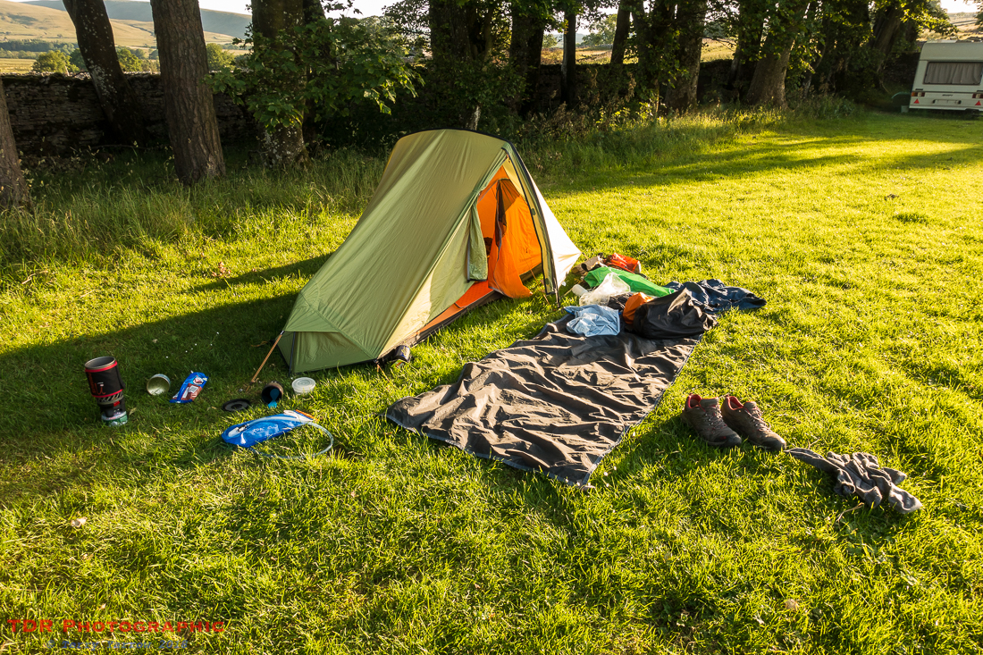
Having showered and changed, I cooked dinner on my little stove……well, I say ‘cooked’ but actually it was just savoury noodles with some bits added in 🙂 ! Camp cooking may not provide a gourmet meal, but there couldn’t possibly be a better restaurant anywhere in the world! Sitting on the ground in the evening sunshine, with a view of the Howgill Fells through the trees was just perfect!

After dinner, I sat outside my tent writing up my journal and reading, just listening to the soft sounds of the evening countryside. It was balmy, peaceful and beautiful with no intrusive noise to interrupt my reverie. And then to cap it all, the sky lit up before me.
What a perfect end to an awesome day, and I am still lost for superlatives that would describe it all!
In case you missed the previous posts in this series, there are links below:
Day 0 – Arrival in Saltaire
Day 1 – Saltaire to Skipton
Day 2 – Skipton to Gordale Scar and more
Day 3 – Gordale Scar to Stainforth plus an afternoon climb to Hull Pot and Pen Y Ghent
Day 4 – Stainforth to Chapel Le Dale
Day 5 – Chapel Le Dale to Dent
Thanks for stopping by.
Until next time,
Your friend
The Dorset Rambler
If you would like to contact me, my email address is terry.yarrow@gmail.com – comments and feedback are always welcomed.
All words and pictures in this blog are the copyright of The Dorset Rambler and may not be reproduced without permission.

Wow! Beautiful photos! And your day’s hike seems like it was beautiful for you internally, as well. 🙂
Thanks Lynette 🙂 Yes, the whole walk was great and these backpacking trips always impact me positively.
I do love being on your metaphorical shoulder for these trips.
I’ve walked the lanes of Suffolk ,quite a bit of the Weald and some of Bodmin, but never the steep north country.Too late now, so your accounts are double pleasurable.Thank you.
Aww, thank you so much for your kind comment. I’m glad that you walk regardless of where it is. Those are beautiful areas too, as is my Dorset.
I love what you wrote about Lund’s farm. This is the farm I grew up on, it forever holds a deep place in my heart.
Ah, that’s awesome Benita, I loved it up there 🙂 Thanks for your comment.