

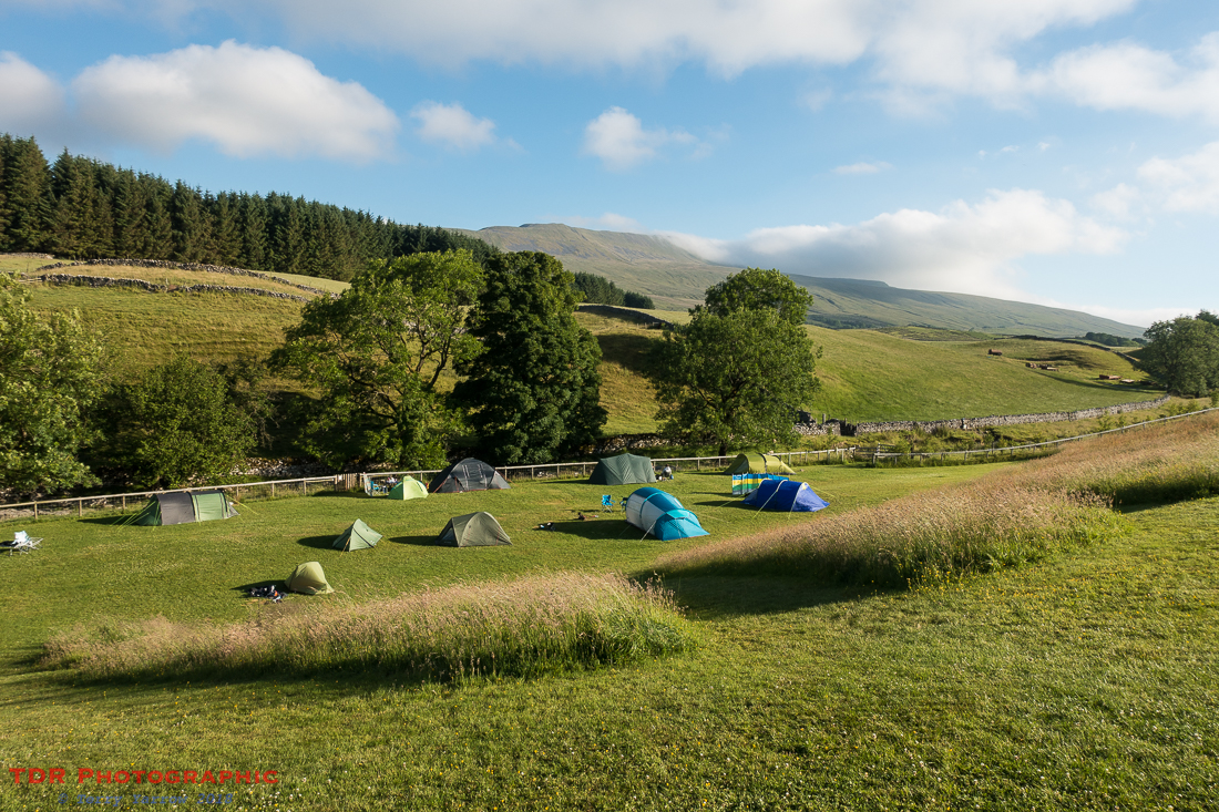
This was a day with a difference! Well, it started differently anyway – you see, they were doing cooked breakfasts at the campsite 🙂 ! Not sure if this was a regular occurrence or if it was because it was one of those ‘charity walk weekends’. Either way, I decided I would make the most of it so at 7am I sat down to my first, and only, cooked breakfast of the trip – and very nice it was too. Oh, and I ordered a packed lunch too – such decadence 🙂 !
I chatted to some lovely people as I tucked into my plate full. They were virtually all people doing the Three Peaks Challenge for charity and I learned that there would be at least a thousand walkers out that day, all of whom would be climbing the three main peaks, including Whernside that was on my route. It doesn’t feature on the official Dales High Way route but I was intending to detour a couple of times on this day so that I could go over the top, and also so that I could take in the Ribblehead Viaduct. It was to be a bit of a self-imposed convoluted route for me.

It was 8am before I was out on the trail and I made my way down the road to the little church of St Leonard’s. This one time chapel of ease dates from the 17th century mainly, although there is evidence in the masonry that parts are at least a 100 years older. Many of the graves in the churchyard are those who lost their lives during the building of the Ribblehead Viaduct and the Blea Moor Tunnel – it is said that up to 200 people died during the construction, either from illness or accident. Sadly, the church wasn’t open this morning but I sat awhile in the churchyard before continuing on my way.

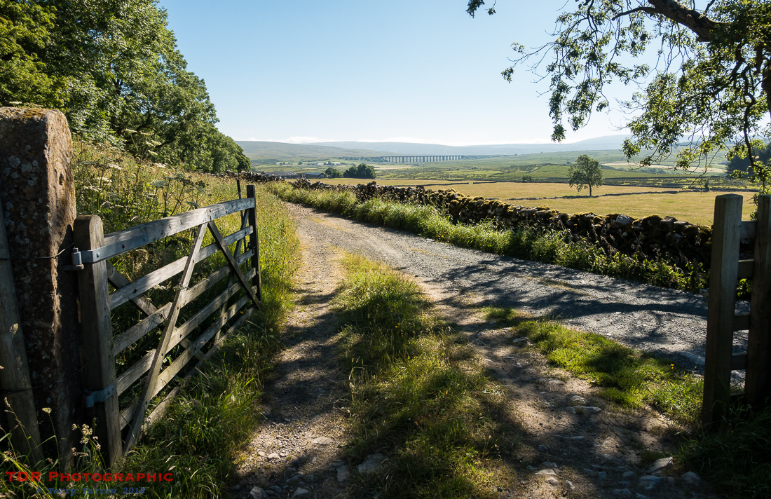
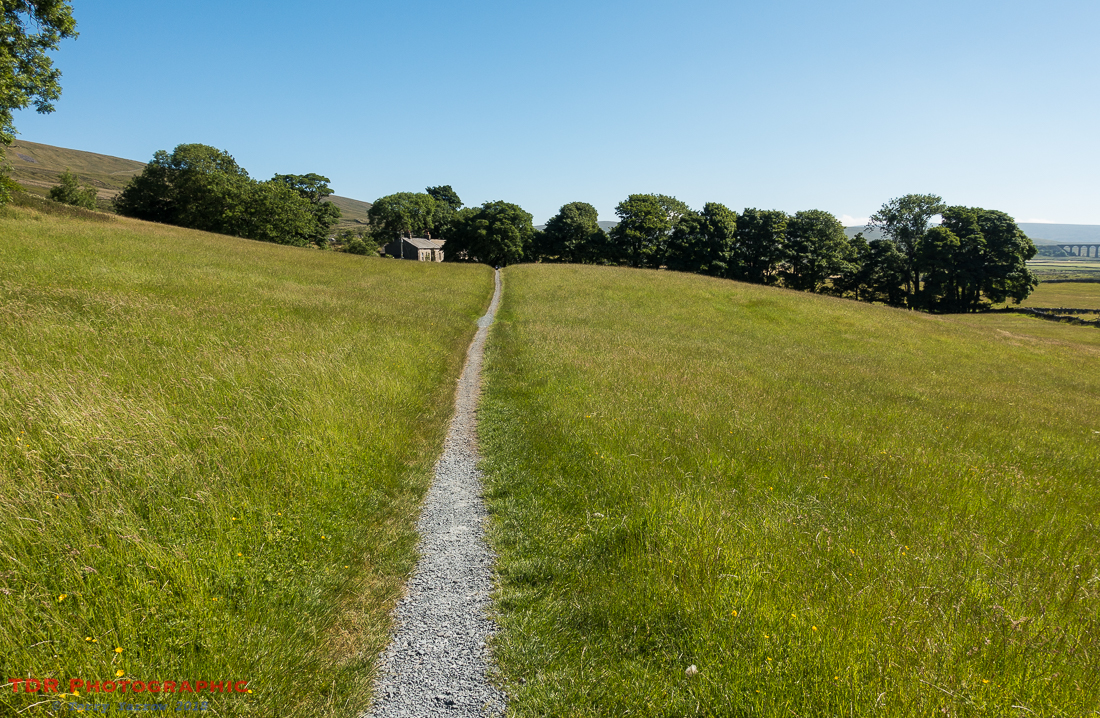
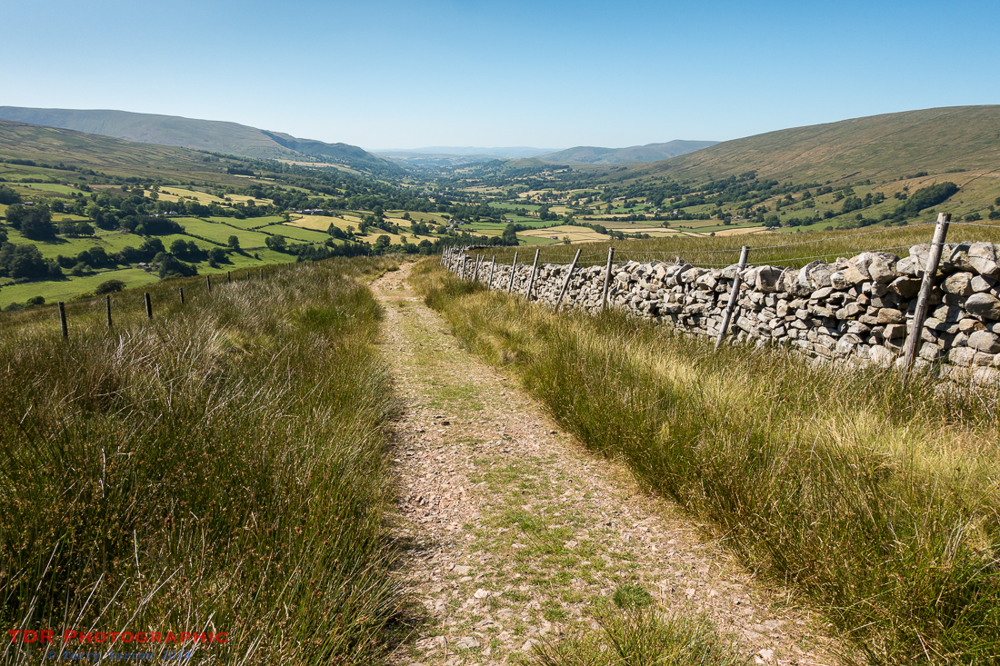
The first part of this walk was an absolute delight, following a rough tarmac lane along a partially wooded valley before opening out onto the open fells below the Whernside ridge.

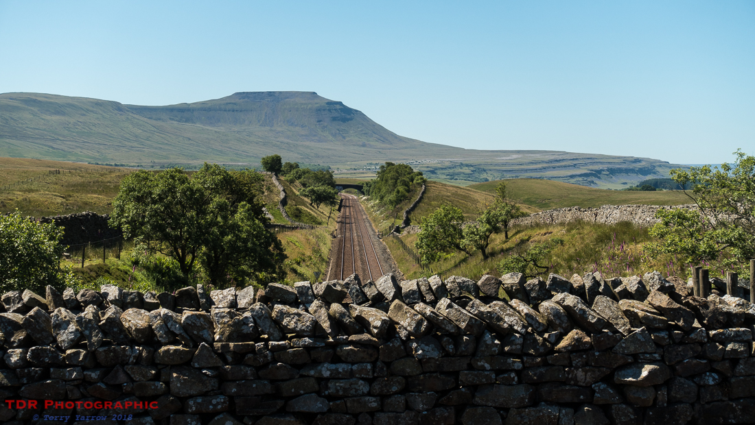
From here, the track skirted along the bottom of the rise, following the line of the ridge. I could have climbed up onto the ridge-top itself at this point and crossed Whernside from the west but I wanted to walk past the viaduct so I stayed in the valley below the hill for the first few miles, choosing to climb to the top from the east side later, even though this meant doubling back on myself somewhat. Along this section, I got my first sight of the famous viaduct in the distance.
These were wonderful miles of easy, level walking on good tracks, with many beautiful meadows to cross along the way.
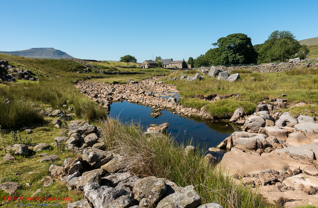
When I reached the end of the ridge, I sat beside the beautiful Winterscales Beck to have my ‘elevenses’ snack. Ingleborough, yesterday’s peak, was in the distance.
Soon after, I reached Blea Moor Sidings and took a detour from my route, following the track south to reach the viaduct. Along this part of the track, I passed the first of hundreds of walkers on the Three Peaks route. It was a strange experience, I think I said ‘good morning’ a thousand times in that short mile or so 🙂 ! In fact, it was a relief when, having visited the viaduct, I retraced my steps back to Blea Moor Sidings and was walking in the same direction as my fellow walkers 🙂 !
The Ribblehead Viaduct is a grade II listed structure that was built in the 19th century to carry the Settle to Carlisle railway across what is some very challenging terrain. It took a workforce of around 2,300 men to build, and was the last main railway in England to be built using manual labour. The workers and their families all lived in temporary shanty towns below the viaduct, and the land that these towns occupied is also now a scheduled ancient monument. In the 1980’s, closure of the line was threatened but this was subsequently overturned thanks to public opinion, and Michael Portillo. I was glad of this because it would be my route home 🙂 ! The line in fact remains popular and is often recognised as the most scenic railway in England.


As I retraced my steps, I looked back to see a train crossing the viaduct – I wished this had been a steam train but today, it was just a modern diesel electric. Preserved steam trains do run this line from time to time but sadly not today!
I joined a train of another sort, a train of people, and walked on, passing first of all the remote Blea Moor Signal Box and then the aqueduct that carries Force Gill over the railway line…….not that there was much force in it today 🙂 !

I followed the line of walkers across the aqueduct and took the path that climbs steadily upwards, curving round 180 degrees ultimately to reach the summit of Whernside. Even half way up, the views were awesome, taking in both PenY Ghent and Ingleborough. Foxgloves lined the path.

This was quite a different summit to my previous days, mainly because it was so busy with walkers coming and going, or taking a break before descending to move on to their next peak. Photography wasn’t easy, simply because there were crowds everywhere.

I sat with the multitudes and ate lunch, and below, I could see my onward route into and through Dentdale. And in the far distance, I could see the next objective, The Howgills – they would provide my challenge, and delight, tomorrow.

I started my descent by partially retracing my steps back the way I had come, before curving off to the north, leaving the crowds behind because they were all going the other way. As much as I love people, it was really great to have the fells completely to myself again, well, apart from the odd sheep. The track followed the north ridge downwards, passing a number of semi-dried-up tarns on the way. This was delightful open fell with just a vague path in places – I was glad of the tarns to aid my route finding……and glad of the dry weather too because normally this would be a boggy path in places.
I did pass two other walkers climbing up to the top that I had recently left, and when I joined the main Dales High Way track again, I passed a young cyclist who was making her way up out of the valley, pushing her bike all the way because the track was much too stony to be able to cycle it. We chatted for a time before I left her to continue her climb whilst I continued my downward route into the valley.
The lower I dropped into the valley, the hotter it became and I began to wish that the lovely wind at the top could have followed me. Here though, it was very sheltered. I tried to make the most of any shade I could find, which wasn’t much, and I was glad when I reached the village of Dent itself. This would be my stopping point for the day.

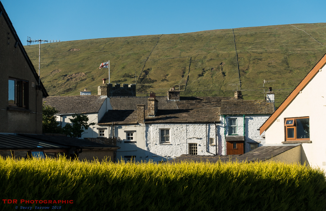
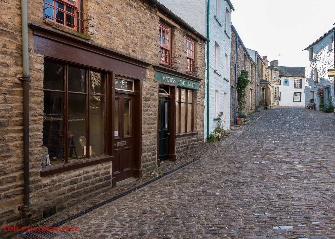

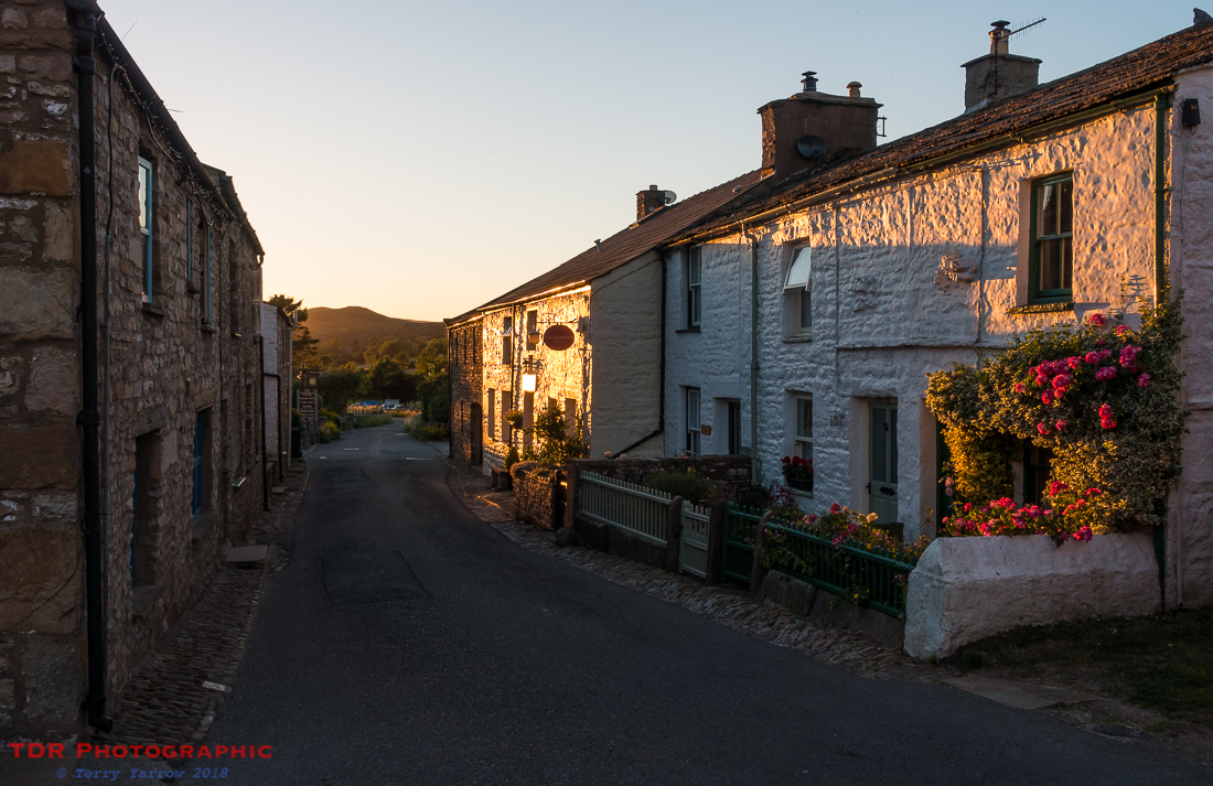
Dent is a delightful village nestling it the long valley of Dentdale – in fact, it is the only village in the valley of Dentdale. With many quaint old cottages, some of them converted from shops and banks, it’s partly cobbled streets, and it’s old pubs, it makes a lovely place for a wander. After pitching my tent and showering, I did just that as the late afternoon sun threw long shadows across the cobbles.
The settlement was originally founded by the Vikings and apparently it was at one time famous for knitters! Back in the 18th century, both men and women used to knit, often gloves and socks, and often whilst walking in the fields. It provided a much needed boost to their income.

It is also famous for being the birthplace of the celebrated geologist, Adam Sedgewick, and there is a memorial to him in the village centre. These days, apart from its heritage centre, it is probably most famous for having the highest mainline railway station in England. Dent Station stands at 1,100 feet above sea level but if you live in Dent and you want to catch the train, you would have a 5 mile walk to reach the station as it is actually not near the village at all!
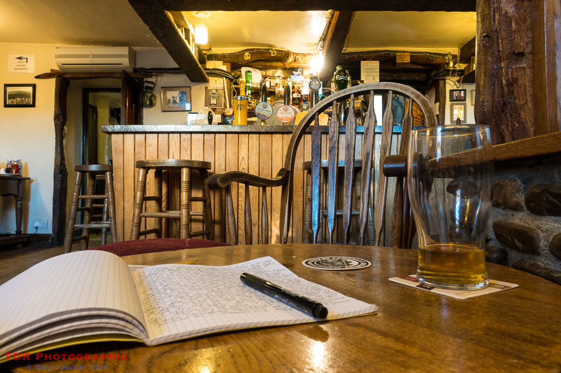
I decided to make use of one of the pubs to refuel and rehydrate – well it saved cooking on my little stove, and it gave me an opportunity to write my journal. I had actually intended to walk to the station but I had already walked 16 miles that day so I contented myself with a stroll through the village back to my campsite. The light from the setting sun was awesome as it slanted across the old buildings and flower beds.
It was a fitting end to a great day when despite a slightly convoluted route, I had been able to do everything I had intended. And I was glad to say that my knees and ankles had behaved themselves for the most part……albeit with a bit of careful nursing! It had been another day of amazing walking and amazing views to reach a delightful village to spend the night.
My onward journey tomorrow would take me up and over the Howgills and would include a long and high level ridge walk. I couldn’t wait!
In case you missed the previous posts in this series, there are links below:
Day 0 – Arrival in Saltaire
Day 1 – Saltaire to Skipton
Day 2 – Skipton to Gordale Scar and more
Day 3 – Gordale Scar to Stainforth plus an afternoon climb to Hull Pot and Pen Y Ghent
Day 4 – Stainforth to Chapel Le Dale
Thanks for stopping by.
Until next time,
Your friend
The Dorset Rambler
If you would like to contact me, my email address is terry.yarrow@gmail.com – comments and feedback are always welcomed.
All words and pictures in this blog are the copyright of The Dorset Rambler and may not be reproduced without permission.

What marvelous series of posts! I am inspired and grateful!
Ah, thanks Michael, you are very kind.
Yes, these posts are quite wonderful. 🙂
Ah, thanks so much Lynette. It’s nice to have your encouragement.