

Day 3 dawned to bright sunshine again. Although I was up just after 5.30, the young walkers had already left for their DOE trek. This was another of those days that I had planned in two parts – during the morning, I planned to walk just over 12 miles to my next campsite at Stainforth, and then in the afternoon, I planned to do a second walk, a circuit that would include Pen Y Ghent, one of the famous three peaks. I had set myself a goal of climbing all three peaks on my trip although they don’t all feature in the official route so the best way for me to do the first was to arrive at Stainforth in time to set up camp and then get into the town itself to pick up the bus to Horton in Ribblesdale to start my second walk. I wasn’t sure if I would make it in time!
Once again, walking in the early morning sunshine was wonderful – this is definitely the best time of the day.

As I made my way towards Malham Cove, I could see a cloud inversion in the distance. This awesome spectacle occurs when the ground temperature is lower than the air temperature above, so that cloud sinks into the valley almost as water would.

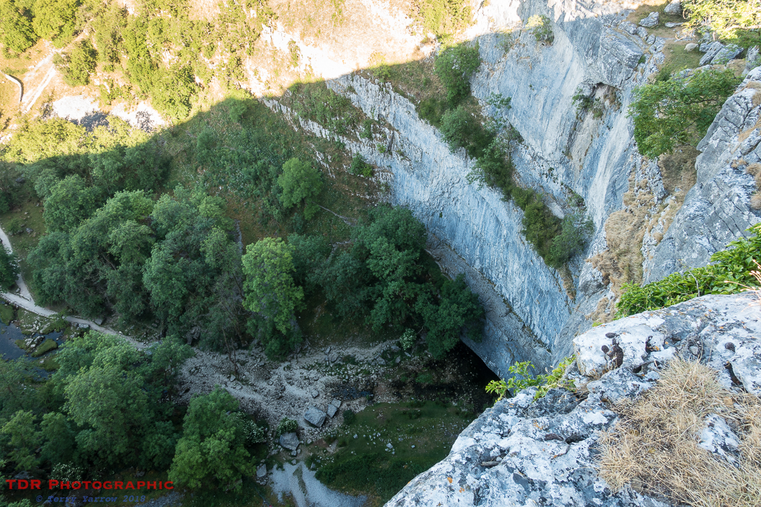
It wasn’t long before I reached Malham Cove, another of those awesome physical features of this limestone layered area. Down south where I am from, a cove is usually found on the coast, but here, there is no sea, just a giant curving and shear cliff above a valley with a stream running through it. It is a spectacular place!
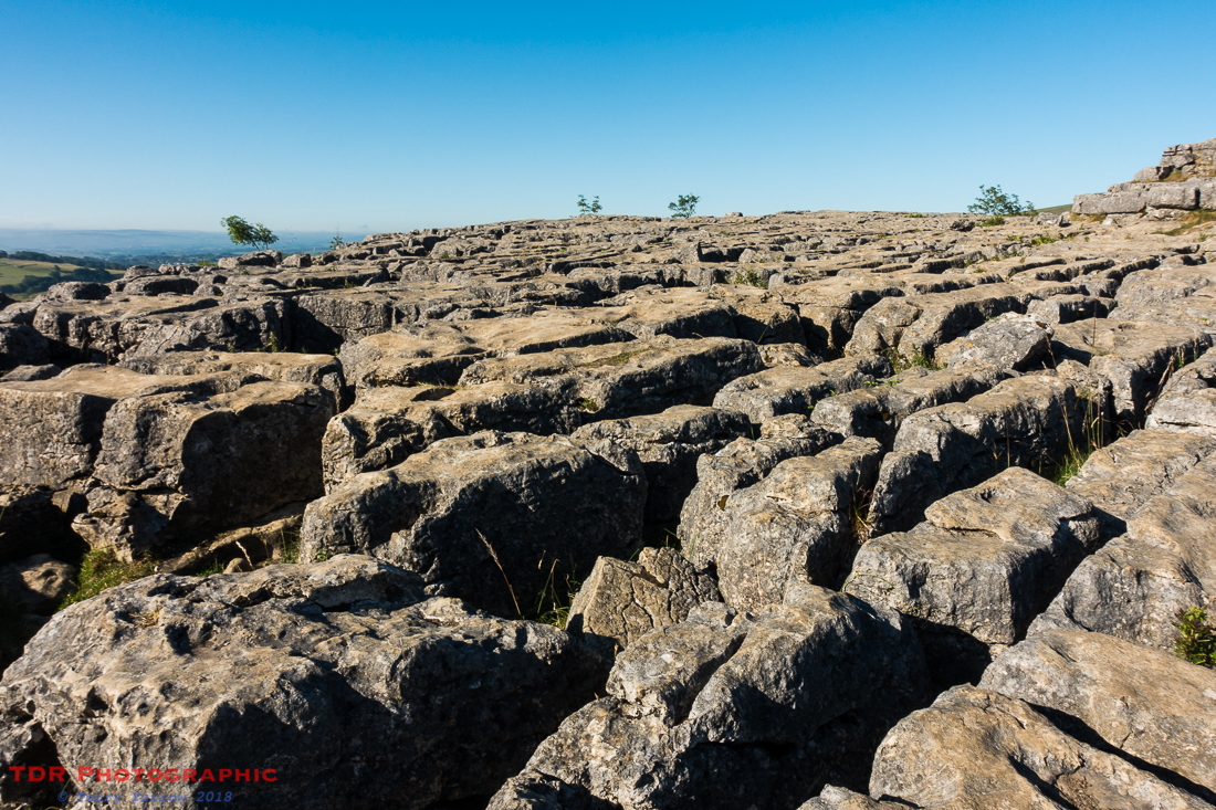
Along the top of the cove is a huge limestone pavement, peppered with deep cracks formed by action of glacier and rain – the surface would have been scraped flat by the glacier but then subsequent rain filtering through minute cracks has, over the millennia, caused these to become great fissures so the the surface now resembles a city pavement.
The view from the top is just amazing, stretching out far into the distance. Again, the photographs just do not do this place justice, especially with the contrasty early morning sun. Peregrines nest on these cliffs and I could see the young birds who had fledged for the year.
It is amazing to think that this cove was formed by a massive waterfall of ice age meltwater said to be as much as 300 meters wide! Today, there is no waterfall as the stream goes underground a mile or so before it reaches the cove, and then emerges at its base, having made a circuitous journey through a complex underground cave system.
However, aside from its fame as an awesome and popular natural limestone feature, for just a few hours in December 2015 it had another claim to fame! After extremely heavy rain from Storm Desmond and it is believed for the first time in centuries, the waterfall once again flowed briefly, making it the highest above ground waterfall in England for that short time.

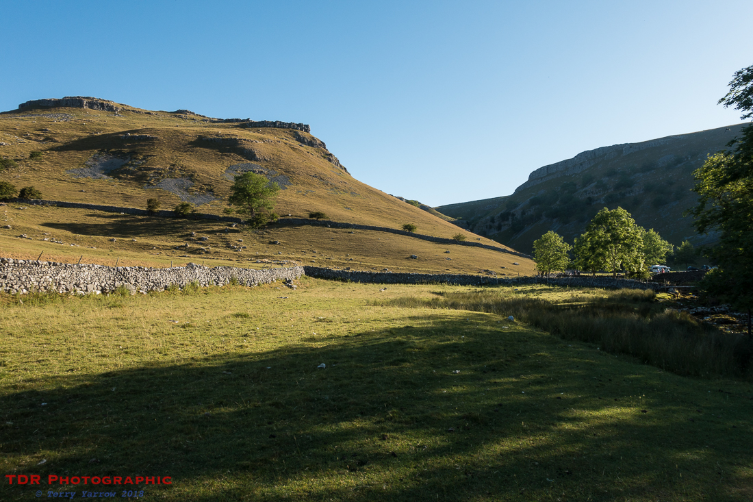
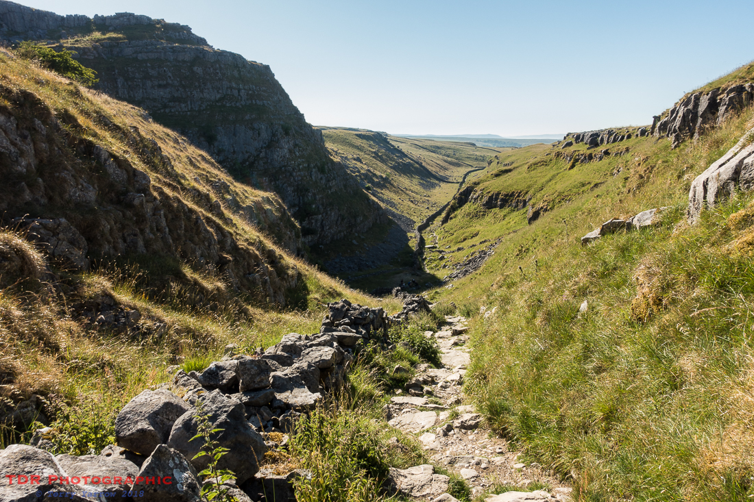
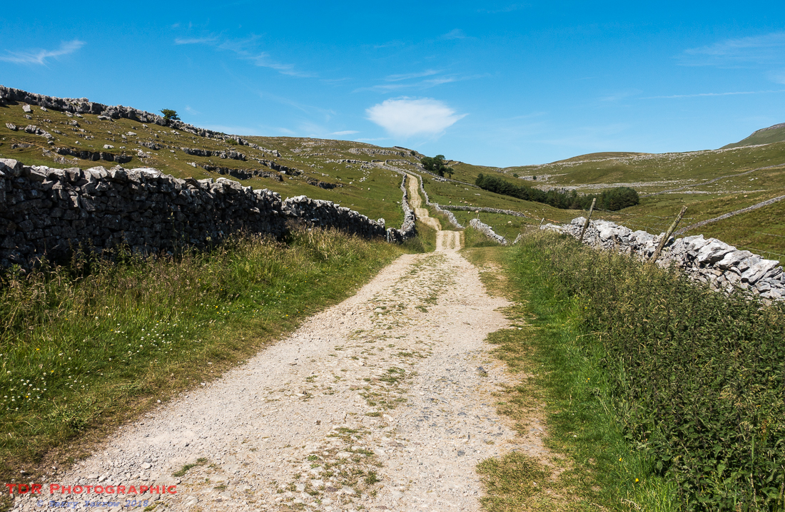
Sadly, I had to leave the cove – I had a bus to catch 🙂 – and I made my way up Ing Scar, another of those deep gorges. Not as impressive as some others but nonetheless beautiful for that. At this point, I have to confess that I took a wrong turn but quickly realised that I was in the wrong place and corrected it. The problem is, when the scenery is so amazing, it is easy to forget that you still need to pay attention to where you are walking. It is at these times that I am grateful for my OS Maps Ap because of course the guide book does not show much of the surrounding land.
Climbing steadily upwards to Kirkby Fell, I looked back to see Malham Tarn in the valley below. It was another of those long, slow climbs which some enjoy and others don’t – I think you are either a short, sharp, steep kind of a guy or gal, or a long, slow, steady kind. I think I’m probably the former, preferring steep climbs especially if they involve some scrambling 🙂 !

Having climbed steadily for some time, I reached the top of the fell and decided to stop for elevenses with amazing views down through Stockdale. My onward route would take me all the way down that dale.

On the way down, I stopped to look back up the valley to Kirkby Fell where I had been sat just a short time ago, the fell top standing sentinel over its dale.

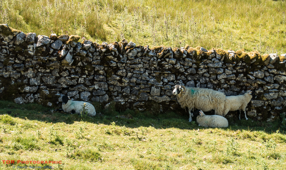
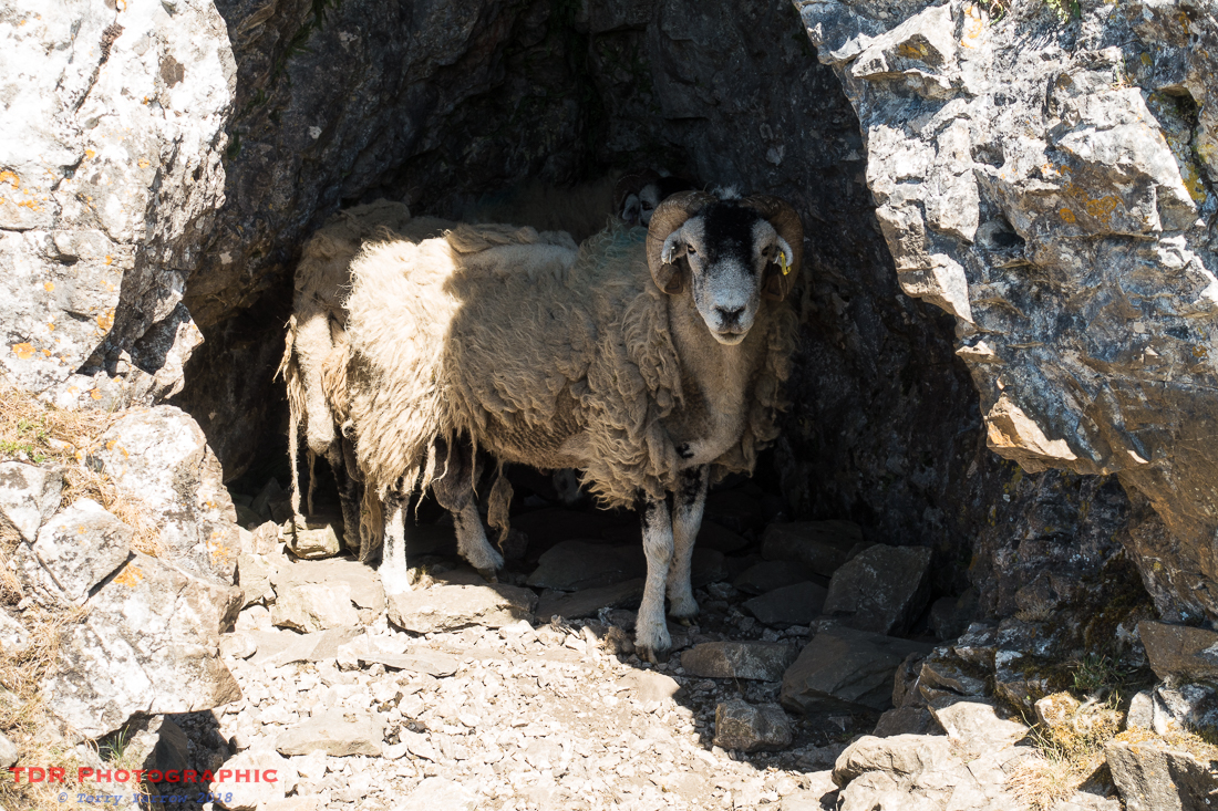
The day was now hot and the sheep were desperately seeking places to find some shade, leaning into dry stone walls, or even hiding in shallow caves. I wondered if the cave went any deeper but I didn’t want to disturb the sheep so I continued onwards.
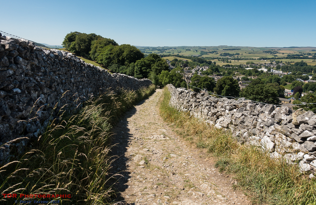
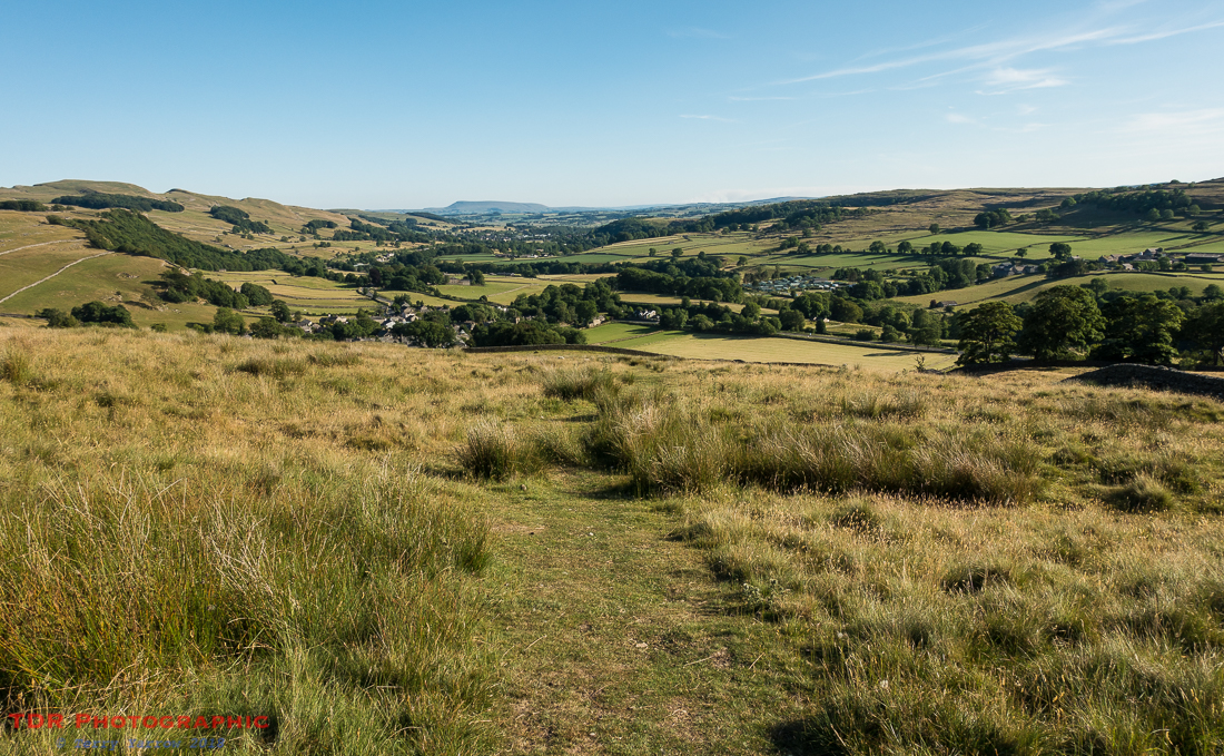
As I continued to drop down along a lovely grassy path, Settle came into view and ultimately I joined one of those typically Yorkshire walled lanes to reach the town where I stopped for an early lunch…..and of course, a cup of tea 🙂 !

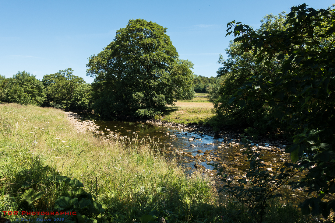
From Settle, it was a three mile, fairly level riverside walk to reach my camp for the night. I always enjoy these riverside walk because apart from the beauty of nature that surrounds river beds, it means that you no longer have to think too much about route finding 🙂 ! The River Ribble is beautiful and it runs all the way from Settle to Stainforth, and beyond of course, where I found my camp and set up my tent.
I should say at this point that I used camp sites all along this route because it was so hot that I felt I really needed a shower at the end of each day. I should say also that, in any event, wild camping is not legal in these parts.
My Afternoon Walk
Having set up camp and refreshed for a short time, I rushed off to pick up the bus to Horton in Ribblesdale. I could have walked my whole afternoon circuit from my campsite but that would have made a much longer walk…….and England were playing in the World Cup that evening 🙂 ! As it happens, I still missed the first half!
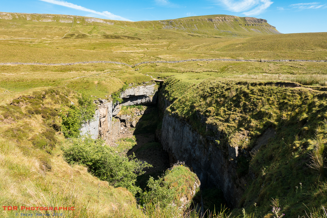
My first objective was to seek out Hull Pot before making my climb up Pen Y Ghent, so I followed Horton Scar, walking along a broad, walled lane. It wasn’t long before Pen Y Ghent appeared before me.

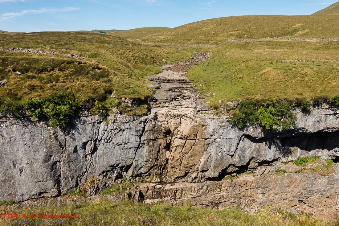
I needed to detour off my track for half a mile or so to cross Horton Moor to reach Hull Pot which I found without much difficulty – well it is pretty big 🙂 ! In fact this pothole is some 300 feet long and 60 feet deep and it was created by a collapsed cavern. It is an awesome sight, especially with Pen Y Ghent as a backdrop, but it is probably even more impressive in the wet season as so much water flows over the cliff that it can completely fill the pothole to the brim. On this day, Hull Pot Beck was dry at the hole mouth, the stream going underground before it reached that point.
Retracing my steps, I again reached the main track and started my climb to the summit of Pen Y Ghent. At this point, I realised I had made a mistake! Due to a senior moment, I had confused litres with pints which meant I did not have as much water as I thought I had…….and this was to be a hot and thirsty climb! This sort of weather does highlight the extreme need to carry an adequate water supply! Had I had my full backpack with me, I would have been able to find water because I carry a lightweight water purifier with me but that was back in the tent.
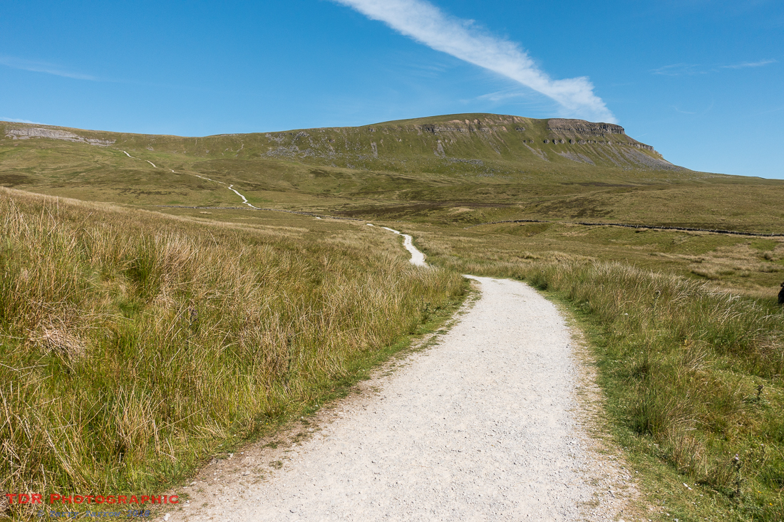
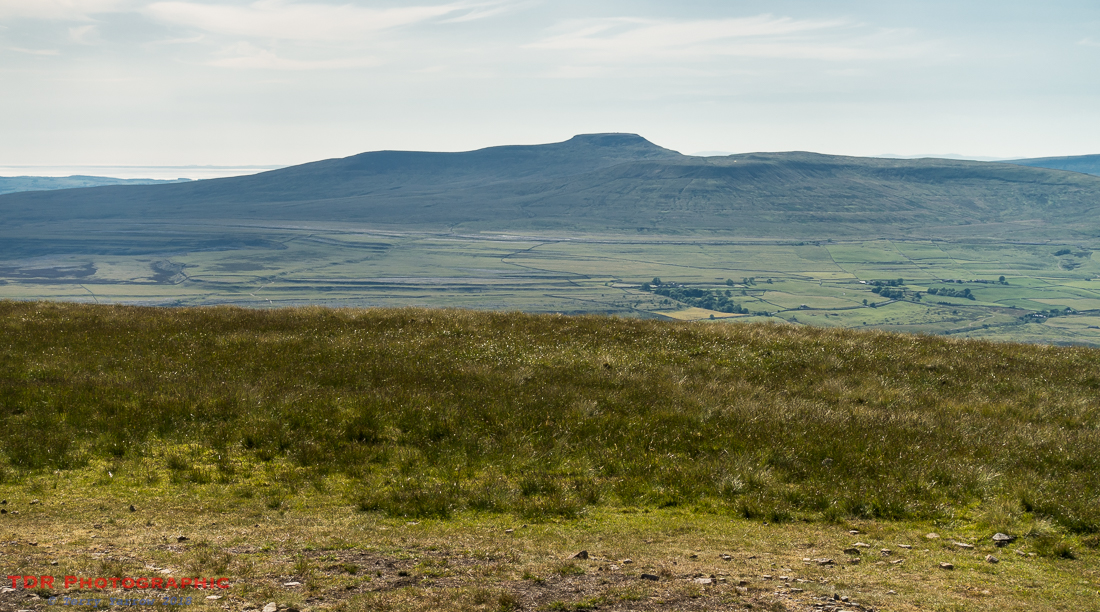
Nevertheless, by eking out my water carefully, I reached the summit! The views were of course phenomenal and seemed even better because I had the place all to myself. It was just beautiful and it was one of those places where I could again have spent hours. In the distance I could see my next objective in my personal Three Peaks Challenge, Ingleborough. Of course, the official Three Peaks Challenge is to climb all three peaks, a circuit of some 24 miles, in one day – I was doing mine over three days, but it was something I really wanted to do.

I decided that the quickest route back was straight down the southern nose of the mountain, and then to take a direct straight line across the moor. This would be around 5 miles and I have to say that I was grateful for the dry weather because this path clearly looked as if would be impassible in wetter times. There would be boggy areas everywhere! Thankfully not today. The first part of the route was a scramble down the face but it then levels off slightly, making walking easier. I stopped to take a look back up the steepest part of the route.

The onward route would be much easier in this dry period, even though in places the path was somewhat vague. There was usually a style to aim for though 🙂 !

Eking my water out all the way, I finally reached the point where I could look down and see Stainforth below, and my campsite just beyond. I reached my tent, rehydrated, and then had a quick shower and did some laundry – this basically means that I wore my clothes into the shower 🙂 ! That’s backpacking laundry 🙂 !
Having pegged out my wet clothes…..well actually hung them over any fence post or branch I could find, and failing all else hung them on the low level washing line, also known as the ground 🙂 , I rushed off to the site bar where they were showing the football. Unfortunately I missed the first half but I still enjoyed the second half with a well earned meal and a pint. And I was able to charge up my battery pack as well. It was definitely win, win 🙂 !
Back in my tent later, I reviewed my day – I had backpacked 12.2 miles, pitched my tent, caught the bus, walked another 8.6 miles, showered and laundered, seen Hull Pot and climbed Pen Y Ghent, had a drink with a meal, and watched football! I was a happy man as I had achieved everything I had set out to achieve 🙂 !
Tomorrow would bring further challenges, not least the near vertical scramble down off Ingleborough, but for now, I could sleep contented!
In case you missed the previous posts in this series, there are links below:
Day 0 – Arrival in Saltaire
Day 1 – Saltaire to Skipton
Day 2 – Skipton to Gordale Scar and more
Thanks for stopping by.
Until next time,
Your friend
The Dorset Rambler
If you would like to contact me, my email address is terry.yarrow@gmail.com – comments and feedback are always welcomed.
All words and pictures in this blog are the copyright of The Dorset Rambler and may not be reproduced without permission.

You do seen very happy. 🙂 Thanks for sharing your walks and photos.
I was Lynette – backpacking simplifies life so much, and where could be better than the Dales 🙂 Thanks for your comment. I’m glad you enjoy my posts 🙂