

Our last day dawned bright and we made our way through the quiet streets of Trefin in the early morning light to rejoin the coast path at Aber Draw with its old mill remains. Making our way along the coast path, we quickly reached the entrance to Porthgain Harbour with its distinctive white bollards on the headlands either side.

Standing looking down on the harbour, the expansiveness of the now ruined buildings on the dockside is immediately striking. These were the hoppers where stone was once stored, marking what was in many ways a 19th century industrial revolution. From 1837 for nearly 100 years, this little harbour was used to export roadstone, slate and bricks, with the stone being quarried from the hilltop behind the hoppers.
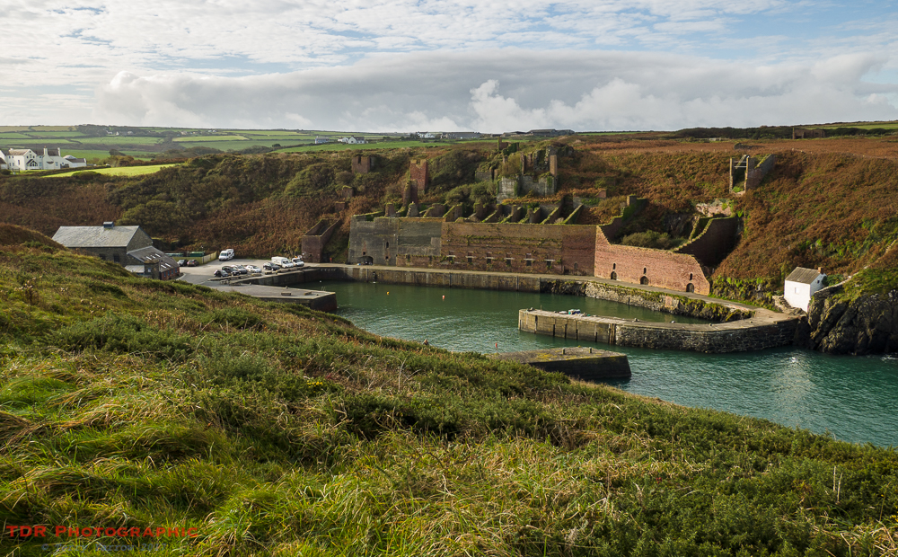
The port in fact reinvented itself several times. Having started life in the export of slates which were transported to the quayside via a tunnel bored into the hill, it was extended in the early 1900’s to allow larger ships to moor at the quay and not long after a brickworks was added. This used the waste from the slate quarry to make the bricks. For the last 20 years of its life, the port was used for roadstone, with the hoppers being filled with stone of varying sizes.
The port is now almost a museum of a bygone age, the once thriving busyness now replaced by an empty stillness. But it is a relic that is worth exploring.
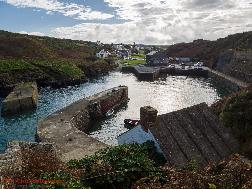
Climbing up the steps behind the old pilot house, we discovered the other part of this old industrial complex, the quarry itself, that provided the raw materials for the port’s activities. Remains of brick buildings, stone crushing plant, weigh bridge, engine sheds etc litter the cliff top with inclines, cuttings and track beds linking them together.

And by the water, the deep pits that formed the quarries themselves, huge areas where stone and slate were extracted for some 80 years. It felt like this was almost a graveyard of the quarrying industry.
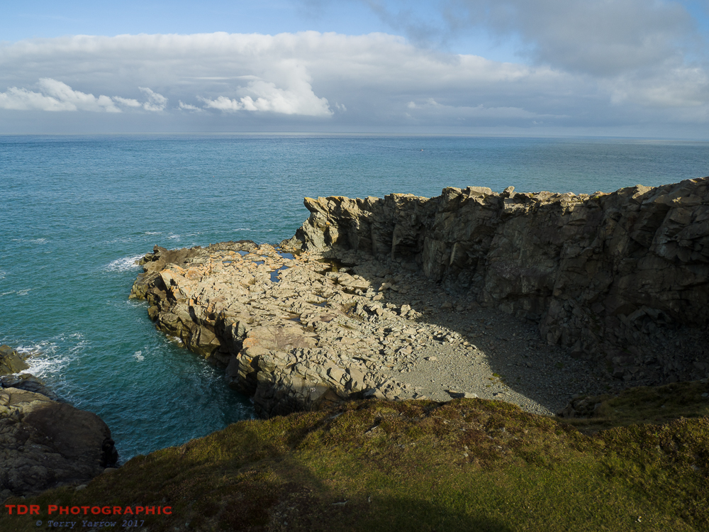
We spent much time exploring the old workings before continuing on our way. Not that we got very far before another detour at Traeth Llyfn – there was so much to see and explore all along this route. This is a lovely sandy beach that can only be accessed by steep steps……provided the tide is out! We climbed down to the beach despite the fact that we knew we would have to climb back up again 🙂 !

Traeth Llyfn is a lovely secluded beach made up of craggy rocks and smooth sand – indeed, Traeth Llyfn literally translates as ‘smooth beach’. The steps down take you to the north end of the beach and great care is needed as it is easy to get cut off by the tide if exploring the southern end.
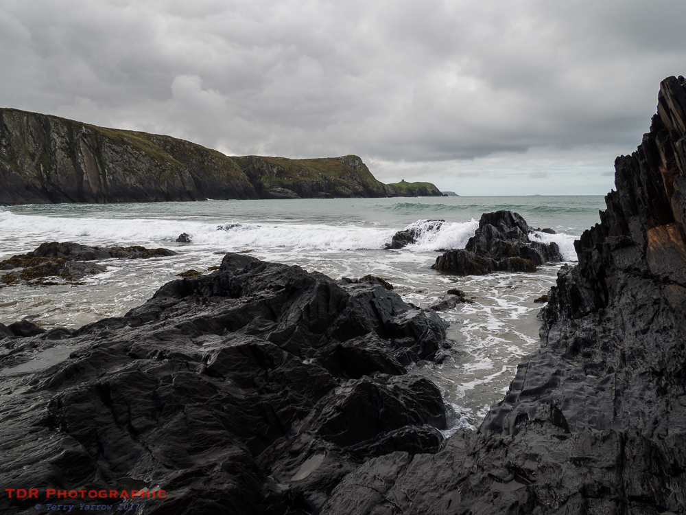
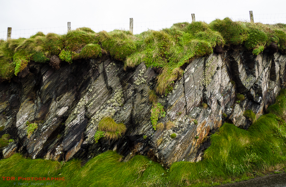
Here too there was evidence of quarrying, and some lovely colours in the cliffs too.


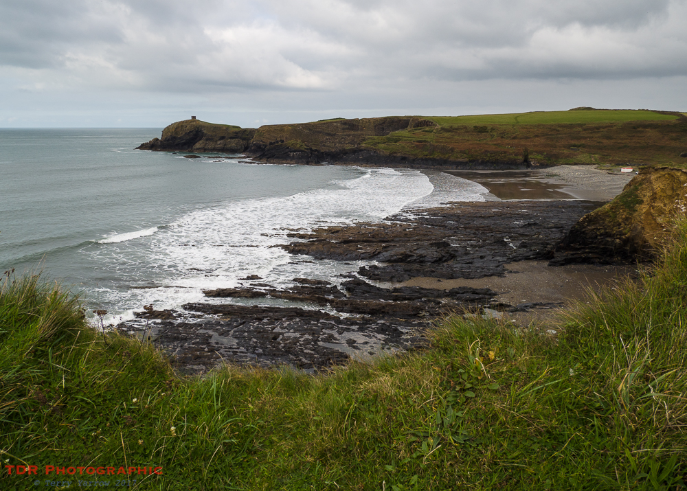
We climbed back up the 133 steps to regain the coast path and continued on our way……but again, not for long, as just a short distance farther on we reached Abereiddi, another place full of interest, and one to spend time exploring.
This again is an old quarry, with slate being mined here from around 1830 to 1904 and transported to Porthgain for onward shipment. The quarry gives the impression of having been a small port but in fact it was not. The illusion has been created by the fact that when the quarrymen had ceased working the area, they blasted a channel to the open sea and the quarry flooded. This is now known as The Blue Lagoon and is a deceptive 25 meters in depth. There are remains of buildings all around, including the old engine house which stands on the ledge across the lagoon.
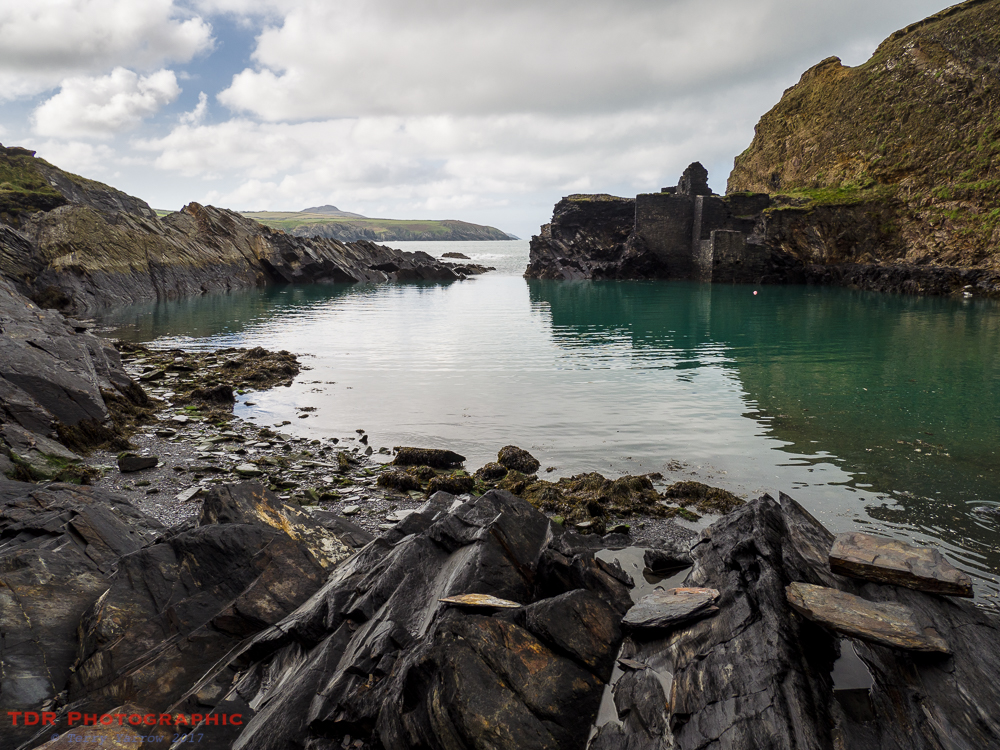
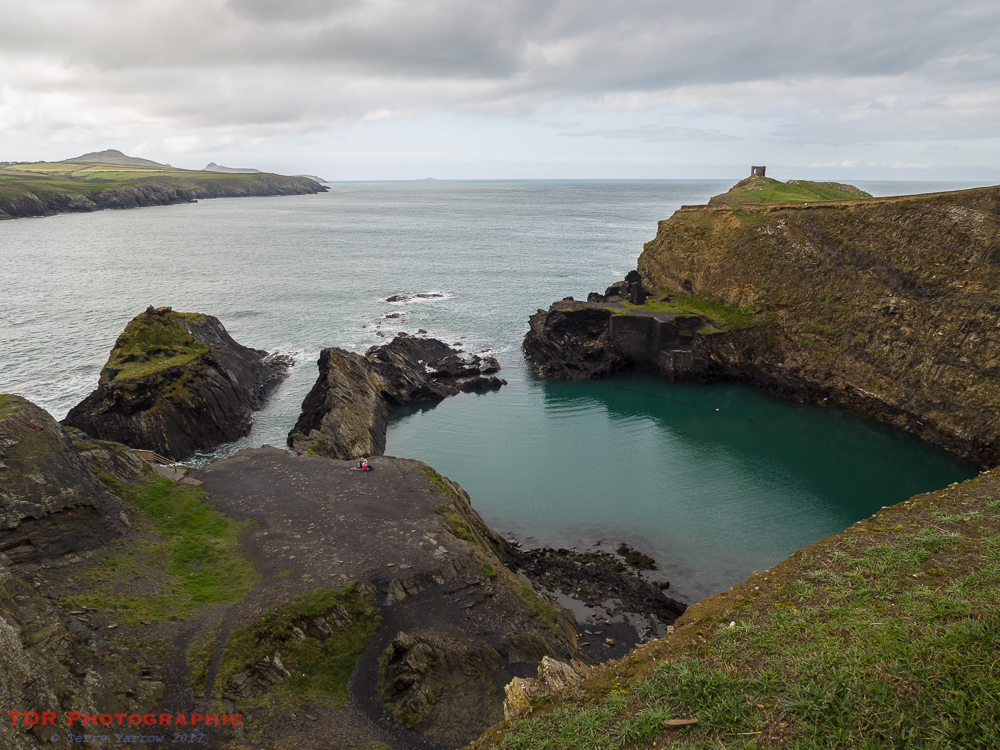
Beside The Blue Lagoon, the headland of Trwyncastell stretches out to sea. This crag comprises volcanic rock and on its summit stands Abereiddi Tower which is thought to have been a watch tower although on ancient maps it is described as a summer house. It is a single story stone tower which apart from windows looking out to sea, also includes a fireplace.

Actually one of the more welcome things about Abereiddi was that beside the beach was a tea wagon 🙂 ! We stopped for a cuppa and sat for a time listening to the waves rolling up the shore before heading off along the coast path again.
We had already seen a number of seals during the walk so far but when we reached the tiny cove of Aber Pwll, the number doubled. There were adults and pups, the latter being so much more conspicuous with their cream coloured fur, and they were everywhere, even up a stream bed inland of the bay. They were obviously quite used to humans.


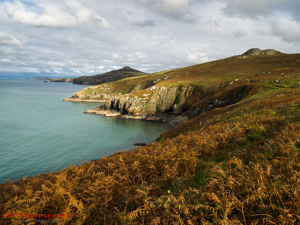
Climbing out of the bay, we looked back across the expanse of craggy coast that we had walked.

The day was drawing on and the sun was going in and out almost in recognition that the coast here does the same thing. We continued our serpentine way and could see in the distance another of those distinctively shaped headlands, St David’s Head. This is easily recognisable by the conical shaped tor that we dubbed Carn Lidl – its actually called Carn Llidi! Having dubbed that one Can Lidl, we figured the nearer and flatter hill must be called Carn Aldi 😉 !


The clouds were gathering more and more, with the occasional breaks allowing the sun to throw spotlights across the hills. This was beautiful and much more interesting than straight forward bright sunshine although we feared that rain might reach us before the end of our walk.

Eventually we reached the point where we were about to turn and round St David’s Head but before we did so, we stopped to look back the way we had come. The view took in the whole coast that we had walked over the last two days, reaching as far back as Strumble Head with the lighthouse visible on the extreme left in the picture below.
Finally, we left the view behind and rounded the headland and we could see below us the wide expanse of Whitesands Bay which would be our stopping point. We dropped down onto this beautiful beach in the fading light and as we made our way up the narrow lane that leads to the city of St David’s, light rain began to fall.

You could call this four day walk the ‘Two Saints Way’, having walked from St Dogmael’s to St David’s, and with the latter being named after the patron saint of Wales, it seemed a fitting end to our journey. It had been four days of wonderful walking in near perfect walking weather. What could be better?
Thanks for stopping by.
Until next time,
Your friend The Dorset Rambler
If you would like to contact me, my email address is terry.yarrow@gmail.com – comments and feedback are always welcomed.

Reblogged this on World4Justice : NOW! Lobby Forum..
Excellent!
Thanks Michael
Absolutely beautiful photographs. Sigh.
Thanks so much, you are very kind.
Thank you for transporting me to this slice of heaven… your writing is wonderful and you’ve helped me to feel enlivened by this land…such a refreshing read. thank you so much!
Thanks Kerry for your kind comment.