

The next day dawned to a damp mist although with the forecasted strong breeze, we didn’t think it would last long. We made our way through the tiny hamlet of Llanwnda, a somewhat quirky and quaint settlement with a rich past. It’s most recent claim to fame was featuring in a documentary of Griff Rhys Jones in 2007 called ‘A Pembrokeshire Farmhouse’ which detailed the restoration of that building. This though was a place steeped in Celtic Christian history. We stopped to look at its remote church, the church of St Gwyndaf.
St Gwyndaf was a 6th century Celtic saint from Brittany who settled for a time in Pembrokeshire. He had an aristocratic background and married a noblewoman, the couple having two children. All four became Saints. The church itself dates from medieval times and has some interesting features. On the ancient roof beams is carved what is thought to be the head of a monk – see if you can spot it in the pictured below. The small high up door to the right is thought to have at one time led to a rood screen which has long since been removed.


Our route from Llanwnda took us out of the village and down a damp and lush wooded valley to reach the coast path again at Carreg Wasted. This is famous for being the landing place of a small French army in 1797 on what was to be the last invasion of Britain. The invasion didn’t last long and the troops surrendered just four days later at Goodwick Sands. A memorial stone has been erected on the headland to commemorate the event.

The mist had by now lifted and although a dull day, the still vibrant yellow gorse made it seem like the sun was shining.

As we made our way onwards though, the sun did start to make an appearance. We passed Penrhyn with a single delightfully remote white rendered cottage right on the clifftop. What an idyllic place to live!
Oh, and apparently there are Dolerite Outcrops too……although again, we thought it would take a geologist to point them out 🙂 !
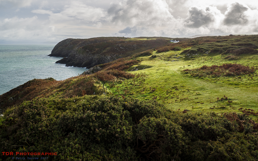
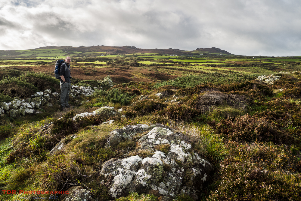
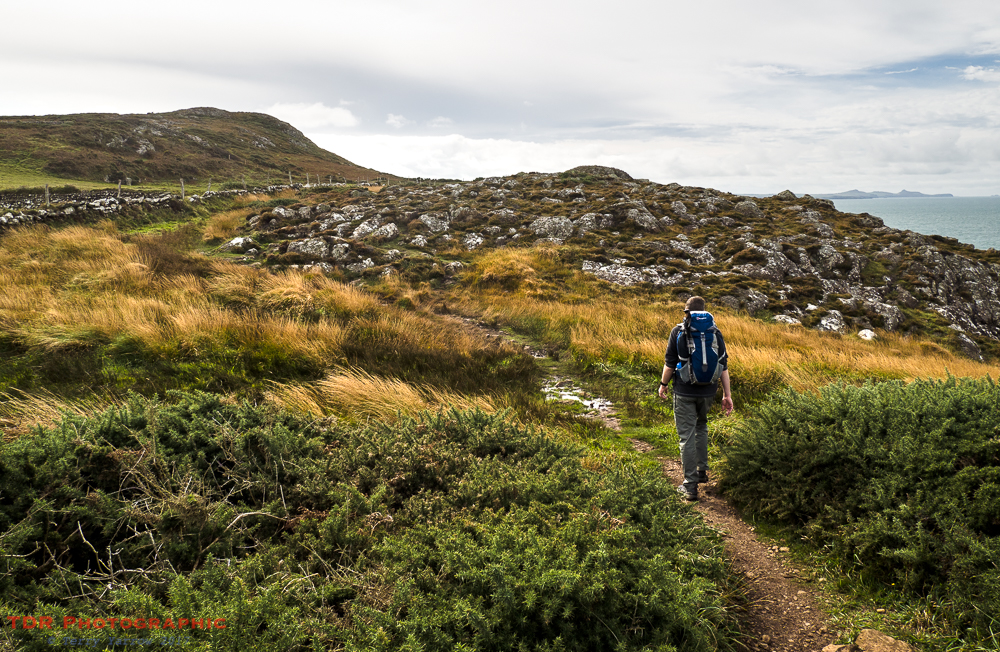
After two days of steep climbs and falls, it was pleasant to be walking for a time on more level ground, with fine grassy stretches mixed with rocky outcrops. In the sunshine, this was most picturesque. Level, however, is not a word that can be used to describe much of the Pembrokeshire Coast Path as we were to find out all too soon as the path once again became rock strewn and undulating!
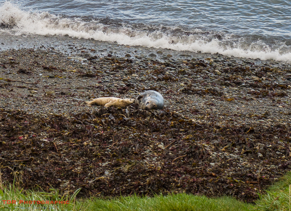
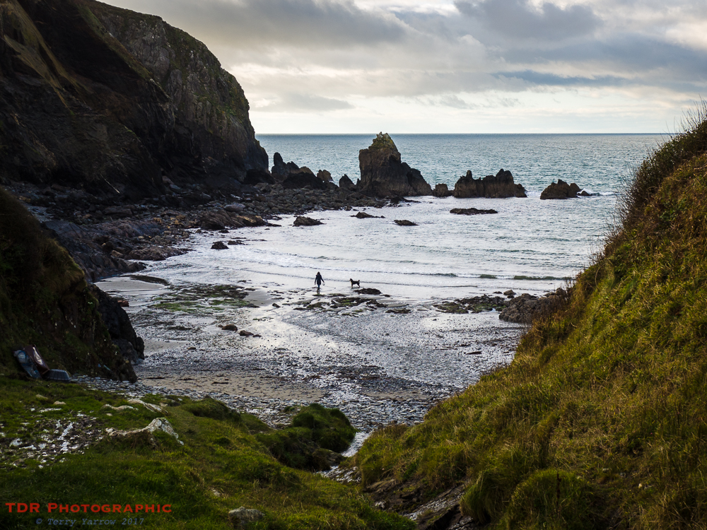
At Porthsychan we came across the first seals of the day, an adult and pup just languishing on the beach. We would see many more before the day was done, some swimming in the sea, some playing in rock pools, some just dozing on the beaches, some resting under small waterfalls, some perched on rocks – we wondered how they got there as they are not noted for their climbing ability 🙂 ! They are always interesting to watch, especially as they attempt to waddle and wriggle their way up the beach and over rocks.
As we neared Stumble Head, we turned to look back the way we had come and could see in the far distance that same distinctive shape of Dinas Island with a myriad minor headlands between it and us. We had wound our way round and over every one of them.

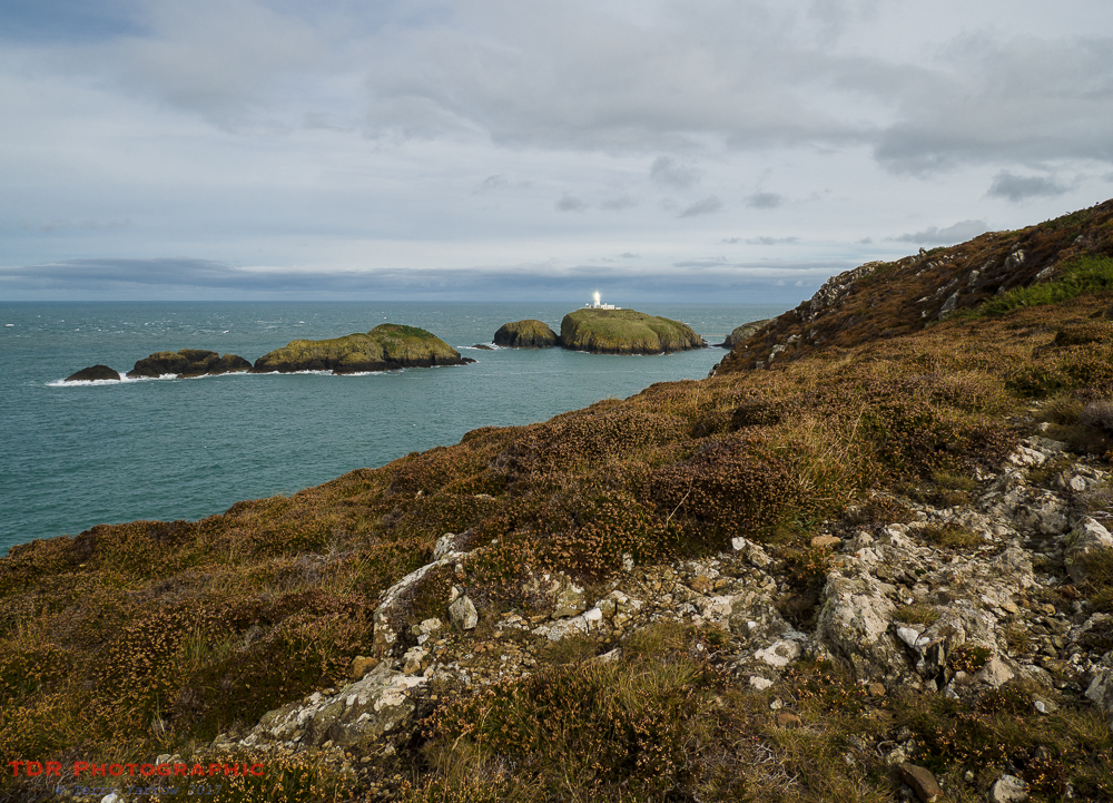
Soon we reached Strumble Head with its well known lighthouse standing atop one of the islands. I say ‘island’ because that is what it is, although in reality it is just a short hop from the mainland and is connected by a footbridge. The lighthouse, now unmanned, was built in 1905 to replace a lightship that was previously moored nearby, since there had been numerous shipwrecks in the area. Interestingly, as recent as 2003 one wreck was discovered that was thought to have been part of the French fleet that invaded in 1797.
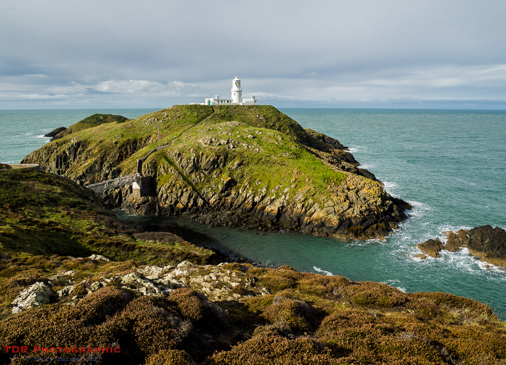
Looking at the foaming seas even on this relatively calm day and with the bay sheltered by the headland, you could see why a lighthouse was needed at this point.

At this point too is one of the best examples of up-cycling that you are likely to see. This is an old wartime lookout post that has been converted to a wildlife observation post as this area is well known for its dolphins and porpoises…….not that we saw any on this day 😦 ! The whole area is an SSSI, rich in wildlife, and the lookout was opened by Bill Oddie in 1988.

As we made our way round the headland and turned south, we could see clearly the three islands lined up before us across Carreg Onnen Bay. Interestingly, the two smaller islands to the left in the picture, Ynys Onnen and Carreg Onnen, were offered for sale some years ago having been in the hands of a local farming family for generations. The problem of course is that you couldn’t build anything on them so they would be of little use to most people. The papers at the time were suggesting figures of around £40,000 but I do not know if they were ever snapped up.
There was some delightful walking along this section. Although some of the land was a little marshy, the long yellow autumn grass made a beautiful foreground against the rocks beyond. Already in the distance we could see another distinctively shaped headland that would be our route tomorrow, St David’s Head. It is on the extreme right in the picture below.
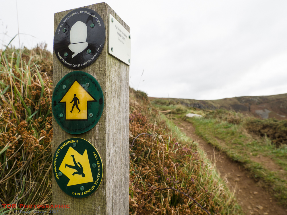
And along this part too, some strange signs! One wonders what that path to the right is like – could it be precarious……..go down there and you will fall flat on your face? 🙂 The sign stands at the lip of Pwll Deri, one of Pembrokeshire’s most popular beauty spots, and home to one of its most remote youth hostels.
The day had now become overcast again bringing some lovely clouds to the pictures. It was a subdued light that somehow suited the landscape, adding a mood that was appropriate to the character of this rugged and rough coast.

Before long, we reached Abermawr Bay, with now heavy skies above. For once there were people around us, a sure sign that there is parking nearby.

We stopped at this point and fell into conversation with a lady with a dog. She told us that her husband was out in the bay somewhere swimming and my immediate thought was, ‘rather him than me’! It seemed that he loved to swim whatever the weather but that this was likely to be the last of the year. His dog gazed out to sea, watching to see him come ashore……

……which he did a short time later, and his dog ran off happily to meet him.

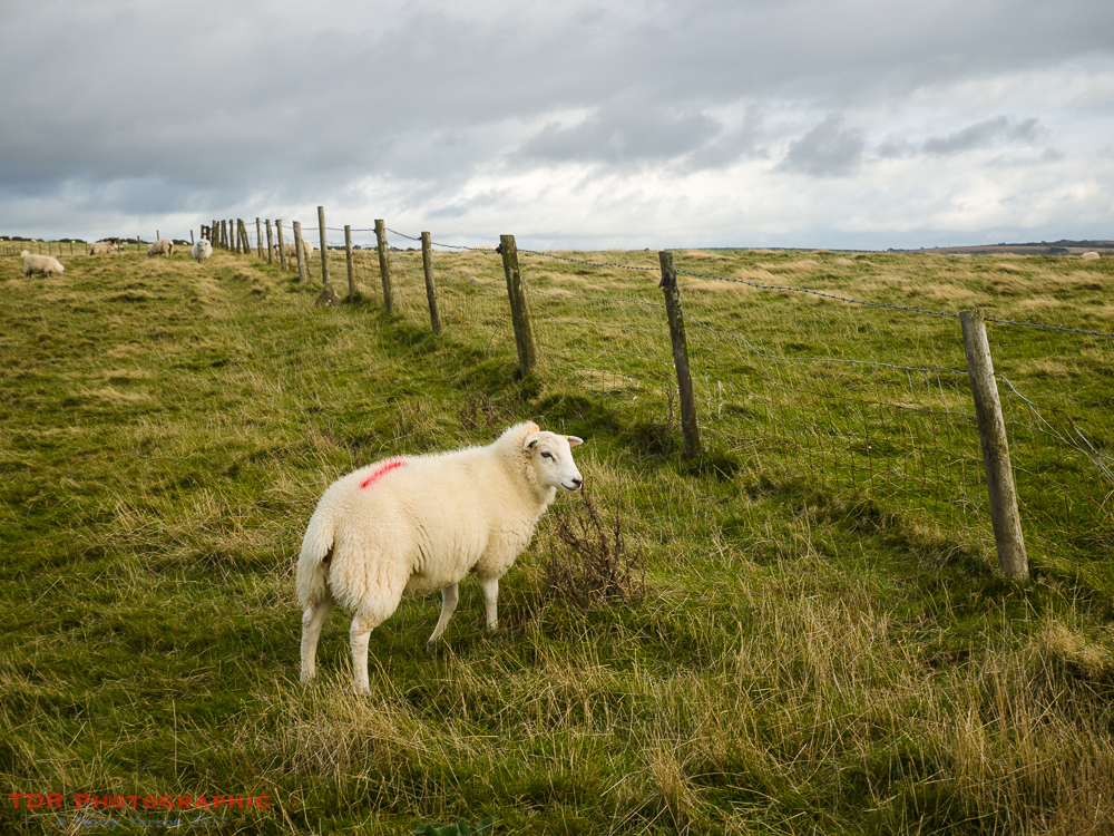
There was something else strange along this part of the coast and that was that the sheep were all clean! Normally they are quite grimy but these looked as though they had just had a bath and a coiffure 🙂 !
We passed another little cove at Pwllstrodur, and another dog walker silhouetted against the patch of bright light reflecting off the water. The apparent peaceful tranquility belied the very breezy conditions!
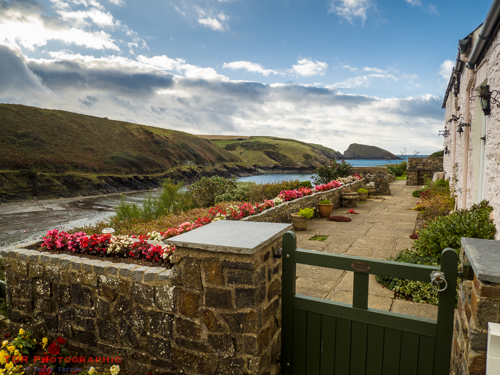
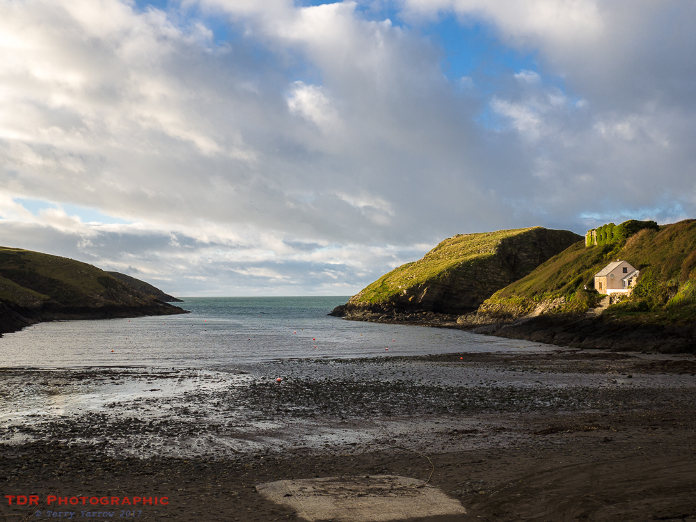
Eventually we reached the delightful old harbour of Abercastle with its row of cottages on the hillside overlooking the water. This is another ancient trading port, exporting slate, grain, limestone, butter, honey, etc in bygone days. Now though it is a stopping point for pleasure craft.
The sun was low in the sky as we rounded the harbour and made our way back out along the other shore. Across the harbour, we could see being picked out by the sun, a cottage, the ruined ivy-covered granary, and the islet of Ynys y Castell, a promontory earthwork fort.
We had decided that our stopping point tonight would be Trefin and we climbed out of the harbour onto the last few miles of coast path for today. And what a lovely part it was too, with level grassy paths underfoot and a setting sun before us.

The lower the sun got in the sky, the brighter pink turned the clouds to our left. what a beautiful pastoral scene this was, especially with the dark clouds that had still not blown completely away.

As we neared our stopping point for the night, we took a last look out to sea to watch the sun drop below the horizon. It cast highlights and shadows across the sea as the waves rolled in on an endless quest to reach the shore. The craggy coast took on a dark, foreboding nature as everything settled down for the night ahead.

Reluctantly, we turned away to follow the last half mile of path into Trefin and our night stop. On this beautiful evening, I couldn’t help but think back to the last time I stayed here. On that occasion, there had been driving rain and a howling gale and as I had laid in my tent, I almost feared that it would take off or that trees might come down on me in the night. Oh, how different this day was!
What a fabulous day! Another 17 miles of awesome walking along some of the best coastline you could hope to find! We were nearing the end of our time away, but as we settled down for the night, we were looking forward to what joys tomorrow would bring us.
Thanks for stopping by.
Until next time,
Your friend The Dorset Rambler
If you would like to contact me, my email address is terry.yarrow@gmail.com – comments and feedback are always welcomed.

1 Comment