

We were woken early by the rumbling of a train, the sound coming in through our open window – it had been a warm night. There was a coastal railway line running right behind our B&B – we would cross that line at the start of our walk.
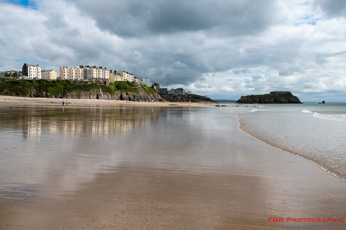
After breakfast, we rammed everything into our packs for the last time and set out on what was to be a shorter day’s walking (13 miles) as we had to travel home afterwards. I had mixed feelings as we made our way out of the village, sad because it was our last day, but also looking forward to some lovely walking again. I clearly remembered the first part from my previous visit, a delightful, flat, mile and a half walk along the wonderfully wide and deserted Tenby South Beach in the early morning light, watching the sun rise as I walked.

Because of breakfast, we were later leaving on this occasion but it was nonetheless beautiful for that. In fact we had a virtual sunrise because the day had dawned overcast but the sun made an appearance as we made our sandy way towards Tenby. The light glistening on the water was mesmerising with the ever changing, ever moving, sparkling highlights almost resembling a starry night sky with scudding clouds. It was a constantly changing scene with a backdrop of dark clouds as they faded into the distance.
Ahead of us, we could see the town and St Catherine’s Fort on its island jutting out to sea. We were in for a pleasant surprise when we reached that stronghold.

On my previous visits, including family holidays, the fort had always been closed and apparently derelict, and therefore held a mysterious attraction. When we arrived on this occasion, we noticed that the fort was open so naturally, we took the opportunity to look inside. The fort dates from the 19th century and was built by Lord Palmerston to guard against the perceived threat of invasion by Napoleon, the threat being to the naval base at Pembroke. It was felt at the time that invasion might not come via the more obvious Milford Haven inlet but in fact come overland from the south Pembrokeshire coast so a series of forts were planned. Ultimately only this one was built.
The inside could be described as semi-derelict but that made it all the more interesting. This will probably change as the income from the entrance fees is used to pay for renovations and improvements. Even now, it is only open subject to the tides and weather, and of course, volunteers, so we were fortunate with our timing.

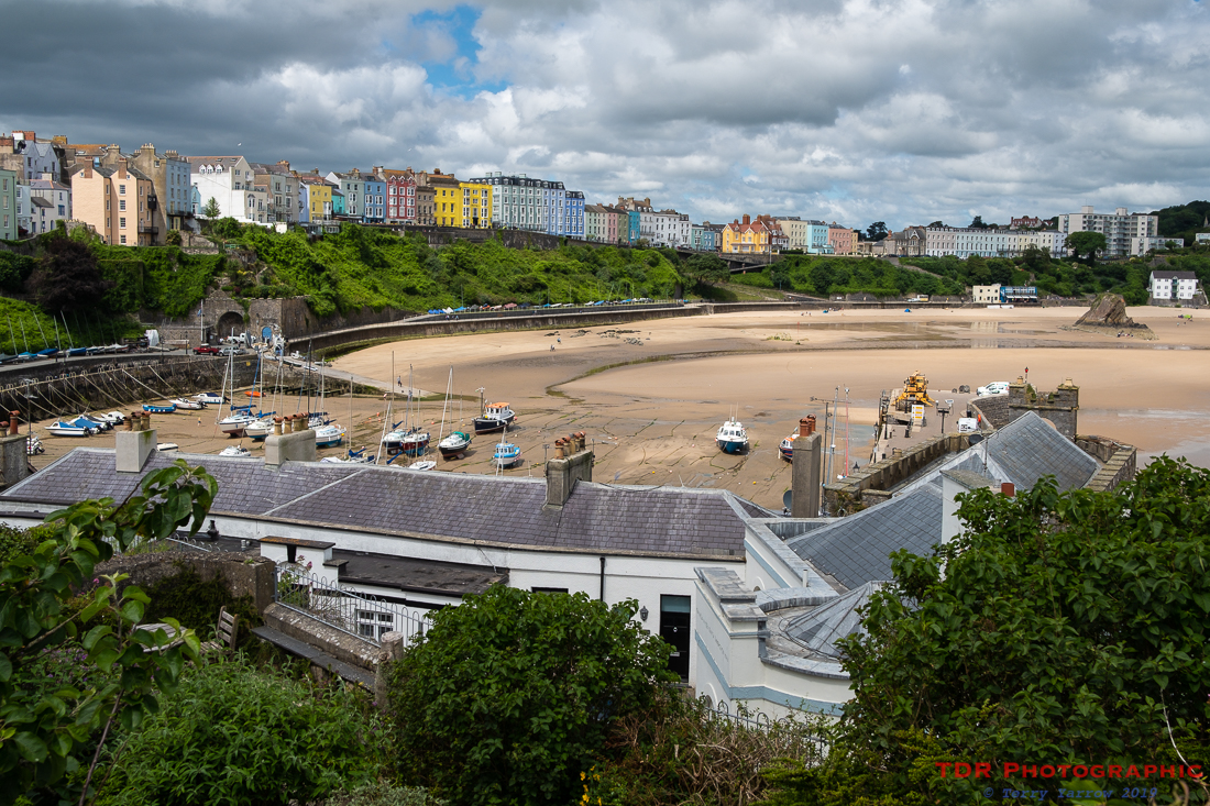
The fort is not the only military establishment in this town as Tenby Castle is even older, dating back to the 12th century. It was built on a rocky promontory to protect the town prior to its walls being built. It is now mostly ruined but is a lovely place to stroll around.
Rounding Castle Hill gives a view out across the harbour and North Beach, which is equally as wide as its southern compatriot. It was at this point that my camera memory card ran out so I had to hot-foot it into the town itself to buy another.
On the north side of Castle Hill also stands the old lifeboat station. This bright and beautiful building is now a private house, having been converted as part of the television programme, Grand Designs. It stands beside the new, and larger, lifeboat station.

Having spent so much time in the fort and the castle, it was approaching lunch time so we stopped off at a rather good Greek cafe which had views across the North Beach. It was beautiful sitting out on the terrace and we could happily have stayed longer but time was rolling on, so we did too. But not without taking a last look back at Tenby with its beautiful beach and wonderful pastel coloured houses.

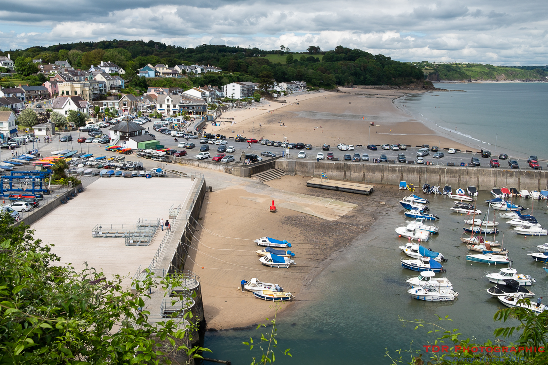
General perception of the Pembrokeshire Coast Path is that it is wilder in the north and tamer in the south, but that doesn’t mean that the latter is without its high headlands. It had these in plenty, and some really stiff climbs as well. After several miles of ups and downs, we dropped off the heights through some beautiful undulating woodlands into Saundersfoot, a one-time exporting point for local coal. We debated whether to stop for tea and cake but chose instead to keep walking as, with so much to see, time seemed to be marching faster than we were.
There were yet more headlands to come but we did not have to climb over all of them thanks to the old railway line that had been cut through the cliffs. This was an industrial, narrow gauge railway that was built in the 19th century to connect Saundersfoot Harbour to the local mines. Its disuse means a definite plus for walkers such as us 🙂 !
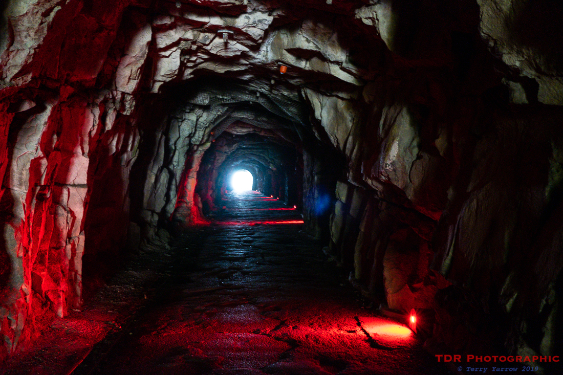
Having walked through three tunnels, we came out to another little ‘coal’ settlement, Wiseman’s Bridge……where we spotted an ice cream van. Unable to resist, we stopped this time 🙂 ! We sat on the sea wall savouring the ice cream, and the moment. We had only a mile or two to go to complete our walk.
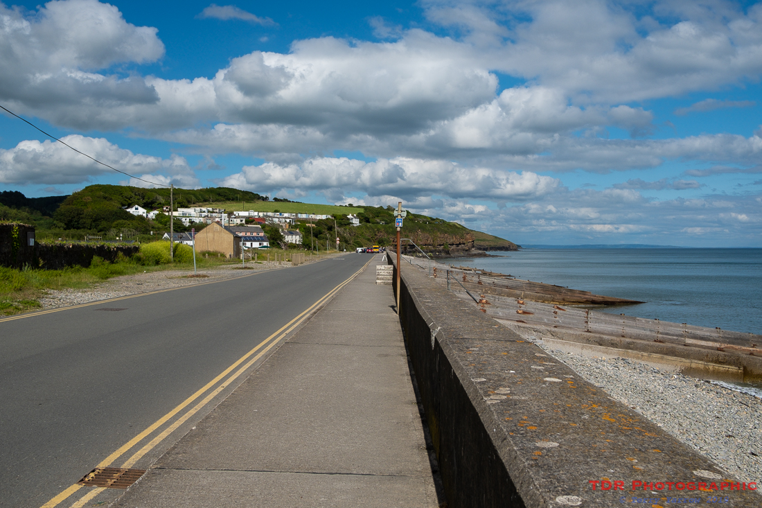
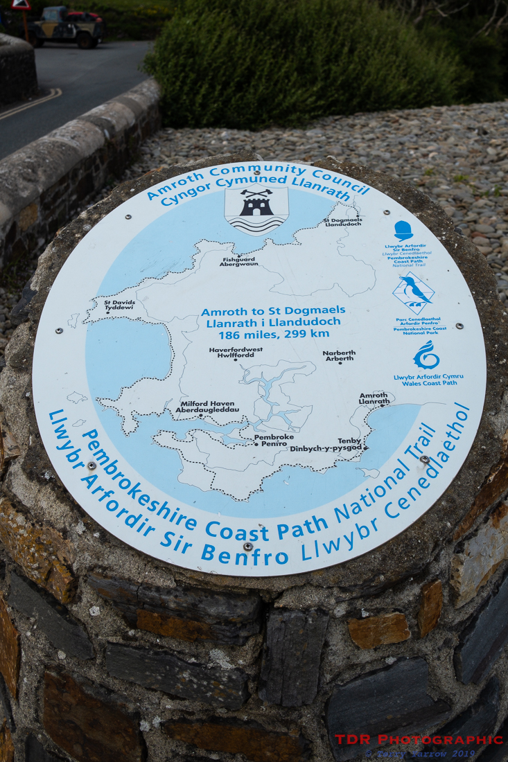
There was, though, one last climb to negotiate with much of this, part of the Celtic Cycleway, being on tarmac paths, before dropping down through another woodland into Amroth. This is a long, straggling town which again started life as a small miner’s settlement. Our final half mile was along the Amroth sea front to reach the official end point where we all touched the stone. Then we crossed the road for a celebratory drink and some food……..which in the end we had to eat ‘on the run’ because time had run out and we had a long drive home.
This had been an awesome four days, the weather had been perfect, the coastline ruggedly beautiful with something different each day, amazing beaches, lots of wildlife, good food, and most of all, the best company a man could wish for. And amazingly, despite carrying weight, I had had few problems with knees and ankles – sadly, the same can’t be said since I have been back home but that’s another story.
If you have missed the previous days, there are links below:
On the Pembrokeshire Coast Path again – 2019 Day 1
On the Pembrokeshire Coast Path again – 2019 Day 2
On the Pembrokeshire Coast Path again – 2019 Day 3
Thanks for stopping by and reading my ramblings, and I hope you enjoy exploring with me.
Until next time,
Your friend
The Dorset Rambler
If you would like to contact me, my email address is terry.yarrow@gmail.com – comments and feedback are always welcomed.
All words and pictures in this blog are the copyright of The Dorset Rambler and may not be reproduced without permission.

Great photographs. I remember seeing the lifeboat station on Grand Designs.
Thanks John. Yes, we watched it long before we went to Tenby for the first time.
I love Tenby! And, yes, I remember the tv programme about the Lifeboat House, too.
The lifeboat house looks a nice place to live but probably not in stormy weather 🙂