

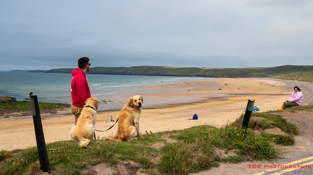
Day two dawned somewhat cloudy although fortunately it wasn’t to last. Compared to my more usual camping trips, this was a leisurely start to the day with a cooked breakfast, followed by a ‘taxi’ back to the coast by the B&B owner, George, and two very friendly dogs. Together, they duly deposited us at West Angle Bay where we began our day’s walk.
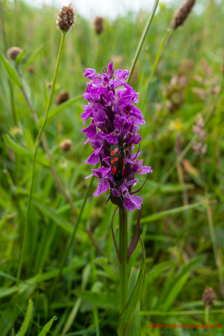
The bay was deserted apart from a lone dog walker who was of course quickly joined by our host with his two charges. We bade our farewells and headed off through a lovely stretch of meadows which was rife with butterflies, including the six spot burnett below, enjoying an orchid.
In fact, there was to be much wildlife to see over the next few hours, including numerous jelly fish which were for once clearly visible swimming offshore – sadly, these are more normally seen washed up on beaches. There were also seals, lots of seabirds, and a number of choughs with bright red legs and beaks standing out in the gloom.
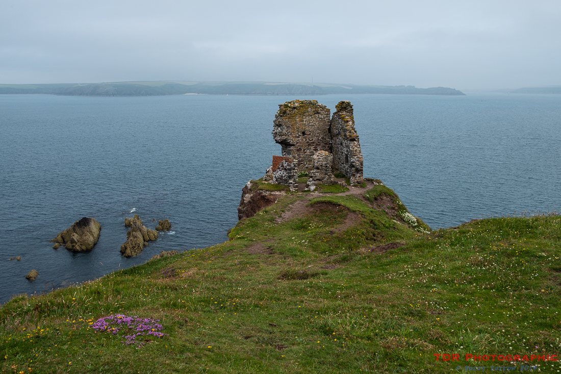
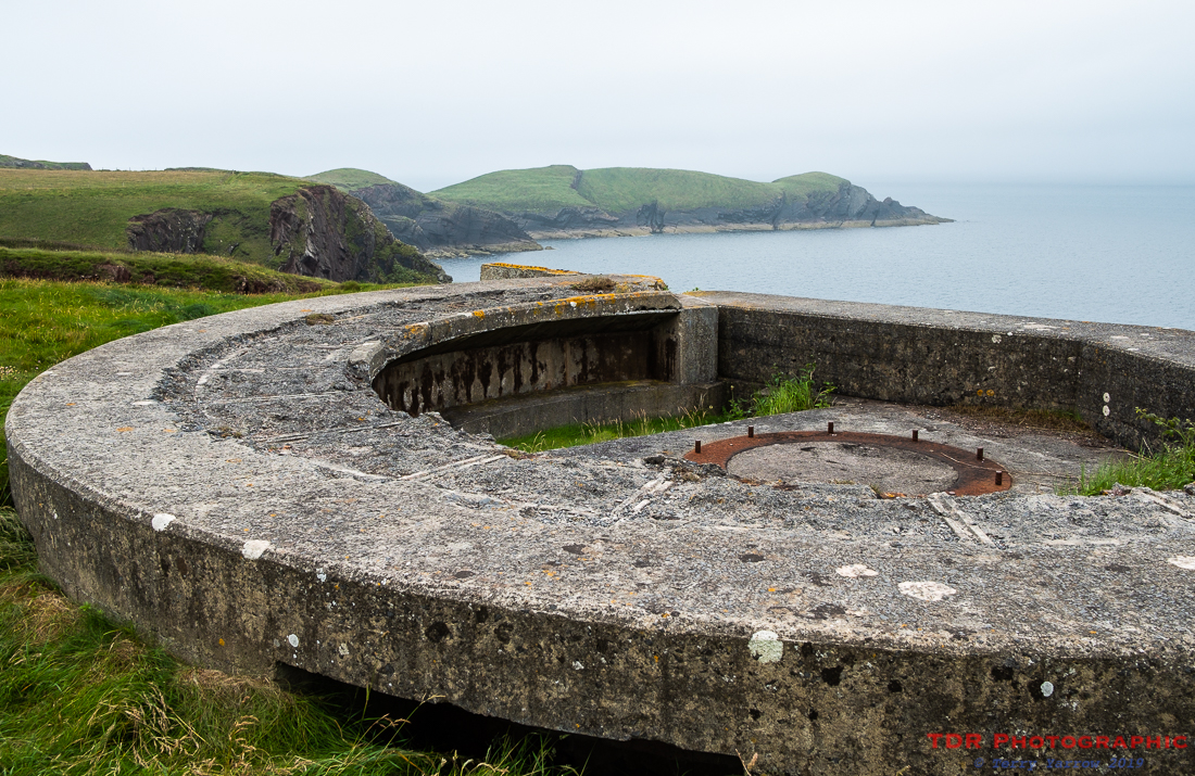
There were also many military ruins, all part of East Blockhouse which once protected the Milford Haven entrance from invasion. These relics were all very strategically placed, looking out across the harbour entrance towards St Ann’s Head on the other side. Over there, there would be other gun placements looking towards us, although these too were deserted for the most part.
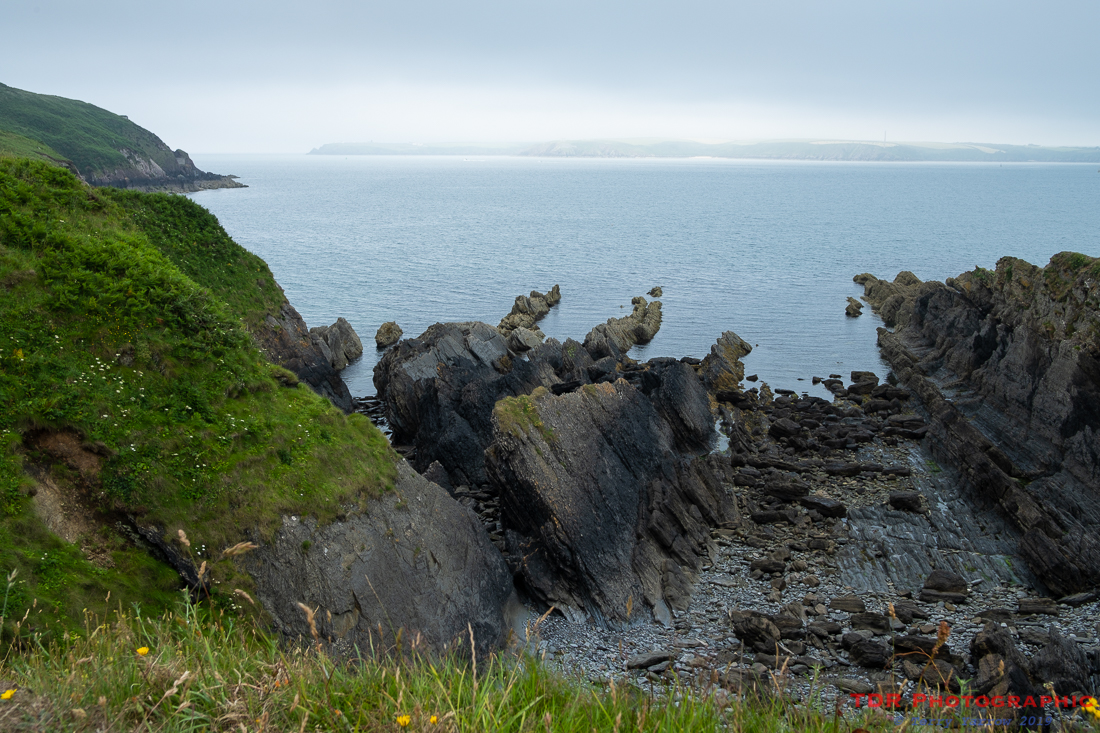
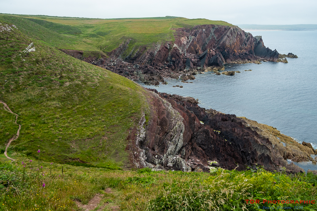
Having spent some time exploring the various ruins, we continued on our way and the cliffs took on a reddish hue. As with most of Pembrokeshire, the coastline here was rugged with many inlets, and many ups and downs. It made for tough but exhilarating walking.
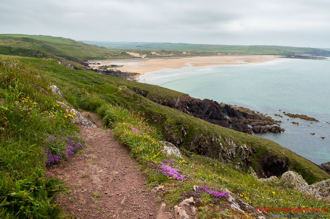
Our first real goal of the day was to reach Freshwater West for lunch. I well remember being fooled when I first backpacked this route because when Freshwater first came into view, it looked so close that I thought it would take minutes to reach it. Looks can be deceiving and in fact there were a hundred bays, inlets and headlands in that seemingly short stretch that turned into a switchback. This time I was prepared 🙂 !
It was a hot walk though as it had brightened up by now, and the climbs were steep.
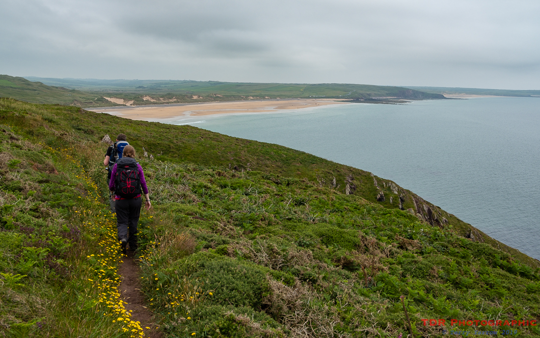
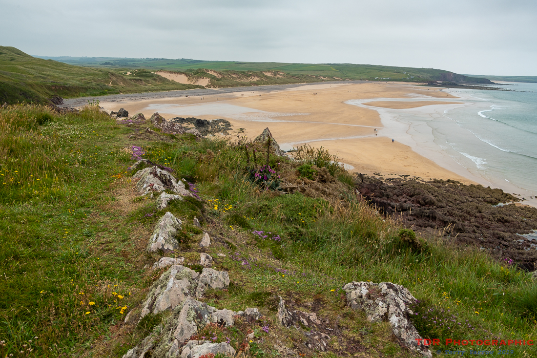
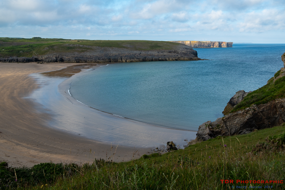
Eventually, we reached the beach, a really beautiful, wild, wide and open beach and we made our way along the sand and then through the dunes to reach our goal, a tiny boat shaped trailer that sold food and drink. This is known as Cafe Mor and the food it sells is awesome. We bought lunch and sat on the grass above the beach, and immediately donned some extra layers out of our rucksacks because suddenly it had got cold!
Having satisfied our hunger, we set out walking again……and soon had to remove the extra layers because away from the bay, the temperature immediately rose again. We walked quickly, partly because for a few miles we had to join the road, but also partly because we knew that at the end of those few miles we would reach Castlemartin and that there in the village hall they served home made cakes and teas – well its always nice to have a ‘pudding’ 🙂 !
We sat outside the hall enjoying our dessert whilst airing our now somewhat ‘glowing’ (AKA ‘sweating’) feet! The reason for having to join the road is that all along this part of the coast stands the Castlemartin Firing Range, part of which has no public access. The remainder of the range is open to the public at certain times, and I had done my research well because today, being Saturday, was one of those days.
We left the village and made our way down military roads to reach the coast again, our way being temporarily blocked by an ice cream kiosk…….well, part of an ice cream kiosk actually. It seems that it was being moved on a trailer when it somehow managed to slip off onto the vary narrow road used by military vehicles. Various people, including some of the soldiers were puzzling over how to move it! It seemed strange to me that an ice cream kiosk would even be on a firing range in the first place!
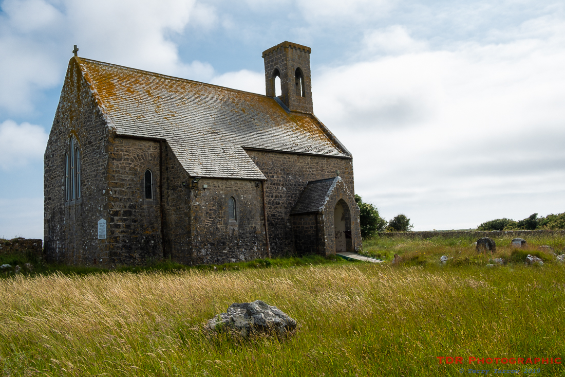
We also passed the restored church and deserted hamlet of Flimston. It was in the late 1930’s that the residents of this hamlet were given notice to quit and the army moved in. The buildings actually went through WW2 fairly unscathed and it was in fact in the 1970’s that the army destroyed most of the buildings because at the time, it had been intended to move the artillery section from Lulworth in Dorset up to Castlemartin. In the end, the move did not happen but the houses were left in ruins. Only the church itself was complete – this had been restored in the early 1900’s as a memorial to three brothers who died in the Boer War.
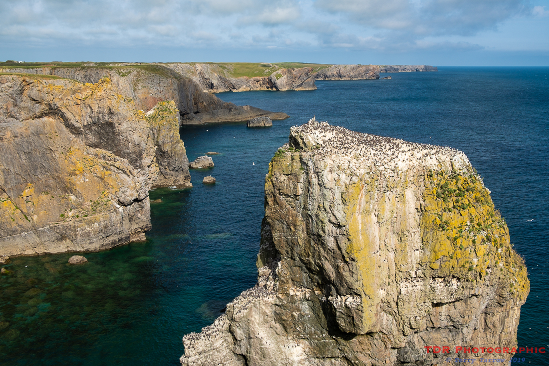
We reached the coast again at the Eligug Stacks. These stacks of rock are inhabited by guillemots and razorbills, and in fact they are named after the Welsh term for guillemot. To say they are crowded is an understatement and sitting there watching the various birds come in to land on the packed top was quite humorous.
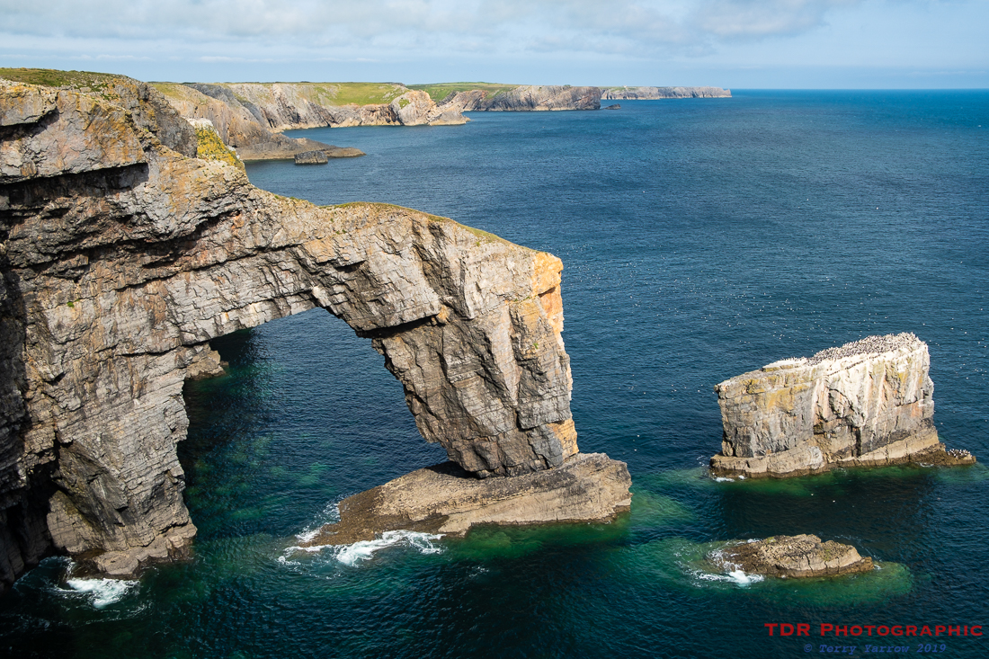
A little further along stands perhaps one of the most famous features of the Welsh coast, The Green Bridge of Wales. This massive arch stretches out to sea, the harder rock withstanding storms better than the surrounding softer rock that has eroded away. At one time the Eligug Stacks would have been part of a similar arch which has long since collapsed. The Green Bridge will presumably follow suit at some point and become another stack for the birds to nest on.
Leaving these two amazing features behind, we continued on our way along this rugged and rocky coast, passing many deep inlets and narrow chasms. In one such chasm stands the ancient St Govan’s Chapel, carved out of and built into the cliff face.
There are various stories about St Govan who lived in the 6th century, some saying he was a monk and a good man, some saying that he was St Gawain, a knight of the round table, and some saying that he was a rogue. It is said that he was set upon by pirates whilst at sea making his way to Wales and that the cliffs opened up before him leaving a fissure just large enough for him to squeeze into and hide. In gratitude, he decided to stay on, and spent the rest of his life living in a small cave in the cliffs. After his death, the site became an important place of worship and the chapel was built there, over the cave, sometime in the 13th/14th century. It is said that St Govan himself is buried beneath the altar.
As is often the case with these things, there are many associated stories, such as the saint’s handprints being found in the rock, the church bell having been ‘imprisoned’ in a nearby rock so that if you tap it, the bell chimes, the number of steps to the chapel varying depending on whether you are going up or down, etc etc. There were also two wells from which Govan could collect water and one of these became a holy well.

The light was beginning to fade as we left the chapel and climbed the steps back up to the clifftop………now, how many steps were there? 🙂 We made our way round the headland and soon stood above Broad Haven Beach with just a short walk to reach our stopping point at Bosherston.
What an awesome day’s walking this was, 19 miles of glorious coastline, good weather, lots of wildlife, and so much to see along the way. We were staying at the local pub that night so did not have far to go to buy food, and we ended the day sitting on a roof terrace outside our rooms reminiscing over our day.
Thanks for stopping by and reading my ramblings, and I hope you enjoy exploring with me.
Until next time,
Your friend
The Dorset Rambler
If you would like to contact me, my email address is terry.yarrow@gmail.com – comments and feedback are always welcomed.
All words and pictures in this blog are the copyright of The Dorset Rambler and may not be reproduced without permission.

2 Comments