

Some three years ago I backpacked the whole of the Pembrokeshire Coast Path during a very cold, wet and windy April and despite the weather, I fell in love with that rugged coastline. Recently, it beckoned me again but this time I walked it not alone as I did previously, but with the best walking companion, my son Paul. And that wasn’t the only difference, this time it was October and the weather was near perfect……for Pembrokeshire at least 🙂 !
The Path runs from St Dogmaels in the north to Amroth in the south, a distance of some 186 rugged miles. This time, we were intending to walk for four days, finishing at the city of St David’s, named after the patron saint of Wales.

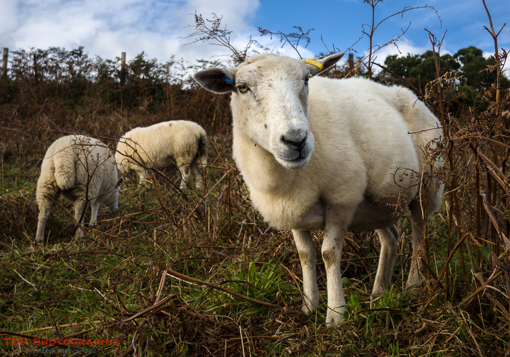
We set out from St Dogmaels on a bright and breezy morning, walking along the shoreline of Cardigan Bay, following the road and then track that climbs steadily upwards to reach the point of Cemaes Head where the path takes a sharp left turn. At this point, we were greeted by some unusually inquisitive sheep.
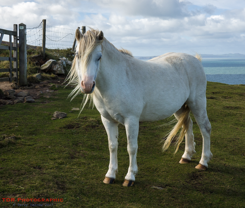
And sheep weren’t the only animals to greet us either, as a little further on, some very friendly ponies came over to say hello. Nice to have a bit of a welcome party and to know that the natives were friendly 🙂 !
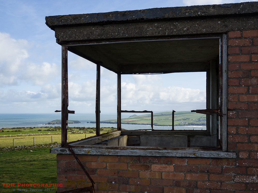
All along this coast, there are relics of war and we passed the first of these on Cemaes Head. A lookout post in a comforting state of dereliction – these relics of war are also a symbol of peace by their very dereliction from decades of disuse. You can’t help but wonder though what it would have been like standing there when this building was in its heyday. In fact this particular post dates from long before WW2, having been built originally as a coastguard lookout in the 19th century.
The coast along the northern part of Pembrokeshire is truly spectacular with many high headlands and craggy inlets where river and sea meet. It is a switchback of steep climbs and falls and a sign part way along makes it very clear that this is a tough section, stating that there are no escape routes, no water and no provisions until you reach Newport. But of course it is this very fact that makes it such an awesome place to walk.
The highest point of the whole coast path goes by the somewhat unpronounceable name of Pen yr afr. We made our way across this 574 feet high monster bathed in beautiful sunshine – so very different from the last time I passed this way. The only similarity was the wind although even that was nowhere near as fierce as three years ago when I struggled to even keep on my feet.

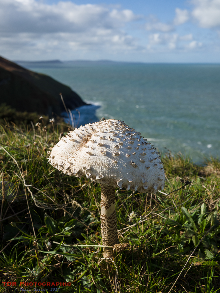
It is of course the ‘season of mists and mellow fruitfulness’ and with that comes a plentiful array of fungi. We would pass many more of these before the end of our walk. As we walked, we kept a constant eye on the sea for any telltale signs of dolphins but on this occasion they were conspicuous by their absence.
Along this first part of the walk, the path underfoot was soft and grassy and with beautifully autumnal bracken on either side. This was not the case with the path generally though as much of it is rocky and hard on the feet. For now though, we enjoyed the softness and the slanting autumn sun. In the distance, we could see the distinctive shape of Dinas Island, which is actually not an island at all! We would be walking round that tomorrow.

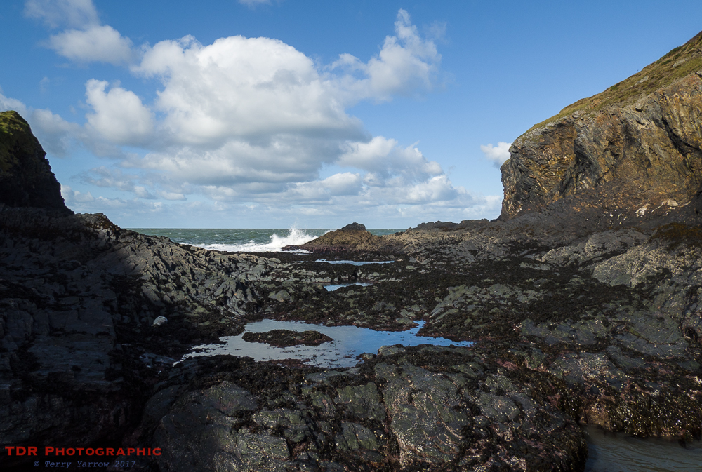
Very soon, we dropped down once again to sea level at Ceibwr Bay, a one time seaport serving Moylgrove and its farming community. Just before the bay we passed a well positioned seat, sheltered nicely from the wind, and lunchtime suddenly appeared out of nowhere 🙂 ! Refreshed and replenished, we explored the bay with its rocky outcrops and not quite ‘crashing’ waves. The upturned strata made for an interesting and rugged coast, but needed great care when walking across it.


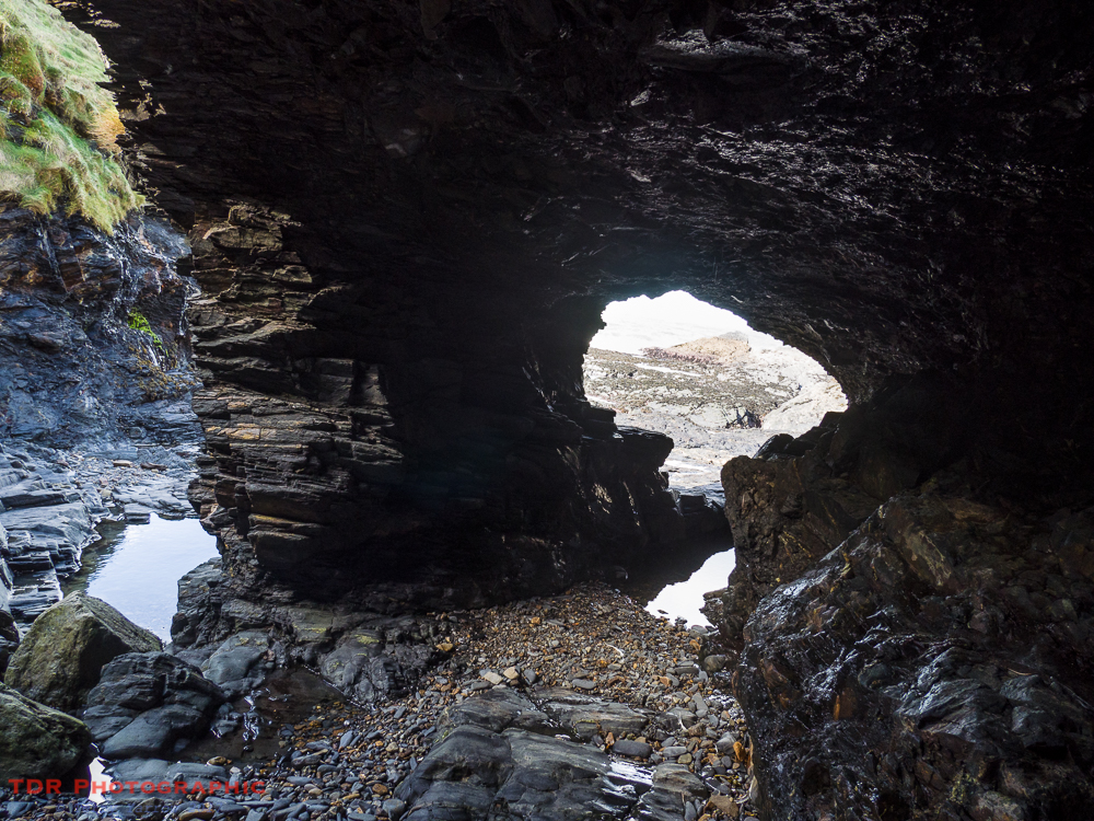
Just a short way on, having climbed up over another headland, we dropped down yet again to another equally rugged inlet with an even more unpronounceable name. This was Pwll y wrach, also known as The Witches Cauldron, marine erosion at its best. Several caves formed at this point when softer rock was worn away by the sea along a fault, and the subsequent collapse of some of these created the cauldron itself, accessible only by boat. This was definitely a place to explore!
It was at this point that we saw our first seal, a cream coloured pup sleeping on the rocks, unreachable because of a tract of water in front of us. This was the first of many as throughout this walk, every bay and inlet had seals either sleeping or playing.
The light as we walked along this part of the coast was spectacular. Bright sun intermingled with cloud gave a spotlight effect which combined with the outcrops and foaming sea made a breathtaking scene. One can only stand and wonder at the beauty of this created landscape. It is one of the things that motivates me to walk.

According to our guidebook, a feature of this area is ‘rotational slumps’ and apparently there are a number although we decided that it would probably take a geologist to recognise them. They are caused when the top layers slide in a rotational manner down harder and slippery sub-strata, causing a layering effect to the land.
After much up and down, in and out, winding walking, we finally rounded a headland to see Newport Sands in the distance with Newport beyond. That would be our stopping place for the night.
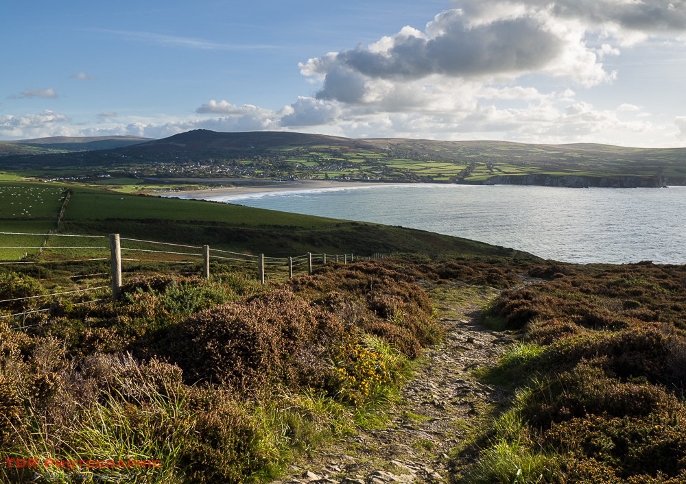
We dropped down off the headland to reach the Nevern Estuary and the wide expanse of sand to reach the crossing point of the river and made our way along the southern estuary shoreline as the sun set before us, to enter the town itself and our overnight stop.
They say that walking the whole of the Pembrokeshire Coast Path is the equivalent of climbing Everest in terms of ascent and the first section from St Dogmaels to Newport is the toughest but the views and the sheer ruggedness of this coast makes it all worth while. To walk it in such perfect conditions just made it all the more special.
Tomorrow would see us out on the next section of the path, heading for Llanwnda. We were looking forward to it.
Thanks for stopping by.
Until next time,
Your friend The Dorset Rambler
If you would like to contact me, my email address is terry.yarrow@gmail.com – comments and feedback are always welcomed.

1 Comment