

As you may know, I have recently completed the Wainwright Coast to Coast long distance path that runs from St Bees on the west coast to Robin Hood’s Bay on the east coast and I have been detailing my experiences over the last few weeks. This blog entry is a summary of hints and tips for anyone thinking about doing this walk, or indeed any long distance end to end walk. It is of course not an exhaustive list but rather a summary from my own experience. I hope you will find it interesting and helpful.

Overall assessment of the route
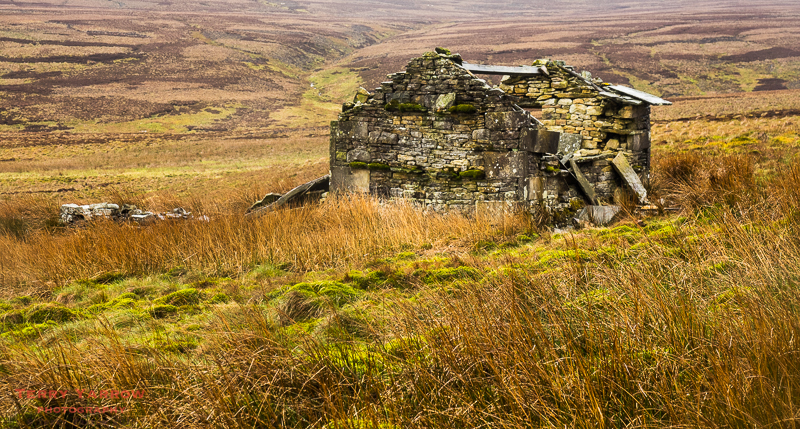
The first thing to say is that it is a fabulous walk with amazing scenery, awesome views, a generally good choice of accommodation, friendly people, and lots of interesting things to see on the way. That said, it is a tough walk – you will climb the equivalent of Mount Everest and descend as well of course. It is officially 192 miles from end to end but with perhaps a few extra miles to reach accommodation on some days, this will probably increase to 200 or so. There are some steep climbs, rocky paths, boggy parts, and not being a national trail, it is not always well way marked. Oh, and lets not forget the weather as you will pass through the wettest place in England. It is however all perfectly ‘walkable’ provided you have a level of fitness and are able to use navigation aids. More than that, it is a thoroughly enjoyable experience. No wonder it is an internationally acclaimed route.
To backpack or not to backpack
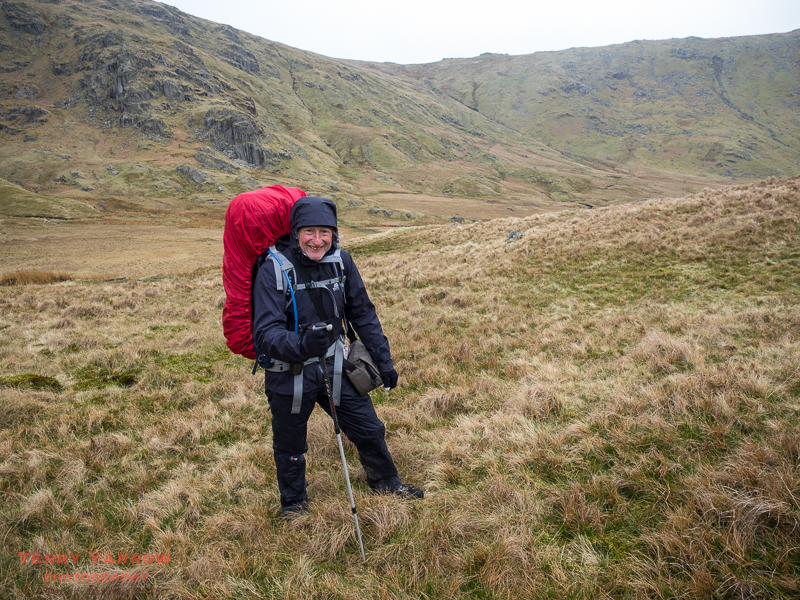
There are a number of ways to complete the route – to backpack it and carry everything, to use baggage transfer, or to do short sections only. I chose to backpack it for a number of reasons which I can sum up in just three words – purist, challenge and freedom. I enjoyed the challenge of not relying on anyone or anything else, and I enjoyed the freedom to stop wherever I wanted without having any prior set agenda, meeting difficulties as they arose. This freedom is particularly enhanced if you can wild camp but in my case, the conditions were against me this time. Only 2% of people backpack the route but for me, nothing can replace the feeling of having won through as I walked into Robin Hood’s Bay.
Using baggage transfer has obvious advantages and is comparatively inexpensive on this route. It does mean though that you need to pre-book accommodation so that they know where to deliver your bags, so taking some of the spontaneity out of the walk. On the positive side though it does mean that you can probably enjoy each day’s walking a little more since you don’t have to focus on just getting over each hill with a load up.
Having completed it once by the ‘purist’ method, I could be persuaded to use baggage transfer if I did the route again.

Time of year
I don’t think that there is a right time of year to do this walk although you need to bear in mind that it is a popular walk and becomes very busy in peak season and on bank holiday weekends. Equally, conditions in winter will not necessarily favour walking. My view is that spring or autumn is probably the best time but it is down to personal preference. If you are backpacking of course, walking in warmer weather means you will have less to carry.
Navigation
This is probably the worst way marked of the popular long distance walks. I took four navigation aids with me – a GPS with the route downloaded, strip map and compass, guide book, and an iPhone map Ap (UK Map) and I used all these. Having walked with others who used different maps etc, I would recommend A-Z Adventure Atlas which has Ordnance Survey maps rather than the strip map that I took. It fits neatly into a waterproof cover too. Care is needed with the GPS download as the route may vary slightly from the guide book, which can be confusing. I used the Stedman guide book which proved helpful and generally adequate although there may be better ones. You do need to be aware that guide books go out of date so you might need to double check if it states for example that there is a shop in a certain village – I was caught out several times during my walk.

Navigation can be particularly difficult in bad weather. Thick mist is an obvious issue but even on a clear day when it is very wet and windy, it can be really difficult to read a guide book or map without it being destroyed! There are also some notorious navigation hot spots where people regularly go wrong but I will detail these in a separate entry. The good news is that although I took an occasional slight detour, at no point during the 200 miles did I stray too drastically from the route.
Paths
Paths are a mixed bag. Some road walking, some lovely grassy paths, some very rocky areas, some cliff tops, some ‘paved’ moorland paths, some forest trails, some farm tracks, and some wild, exposed and very boggy moorlands. I will try to detail these more specifically in the next entry.

High level alternatives
There are a number of alternative high level routes that you can take and, depending on your fitness, I would recommend taking at least one of these if the weather conditions are favourable. The main ones are the High Stile/Haystacks ridge (my day 2), the Calf Crag to Helm Crag ridge (my day 3), Helvellyn and Striding Edge (my day 4), Nine Standards Rigg (my day 7), Gunnerside and Melbecks Moors (my day 8). Haystacks and Helvellyn are particularly fine routes.
West to east or east to west?
Wainwright recommended west to east so that the prevailing weather will, in theory, be on your back which makes sense. However, it does mean that you will have the most climbs and arguably the best scenery in the early days. Walking east to west will mean a slightly easier first half enabling you to get fitter and stronger before you scale the greater heights which also makes sense. Most would also probably say it will ‘save the best to last’. At the end of the day, you ‘pays your money and takes your choice’ 🙂 !
How many days?
This is like saying how long is a piece of string as it depends entirely on your fitness level and what you want to achieve. Most people take around 2 weeks, slightly under or slightly over. Some take a rest day in the middle. I averaged 16 miles a day carrying a 20Kg pack which was about right for me. Remember, you want to enjoy it and anything good should not be rushed.
Plan well but be flexible
One of the things I like to do when preparing for a long walk is to research and plan it well, looking at guide books and reading accounts written by others who have completed the walk (one of the reasons I blog my walks afterwards is to help others who are considering doing the walk). I think preparation is essential but I also think it helps to leave some space for changes along the route – prepared but flexible is my approach and it works for me. That is of course one of the benefits of backpacking the route.
Organising the day
This is of course down to personal preference as well as meal times if you are staying at B&B’s but for me, it worked to get up and go to bed with the sun……assuming there is any sun 😉 ! I was usually out on the trail between 6.00 and 7.30am and aimed to arrive at my stopping point for the night whilst there was still some sunshine (hopefully) in order to dry the tent which was invariably wet from the previous night. Starting early can also help to avoid the ‘rush’ as most walkers will leave after breakfast. In terms of distance walked, this will depend on the terrain and fitness levels. The most important thing is to enjoy the walk and leave enough time in the day to ‘stand and stare’ as there is plenty to see.
Food and drink
With food, there is a need to think ahead as there may be days when no food is available along the route you have chosen. I found it useful to always carry extra food that will travel well such as cup-a-soups, pork pies, breakfast bars, nuts etc., plus some dehydrated meals provided you have a stove. I carried water, but I also carried a light water filter just in case I ran out for any reason. Depending on where you stay, there will usually be a pub available for a main meal and often they will offer packed lunches too. As mentioned earlier, don’t rely too much on the guide book for shops and cafes on route as they may have closed down since the book was last revised.

Weather
I think it is fair to say that in the mountains of the north of England, weather is at best mixed so prepare for the worst. Borrowdale, and indeed the Lake District generally, is one of the wettest places in England so be prepared for rain. During my 13 day walk I encountered lots of heavy rain, sleet, below freezing temperatures, gale force winds, lots of surface water, mist, low cloud, but also beautiful sunshine. In terms of wet weather gear, I carried a waterproof jacket and trousers, gaiters, waterproof cover for the rucksack, and waterproof cover for the camera. I also needed gloves and a woolly hat even though it was May. Everything in my rucksack was stored in waterproof stuff sacks.
One thing I did try this time was to carry some waterproof socks and these proved invaluable when putting on boots that were still wet from the previous day. Oh, and I always carry a change of shoes for the evening so that I don’t have to go to the pub in wet boots. Don’t forget that wet grass can mean wet boots even if it is not raining.
People
One of the features of this walk for me was the friendliness of the people, both the local residents and fellow walkers. I lost count of the number of times locals chatted to me and pointed out the route, and I walked with people of several different nationalities. There was a real community feel about the walk and that was one of the highlights.
One of the strangest things was when I came to sign the book at the end of the walk and the name immediately above mine and completing the walk on the same day as me was a girl who lives just a couple of miles from me in Dorset. What a coincidence…….and not only that but by chance I shared a room that night at the local hostel with her father.
Electrical equipment
Keeping mobile phones etc charged up can be a potential issue if you are backpacking. I like to keep in touch with my family and I like to Tweet the walk as I go, plus of course I am a photographer. This means that I have at least two things that need charging regularly. I researched solar chargers which seemed the ideal solution but was unable to find one that was small, light and yet charged well…….unless you live in Florida with permanent sunshine! I resorted in the end to a battery pack that would charge an iPhone seven or eight times. Ultimately I didn’t have to use it that much because I found that pubs and cafes are more than willing to allow you to use their sockets to charge equipment. One thing I did do though is to carry a second cheap pay-as-you-go phone on a different network to my main phone in case of emergency.
Mobile signal
Be aware that a mobile signal is not always available in a lot of areas, notably in the Lake District where some of the pubs in the valleys do not seem to have any wifi either.
I hope this has been useful but if you want to ask anything specific, please do feel free to comment on the blog or email me. In my next blog entry I will try to give a very brief summary of each day, including potential difficulties.
Until next time,
Your friend, The Dorset Rambler.
Comments and feedback on this blog are welcome. If you would like to contact me, my details are on my website which is http://www.yarrowphotography.com.
If you would like to join me on my walks, my Twitter feed is http://twitter.com/adorsetrambler.
All photographs, poems and words in this blog are the copyright of The Dorset Rambler and must not be reproduced without permission.
