
Day 12 – Blakey Ridge to Littlebeck – 19 miles
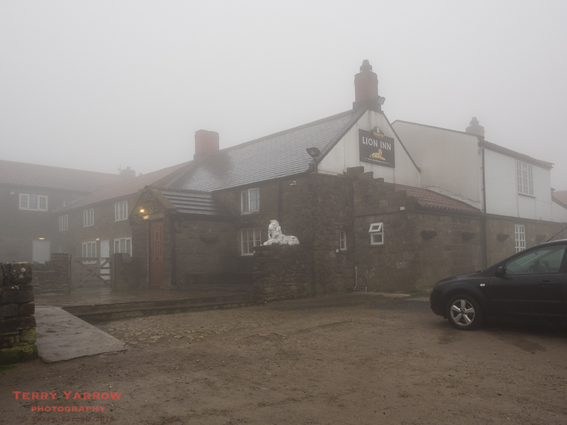
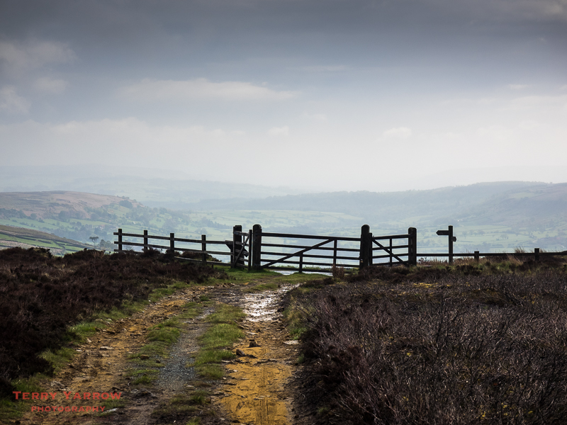
I woke at 5.30am after a disturbed night, caused by the constant flapping of the tent in the strong gusting wind. I peered outside to see thick mist and low cloud with heavy rain – not what had been forecasted at all! However, it wasn’t unusual since the Lion Inn is one of the highest pubs in England!
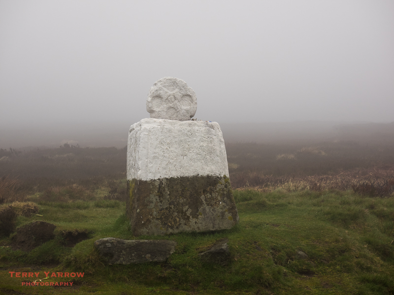
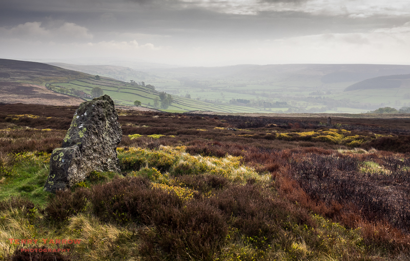
I decided to get going early and was out on the trail again before 6.30am, initially following the road across Danby High Moor. Being on the road was something of a relief bearing in mind the poor visibility, although it did mean dodging the occasional car that loomed suddenly out of the mist. After a couple of miles, I passed Fat Betty, the stone in the picture below. This is in fact a medieval cross dating from the 12th century and is also known as White Cross. These wayside crosses or marker stones would have been used for hundreds of years as a guide for pilgrims crossing these wild and remote moors.
Naturally there are numerous different legends surrounding Fat Betty but the truth about its origin has been lost in the mist of time (pun intended 🙂 ). The most plausible explanation is that it was something to do with the nearby Rosedale Abbey – the nuns there wore white habits.
There is a more modern tradition whereby walkers take a sweet or snack from the stone and leave something of theirs for the next traveller. After the wind and rain and mist, the few sweets that were on there were somewhat the worse for wear so I just picked one up and put it back as a nod to tradition 🙂 !
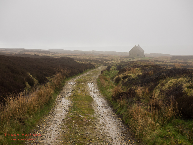
After some time on the road, I branched off across moorland paths, passing Trough House on the way. This very remote house stands on the high moors and is used as a shooting lodge. Had the weather really closed in this would have made a good sheltering spot……..except that it was locked.
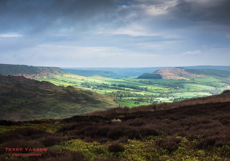
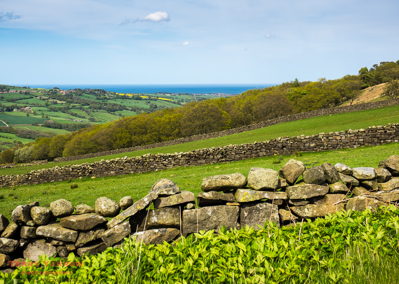
The 10 miles from Blakey Ridge to Glaisdale is nearly all downhill and I gradually dropped out of the low cloud although it still took some time for the rain to stop. In the valleys below I could see splashes of sunshine appearing, but not where I was! Great Fryup Dale looked particularly inviting when bathed in sunshine, although it wasn’t actually on my route. Its name by the way has nothing to do with breakfast – in fact it was probably named after Frige, an Anglo-Saxon goddess, and hop, meaning a small valley.
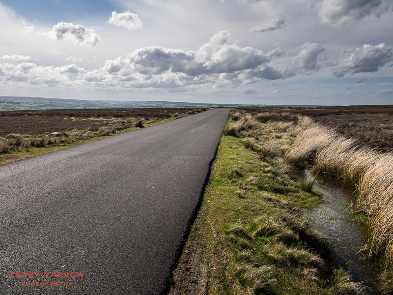
The walking was really more of yesterday – crossing the open moors on wide sandy/stony paths or narrow country lanes with skylarks overhead and grouse, lapwings and curlew all around. Finally as I dropped down to another stretch of road walking, the rain stopped and I got the weather that had been forecasted:) ! My abiding memory of the walk along Glaisdale Rigg on the road is being able to FaceTime my wife and young grandson – modern technology makes being away from home so much easier!
Leaving the road once more for another moorland track, I bumped into a backpacker coming the other way. In nearly two weeks, he was the only backpacker I had seen apart from myself – apparently only 2% of people backpack the C2C, the rest use baggage transfer services or just walk parts. He was a young guy originally from Northallerton but who had moved to London. He had just given up his job and was walking the C2C from East to West before looking for a new position. We compared notes for a while before bidding our farewells and I continued downwards towards Glaisdale while he continued upwards towards Blakey Ridge.
Walking into Glaisdale in bright sunshine, I was delighted to see a tea rooms that was open. It was no more than a wooden outbuilding beside a house but the welcome was very warm and the tea and cakes were very timely after 10 miles of walking. I sat out on the little raised decking area drying off in the sun and chatted to the lady owner. Below me in the garden was an outside model railway although sadly it wasn’t running that day as the lady’s husband was out.
I have to say that with views stretching across the valley, I could have happily sat on that raised balcony for the afternoon but I still had some miles to walk so I headed off again.
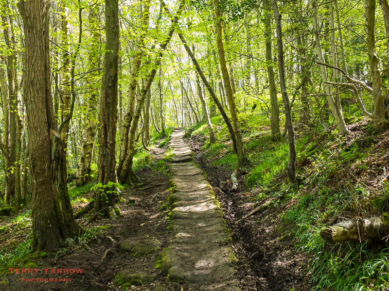
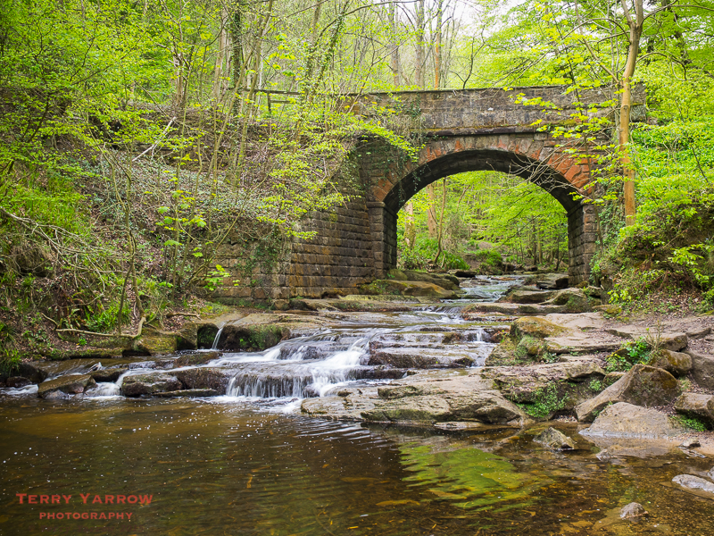
The route was now at a much lower level at least for a time, and I left the town and followed the River Esk through some beautiful woodlands, passing Beggar’s Bridge on the way. The story goes that a young pauper was courting the squire’s daughter and went overseas to make his fortune. He wanted to say goodbye to his lover but was beaten back by the river which was so swollen. Many years later when he returned, he married the girl and built the bridge to help others who might be in the same situation.
This was easy walking as the path had been ‘paved’, and there was some delightful sunlight filtering through the trees that were wearing that lovely fresh green foliage of spring .
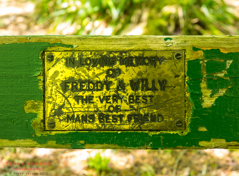
On the way through, I passed an interesting memorial bench dedicated to Freddy and Willy who were clearly two dogs. I could imagine their villager owner walking with them through these woods.
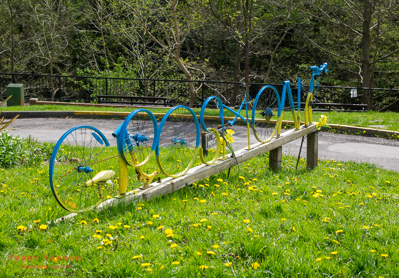
I passed through Egton Bridge, another pretty little village, and then walked on along an old toll road to Grosmont with its somewhat interesting sign. It actually took me a while to work out what it said. It was in fact created from old bicycle parts to celebrate the coming of the Tour De France to Yorkshire.
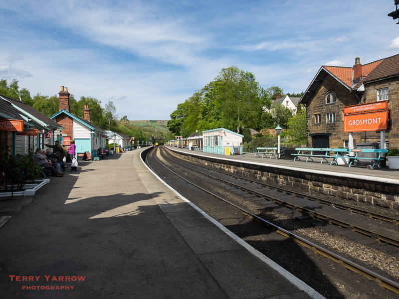
Grosmont, a somewhat ‘grittier’ town than its neighbours, is known for a number of things; its priory, its iron ore mines, its iron works and furnaces, its tunnel for the horse drawn railway – said to be the earliest passenger railway tunnel in the world (in fact the settlement used to be known as ‘Tunnel’) – but perhaps it is now best known for its preserved steam railway. I had lunch and spent some time looking around the various railway paraphernalia and would have liked to have stayed longer but I needed to move on.
I did know that this mainly downhill day was going to end with a steep climb up over Sleights Moor at 700 feet but after 15 miles of walking, the climb still came as a shock to the system. There are two interesting things about this part of the walk – one is that on the climb out of Grosmont I had my first sighting of the North Sea where my walk would end, and the other is its name. This area is known as Eskdaleside Cum Ugglebarnby!
Having reached the top of the climb, I really enjoyed walking across the moors. It was now a beautiful day despite the breeze and of course the skylarks kept me company. It was so lovely that I actually sat for some time beside the empty road to drink in the sights and sounds. It is strange that an area so peaceful should be known partly for a murder committed in 1841 which was the first case where an officer from Scotland Yard was sent to the provinces to solve.
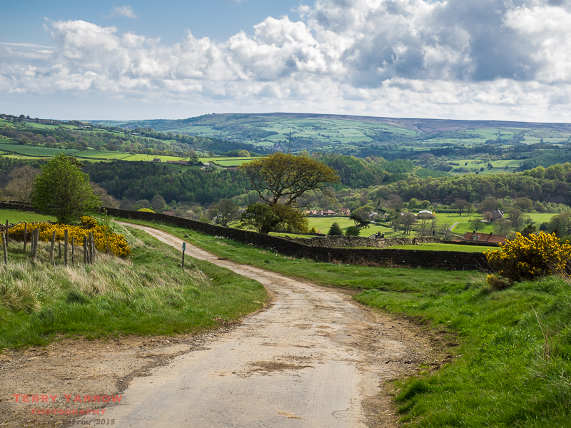
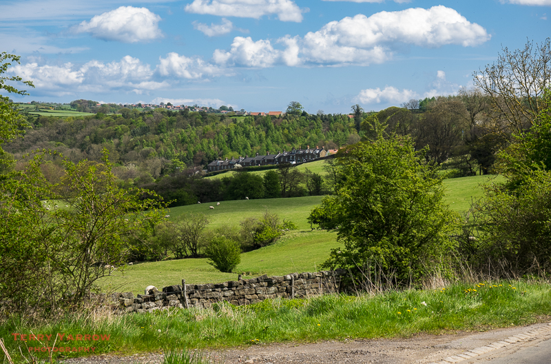
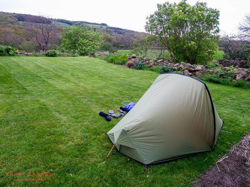
I dropped down off the moors towards Littlebeck but detoured slightly to Intake Farm as I had decided to stop there for the night. I arrived and was greeted warmly by Judith and Robert and given a cup of tea and cake in their kitchen…..and I didn’t even have to take my boots off. There couldn’t have been a better welcome and the shower was welcome too 🙂 ! I pitched my tent on the back lawn with views across the valley to the woodlands that would be my route out tomorrow.
As the light faded, I lay in my tent listening to some gentle music and thinking back over what had been a great day’s walking despite the earlier rain – and thinking that there couldn’t have been a better end to the day.
Day 13 – Littlebeck to Robin Hood’s Bay – 12 miles
I woke after a really good night, with mixed emotions! This was to be my last day on the C2C and part of me was excited at the prospect of reaching my goal at Robin Hood’s Bay, while the other part of me was sad as I wanted the walk to continue. I was out on the trail again before 6.30am as I wanted to leave enough time at the end of the day to take a bus ride into Whitby, a place I had never seen before other than in pictures.
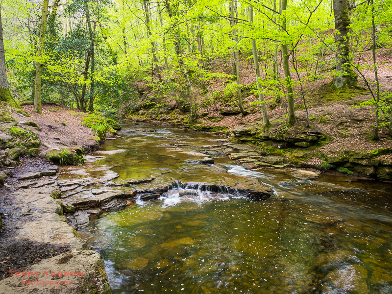
I dropped first of all down into the lovely peaceful village of Littlebeck, a once busy centre of alum mining, before entering the most beautiful stretch of woodlands imaginable. This was Littlebeck Woods and this first part of today’s walk was described accurately by Alfred Wainwright who said…….
“Then follows a descent to this tiny hamlet, set in a secluded and sheltered valley amid scenery of bewitching beauty; a heaven on earth in exquisite miniature. Here a path is taken amongst the trees, with sparkling stream as companion to the higher reaches of the valley.”
Despite the cloudy morning, this was a wonderful walk with birdsong to accompany me all the way.
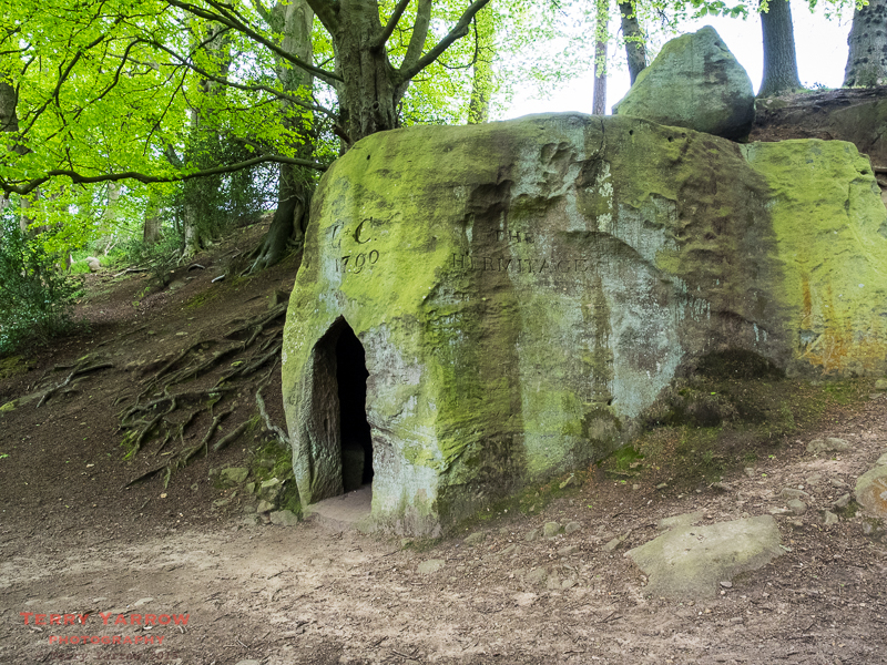
I passed first of all The Hermitage, a cave like dwelling carved out of a single sandstone boulder with the date 1790 above the door plus the initials GC reputedly referring to George Chubb, a local school master. It was said to have been carved out by an out of work seaman acting on Chubb’s instructions. Above the folly are two wishing chairs and it is said that if you make a wish in one, you must sit in the other to make it come true.
A little further on, I passed the Falling Foss waterfall, a 20 meter cascade which is part of May Beck. Beside the waterfall is the Falling Foss Tea Garden which is in the grounds of what was Midge Hall, a former game keepers cottage. Left derelict for some 50 years, this has now been restored……although sadly it was closed when I passed as it was still early in the morning 😦 !
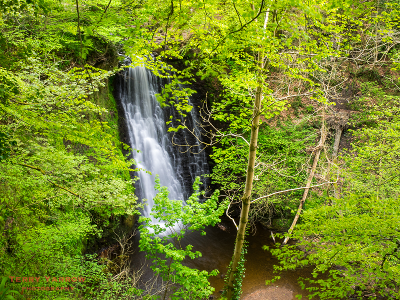
This is such a delightful glade as the beck ripples its way across boulders and cascades with woodlands on either side. This must surely be a popular place in the summer but today I had it all to myself! I really wished that the sun had come out to brighten up the photographs but it wasn’t to be.
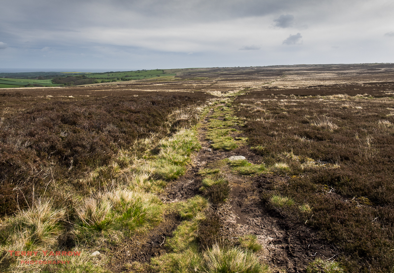
It was with regret that I left the woodlands and climbed gradually up the hillside to reach the open moors once again. This was to be my last stretch of moorland and I crossed it just as the rain began to fall, although fortunately despite flurries during the morning, it didn’t come to anything significant. Crossing these moorlands was actually quite difficult as both Sneaton Low Moor and the Graystone Hills were extremely boggy in places and by now, I was nursing a pair of split boots, just trying to eke them out to the end of the walk before they gave up completely 🙂 !
Once off the moors, the walking became much easier as I headed across better drained grassy paths towards the coast, and then a section of road walking through Low and High Hawsker.
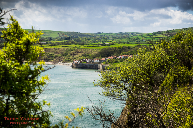
Finally I dropped down through a caravan park to reach the coast at Pursglove Stye with the North Sea directly ahead of me – a gateway led nowhere. I wondered who had put it there and why! This part of the coast is known for its fossilised timber that was mined, shaped, polished and transformed into Whitby Jet.
This seemed to be a case of so near yet so far! After walking 9 miles, I wanted to take a break and have a sit down but I had decided I would only stop when I could see Robin Hood’s Bay. Every rise I climbed or headland I rounded I expected to see the bay in front of me, only to see yet another headland or hill.
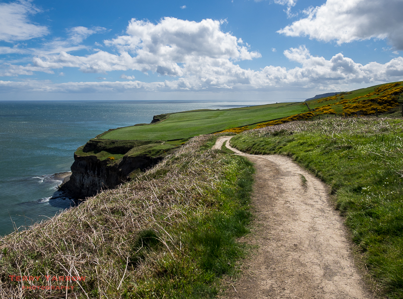
Finally I saw the bay in the distance through a gap in the cliff top hedgerow. My goal was in sight and I sat and enjoyed the moment. The walk wasn’t yet over of course as there was still a mile or so to go. These last few miles along the cliff top seemed a fitting end to the walk, mirroring the miles at the start of the walk two weeks earlier along the Irish Sea.
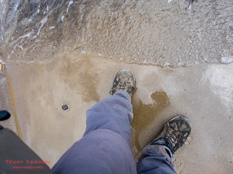
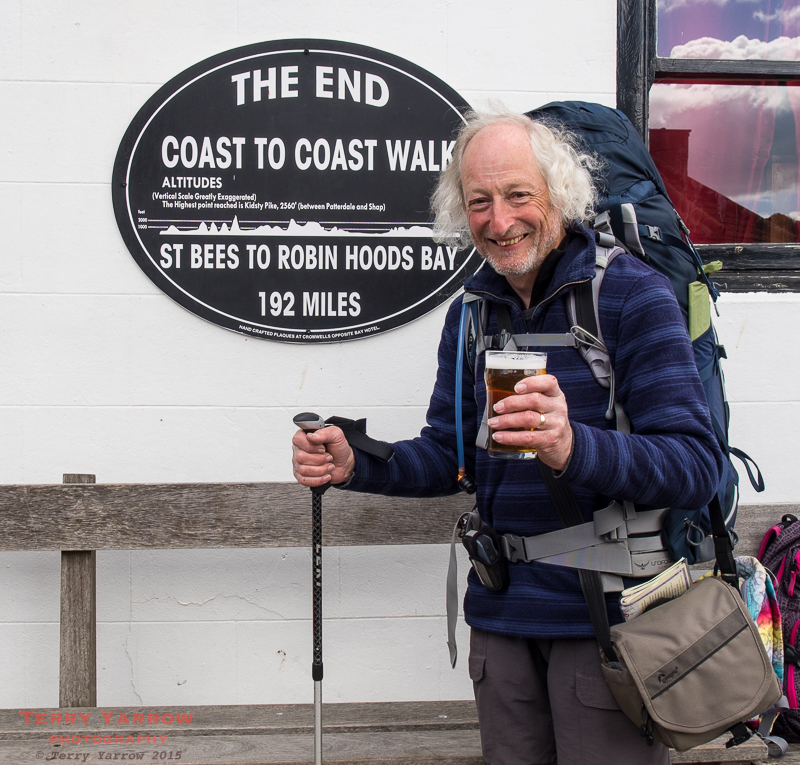
The last mile was easy and pleasant as I made my way first along the cliffs and then steeply down the road to the town itself where I immediately went to the beach to follow tradition by putting a toe in the North Sea and depositing the pebble I had carried for 200 miles. It was a great moment.
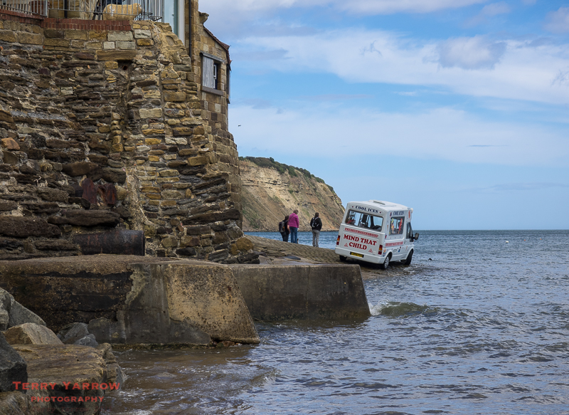
I looked across to the slipway that marks the end of the walk with an ice cream van perched precariously beside the water. I was back in civilisation!
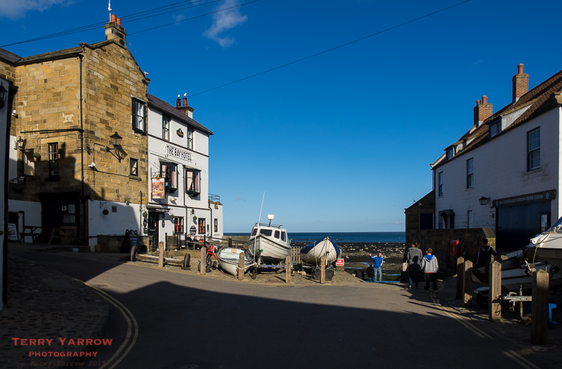
I made my way to the Bay Hotel where I ordered a pint of Wainwright Ale from the first floor bar – disappointingly the Wainwright Bar below was closed as it is only open at weekends. Later on I would sign the Coast to Coast Book which is kept on the bar but for now, I just sat outside looking out to sea reflecting on what had been a fantastic walk, an amazing two weeks, a fabulous experience, and one that already I couldn’t wait to repeat!
Thanks for stopping by and for sharing this walk with me. I hope it might inspire you to put on your walking boots and try it for yourself, you won’t be disappointed. In my next blog entry, I will summarise the walk, give some hints and tips for would be walkers, highlight some of the challenges met on the way, and hopefully provide some practical information to help with your own planning.
Until next time,
Your friend, The Dorset Rambler.
Comments and feedback on this blog are welcome. If you would like to contact me, my details are on my website which is http://www.yarrowphotography.com.
If you would like to join me on my walks, my Twitter feed is http://twitter.com/adorsetrambler.
All photographs, poems and words in this blog are the copyright of The Dorset Rambler and must not be reproduced without permission.

A wonderful read Terry! Thank you so much for sharing. Your writings have me both full of enthusiasm for my upcoming C2C journey and also apprehensive as I have never done anything remotely similar. I very much look forward to your final ‘tips and observations’ posting.
Thanks Mark, it’s great to have your feedback and I’m really pleased the blog is helpful. I would be very interested to hear your thoughts on the walk when you have completed it. In the meantime, I wish you well with your planning.