
Day 10 – Bolton-on-Swale to Osmotherley – 19 miles
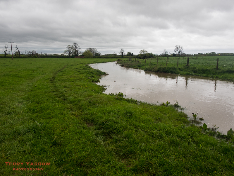
I woke after a surprisingly good nights sleep in my dirty, junk filled farm outhouse! I had half expected all manner of creatures to be crawling over me in the night but if they did, it didn’t waken me. I was up and out before anyone at the farm had made an appearance and I made my way across fields beside a swollen stream to regain the C2C path again. Surprisingly, the morning was dry although heavily overcast. Dull weather and intermittent rain was to stay with me for most of the day.
This wasn’t a day I was particularly looking forward to as it was to be mainly a continuation of yesterday evening’s flat farm fields. Wainwright himself said that the trek across the Vale of Mowbray was likely to be a tedious day for most people – he bemoaned the fact that there were no dry stone walls, no decent footpaths, no views, ‘nothing of interest to anyone but farmers’. He writes, ‘Tedium grows apace and one plods onward mechanically, head down, thinking nostalgically of places left behind: Lakeland, limestone country, the Dales’! He made great efforts to find decent footpaths but for one eight mile section, every attempt failed so he suggests that, ‘It is better to stick to the road in this section and get on quickly’. I took his advice.
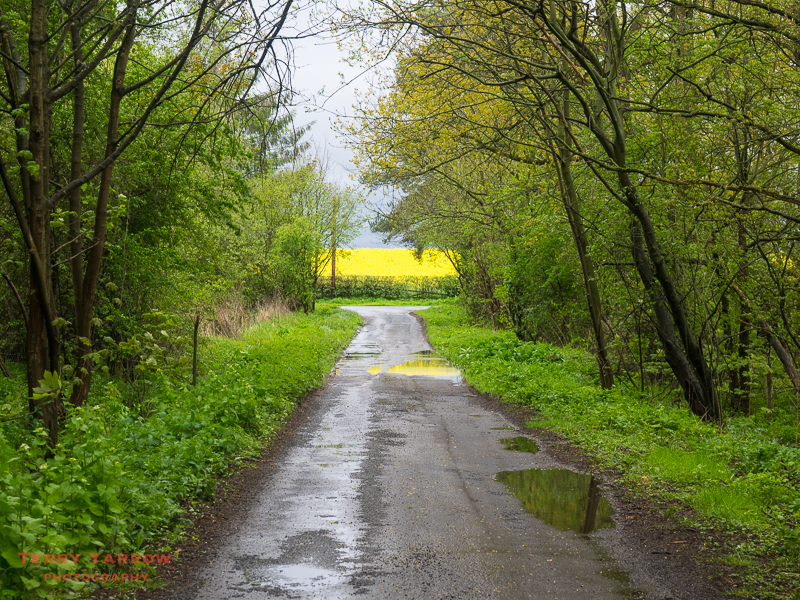
Fortunately the roads were very quiet and although tarmac is hard on the feet, at least you can put yourself into autopilot and walk without having to think about what is underfoot. I would imagine that later in the year when the hedgerows are in full bloom, this would perhaps not be such a bad section to walk. One benefit of course is that the further you walk, the nearer you are getting to the North York Moors and higher ground again.
After yesterday’s deluge, there was mud and water everywhere, and I trudged for most of the morning along the tarmac, choosing to avoid the few off road paths that had been developed since Wainwright’s day. I passed through Streetlam and walked on to Danby Wiske where I had hoped I might be able to buy a bacon sandwich at the pub – it was closed 😦 ! Danby Wiske is the low point on the whole C2C in terms of elevation, and in more ways than that according to Wainwright who described it somewhat unkindly as a ‘slough of despond’!
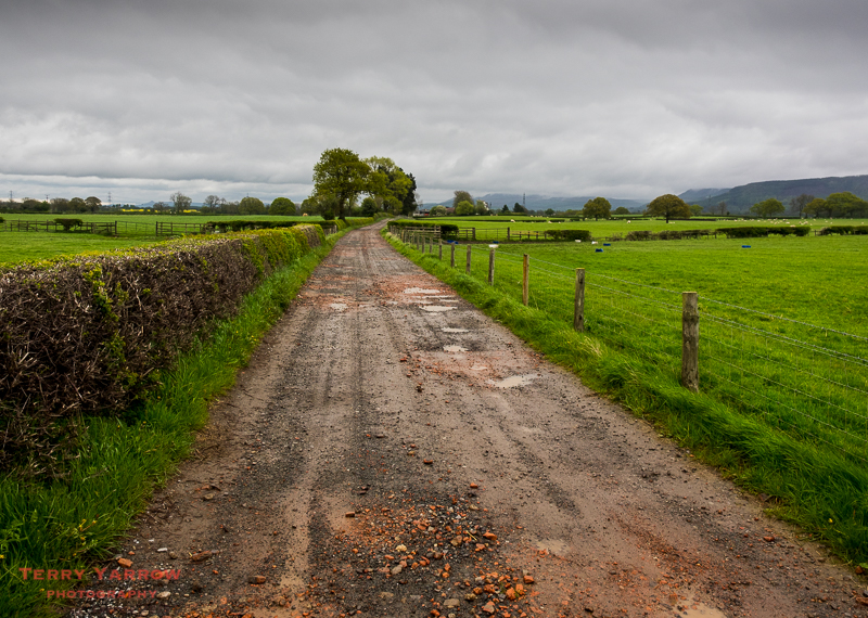
After some 8 miles on country lanes I eventually reached the A167 and I walked beside this busy road for a time before finally, branching off cross country for almost the first time today. For the next few miles, farm tracks would be my companion.
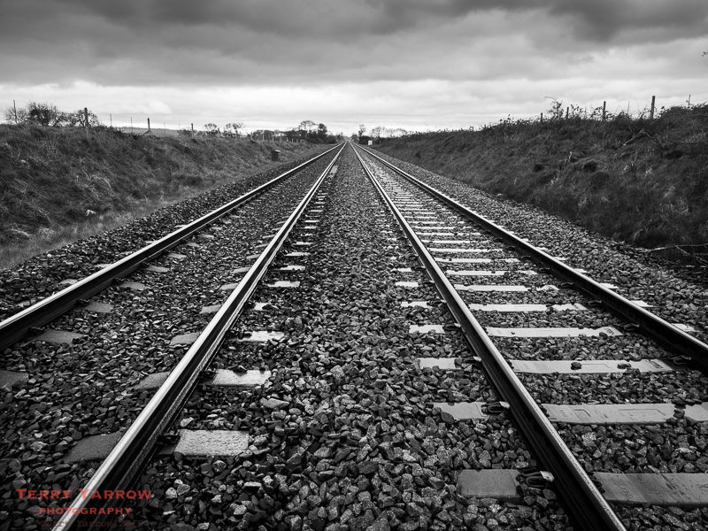
This was another day spent walking alone as I passed no one going in my direction. I did however pass several groups walking in the other direction including a group of four who had come across from Cincinnati specifically to walk this route. We stood for a time beside the railway above talking in the rain.
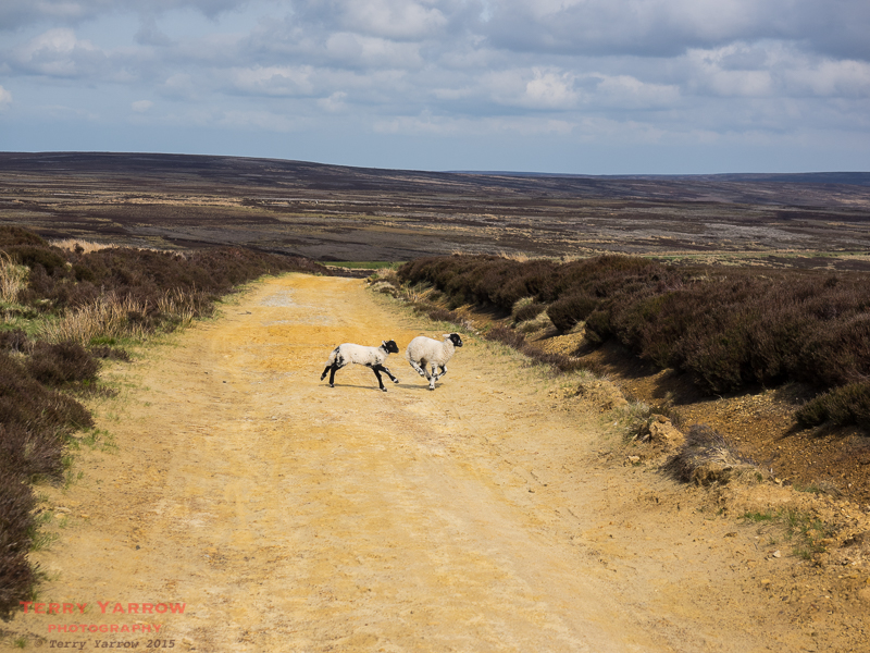
Having crossed the railway line, my route continued on wide, flat, uneventful farm tracks with those ever present clouds above and distant views of the Cleveland Hills which would be my route tomorrow. I couldn’t wait!
Finally I reached the A19 and took my life into my hands by dodging traffic to cross this very busy road into Ingleby Arncliffe with Ingleby Cross beyond. I had originally intended to stop here for the night as the Blue Bell Inn has a camping field but in the end I decided to keep on walking to Osmotherley.
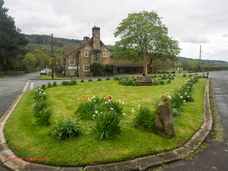
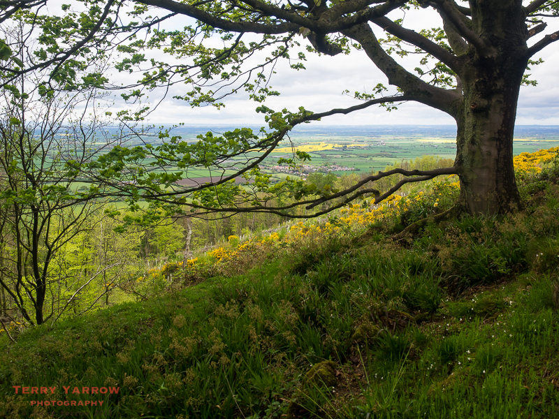
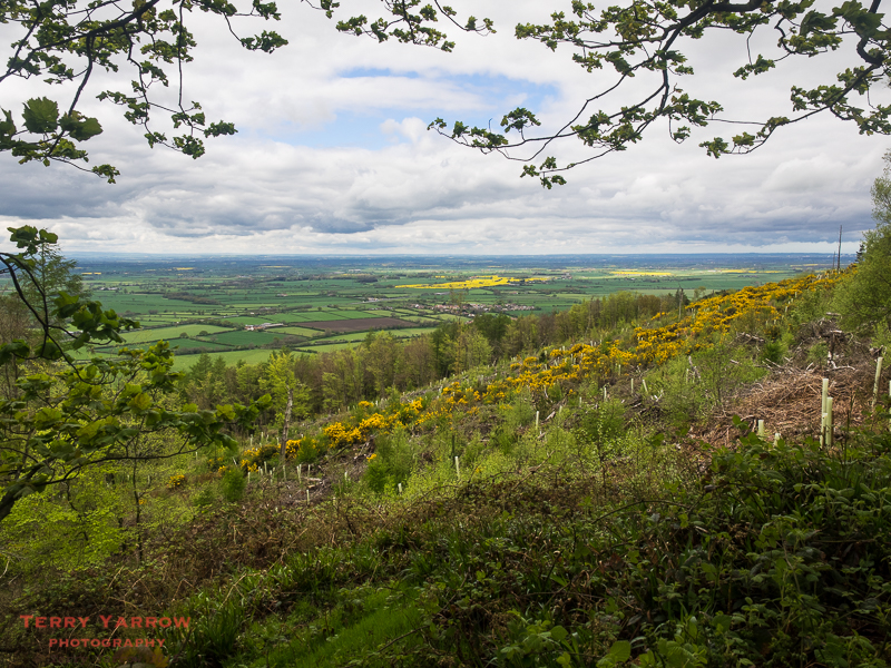
What a difference a few miles can make! The path took an immediate upturn – and so did the day! I left Ingleby Cross and started to climb steeply up through the heavily wooded Arncliffe Woods, with glimpses of the lovely views across the Vale of Mowbray. The clouds finally cleared bringing dappled sunshine to my path and there was a delightful array of birdsongs all around me as I wound my way up through the trees climbing inexorably to join The Cleveland Way at the top of the ridge.
The day was now drawing on though so at this point, I needed to leave the path and I dropped down into Osmotherley for my overnight stop.
Looking back on the day, the things that stick in my mind are the skylarks who serenaded me, almost as if to encourage me, as I trudged the earlier country lanes in the drizzle, and the delights of the last few miles as I at last climbed out of the flatlands. I had ‘crossed the divide’ and was now on the edge of the North York Moors…..and I was really looking forward to tomorrow.
Day 11 – Osmotherly to Blakey Ridge – 18 miles
Today the forecast was good – the forecast for the walking that is, and the forecast for the weather as well! It was a surprise therefore to wake to rain, although fortunately it didn’t last long. This was to be a tough day, some say the hardest of the whole trail, with the first half of the nearly 20 miles being a switchback of steep climbs and descents across the Cleveland Hills, but it was a day I was relishing, especially after the flatlands of yesterday!
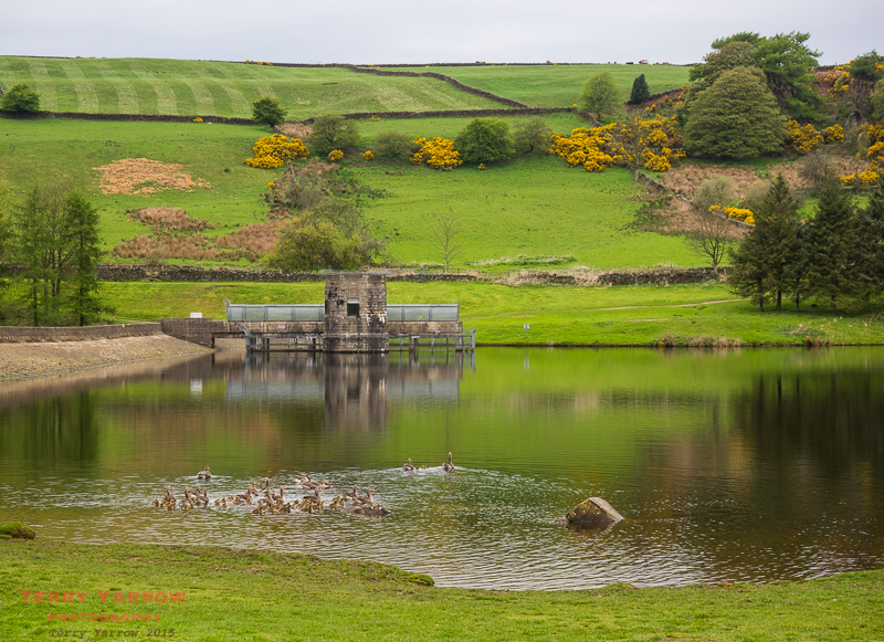
I packed up and once again was out on the trail before 7.30am, making my way first up the road and then skirting round the perimeter of the Cod Beck Reservoir, named after the small river that feeds it.
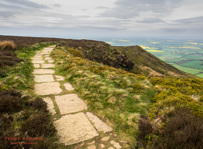
I continued to climb towards the ridge top, partly along the road, and then on lovely forest tracks, accompanied by the constant music of birdsong and with colourful flowers all around. Eventually I cleared the woods and reached the foot of the open moorlands. The next few miles were just fantastic – the views were amazing, the path made for easy walking as it had been ‘paved’ with rocks (probably thanks to the Cleveland Way and Lyke Wake Walk that share the route), the sun was out but it wasn’t too hot, there was a lovely breeze, and the path was well way marked. In fact despite the many steep and testing climbs and descents, it was near perfect 🙂 !
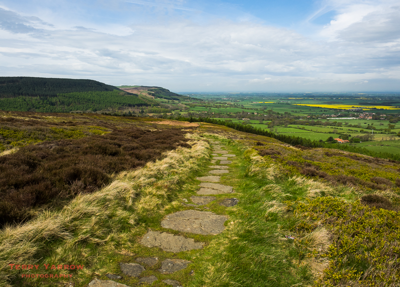
This was very much a ‘between two worlds’ experience as the route followed the northern edge of the escarpment with stark moorlands on one side and the fertile, flat plains on the other, and of course the industrial north beyond that. The path levelled off for a time as I made my way across Live Moor towards the higher Carlton Moor and I passed many other walkers along the way – I realised that today was Sunday so there were many dog walkers out for the day.
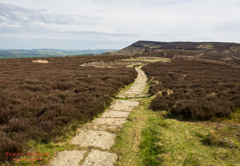
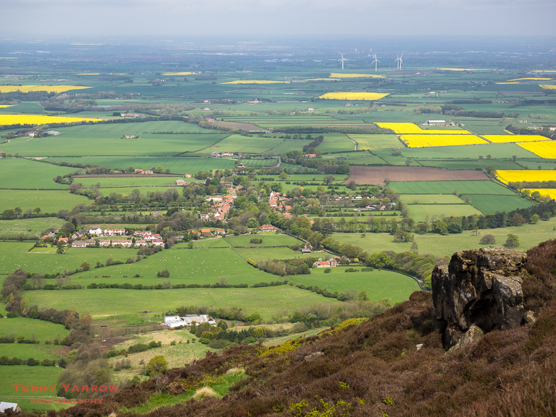
The conditions were so perfect that despite the number of miles left to walk, this was a place to linger and I stopped often to take in the views across the flatter land to the north towards Teeside. And towards the east, the distinctive shape of Roseberry Topping was ever present.

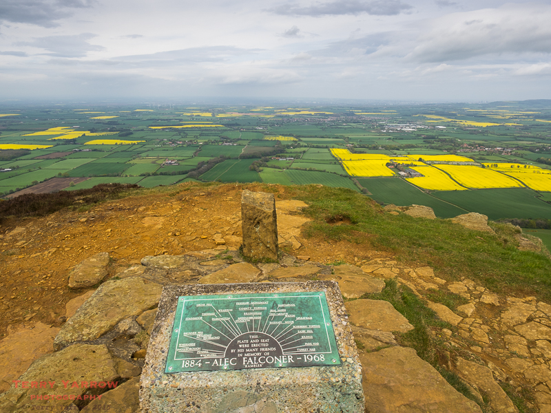
Dropping down Carlton Bank to cross the road, passing a disused alum mine on the way, I made my way up another steep climb to the top of Cringle Moor, with its stone seat, boundary stone and memorial to Alec Falconer, a rambler who was instrumental in bringing the Cleveland Way to be a recognised path. It is thanks to people like him that this part of the C2C is so well maintained and signed.

There followed another few miles of switchbacks as the path dropped into a deep valley only to climb up again over Cold Moor, only to drop down into yet another deep valley, only to climb steeply up again to Hasty Bank, only to………! It was wonderful!
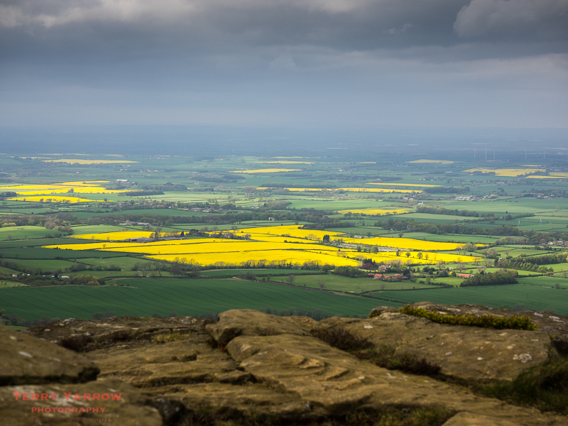
On Hasty Bank, I passed Wain Stones, an ancient outcrop of rocks. With a ring of stones below, it seems that Wain Stones may have had some historical significance dating back to the Bronze Age. Today, they are popular with climbers and walkers alike…..and for me, they made a great place for lunch 🙂 !

And what better place for lunch could there be with this amazing view to look out on!
Leaving Wain Stones behind, the path followed the flat top of Hasty Bank for a time before dropping steeply down yet again to reach the road at Clay Bank Top. This is often a stopping point for walkers as, although there is no accommodation there, B&B owners will often pick walkers up and drop them off again the next day. For me, I was continuing to Blakey Ridge some 9 miles further. The good news however was that after a 9 mile switchback, the climb out of Clay Bank Top to Urra Moor would be the last of the day as the route from there is flat.
I reached the top of the climb and bumped into a couple who were regular walkers in this area. They return each year to do some walking, staying at the Lion Inn on Blakey Ridge which was to be my stopping point for the night. We were to meet later in the pub.
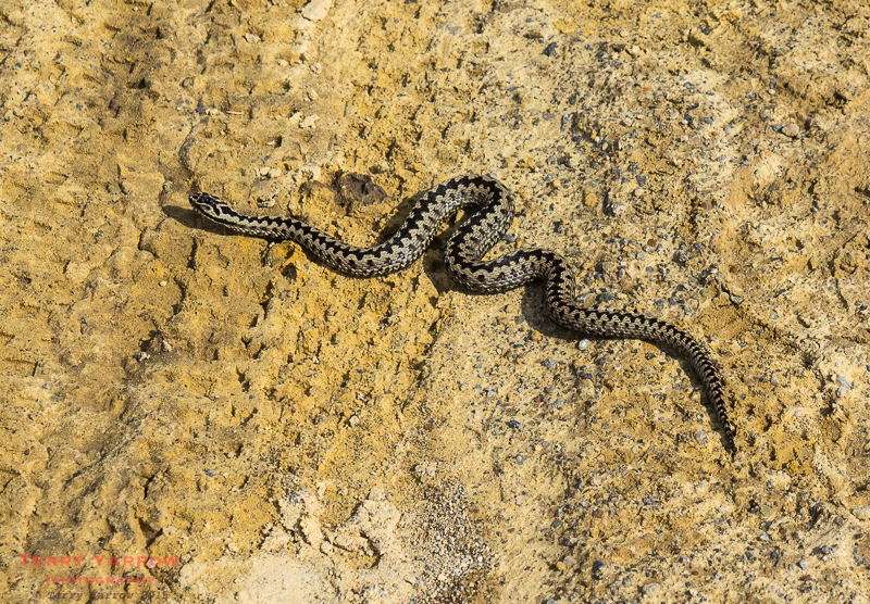
When I say ‘top of the climb’, it is in fact not strictly the top as the path over Urra Moor continues to climb albeit at a much lesser gradient but eventually I reached the highest point of the day at 450 meters. This is Round Hill and from here it is just a gently undulating walk along wide and well maintained paths. I passed a friendly adder who was crossing in front of me. He didn’t show any interest in me and just continued on his way.
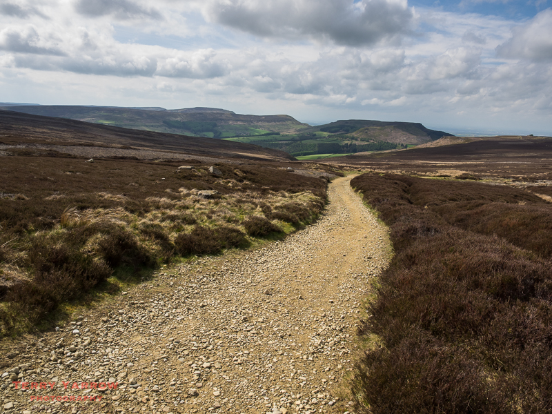
At this point, the path had moved away from the edge of the moors, and the wonderful valley views of earlier were now replaced with views across the bleak, but none the less beautiful, moors. As always there were sheep dotted around and there were glimpses of more southerly views. There were the usual clusters of grouse butts too…..and the usual stiffening breeze!
To a large degree the path across the moors follows the contours, winding around the hilltop before joining the disused railway track near Bloworth Crossing. This was part of the Rosedale Railway that served the iron ore mines. It closed in 1929 having been in use since 1861. As with all old railway tracks, it made a good path to walk.
Despite the easiness of the walking, it seemed to take a long time to cross the moors, maybe because the very flatness took away some of the interest that had been there in the earlier part of the day – there was not even a fence or wall to break up the landscape. Ultimately I rounded a final hill and could see that there was a building in the far distance – it could only be the Lion Inn! It would be another three quarters of an hour of winding paths before I would walk into the inn that dates from the 16th century and is one of the highest pubs in Britain.
Interestingly, just before the inn I noticed some small black and white birds running around on the ground and I was eagerly trying to identify them. What gave the game way though was the somewhat agitated lapwings that were flying around above me – clearly these were their babies. Thankfully they made it into the relative safety of the bushes.
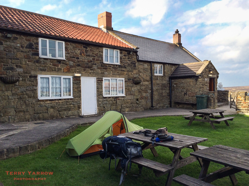
The wind that had started as a gentle breeze earlier in the day, had now increased considerably and was whipping across this very exposed part of the moors. Because of that and the fact that the usual camping field has little cover, the landlord was happy for me to put my tent up in the more sheltered beer garden. Not only that, but the pub had showers as well. It was a great place to camp…..well in fact it was the only place to camp – there is little else around on this the highest point of the North York Moors.
Having showered and set up camp, I decided it was time for something to eat so I took the long walk to the pub 🙂 ! There I spent a pleasant hour or so chatting to the couple I had met on the climb up to Urra Moor.
Later on, I laid in my sleeping bag listening to the wind and the flapping of the tent and reflected on the day. What a fabulous day it had been! A tough one undeniably with all the climbs and descents but a thoroughly enjoyable one too. Alfred Wainwright described the section from Ingleby Cross to Clay Bank Top as the best outside the Lake District – he wasn’t wrong! I drifted off to sleep a tired and contented man.
Thanks for stopping by.
Until next time,
Your friend, The Dorset Rambler.
Comments and feedback on this blog are welcome. If you would like to contact me, my details are on my website which is http://www.yarrowphotography.com.
If you would like to join me on my walks, my Twitter feed is http://twitter.com/adorsetrambler.
All photographs, poems and words in this blog are the copyright of The Dorset Rambler and must not be reproduced without permission.

Love the blog. Looking forward to the remainder. I start the C2C on July 22 as I am coming over from Nova Scotia. Your reports are of course increasing my level of anticipation.
Thanks Mark 🙂 Glad the blog is helping. You definitely won’t be disappointed with the C2C, its a fantastic walk and I reckon you will have better weather than I had. I could happily walk it again tomorrow :)!