

Day 8 – Keld to Reeth – 14.4 miles
I was up at 6.30am and peered out of the tent to see beautiful sunshine. It had been a really cold night in the tent and the morning was still cold despite the sun, partly because my tent was in the shadows. I had breakfast and was packed and out on the trail before 8am. The valley looked beautiful in the low early morning sun.
I made my way down the lane into Keld, a delightfully unspoilt village despite the volume of foot traffic that passes through – it stands on the intersection of both the Coast to Coast and the Pennine Way. Keld is a tiny village today but it hasn’t always been thus. In the mid 19th century it was a thriving and busy centre that stood in the heart of the lead mining district. There are many relics from that era littering the surrounding hills. Today though, those hills are quiet and still.
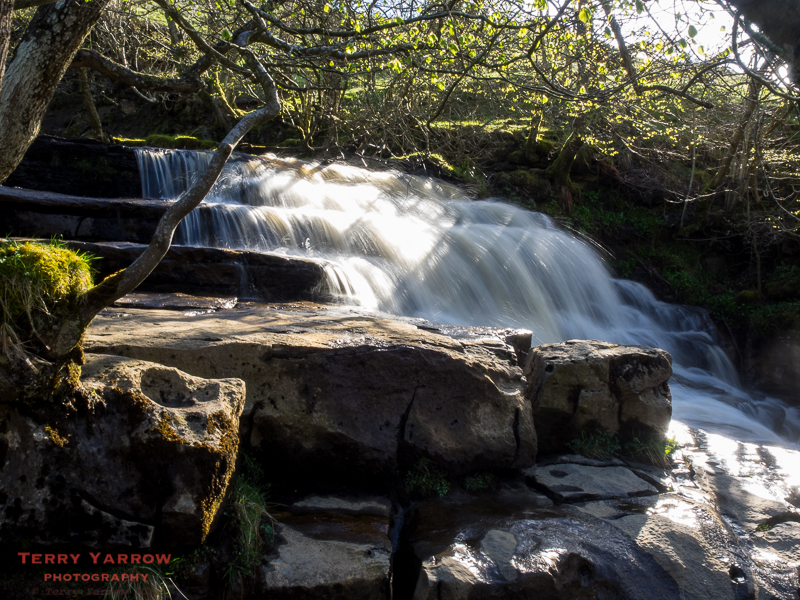
The path soon dropped down to meet and cross the River Swale before following the north bank of the river, passing a very full and flowing Catrake Force – a 17th century traveller was right when he once said, ‘The Swale rusheth rather than runneth’! This waterfall in fact has four levels as the river flows down the hillside.
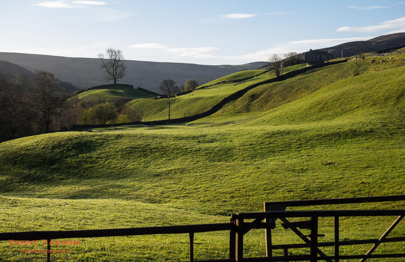
Even this early in the day, I was already passing debris from the past, old barns, mine workings and even machinery. I paused to look back at Keld nestling in a hollow in the hillside.
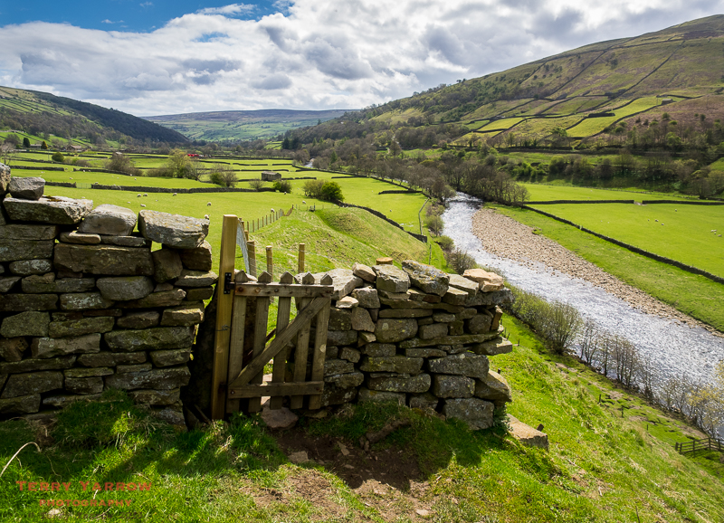
There are two alternative routes to Reeth, a high level and a low level route – the former climbs over Melbecks Moor and is all about industrial archaeology with a myriad mine workings, and the latter follows the very beautiful valley beside the river. I really wanted to do both! I still wasn’t sure which to do so I compromised. Dropping my rucksack out of sight, I spent some time climbing up the high level route taking in the amazing views and passing the much photographed Crackpot Hall. The original building dating from the 16th century was a hunting lodge but the current ruin was in fact a farmhouse built some 200 years later. It may also have been used by the mining industry. Abandoned in the 1950’s, it is now cared for by the Gunnerside Estate to prevent any further deterioration.

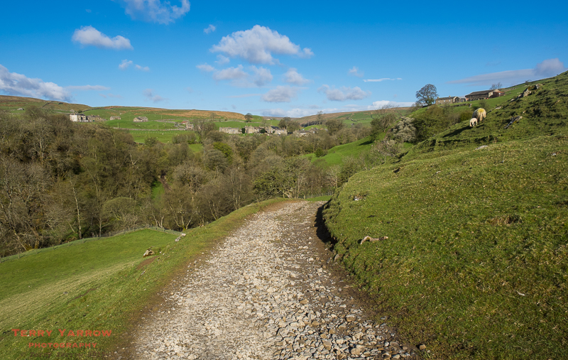
Ultimately I retraced my steps, retrieved my rucksack and headed down the lower path to join the river. With the wide and comparatively dry path, this was easy walking and I was accompanied by many oystercatchers and lapwings with their cries blending with the rippling stream.
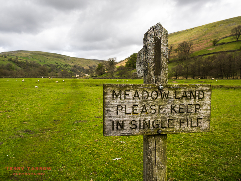
At times, the path left the riverside and crossed verdant meadows with a perhaps unusual request for walkers to cross in single file. I was walking alone so complied quite easily with the sign 🙂 !
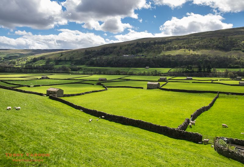
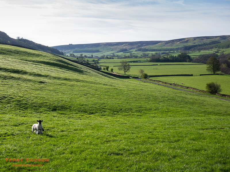
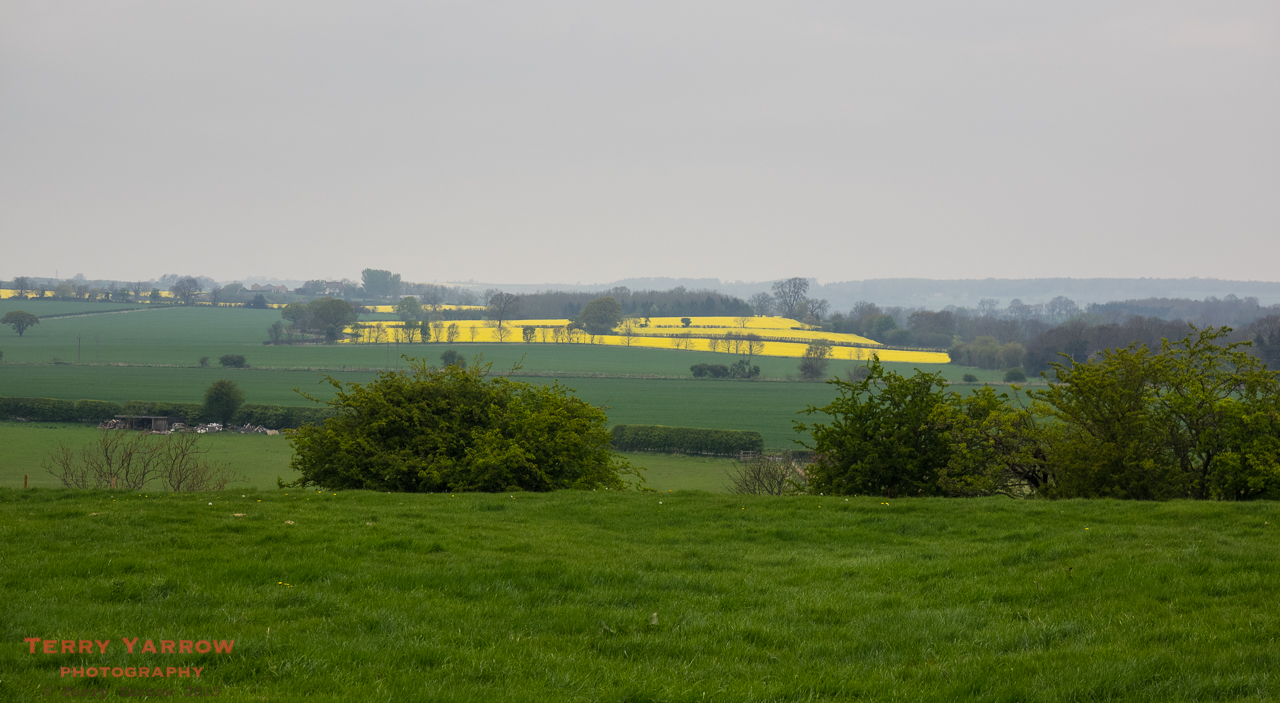
There are a few things that stand out in Swaledale and one of these is the number of dry stone walls and of course old barns! And after all the rain, the pastures within shone verdant green in the sunshine.
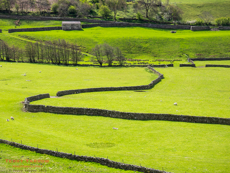
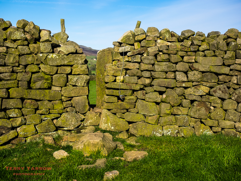
Another feature of this part of the route was the huge number of very small gated stiles that have to be squeezed through in order to pass the equally numerous dry stone walls. No easy matter when carrying a 20 Kg pack! But the route is undeniably pretty.
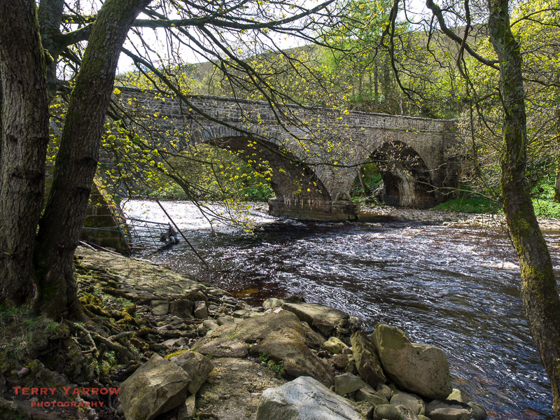
Following the riverside path eventually brought me to Gunnerside where the ever widening river passed under the road bridge. I joined the road and made my way into the village where I was pleasantly surprised to see a cafe. I stopped for lunch and while I was sat outside, Stuart, my walking buddy from yesterday arrived. We were to walk the rest of the day together.
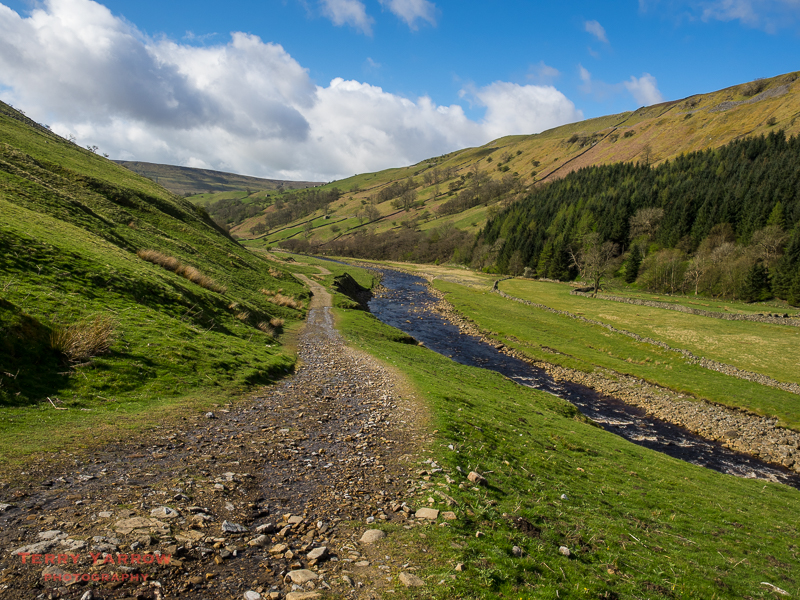
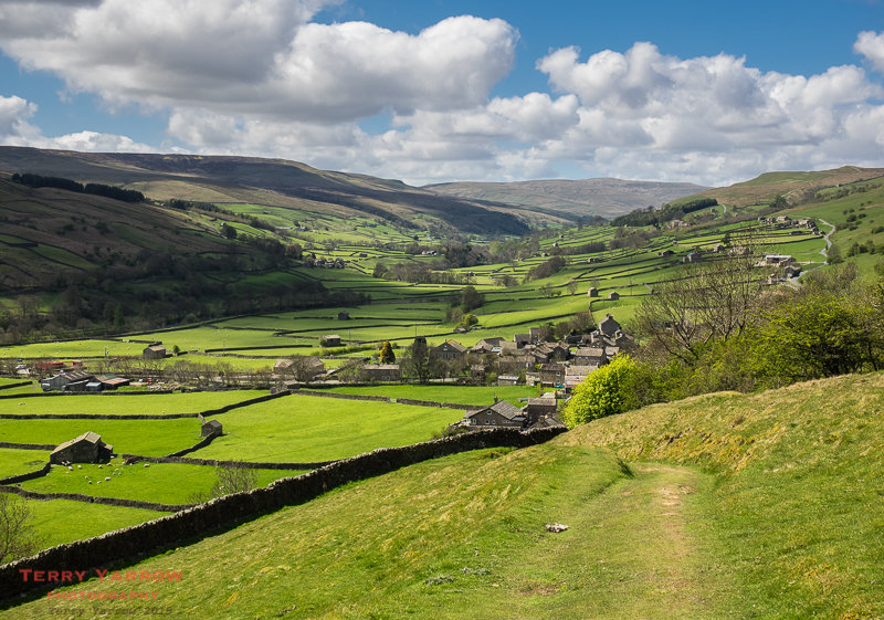
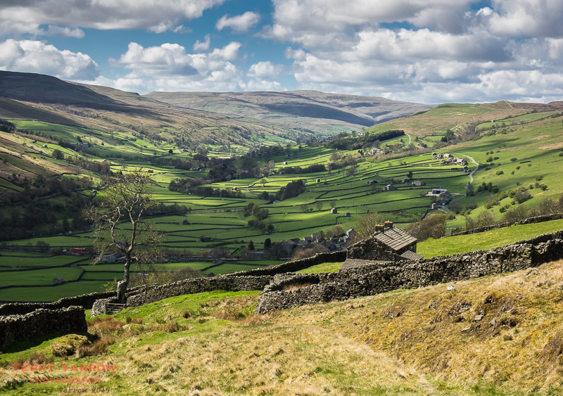
Leaving Gunnerside, the route took us partly up the valley side where we could look down on the valley floor. The pictures below probably sum up this part of the walk with its now broadening and flattening valley, beautiful pattern of fields, barns, dry stone walls and small green pastures.

Still climbing, we eventually reached open moorland for a time although this was not the bleak open moorland of the Pennines. The views were just gorgeous, especially on a beautiful day such as this. I should perhaps mention here another thing that seemed to typify this valley and that is……dead rabbits 😦 ! There were literally hundreds of them all along this stretch of the walk, in various stages of decay. It was quite gruesome unsettling. Despite researching this since I have been home, I have not been able to establish the cause of this phenomenon. One possibility is that there has been a flare up of one of the rabbit diseases such as Myxomatosis or Hemorrhagic Viral Disease and another is that they are being shot for some reason. Even the local wildlife trust weren’t able to help me.
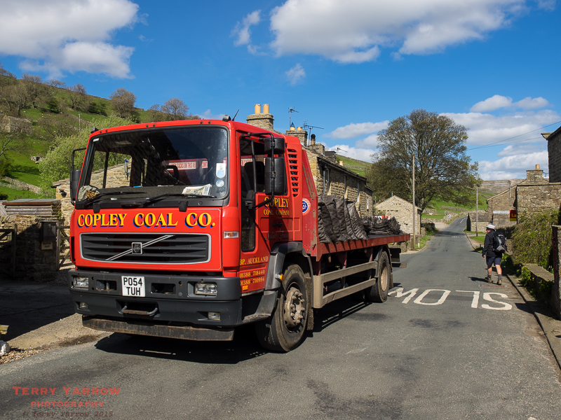
Continuing on our way, the route dropped gradually down to the road and through the village of Healaugh where I saw a somewhat unusual sight, coal being delivered to houses. This was once a common sight but now is much rarer especial as it involves lifting hundredweight sacks of coal on the shoulders. Maybe this is still a feature in the northern parts of England.
From Healaugh, the last couple of miles followed the river bank again, a lovely flat, grassy walk in the most picturesque countryside. One interesting feature of this last part was the suspension bridge that provides a crossing over the Swale. The original bridge built in the early 20th century was damaged in a storm in 2000 when the level of the river rose by 3 meters in 20 minutes. It was rebuilt by the National Park Authority although in reality, there is no public right of way over the river and no-one has claimed ownership of the bridge.
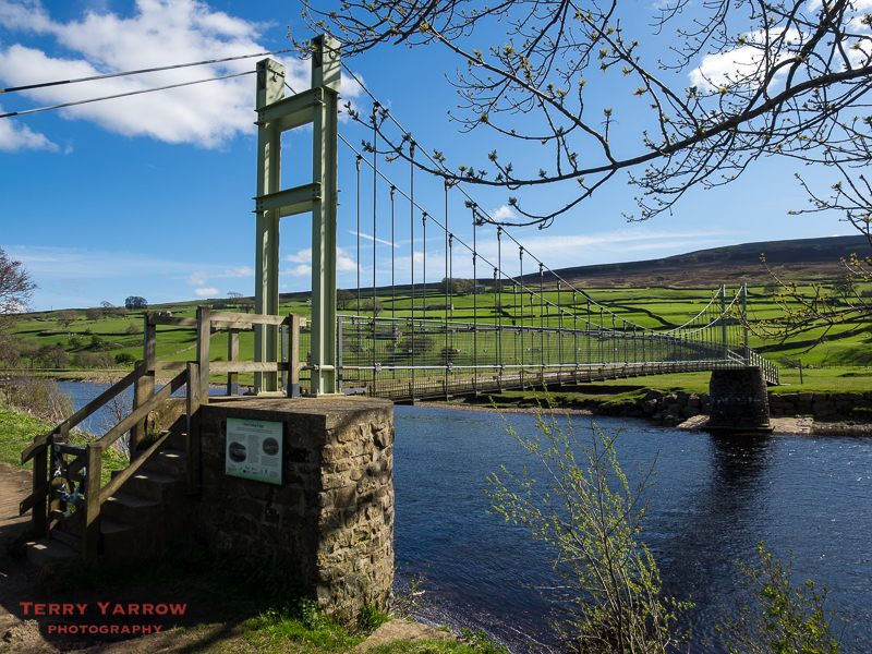
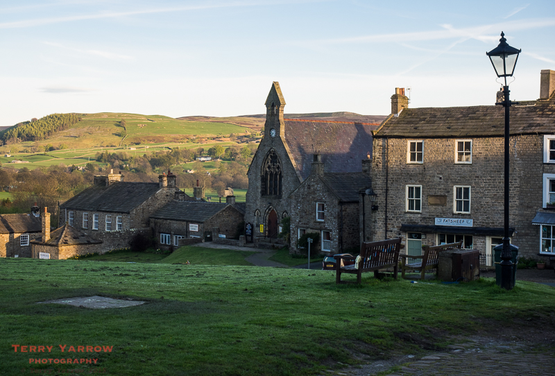
From the suspension bridge, it is a very short walk into Reeth itself, and a delightful town it is too, with houses clustered around a large green. The first thing I did was to go to the post office and pick up the map covering the second half of the C2C walk – I had inadvertently left it at home so my wife posted it to me. Then I headed for the local camp site where I was very kindly offered the use of a caravan to save putting my tent up. This is something the owner does regularly and bearing in mind how cold it was last night, it was an offer gratefully accepted 🙂 !
I sat in the caravan drinking a welcome cup of tea with the late sun streaming through the windows thinking back over the day. What an amazing day, one of the most enjoyable so far, with fabulous scenery, great walking, and beautiful weather. I wasn’t sure that tomorrow would be as good!
Day 9 – Reeth to Bolton-on-Swale – 20 miles
Despite being in the caravan, it had been a cold night with below freezing temperatures again. I was glad I hadn’t slept in the tent! I was out on the trail again before 7am and made my way out of Reeth, stopping at the local shop for food on the way. It was a beautiful morning again although I knew that the forecast wasn’t promising!
The first part of the walk was a gentle stroll beside the river before crossing the road to climb partly up the valley side. The river look beautiful in the early morning sunshine and it was quiet and peaceful.
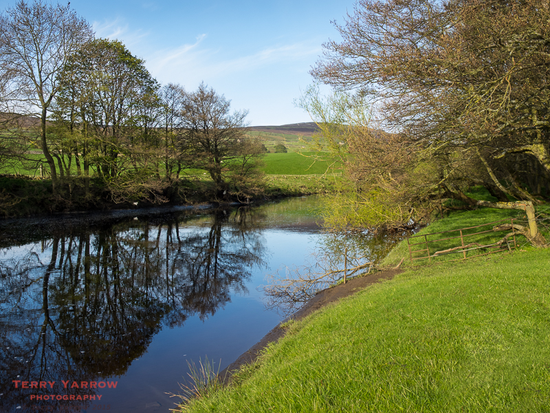
The valley had a very different feel now from when I first entered it. Back at Ravenseat it was a deep, steep-sided gorge but now it was flatter and broader, giving a very spacious feel to it. The grass was wet with dew but the walking was easy and in the distance I could see the next point of interest on my walk, Marrick Priory.
This was to be a continuation of yesterdays obstacle course though. In fact the stiles seemed to be getting ever thinner, so much so that it was difficult to even squeeze a leg through 🙂 !
Marrick Priory was a Benedictine Nunnery established in the 12th century. It was closed at the Dissolution of the Monasteries in 1540, the nuns being evicted and given pensions. The church continued to be used for worship by the local community until 1948 after which it became a farm building. Ultimately the Priory was renovated and extended to become an outdoor education centre for young people.
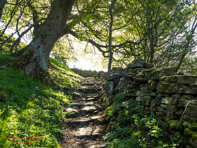
Behind the priory is a series of 375 steps known as the Nun’s Steps as they were said to be used by the nuns as a walkway down to the abbey. These climb steadily up through Steps Wood to reach the village that gave the abbey its name. With the sun filtering through the trees, this was a lovely walk.
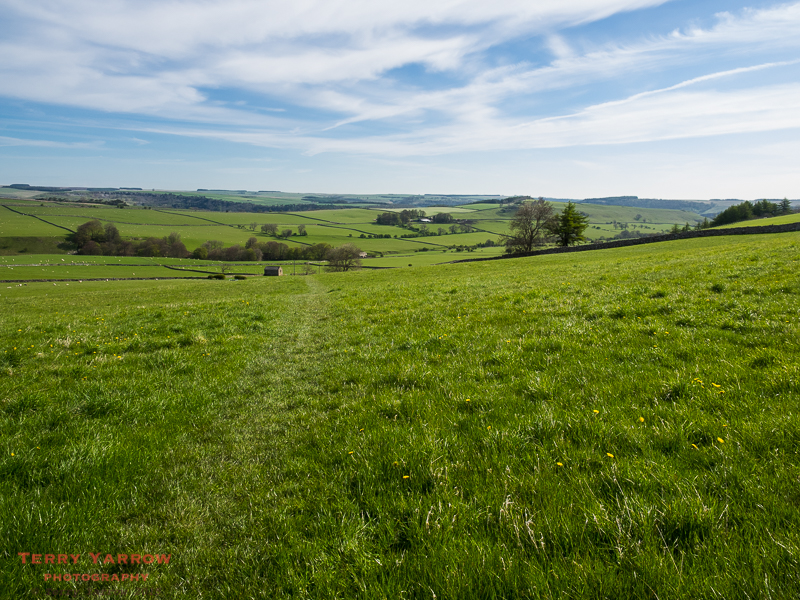
I passed through the lovely quiet village along the road before once again branching off cross country, crossing yet more small pastures and gates to reach the hilltop in the picture below. The countryside ahead of me was much more like my own Dorset, rolling hills and shallower valleys. It was very pleasant walking.
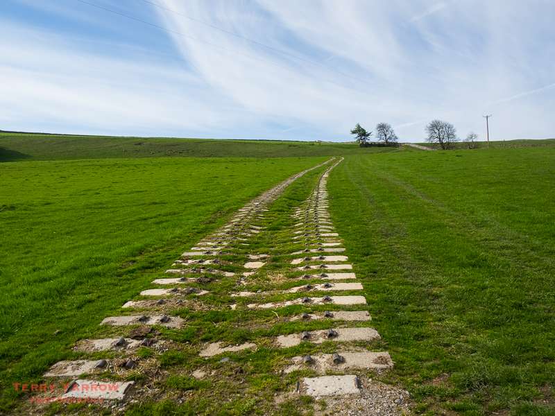
One interesting feature was that at the bottom of the valley was a renovated cottage which was now lived in but which unusually had no road or farm track for access. The only way to get to it was across fields…….which maybe explains the use of the old railway sleepers across the field in the picture below. Clearly, in wet weather or snow it would be difficult to get up that hill 🙂 !
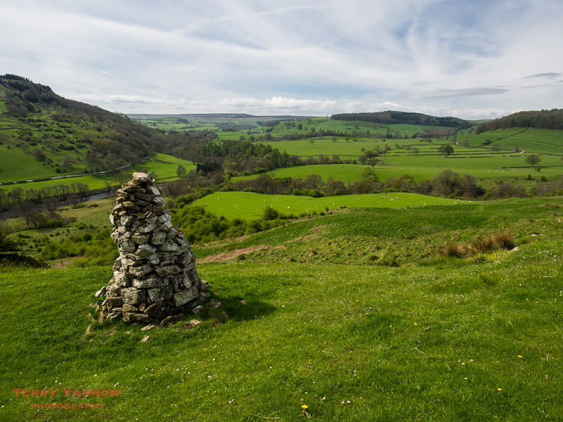
The route eventually took me out onto the country lane and quite a long road section through the village of Marske before crossing more fields and climbing steeply up to the foot of Applegarth Scar, a craggy outcrop on Park Top. I sat and rested awhile beside the cairn just enjoying the view across the flatter land that I had just walked. It was a lovely spot. Behind me were the sheer cliffs enjoyed by climbers but my route onwards was along the ‘shelf’ below the cliffs.
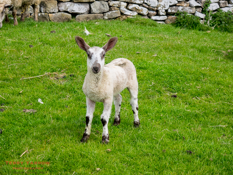
The ‘shelf’ gently drops down towards Richmond and it was along this section that I met two other walkers, the only ones I had seen all day. They were a lovely elderly local couple who were out looking for wild flowers. We chatted for a while before I continued down through Whitcliffe Woods into Richmond passing the interesting long eared lamb in the picture below. This was in fact a Mule, a cross breed from a lowland ram (usually a Bluefaced Leicester) and an upland ewe (probably a Swaledale in this case). It combines the strong points of both.
Although Richmond is a delightful town, it came as a culture shock! After nearly 10 days away from civilisation, this was a busy and bustling town with lots of people and traffic around. I bought lunch at a cafe in the square and made use of their Internet before hurrying on – I wanted to be out in the quiet of the countryside again!
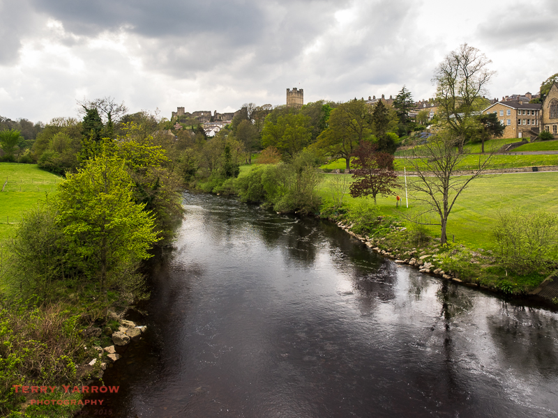
As I left the town, I looked back to see the church and castle standing guard oner the river.
Most walkers tend to overnight in Richmond as there is much to see with its cobbled streets and interesting buildings. That means a long day of over 22 miles the next day though as there is little accommodation along that part of the route. I knew of one farm that the guide book said offered camping facilities so I continued on my way. What I did know was that the next 20 miles or so were mainly across what I call ‘triple F’ – flat farm fields 🙂 ! Wainwright himself states that unless you have an interest in rural scenes and farming, you will find this section ‘tedious’. It is the flattest part of the whole route crossing the Vale of Mowbray from Swaledale to the Cleveland Hills. For that reason, I thought it best to get some of those miles done today.
I hadn’t reckoned though on two things. The first was a detour that was to take me for some way along a very busy A road, and the second was the almighty downpour that was about to hit me! They coincided! The drains were unable to cope with the deluge and the roads flooded which meant that in addition to the rain that was pounding me from above, I got drowned in spray every time a car went past…..and this was a BUSY road!
I only passed one person, a local, who knew of no nearer accommodation so I continued, crouching to avoid the wet which seemed to be coming at me from all directions. Eventually I reached Bolton-on-Swale where the church was open. I went in to shelter for a while. It is in fact a walker friendly church that provides snacks and drinks for passers by and the vicar’s telephone number was there. I rang her and asked if it would be possible to spend the night sleeping on the church floor or even in the porch but unfortunately because of insurance restrictions, it wasn’t.
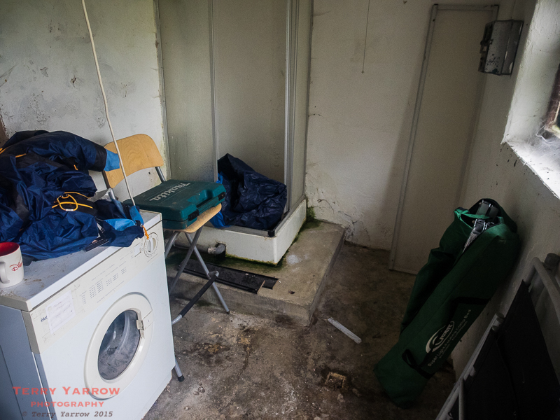
I headed back out into the rain, tramping across sodden fields to reach the farm and I knocked on the door. ‘Do you still do camping’ I asked. ‘No, but you can’, came the reply. The farmer took me round the back to the old camping area and showed me where the disused shower room and toilet were. I looked outside to the flooded grass and looked inside to the somewhat cluttered and dirty shower room…..and I chose the latter! ‘Can I just crash in here?’ I asked.
And so I spent the night amongst farm debris, spiders and goodness knows what other creatures! But at least it was dry 🙂 !
Thanks for stopping by.
Until next time,
Your friend The Dorset Rambler.
Comments and feedback on this blog are welcome. If you would like to contact me, my details are on my website which is http://www.yarrowphotography.com.
If you would like to join me on my walks, my Twitter feed is http://twitter.com/adorsetrambler.
All photographs, poems and words in this blog are the copyright of The Dorset Rambler and must not be reproduced without permission.

This is very familiar territory to us and have walked in a lot of the places here. We evan have similar pictures,
I so loved Reeth and Gunnerside and the lovely meadow walks. A place called Muker was a pretty place too. The Gunnerside estate is owned by some very wealthy American man called Miller, popular for shooting!
I’m glad you wife posted the map on for you too 😊
I loved where you slept at the end of the day.
John and Liz
Clun
PS looking forward to Day 6 soon.
Thank you – Hope you are both well and still enjoying your walking. Sending best wishes. Terry