
Day 6 – Shap to Kirkby Stephen – 22 miles
As I have been typing this blog from notes made at the end of each day of the walk, I find myself thinking, ‘I didn’t have very good weather did I’! I seem to be regularly talking about wind and rain and cold. Well today is no different! I woke to the sound of…….RAIN! However, as they say, the walk must go on……or should that be ‘show’ 🙂 ! By 7.30am I was packed up, had donned every bit of waterproofing I had, put on my rucksack and was out on the trail.
I wasn’t really looking forward to the day as I was leaving the wonderful Lakeland mountains behind for a 20+ mile walk across the much flatter ground of the Westmoreland plateau. The guidebook describes it as, ‘A grassy stroll across well-drained limestone bedrock’. Wainwright puts it thus; ‘As every walker knows, a limestone footing invariably means easy travelling on velvet turf’! Hmmm, clearly neither of the writers had walked it on a day like this 🙂 !
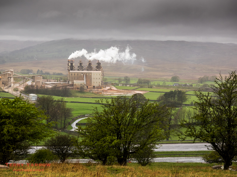
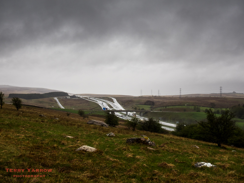
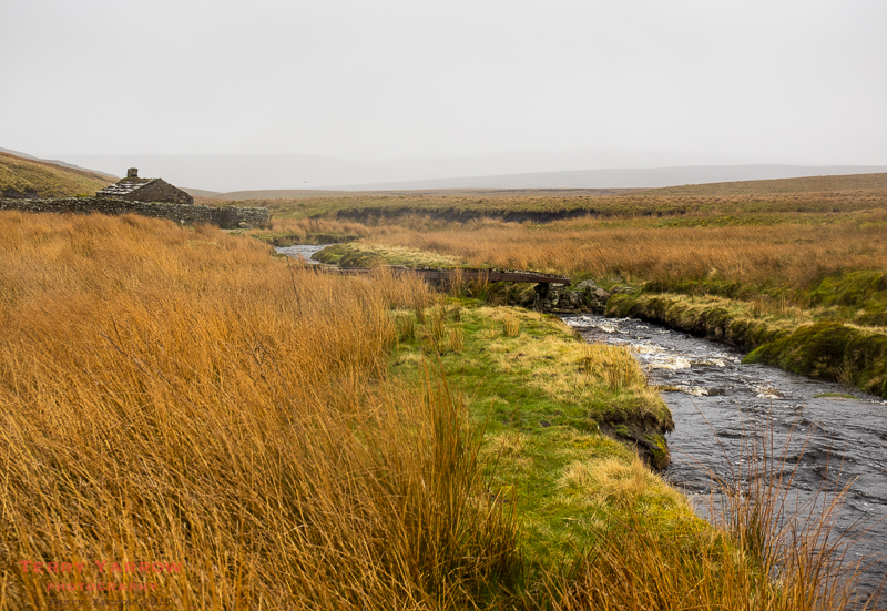
Shap had not been a particularly inspiring town. In fact the things that stay in my memory are the granite works and quarry, the mainline railway, and the M6 motorway, all of which had to be passed, crossed or circumnavigated in the first few miles of the day.

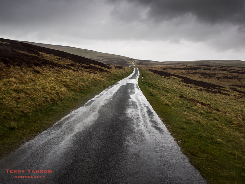
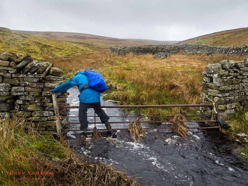
As I left the final obstacle and started out across the first tract of moorland, the conditions became even worse with driving rain, gale force winds and of course mud, mud, mud and mud! Route finding was not easy although this was perhaps more down to the conditions as everything got soaked whenever I took out the guidebook or map. I was grateful for a weather proof GPS. It was also very difficult to keep the camera reasonably dry.
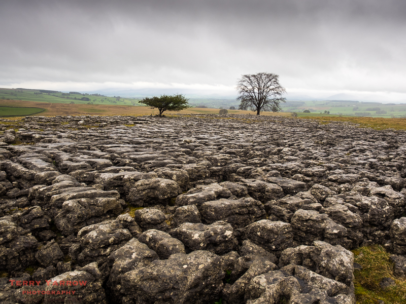
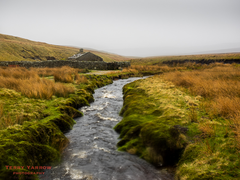
In fact, I think on a day of good weather this would have been a very pleasant days walking as there was some lovely moorland scenery including lots of limestone pavements, and much to explore.
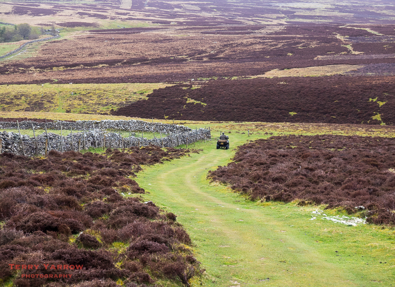
Understandably, with the conditions, I passed few other people. One, in the picture below, was riding a quad bike which had two guns laid across it. The rider was obviously out hunting but for what I do not know – initially I thought perhaps it was grouse but it wasn’t the season for that so it might have been deer or rabbits. Whatever it was, I heard no shots fired.
Just after passing the ‘hunter’ I passed two other walkers coming in the other direction along a farm track looking like drowned rats. I figured I must look exactly the same! They had stayed in Kirkby Stephen last night and had been given a lift for the first few miles to shorten the day. We stood for a while in the rain and compared notes before putting our heads down and heading off into the wind again.

There were actually quite a few things of interest along the way, such as Robin Hood’s Grave (not Robin Hood’s Grave at all 🙂 ), stone circles, limekilns and so on but it wasn’t a day for lingering or exploring – apart perhaps for the last mentioned which provided some brief shelter from the elements 🙂 ! It was a day to just keep walking, and yet in a strange masochistic way, it was still an enjoyable day. But then, I always enjoy walking whatever the weather.

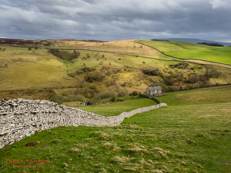
In addition, there were a lot of dry stone walls…..and I love dry stone walls, even if they do mean lots of gates and stiles to negotiate. The field in the picture above was inhabited by lots of Shetland ponies who were most inquisitive as I walked across their patch.
Eventually, I emerged from the fields onto the moorland road below – I think the picture probably conveys well the conditions I was walking in 🙂 ! Down to the right was Sunbiggin Tarn which Alfred Wainwright describes as, ‘Little more than a large reedy pond in the middle of a morass’! He also describes it as a popular picnic spot since the road is nearby, and I can certainly imagine that it would be very busy in warmer, dryer weather. More importantly though, it is an important bird sanctuary and wildlife refuge.
Skirting round the tarn being driven along by the fierce wind on my back, I continued across more of the Ravenstonedale Moor and before long things started to improve. First of all the rain eased and then stopped, and shortly afterwards the sun made an appearance……and what a difference that made as I gradually dried off. It was a pleasure to reach Smardale and to shelter from the wind by yet another dry stone wall looking down into the valley.
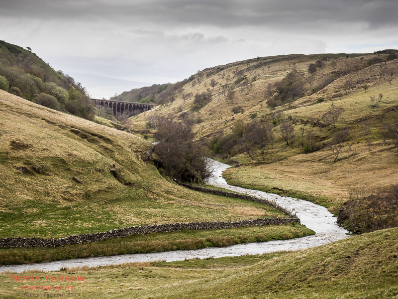
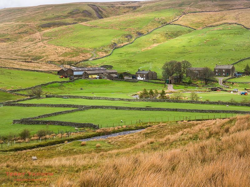
And what a pleasant surprise the valley was with its disused railway, nature reserve, river (Scandal Beck), old viaduct, abandoned railway cottages, and its now defunct limestone quarry. It was a fascinating place and I would love to have spent an hour or two exploring but the day was drawing on and I had some miles still to walk so I continued on my way.

Finally I dropped down off the moor and onto farm land where I could see Kirkby Stephen below me. I had already made a decision to stay at a hostel for the night to enable me to dry everything out and I walked into the village looking forward to sleeping in a bed.

At the hostel, a disused Methodist Chapel, I was greeted by Denise who immediately asked, ‘Would you like a cup of tea?’ – after 22 miles of tough walking in wintry weather, this was the best thing she could have said 🙂 ! Whilst I was sat enjoying my drink on the sofa, an equally wet Stuart, my walking buddy from a few days ago, walked in. It was good to catch up and we agreed to walk together again tomorrow.
I hoped the weather would improve by then!
Day 7 – Kirkby Stephen to Keld – 13 miles
I was up at 6.30am after a great night and I looked out of the window to see SUNSHINE 🙂 ! Sigh, it wasn’t to last!
After a continental breakfast, Stuart and I left the hostel at 8am and almost before we had left the town, the rain started again. In fact we were to walk in gale force winds, driving sleet and below freezing temperatures for most of the day, often knee deep in water – it could easily have been a mid-winter day, such were the conditions. The last mentioned was not really a surprise as the guide book warns that the one thing most people remember about this day is the peat bogs that have to be negotiated!

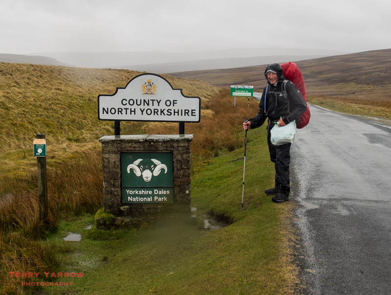
This was to be the day we were to climb up over the Pennines and move from Cumbria into North Yorkshire and I had really hoped to pass Nine Standards Rigg, the series of cairns at the summit, on the way. As it happens, I was once again foiled by the conditions! Battling against the strongly gusting wind and stinging sleet, and with freezing hands, it just didn’t make sense to climb over the high point with poor visibility.

Dropping down to the road, we had some easier walking for a time…..at least, there was solid ground under foot 🙂 ! I paused for a photograph – well this was something of a milestone as I was entering Yorkshire and this evening I would be at the half way point of the walk.
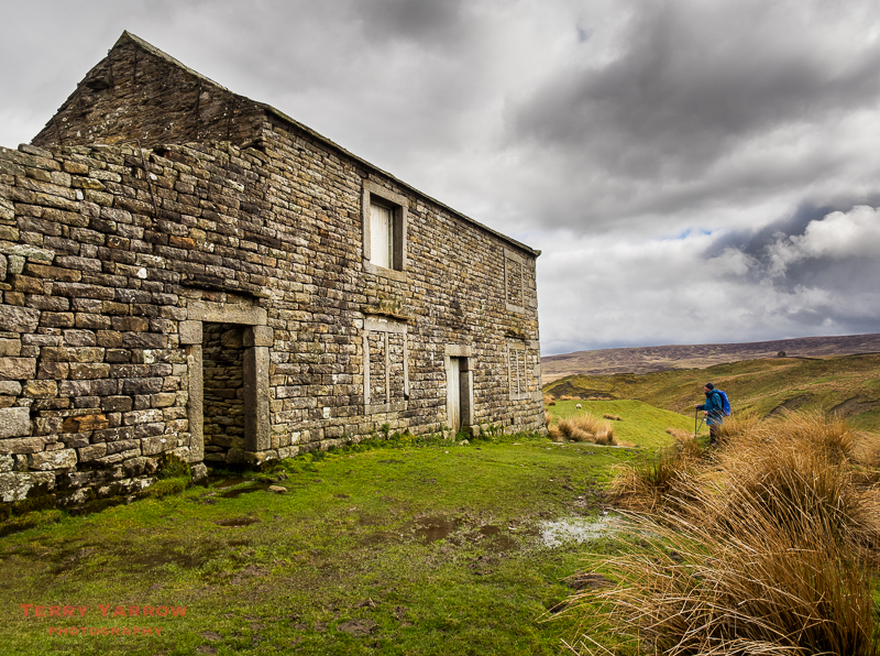
This area is of course the Watershed where many rivers spring so there were becks aplenty. In fact the map shows a whole spiders web of blue lines. It was also an area of disused and abandoned buildings such as the one in the pictures below. I often think it is such a waste when there are homeless people, but in these conditions, maybe no-one would want to live there.
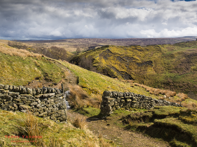
Unfortunately, the comparatively easy walking came to an end all too soon and we had to leave the road again to strike out across the moors. It probably goes without saying that route finding across the moors was not easy and at times, well most of the time, it was difficult to tell the indistinct paths from streams. We often found ourselves just trudging across open moorlands knee deep in water trying to follow the little line on the GPS. Two heads are better than one though and we managed to avoid straying too far. I did wonder though what would happen if the mist came down!
The birds seemed to have less problems than us 🙂 ! Lapwings were everywhere, as were grouse – strange and funny creatures aren’t they! They always make me smile as they rise up from the ground making comical noises. Clearly they were unaware of what the grouse butts were for otherwise they would have made their escape. We could hear many waders too, including the plaintive cry of the curlew.
Crossing the swollen becks was fun at times!
There were other less comical creatures too, like the Swaledale sheep. These are totally functional – tough like the earlier Herdwicks, and great for keeping on these high moors with the sparse vegetation.

As with yesterday, things improved as the end of the day neared. Firstly the rain stopped and the day brightened up, and then Ravenseat came into view, but best of all, at the farm there was a sign advertising cream teas 🙂 ! After all that the weather had thrown at us, how could we resist 🙂 !
It was a delight to sit in the barn out of the wind with a hot drink and a scone laden with jam and cream. Despite the weather, there were others there although not walkers.
Ravenseat is a sheep farm at the head of the Swaledale valley run by Amanda Owen, the Yorkshire Shepherdess, and her husband. Amanda, a TV presenter and author as well as farmer and cream tea provider 🙂 has written a book about her life and how she changed from city girl to shepherd. She told us that she had recently sold the film rights to her book. In addition to all the other things that she does, she has found time to give birth to seven children with number eight due soon. She was a great host and talked non-stop while we were there, telling us all about life on the farm.

It was almost with regret that we left Amanda’s company to continue on our way. What was to come though was one of the most beautiful parts of the whole walk, the Swaledale Valley with its myriad deserted barns and farmhouses. I don’t think I have ever seen so many! The old farmhouse below would make such a great place to live!
We made our way along the side of the valley in beautiful sunshine. What a transformation from the wild and wintry weather earlier as we crossed the Pennines.
And what an amazing valley this is too. In places it is like a deep gorge with steep sides and with a very full river flowing along the bottom. Add in the great views all around, and you have a delightful evening walk!
Gradually the path took us lower until we were walking along the valley floor beside the River Swale, brown from the peat. There were numerous waterfalls along this section – the power and noise after all the recent rain was immense.
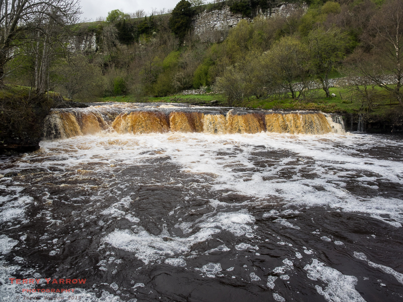
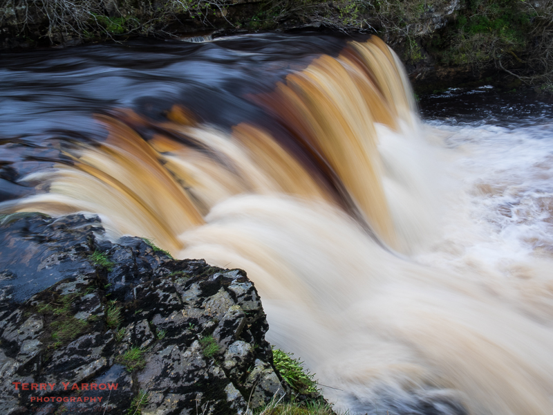
I pitched my tent right beside the waterfall above and later that night would drop off to sleep with the sound of rushing water in my ears. What a great lullaby!
I dropped off to sleep replaying the days events and thinking about tomorrow – there were two alternatives, a high level or a low level route, and I wanted to do both! Sigh, which to choose…..?!

Beautiful!
Thank you 🙂
I am really enjoying this and love your photos, looking forward to my trip in August, I hope I get better weather……. Sarah
Thanks Sarah. Glad you are enjoying it. My weather did get better in the end 🙂
You said in the introduction that you had to use all forms of navigation, yet you don’t really talk about it in your text. Where was the hardest place to navigate and was it just because of bad weather? Thanks
Hi Sarah
The blog is really just a narrative description of each day including people I met etc. It isn’t really intended to be a ‘how to’ guide. What I usually do is at the end of the walk in the blog, I do a separate blog entry detailing more specific things and this will include places where route finding is difficult, whether to back pack it, problems experienced on the way through etc..
Generally, it is mainly the boggy moorland areas that are the problem and the two days detailed in Part 4 of my blog include quite a lot. There are some boggy parts in the Lake District as well but generally the later North York Moors have been paved to avoid damage to the bogs so are easier.
I will set out more information when I do my summary at the end but in the meantime I hope this helps.
Terry
Thanks so much for taking the time to get back to me. I am really enjoying the blog and the photos are beautiful. I just thought I would ask as you make no mention of navigation at all. I am thinking about walking the Wicklow Way at some point and have just watched a fantastic video on you tube, you should watch it; the Wicklow Way by Conor Houlihan, great camera work. Thanks
Date: Mon, 8 Jun 2015 18:38:40 +0000 To: cabinbythelake@hotmail.com
Thanks Sarah, I’ll check that video out.
Hello again Terry,
I love this day you’ve written about very much. I can actually say we were staying and walking in North Yorkshire last September. We went to Tann Inn and saw Amanda’s farm too. Didn’t go for afternoon tea, but will one day. I have also found Amanda very interesting after watching her and her family in The Dales. I have recently finished reading her book that had ended with her having 7 children in 2013. I said to John wonder if she’s had anymore in the last two years! Well thanks Terry as you’ve answered my question! In her book she wrote she would like 10 in total.She sounds a amazing lady and is so interesting when she writes.
Great BLOG Terry.
John and Liz
Clun
Your pictures are lovely!
Just a comment on the phrase”unused and abandoned buildings”seems to refer to Beck Meetings which are sheep pens, they are regularly used by farmers on Birkdale common. Pity some people use them as toilets, not pleasant working conditions!
Reading this in Nov. 2017. Just want to report that Amanda has 9 children now!