

If you have been following my posts, you will know that I recently walked the Wainwright Coast to Coast Path, a 200 mile route across the north of England. I have already blogged my experiences but I thought I would post one last entry giving a very brief summary of each day as I remember it, mainly for anyone who is thinking of completing this great walk. The idea is to just give a flavour of the paths, terrain, difficulties on the route etc to help with your planning.
Day 0 – St Bees to St bees Head – 3 miles
A day spent mainly travelling up so just a few straight forward miles along the coast path to reach my first accommodation.
Day 1 – St Bees Head to Ennerdale Bridge – 13 miles
Good cliff top path to start, some roads, some slightly muddy paths at Stanley Pond, steep climb up Dent Hill (350 meters), steep drop down other side, lovely walk through Nannycatch, road/roadside into EB. Some tiny kissing gates to negotiate, plus one high stile. Care re route needed at Stanley Pond, when leaving Cleator and at Dent Hill.

Day 2 – Ennerdale Bridge to Borrowdale – 18 miles
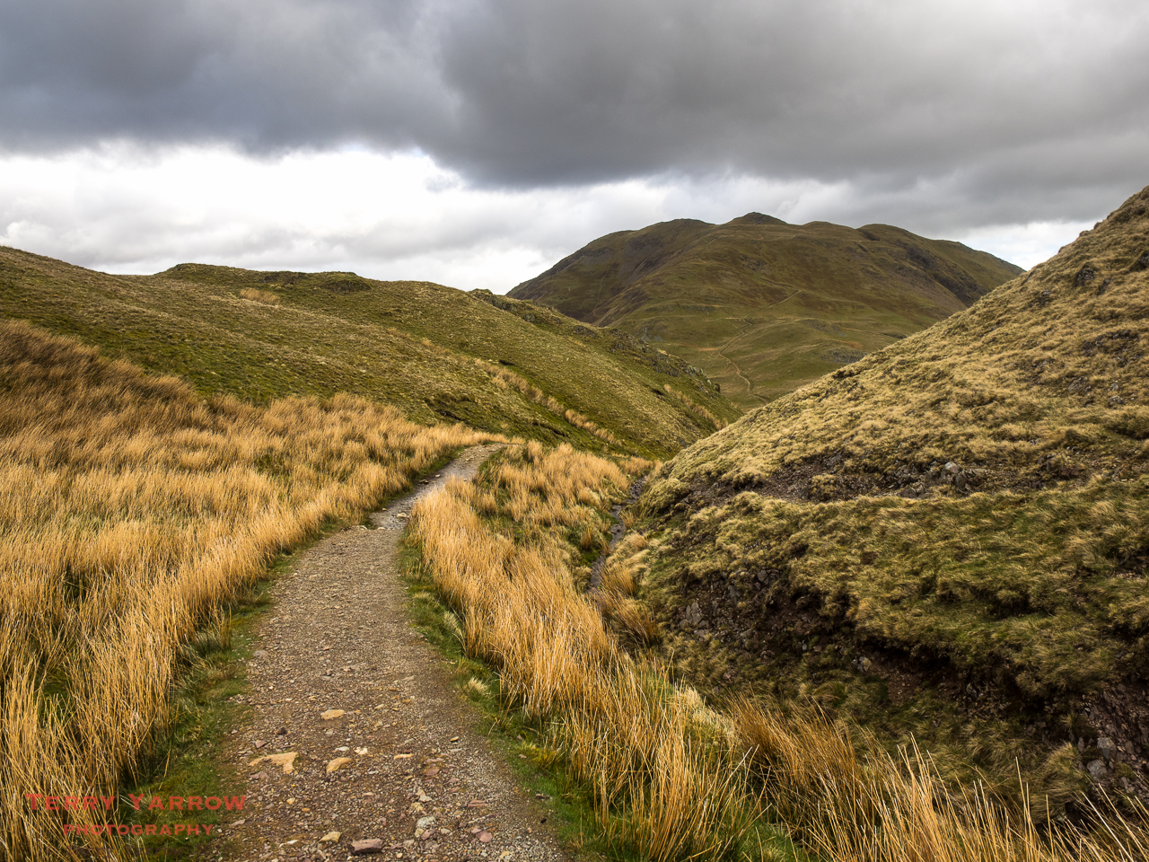
Road to Ennerdale Water, rocky path beside lake, wide forest track to Black Sail, steep and rocky climb to Brandreth (600 meters), old tramway down to Honister, good paths or road into Borrowdale. Care re route needed when leaving Black Sail Hut and when crossing the top from Brandreth to Honister in bad conditions.
Day 3 – Borrowdale to Grasmere – 9 miles
Good but rocky path along valley, steep rocky climb up Greenup Gill, boggy across the top of Greenup Edge (600 meters), good ridge walk, steep drop into Grasmere. Care re route needed when crossing the top of Greenup Edge as it is boggy and the path can be indistinct.
Day 4 – Grasmere to Patterdale – 8.5 miles
Road and good track to Great Tongue, steep and rocky climb to Grisedale Hause and Grisedale Tarn (600 meters), rocky but good path beside Grisedale Beck down to Patterdale, and then mainly farm track or road into the village.
Day 5 – Patterdale to Shap – 16.2 miles
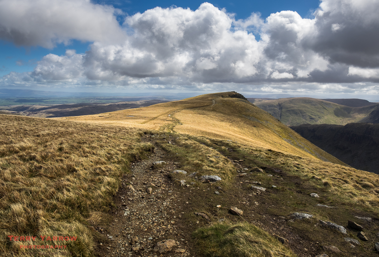
Generally good paths via Boredale Hause to climb steadily to Angle Tarn, good path to the Knott and across Kidsty Pike (760 meters), steep descent to Haweswater, rocky and undulating path alongside lake, flatter and lower level paths to Shap. Last part can be muddy. Care re route needed on Boredale Hause and on the approach to High Street in order to not miss the Kidsty path.
Day 6 – Shap to Kirkby Stephen – 22 miles
Roads and fields out of Shap crossing railway line and motorway, boggy across Crosby Ravensworth Fell, road and fields to Sunbiggin, moorland tracks to Smardale, more moorland tracks with some road and fields into Kirkby Stephen. Care re route needed on Crosby Ravensworth Fell.
Day 7 – Kirkby Stephen to Keld – 13 miles
Road and then wide moorland tracks out of Kirkby Stephen, extremely boggy with indistinct paths across much of the Pennines (depending on which route you take), some road walking on the Green Route, better paths after Ravenseat Farm. Avoid the high level route in bad weather. Expect lots of surface water if the weather has been wet. Great care re route finding needed on the boggy moors.
Day 8 – Keld to Reeth – 14.4 miles
I took the low level route where there are good straightforward paths mainly beside the River Swale, some climbing, many narrow gated stiles to negotiate, many small fields to cross. No real route finding problems on the low level route although some care is needed on the high level route.

Day 9 – Reeth to Bolton-on-Swale – 20 miles
The day starts with a lovely walk beside the River Swale and part way up the valley side with lots more narrow stiles to negotiate, followed by farm land across mainly rolling hills plus some road walking. Richmond is a busy and bustling town. From Richmond, the walking becomes a bit tedious with A roads to negotiate and flat farm land to cross. There is currently a detour near Colburn/Caterick Bridge but no real route finding issues.
Day 10 – Bolton-on-Swale to Osmotherley – 19 miles
Country lanes, wide farm tracks and flat farm fields mostly until Ingleby Cross, then steeply climbing forest track followed by road into Osmotherley. For me, the most tedious day on the whole route. No route finding issues to speak of.
Day 11 – Osmotherley to Blakey Ridge – 18 miles
A day of two halves. The first half tough with many steep climbs – a roller coaster – but most on very well paved moorland tracks. The second half much flatter on high level wide moorland tracks. No route finding issues. Good way marking.

Day 12 – Blakey Ridge to Littlebeck – 19 miles
Wide moorland paths or roads again for first 10 miles and all downhill till Glaisdale. Lower level walking along good tracks or road to Grosmont but a steep climb up roadway over Sleights Moor (700 feet) before dropping down to Littlebeck. No real route finding issues.
Day 13 – Littlebeck to Robin Hood’s Bay – 12 miles
Lovely walk along good paths through Littlebeck Wood, climb on roadway to Sneaton Low Moor, very boggy section across the Graystone Hills, mainly road walking from there to the coast, good walking along the coast path to finish. Care re route needed on the Graystone Hills.
This is not intended to be an exhaustive detailing of the route, just a snapshot of the route. The walking can be difficult with sections which are either very boggy or very rocky, paths which climb or fall steeply, paths which are indistinct and not way marked etc, but with common sense and a good map/guidebook there is no reason why anyone should get hopelessly lost. Obviously care is particularly needed in poor conditions.
I hope this brief summary will prove useful and that you will enjoy the walk as much as I did.
Thanks for stopping by.
Until next time,
Your friend The Dorset Rambler.
Comments and feedback on this blog are welcome. If you would like to contact me, my details are on my website which is http://www.yarrowphotography.com.
If you would like to join me on my walks, my Twitter feed is http://twitter.com/adorsetrambler.
All photographs, poems and words in this blog are the copyright of The Dorset Rambler and must not be reproduced without permission.
