


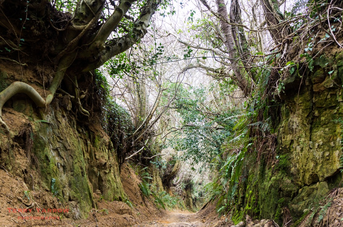
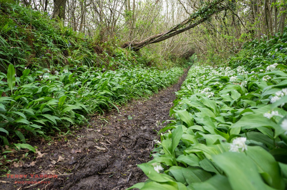
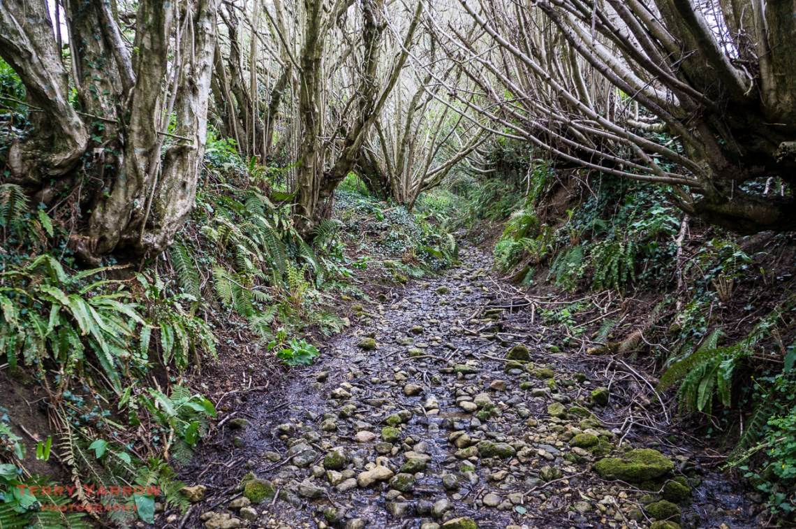
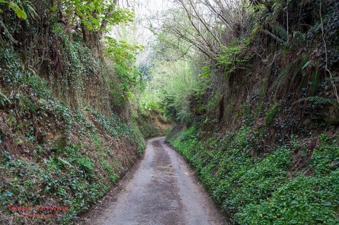
There are thousands of ancient paths criss crossing Dorset’s wonderful countryside but none more fascinating than these labyrinthine paths like the one in the picture above which goes by the interesting name of Hell Lane! These are known as Holloways, although they do have other names such as shutes, bostels or grundles depending on the area they are in, and they are only seen in areas where the bedrock is soft – West Dorset is predominantly sandstone and therefore has many Holloways.
So what are Holloways?
Well the name Holloway comes from the anglo-saxon word which literally means ‘sunken road’, and they date from at least 300 years ago, many going back as far as the iron age. They started life as either drove trails used to move cattle and other animals from farms to markets, routes from inland to the sea ports, pilgrimage routes, or simply boundary ditches. I am not sure whether the term Holloway would have been applied much when the usage of these ‘highways’ was at its peak – I suspect they might well have been referred to as simply ‘lanes’. Holloway, as a name, seems to have come much more to the fore in recent years having been popularised by Dan Richards’ and Robert Macfarlane’s book of the same name. In terms of literature, they also feature strongly in Geoffrey Household’s book Rogue Male, where the main character fleeing his pursuers goes to ground and hides out in a disused Dorset Holloway.
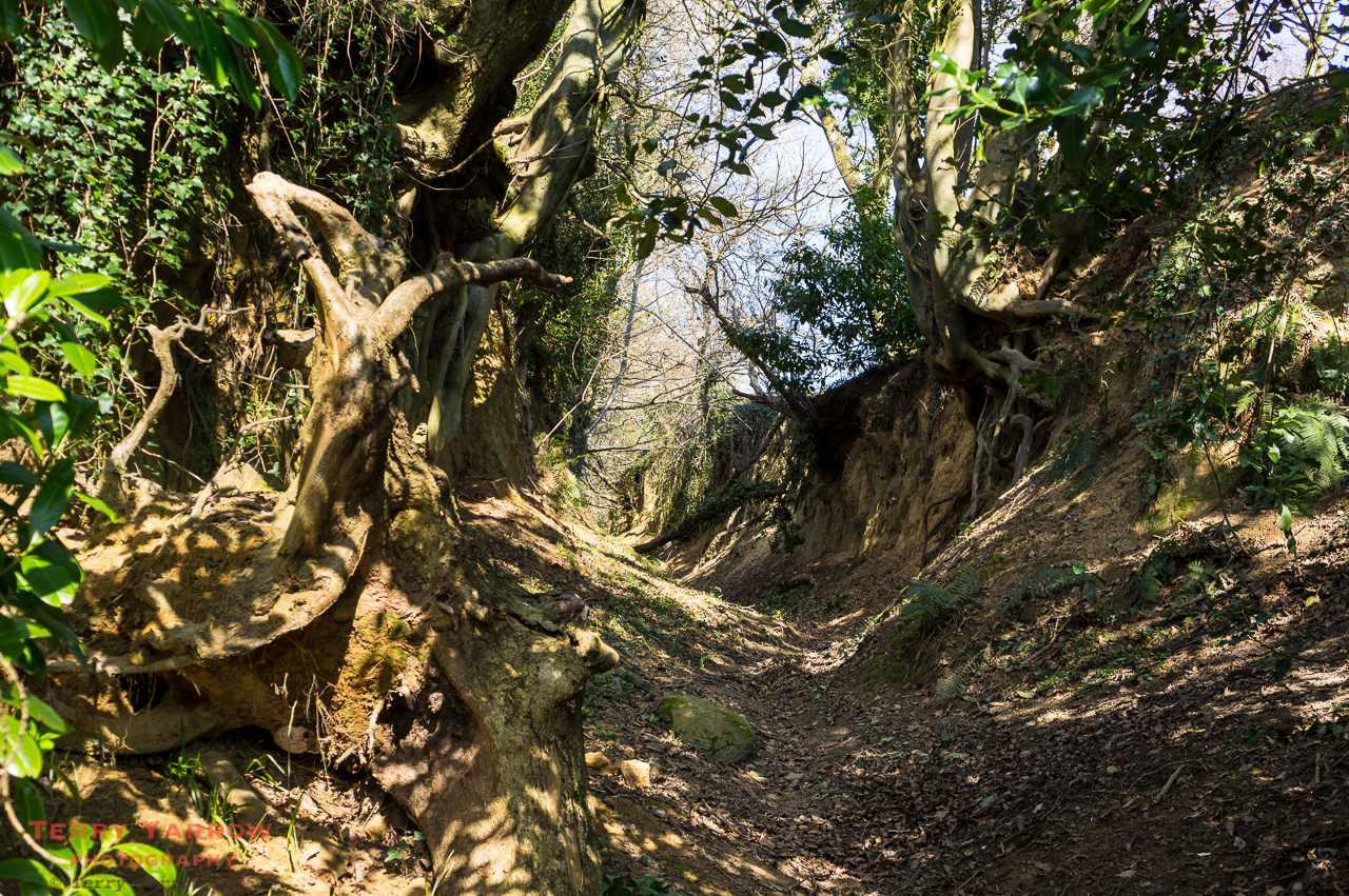
They certainly wouldn’t have started their lives as Holloways because most would have initially been at ground level but centuries of use by cattle, carts and people gradually eroded the soft surface creating a ditch which was then deepened and widened by yet more ‘traffic’ and also by water running off the surrounding land as the ditch became at times a river. Eventually, many have become as deep as 20 or 30 feet creating in effect gorges rather than paths.
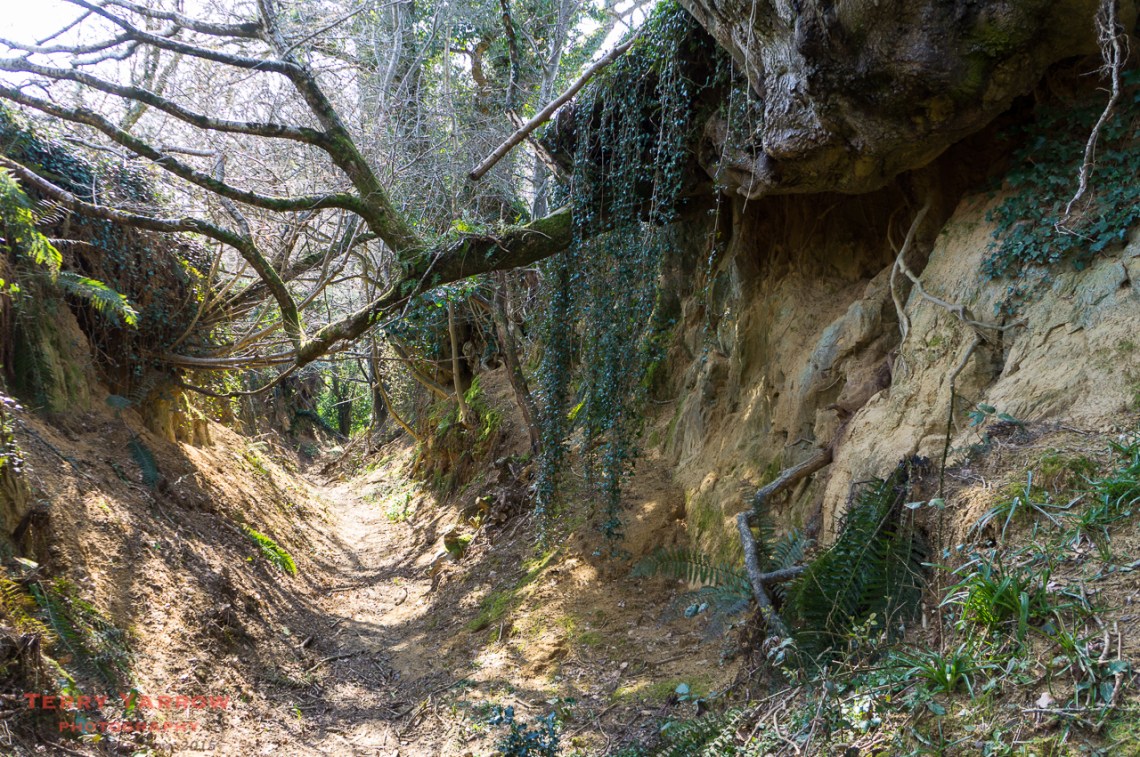
Holloways, and indeed all the ancient byways, are a record of the habits of our ancestors with hundreds of years of repeated use and that makes them rich in heritage and mystery……which is why I love walking them. With walls towering on either side and trees growing out of the top with their network of roots holding the walls in place, these paths have a real air of mystery. You feel like you are walking a natural and secret tunnel as the mesh of intertwined trees and branches above makes you feel shut in. And there is lots of wildlife too! Gilbert White, a pioneering naturalist from the 18th century once said that to walk the holloways was to ‘Access a world of deep history, an unexpectedly wild world, buried amid the familiar and close at hand’. He wasn’t wrong!
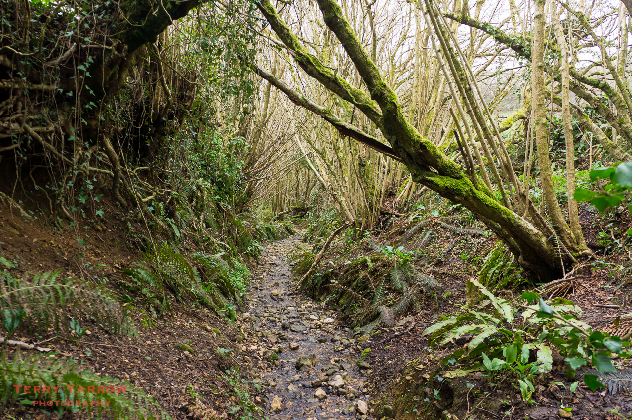
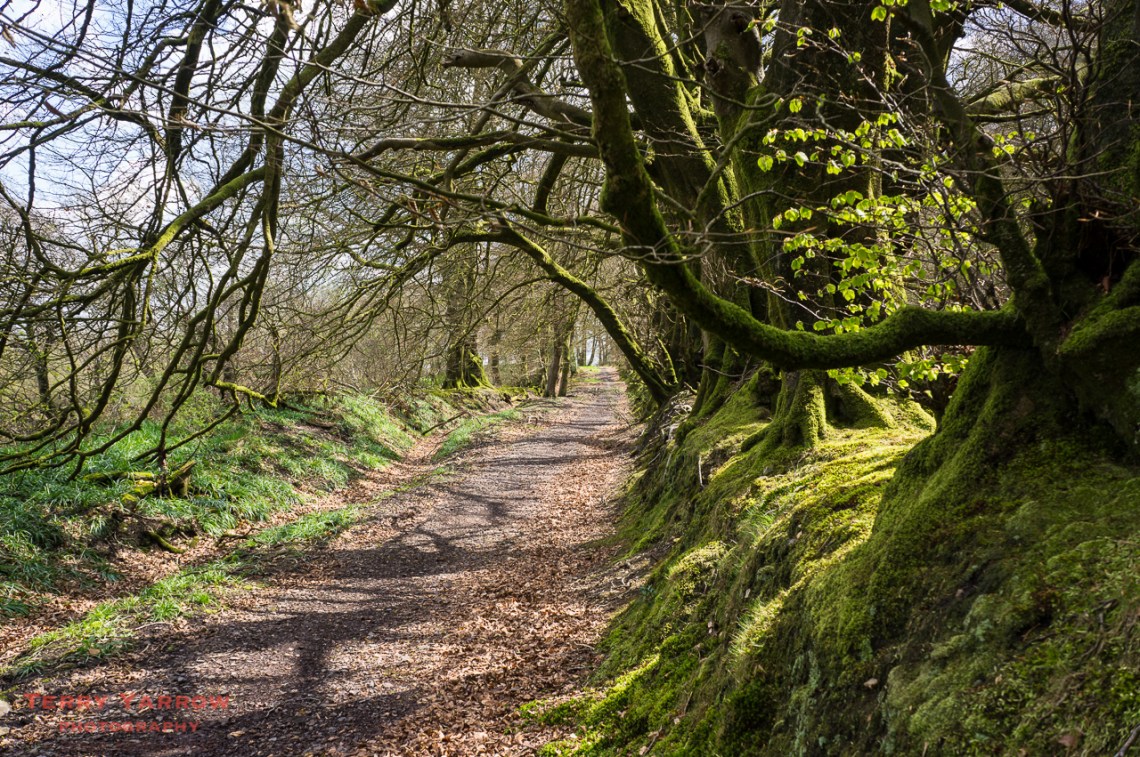
I have a number of regular walks that take in one or more holloways and they are always a delight to walk. On a grey, stormy day you could almost fear to walk them as the gloom and darkness created by the high walls and overhanging branches creates a feeling of shadowy threat. On a bright sunny day with lovely dappled light filtering through the trees, they take on an altogether different feel! But always secret and mysterious. So where are these Holloways? Well the truth is they are many and varied, ranging from the gorge-like to simply shallow sunken paths, worn by feet, wheels, and hooves.
These are a few I have walked.
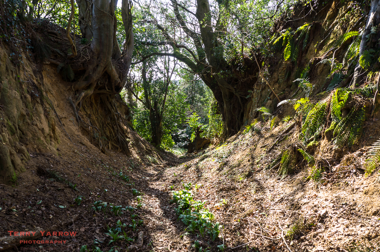
Hell Lane, Symondsbury
Hell Lane is perhaps one of the most impressive and interesting. With Shutes Lane it connects Symondsbury with North Chideock, climbing up over the ridge near Quarry Hill. It is interesting because the eastern part is much more gorge like than the western half – to walk from the ridge down to North Chideock is a bit like walking a shallow river bed! The reason for this difference might well be the fact that the church and other buildings at Symondsbury were built with stone from the quarry. You can just imagine how the constant traffic of heavy laden carts running between quarry and village would have considerably deepened that part of the track to the gorge it now is.
The Winneford Valley – the Holloway runs into the trees, top right
There are others in this area, tracks such as the one, now part of the Monarch’s Way, that climbs from North Chideock, through the Winneford Valley up over Coppet Hill.
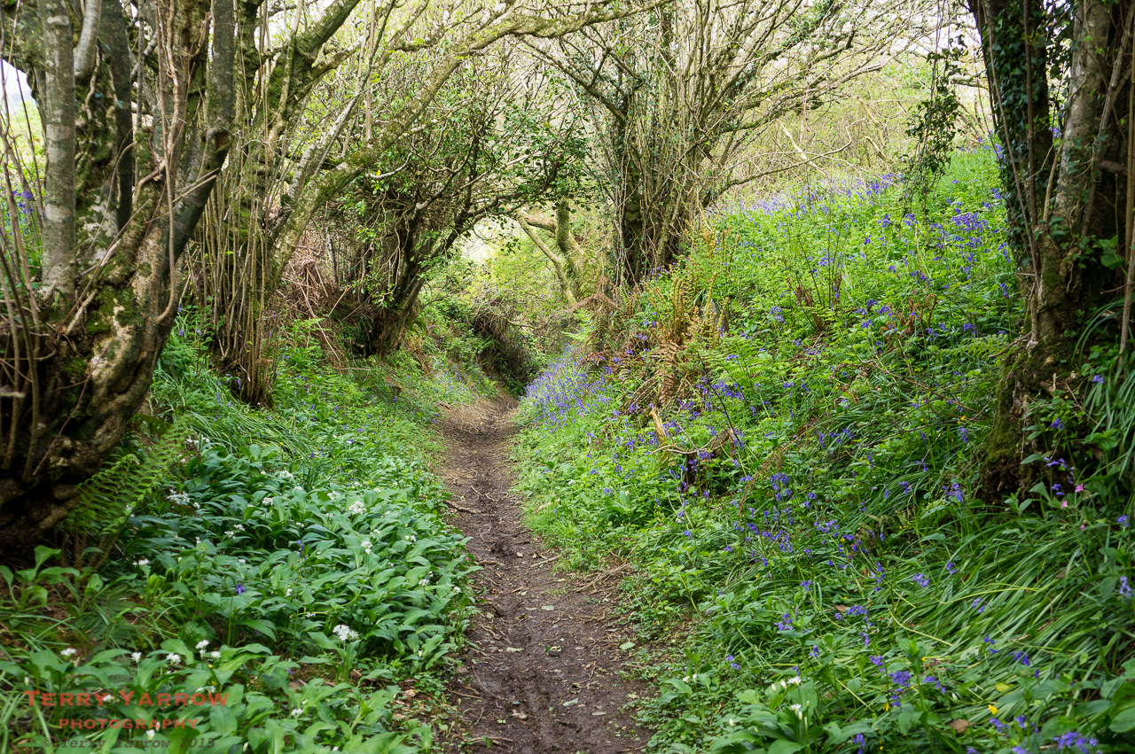
On Henwood Hill
And a smaller, but none the less beautiful, path that runs across the ridge at Henwood Hill. This is a lovely path to walk in spring when the bluebells and wild garlic are in flower.
Coombe Down
Moving away from this immediate area, there is a fine Holloway that climbs from the A3066 south of Beaminster up over Coombe Down. This is deep and wild with gnarled tree roots growing out of the steep sided walls, holding them in place. It is a well walked path, forming part of The Jubilee Trail.
Near South Poorton
Another smaller lane (or is it a river!) runs from the road at South Poorton and drops down to the nature reserve. With it’s fern lined walls and it’s stony, waterlogged bottom, this is a lovely haven for wildlife and this, together with the nature reserve beyond, makes a delightful walk.
The track drops down steeply at West Milton
And there is evidence of further Holloways at the other end of the nature reserve as the track drops down to another interesting village, West Milton.
Lewesdon Hill Lane
One further path that I feel is worthy of inclusion is Lewesdon Hill Lane, although this is not perhaps a Holloway in the true sense. I include it because it is ancient and sunken and a beautiful track to walk – it has even been suggested by some to have been part of the Ickneild Way, that ancient super-highway. With moss covered banks on either side and surrounded by ancient woodlands, there are some wonderful views from this path.
The access road down to Stoke Abbot
If you walk Lewesdon Hill Lane, you may well eventually reach the track that drops from the ridge down to the delightful village of Stoke Abbot. It really is worth walking this part as the deeply cut access road that leads to the village is a Holloway in itself, and of course the village with its pub is a pleasant detour.
Near Chetnole – this section is fairly clear but later it becomes overgrown 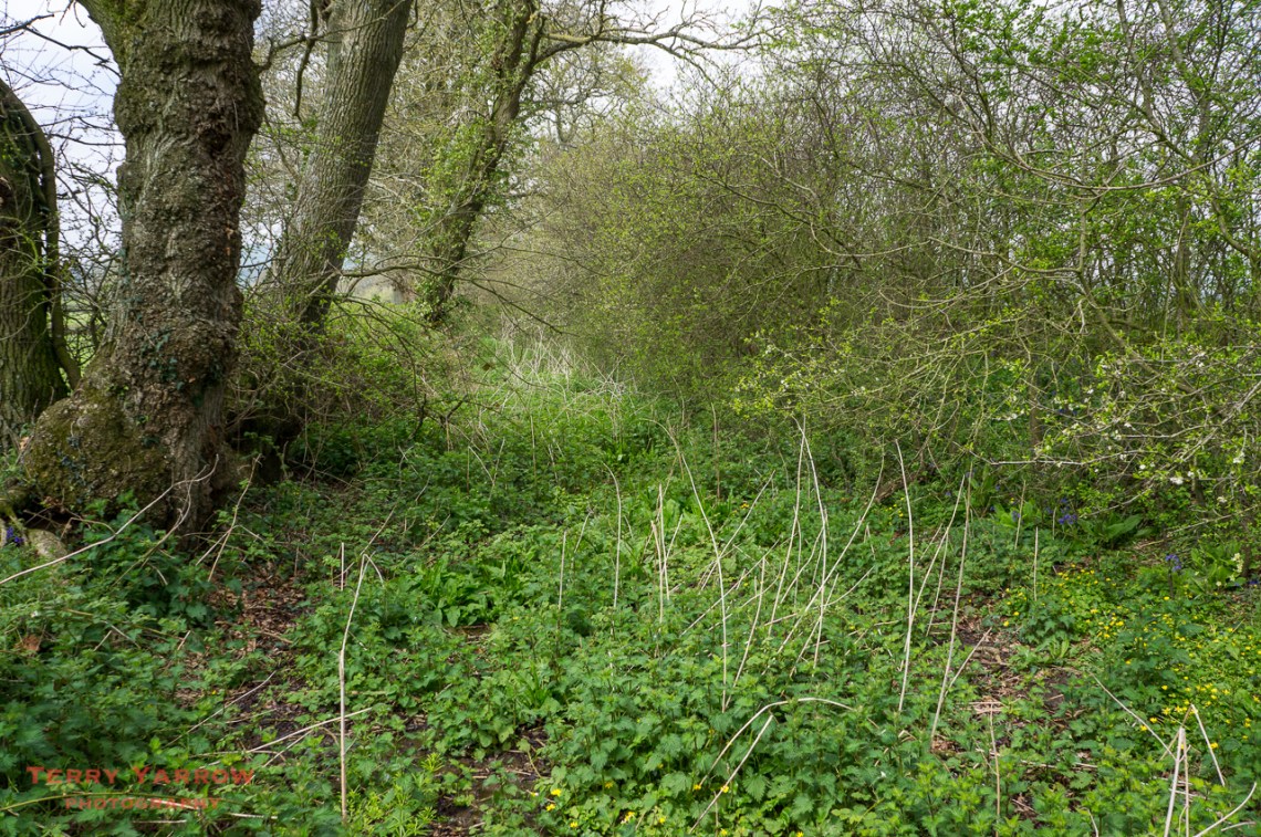
Cutty Stubbs
Sadly, not all of our old sunken byways have been well maintained and with the development of other forms of transport many have fallen into disrepair. The pictures above show sunken paths at Cutty Stubbs and Chetnole – both are now impassable. At Cutty Stubbs, I couldn’t even find the entrance to the sunken path and had to ask the farmer for permission to cross his field to find it! I did once question this with the authorities in an effort to have them cleared and reopened but sadly they ‘fall between stools’ and no-one has a budget that they wish to apply. The reason is that these are often Byways Open to All Transport (BOAT’s) rather than footpaths and responsibility for these falls with the Highways authority. The Footpaths authorities have a budget to maintain footpaths and Highways have a budget to maintain roads and BOAT’s………but naturally their funding is always exhausted keeping the roads in reasonable repair, with nothing left for our ‘off-road’ tracks.
Holloways may have been popularised by more recent writings but justifiably so. They are ever changing, ever different, ever mysterious, but always delightful! And as is often the case when I walk, I travel along them wondering about those who have trod that way before – were they early drovers, were they pilgrims heading for one of the Dorset abbeys, were they smugglers, were they just ordinary people making their way to the port perhaps to emigrate to other lands! Who were they and what was their purpose in travelling these ancient routes? If only the walls could speak! These days walkers and wildlife are the companions of the Holloway and to go there is to enter another world.
Thanks for stopping by.
Until next time,
Your friend The Dorset Rambler.
All photographs, poems and words in this blog are the copyright of The Dorset Rambler and must not be reproduced without permission.

Holloways are fascinating – there are some good sunken tracks/holloways around the Dorsetshire Gap
Ah thanks Philip, I’d forgotten all about those. I’ve walked there many times and have a lot of pictures. A future blog entry methinks 🙂
NB clicked on your link http://www.yarrowphotography.com
but this domain name seems to be up for sale!
Sorry I’d forgotten that link was still on there. I deleted yarrowphotography some time ago as I don’t really market my pictures. I tend to focus more on my blog. Thanks for pointing it out, I will remove it.
Beautifully written account of the history and topography of these ancient paths. Thank you.
I too walked Hell Lane today: just utterly breathtaking
Thanks so much Wendy. Hell Lane is an awesome place!
They are not just in West Dorset – we have plenty here in Milton Abbas – perhaps not quite so ‘sunken’ as others.
That’s true. I think I did say in my blog entry that they are everywhere but that West Dorset is a good place to see them because of its soft rock.
Hi Terry, Very interesting reading and enjoyed seeing the pictures of the holloways you have walked. There is one off Dolman’s Hill, very interesting because there are badger sets on both sides with well worn pathways along the banks made by the badgers.
Thanks Linda. I’ll have to explore that one as I can’t recall it.
Great article. I have an upcoming walking holiday in Dorset, and this is just the kind of thing I hope to encounter 🙂
Thanks Stephen. Have a great walking holiday in Dorset.
Reblogged this on The Dorset Rambler and commented:
I had a phone call last week from the people at BBC Countryfile. They are putting together some future programming based on Dorset and wanted to meet with me to discuss it and so that I could give them a guided tour of Dorset’s wonderful Holloways. I am still processing the pictures from the visit but I thought I would reblog this entry on Holloways that I posted earlier this year. The programming is still in the development stage and it may be several months before we know if it will go ahead but it was good to meet with them and show them our beautiful county.
Hi Terry, this is fascinating. Do you know of any in Purbeck?
Off the top of my head, I don’t Becky. They feature in West Dorset because the stone is so soft.
I thought that too, but then I saw them mentioned in this documents: https://www.google.co.uk/url?sa=t&rct=j&q=&esrc=s&source=web&cd=1&ved=0CCEQFjAAahUKEwjJkcjQz4DJAhXEGA8KHZL9Bg4&url=http%3A%2F%2Fwebarchive.nationalarchives.gov.uk%2F20101219012433%2Fcountryside-quality-counts.org.uk%2F%2Fresources%2Fehprofile%2FJCA136-HistProfile.doc&usg=AFQjCNGHkuFa3I6BqAuYkN7Ta8g383Seuw&sig2=Hop9Jyww3k0jjzjo2XB-yA
(Sorry, that’s a very long URL!). I’ve never heard anyone else mention them, though.
Hmm, that’s interesting. Still can’t say that I am aware of any – although thinking about it, maybe the footpath from the top road (Swanage to Kingston) through to Worth Matravers might count as one. I always though it was just a path between hills though rather than a holloway.
There is a small section called Dark Lane at the western end of the hamlet of Shitterton in Bere Regis. It used to be the main route to Dorchester. Unfortunately it is now a little overgrown as there is a new path up to Black Hill that runs parallel to it.
Becky,
One can be found at the northern end of Tabbit’s Hill Lane in Harman’s Cross, Isle of Purbeck.
https://www.bbc.co.uk/weatherwatchers/report/569c7a05-65ed-4620-8b1f-25e2e9d9cd27/ĺ
Thank you for the mention. Glad you enjoyed my blog. Holloway’s are a fascinating subject.
Some of the most beautiful places I’ve ever not seen! Thank you
Thanks Jeanne 🙂
Found this piece after searching on Hells Lane – excellent piece, will definitely be seeking out some of these paths when next in Dorset, so many thanks.
There’s something about a Holloway/sunken track that not only instantly transports you back in time, but links you to the earth in a way other paths can’t.
Cheers
Thanks Jim, its great to receive your feedback. Yes, there is definitely something about Holloways and in fact all ancient paths that grabs the attention.
Reblogged this on Milton Abbas History, Dorset, UK and commented:
I wonder if these holloways coincide with any parish boundary. In Milton Abbas our parish boundaries often feature a central pathway flanked by a double band and ditch, each ban topped with formerly coppiced trees.
There are many boundary ditches known as cross dykes but I am not aware that these necessarily became holloways although some might have. It is true though that often the ancient paths had trees planted on either side, marking their route.
Really interesting blog. Do you happen to know who Dinah’s Hollow is named after?
Thank you. That’s a good question but unfortunately I have never been able to find the answer, sorry.
I came here looking for the same answer. I only just heard of Dinah’s Hollow but I have been recently been researching my family tree and I have family from the Milton Abbas area, which include several ancestors named Dinah. I wonder if they are connected?
I’ve never actually seen anything that says where Dinah’s Hollow gets its name from. I do know that some roads in Dorset have been named after families who lived there (there is a road in Lytchett Matravers known as Dolman’s Hill that was named after the Dolman family, my ancestors). I don’t know if that is the case here though.
You appear to have used a number of my pictures in your blog entry although I don’t recall your having sought my permission. Whilst I appreciate the credit, it is normally courteous to seek permission first since the pictures are copyrighted. If you did contact me and I have forgotten, then I apologise.
I apologise in advance if I sound ignorant, as I am in another country… Are there any historic preservation societies in that area? The Holloways seem of incredible anthropological value. I wonder what small items have been dropped or forgotten along those ways over centuries of use, what those items might tell us about those who have walked them before us, how we’ve changed over time. I would think at least a University would find that sufficiently interesting and would create an interest in discovering and preserving such a part of human history.
Hi Heather. I do not know of any preservation societies in the area other than the Dorset County Council footpaths department. The nearest I have found to a preservation society is the Bridport Museum who have some information on the Holloways so they may be able to help by pointing you in the right direction. I think the growing awareness of Holloway’s generally has only developed in recent years. Best wishes, Terry
An excellent blog and some lovely images to accompany your words. I came across this entry when searching for more information about ‘Holloways’ after reading Robert MacFarlanes book – The Wild Places. My wife and I are regular visitors to Dorset so we are looking forward to exploring Hell Lane. Thank you.
Thank you 🙂 I am sure you will enjoy Hell Lane and Shutes Lane when you come, and of course there is Venn Lane as well (that’s the one I think Robert MacFarlane visited in his book ‘Holloway’).
Thank you for the additional information. I have not read Holloway just the one chapter on Holloways in The Wild Places. I thoroughly enjoy his writing as well those of his great friend Roger Deakin who sadly passed away. I am looking forward to discovering more of Dorset with help from your blog. Thanks again.
Terry, Shaftesbury (North Dorset), an ancient Alfredian Burg and Abbey, has several “Hollows” in the surrounding roads. These are holloways where the current road still uses the original routes cut many years ago through the soft sandstone:
Semley Hollow on A350 just North of Shaftesbury;
Dinah’s Hollow in Melbury Abbas on the C13 road to Blandford;
Motcombe and St James.
Hi John. Thanks for this. I know Dinah’s Hollow and Semley Hollow well. Will have a look at the others. Thanks for your input.
Are there any maps or gpx files to help find and walk these Holloways?
I don’t know of any online but if you email me, I can send you a couple.
Hello, I found this article while doing some research into the Dorset’s Holloways for a trip that I have planned this coming Spring. None of us is from England and I am afraid we will not be able to find some of the Holloways you mentioned. For instance: “On Henwood Hill
And a smaller, but none the less beautiful, path that runs across the ridge at Henwood Hill. This is a lovely path to walk in spring when the bluebells and wild garlic are in flower.”
Would you be so kind as to point directions in how to get to this path? It would be brilliant to walk it in spring.
Thank you so much for taking the time to write about this, know that people from Spain are reading it 🙂
Hi, thank you for your kind comment and I am glad you found my post interesting. If you can send me your email address, I will gladly send you some directions.
Terry
oh thank you so much, here is my address: create_then_exist@hotmail.com
Hi. This post is great. I’m doing some research for a podcast and I was wondering if you’d be prepared to tell me where the Cutty Stubbs holloway is? I’d love to go and take a look at it! Best wishes Tim
Hi Tim. Thanks for your kind comment. Cutty Stubbs is a mile north east of Whitchurch Canonicorum as the crow flies. The holloway is in the hedge line between fields behind Blackmore Farm but it is inaccessible and overgrown. Terry
Thanks for this excellent post. I’m doing some research for a podcast and am wondering if you’d be prepared to tell me where the Cutty Stubbs holloway is? I’d love to take a look at it. Keep up the great work! Best wishes Tim
Thomas Hardy refers to a Holloway in one of his novels. The group in the field above are overheard by those in the Holloway and it is hot gossip!! Can anyone help here?