

Distance – 9 miles
Grade – Moderate/Hard in places
Description – A somewhat strenuous circuit on mainly MOD land, partly along the Dorset Coast Path and partly along the inland ridge with amazing views throughout. Set out to be walked clockwise in order to ensure that the main climbs are earlier in the day, the route also works really well the other way as long as you don’t mind climbs later in the day.
Parking – Free parking is available in the small disused quarry on the left before the road drops down into Kimmeridge village. There is also a paid car park on the coast above Kimmeridge Bay. It is also possible to start the walk from either of the two parking areas along the inland ridge (Whiteway Hill or Creech).
Notes – 1) This walk is only accessible when the Lulworth MOD Firing Range is open – broadly most weekends, the Easter holidays, summer holidays and over Christmas but please do check specific dates online before visiting (search ‘Lulworth Firing Range opening times’) 2) When following the range walk paths, please do keep between the yellow marker posts 3) There are some severe climbs 4) Parts of the walk can be muddy during very wet spells.
Refreshments – These are available at the Clavell Cafe in Kimmeridge village.
Route Description – The walk begins from the disused quarry parking area on the unclassified road just before it drops down to the village of Kimmeridge. From the quarry, follow the road up to the right to reach a stile in the left fence which leads to a path that drops steeply down a field to come out at the top of the village by the church. Follow the road through the village (A) and when you pass the last cottage, go through the gate on the right to cross a field and wooden footbridge, and then turn left and follow the tree line and stream down to the road opposite a row of cottages at Gaulter Gap (the path from the village to the cottages can become very muddy in winter – if you want to avoid this, just stay on the road).
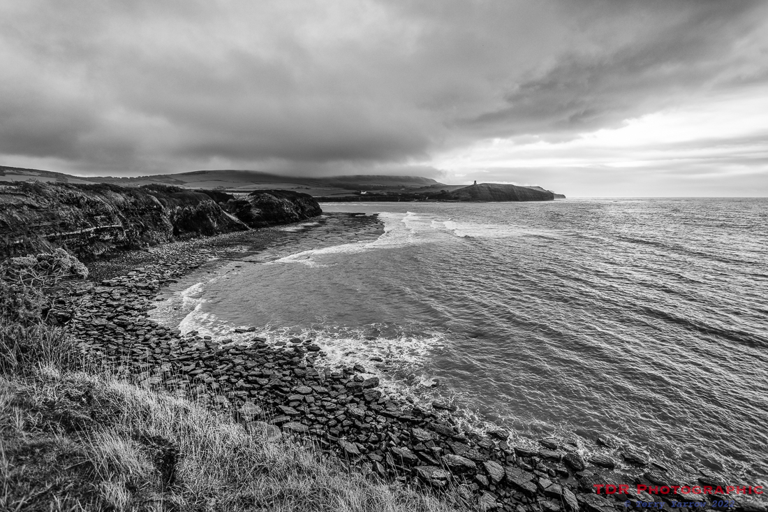
At the road by the cottages, should you wish to explore Kimmeridge itself, turn left and walk across the parking area to reach a track down to the shore (B). To continue the walk, turn right and follow the tarmac road past the cottages before turning off to follow the coast path beside the nodding donkey oil well. Follow the coast path to gradually climb up towards Tyneham Cap, taking time to turn often to take in the views across Broad Bench and Kimmeridge Bay. This route skirts round Tyneham Cap but if you would like to visit this amazing viewpoint, then when you reach a stone seat below the summit, take a detour up to the right to reach the Cap itself (C). Otherwise, just enjoy a break and sit on the seat to take in some equally expansive views, before continuing west along the coast path, crossing Gad Cliff and dropping down into Worbarrow Bay (D).
From Worbarrow Bay (D), there is another possible detour inland to visit Tyneham village, but for this walk, we continue along the coast path (having first visited the lovely beach) to climb again up to the Iron Age hill fort of Flower’s Barrow (E). When you reach the hill fort, do take a short detour again across the hilltop to see the views to the west and then retrace your steps to follow the path that heads east along the inland ridge, crossing Whiteway Hill and Povington Hill. From the Whiteway Hill parking area, the footpath runs beside the road and crosses the entrance road to Tyneham Village – just stay on the ridge top and follow the roadside path all the way to Creech where there is a junction and a road off to the right that drops down the side of the ridge.
Walk down this road, taking care to watch for traffic. At the bottom of the hill, the road turns sharp left; continue to follow the road until you reach a road off to the right signposted ‘Steeple Church only’. Follow this road, passing Steeple Manor on the left, and go right to the end of the road to reach the main church gate with the church porch down the path. Take a moment to look round this delightful church before crossing a stile opposite the main church gate (ignore the earlier stile further back along the road).
Cross the field diagonally to the left, dropping down to reach a wooden bridge across a small stream at the valley bottom and then climb up the next field (note, this field can be very muddy), again diagonally to the left to reach another stile beside a farm gate that exits onto the country lane that bears the quirky name of Devil’s Staircase. Turn right and follow the road a short distance over the top of the hill and back to your starting point.
Points of Interest –
(A) – Kimmeridge Village – This is a delightful Purbeck village of stone cottages, many with thatched roofs. With the Clavell Cafe, delightful church, and a fossil museum (The Etches Collection), it is a lovely place to walk through at the start of our walk, and to explore further later.
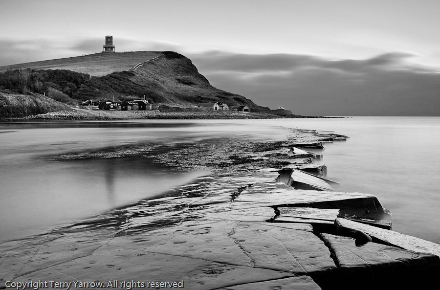
(B) – Kimmeridge Bay – This rocky, semi-circular bay of shale and clay is world renowned for its geology and is an AONB and an SSSI. Historically, fishing and mining have been a feature but now, such things as snorkelling, kayaking, rock pooling, fossil hunting etc have taken over. With Clavell Tower standing sentinel on its hilltop above the bay, it is an area well worth exploring.
(C) – Tyneham Cap – this viewpoint stands high between Kimmeridge and Tyneham village/Worbarrow and has amazing all round views. It is a slight detour from the route but that detour is well rewarded if you make it.
(D) – Worbarrow Bay and Tout – This beautiful and unspoilt bay stands in MOD firing range land and is a place well worth lingering over. The Tout (viewpoint) stands at the east end of the beach, and a half mile walk inland will take you to the ruined and abandoned village of Tyneham.
(E) – Flower’s Barrow is an Iron Age hill fort built over 2,500 years ago. It forms the western end of the 18 mile inland ridge that runs from Ballard Point, above Swanage, and gives lovely views in both directions along the Dorset coast. Coastal erosion means the the fort is at risk, and indeed, half has already crumbled into the sea.
(F) – Steeple church has no steeple 🙂 – in fact the hamlet takes its name from ‘steep hill’. It comprises a church, manor house, farm and a few cottages and is set off the main Purbeck routes. It is quiet and peaceful, and the church is well worth a visit.
Pictures –


Blog posts for further information –
Home, Home on the Range….Again!
Of a walk gone wrong, summer sunshine, and Two on a Tower 🙂
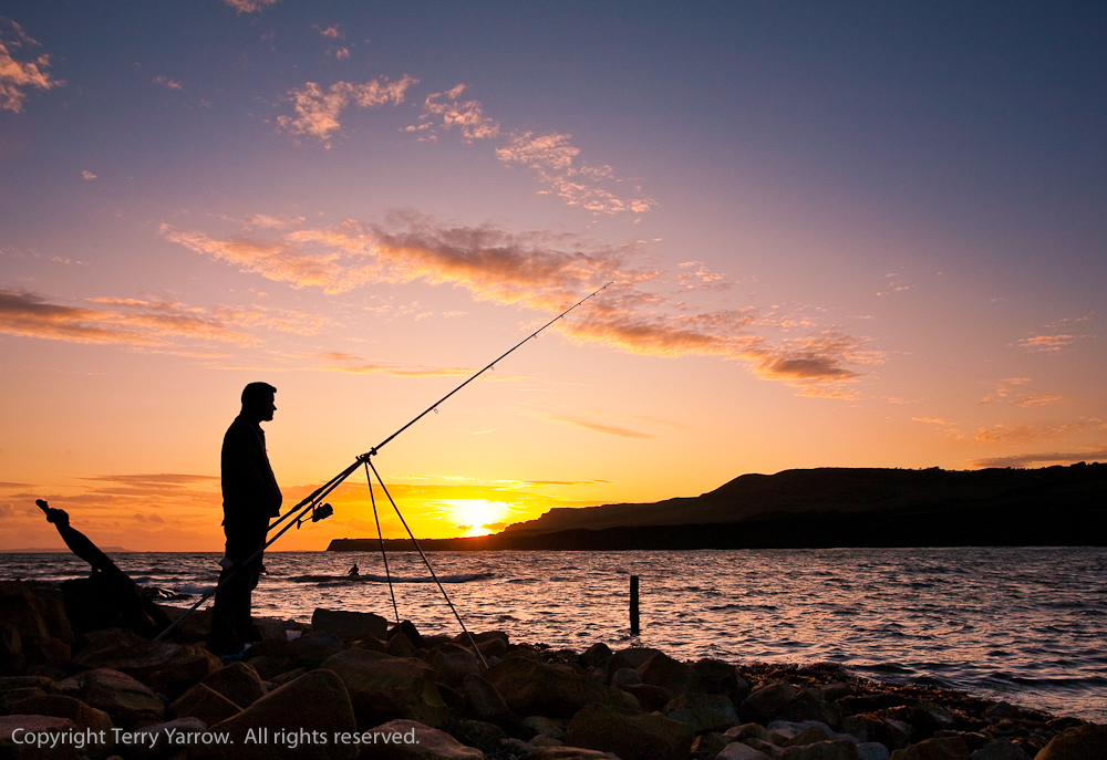
This walk may only be accessible at certain times, but in many ways, it is all the better for that. Being on an MOD range, the land is undeveloped and unspoilt, left only to nature, and the views are breathtakingly beautiful. There may be several steep and arduous climbs but the reward from the tops is tangible, and there is much of interest to enjoy along the way. Watching the sun set over Kimmeridge and then enjoying a bite to eat at the Clavell Cafe afterwards is a great way to end the day. I hope you enjoy walking this route.
Until next time,
Your friend
The Dorset Rambler
If you would like to contact me, my email address is terry.yarrow@gmail.com – comments and feedback are always welcomed.
All words and pictures in this blog are the copyright of The Dorset Rambler and may not be reproduced without permission.
