

I said in my previous post that I intended to return to the Lulworth Firing Range in order to complete the part of the walk that I had not been able to walk the previous day, and I did just that 🙂 ! I also said that I had a cunning plan that I thought might help my arthritic ankle – I got out my walking boots. I normally walk in trail shoes but it occurred to me that boots might actually support the ankle better, and they did…..at least for a time. I managed to walk nearly 13 miles relatively pain free on the day but unfortunately the ankle has become even more painful since, to the extent that I have decided to seek medical advice.
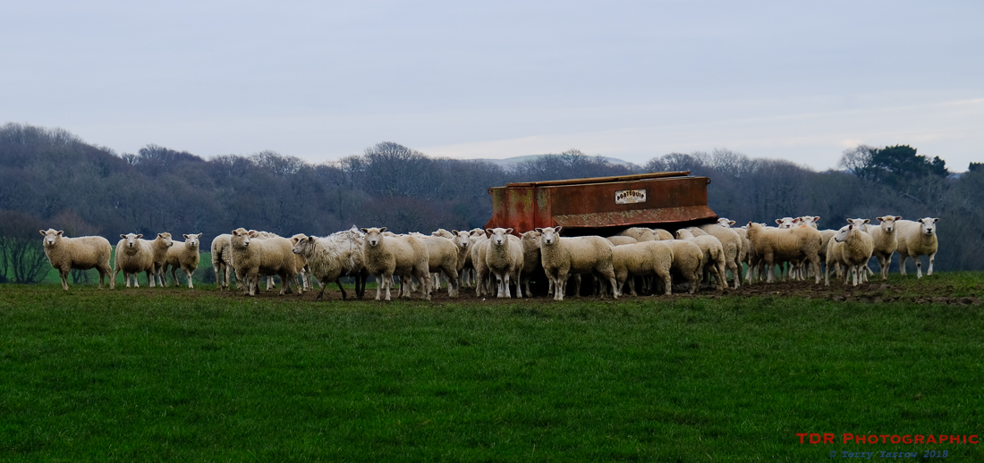
Anyway, back to my walk 🙂 ! I decided to take a slightly different route to the norm, dropping down off the Purbeck ridge towards the coast by taking an easterly route…..passing the sheep above, all lined up at the top of a rise.
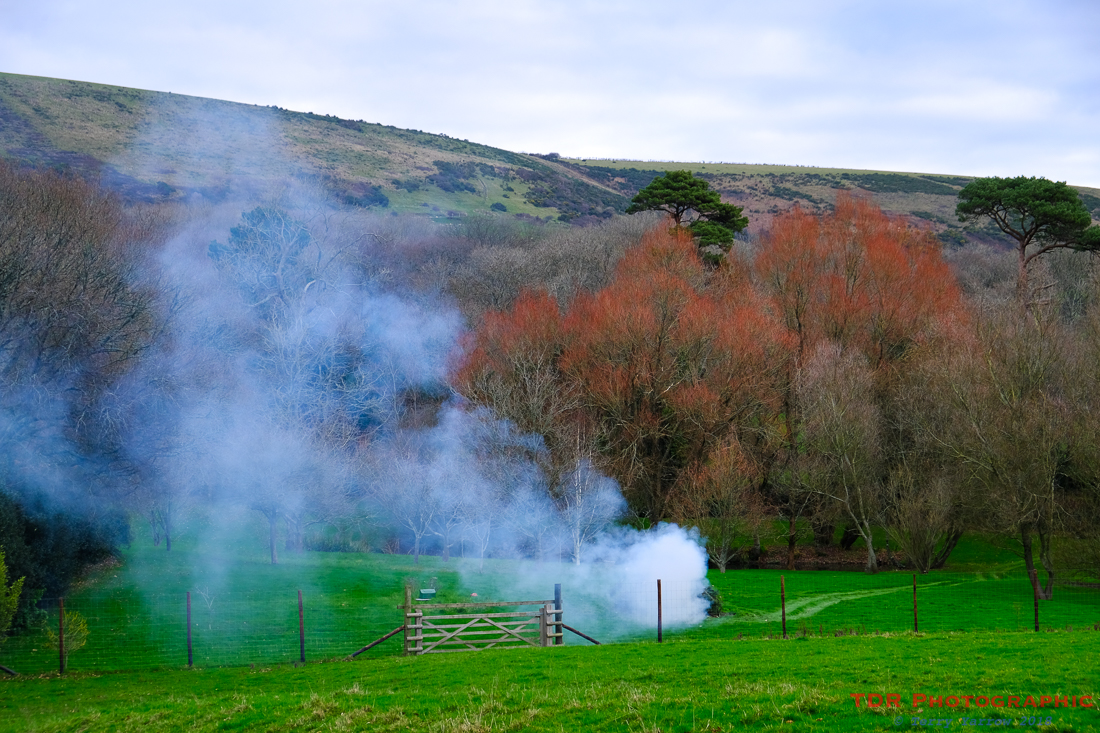
The route took me through the lovely little hamlet of Steeple; just a church, an old manor house, a farm and a few cottages, where someone was burning some garden rubbish on a bonfire. It threw smoke across the landscape and what caught my eye was the red trees which looked for all the world like they were on fire. Despite its name, the church at Steeple has no steeple 🙂 ! The hamlet’s name is in fact a derivative of steep hill as there are hills on both sides.
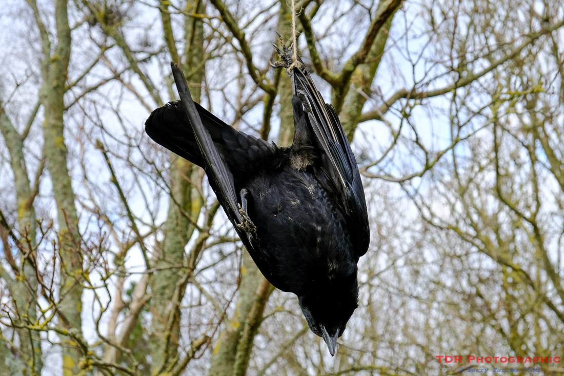
A couple of miles further on, I came across the gruesome sight above – it really upset me to see the dead bird hanging from a tree. And not 20 feet away was a sign warning walkers to keep their dogs on leads because this was a conservation area! Clearly, their idea of conservation is not the same as mine, and obviously just relates to the conservation of game birds in order that they can be shot later in the name of sport! The hanging bird, probably put there by the gamekeeper, apparently warns other birds not to feed in the area.
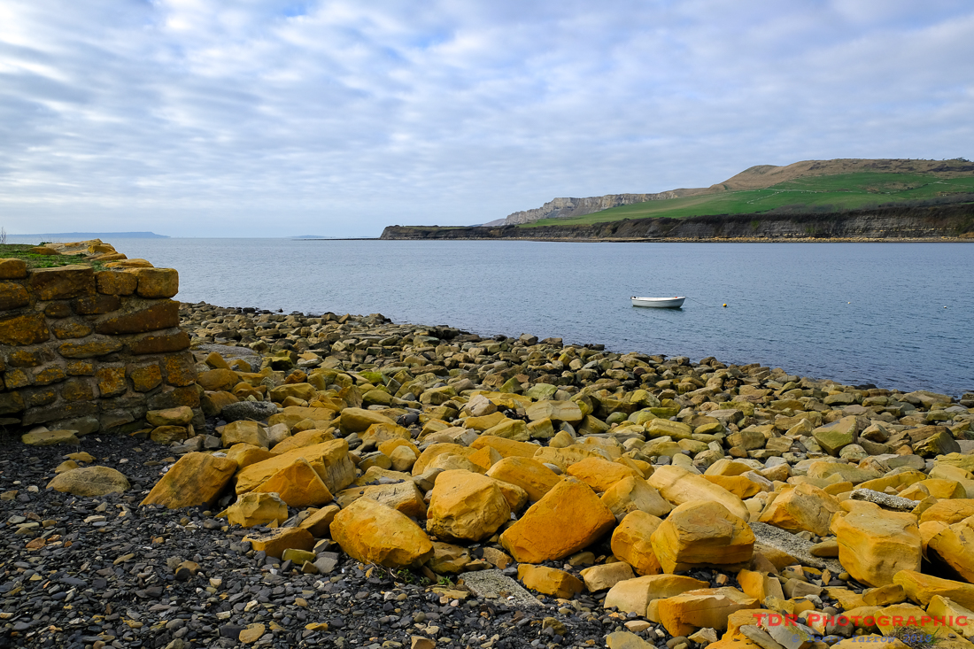
Apart from this, the walk was delightful, even though the weather was overcast. Passing through the landscaped grounds of another of the Purbeck manor houses, I reached the coast at Kimmeridge which is a lovely bay with many shale ledges reaching far out into the sea. When the tide is out, as it was on this day, there are lots of rock pools to explore, and lots of photographic opportunities. It is also an area used for scuba diving and fishing.
The sun almost made a breakthrough whilst I was there, allowing me to get at least a couple of pictures which were not too bad. Being still school holiday time, there were a few people around, and I got chatting to a man from Frome who had come down to take photographs. Kimmeridge is a draw for lots of photographers, especially at sunset, although I was too early for sunset pictures today.
I had intended to have lunch on the rocks at the bay, but it was a cold day and standing chatting for so long meant that I needed to walk in order to warm up a bit before eating, so I headed off in a westerly direction, entering the range walks again at their eastern extremity.
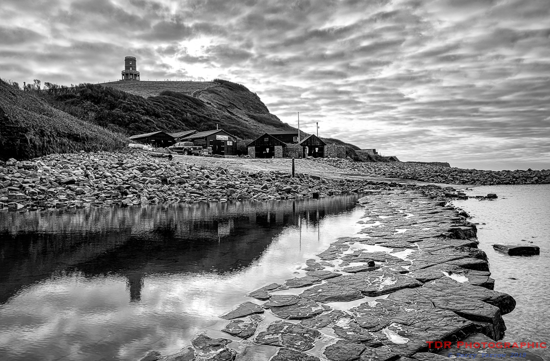
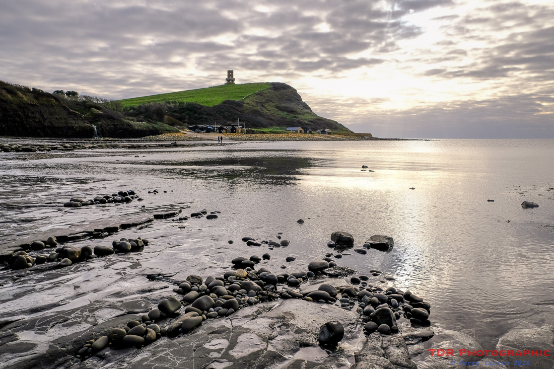
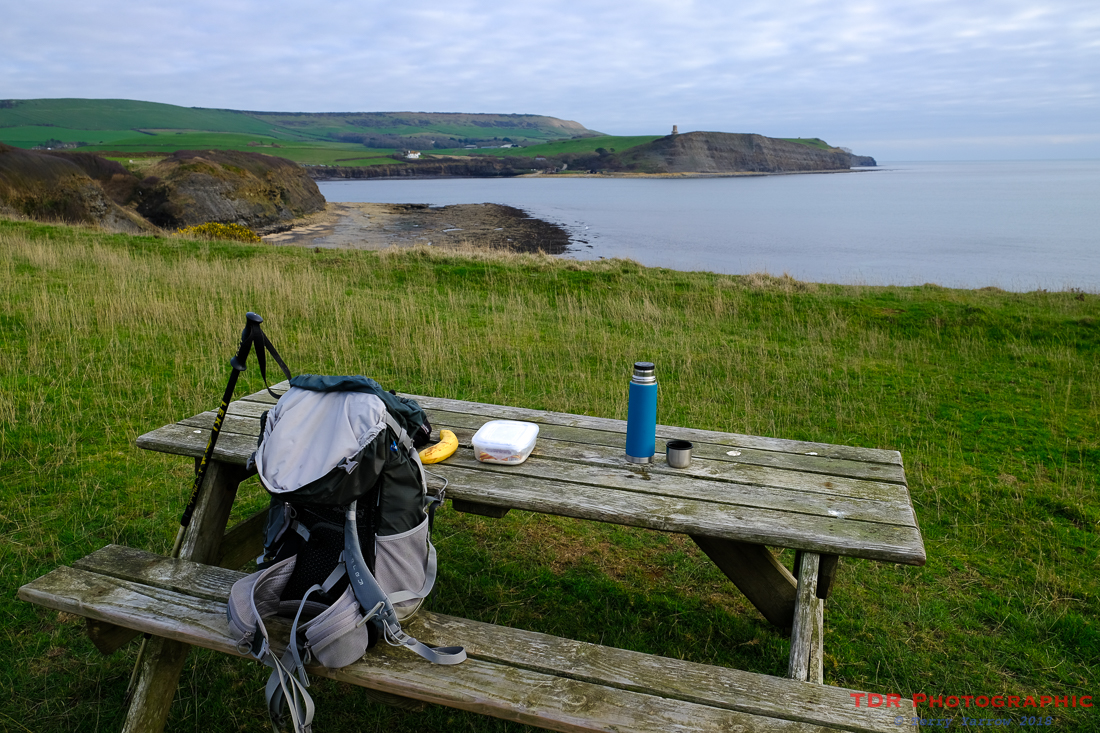
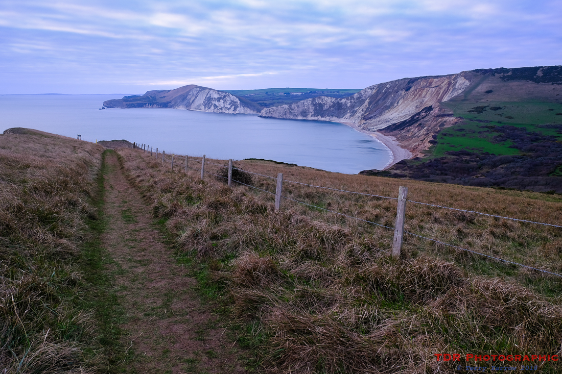
After warming up a bit, I found a clifftop picnic table and sat to eat looking back across Kimmeridge Bay with Clavell Tower standing sentinel like a lookout guarding the beach. This tower which has featured in a number of films and books has now been restored and is in the ownership of the Landmark Trust. If you fancy a holiday there, you need to book well in advance but beware, you’ll need to be fit because you will have to manhandle your luggage up that steep hill. I met an elderly couple once who were struggling up the hill with their cases and when I spoke to them about it, they said that it was ‘part of the fun of renting the tower’. The views from the tower along the coast are awesome!
If you would like more information on the tower and pictures of the inside, I have blogged some on a previous walk here.
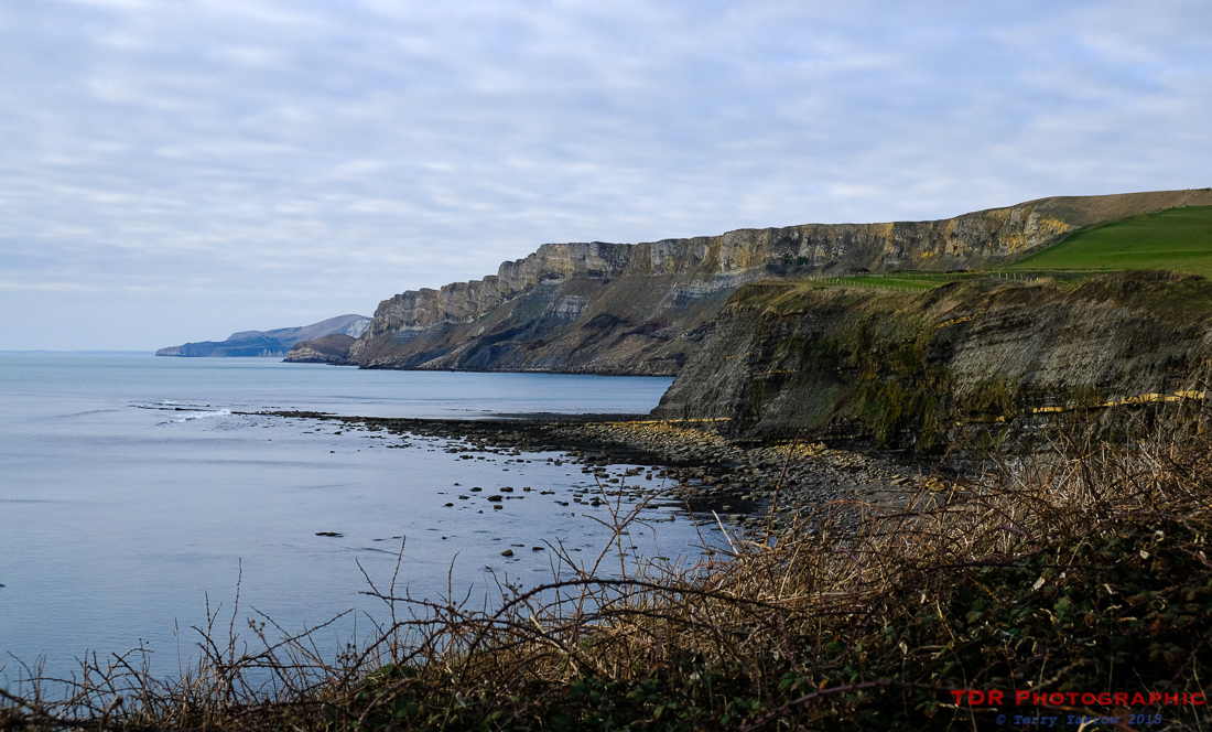
After warming up with hot Bovril, it was soon time to move on and I continued my journey westwards, taking care to stay between the yellow marker posts to avoid any unexploded shells that might be on the range. Ahead of me I could see the distinctive corrugated edge of Gad Cliff – after the next steep climb, I would be walking along that rugged clifftop.
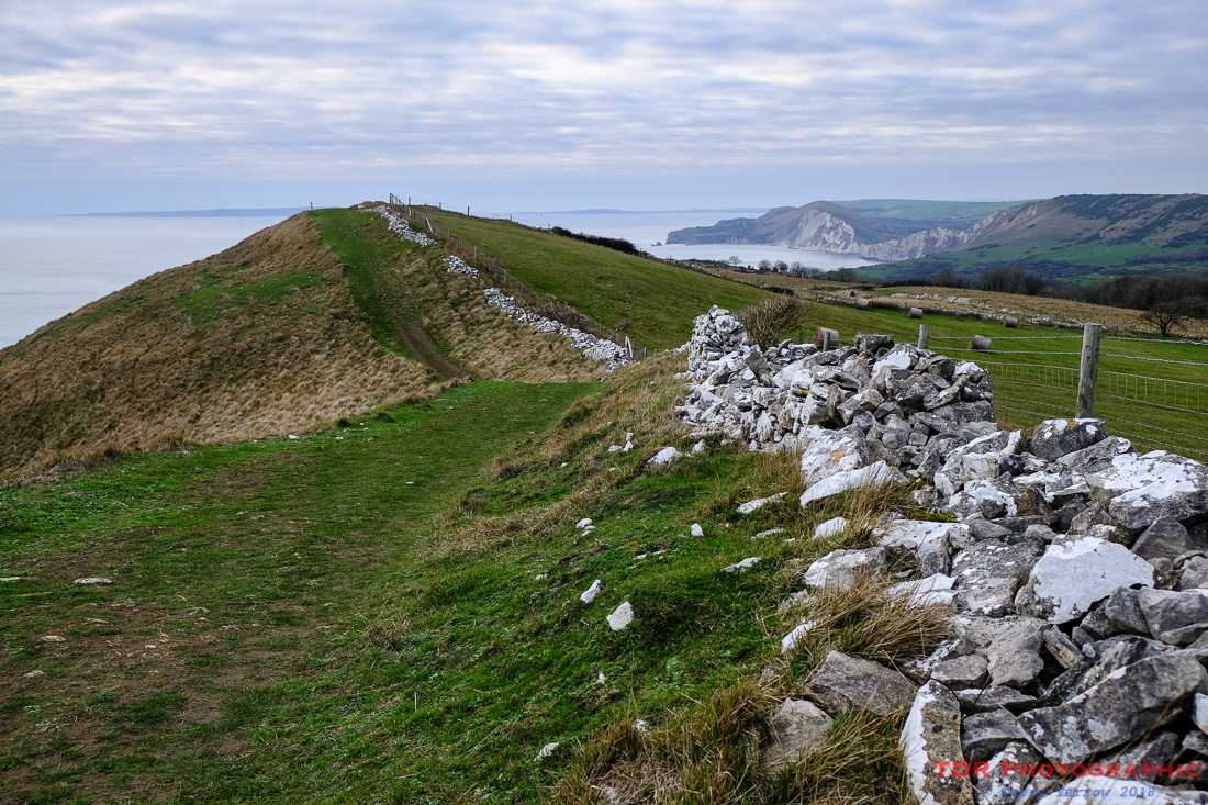
The steady climb took me up to the highest point along this part of the coast, Tyneham Cap, with its twin humps like a camel. Nearby there was a suitably sheltered stone seat, necessary because there was a really cold, stiff north-easterly whipping across the top. After the climb up, it seemed rude not to make use of the seat 🙂 !
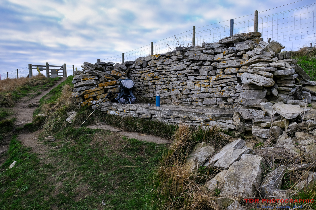
In any event, it was a seat with a view, a view right back down to Kimmeridge Bay, so I sat for a while just drinking it in, and drinking some more Bovril too 🙂 ! It really was worth the climb just to be able to savour that view. The afternoon was drawing on though so all too soon I had to continue my walk.
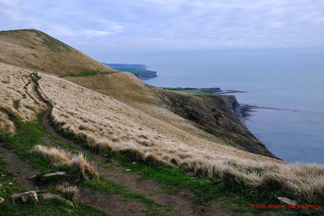
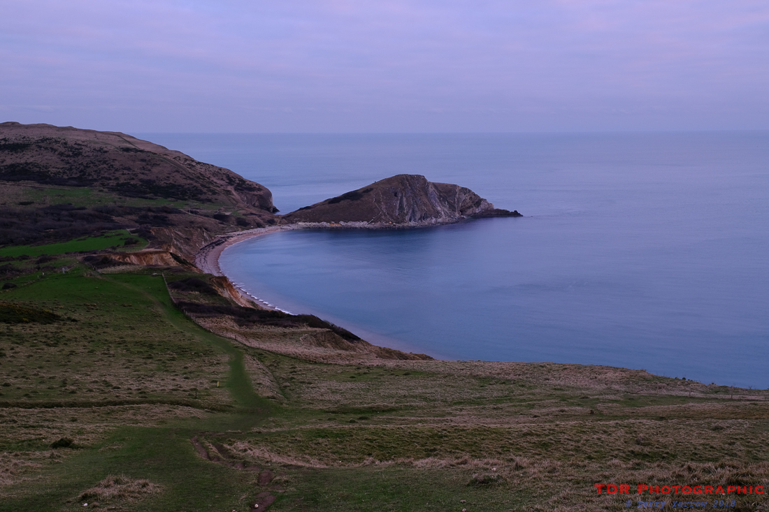
I made my way across Gad Cliff that we saw earlier, and started to drop down the other side into Worbarrow Bay. The whole bay stretched out before me and across the other side were the hills I had walked yesterday, separated by the gap where the path meets the sea at Arish Mell.
With fading light, I didn’t stay long at Worbarrow because I still had some 5 miles to walk so I climbed up again to the top of the ridge at Flower’s Barrow, the hill fort that I also visited yesterday. I could look back again and see the distinctive shape of Worbarrow Tout below. The word ‘Tout’ actually means lookout, so you can see why they gave it that name.
By the time I reached the ridge, the light was fast fading, with just a slight hint of pink in the colour of the sky. As on the previous day, I made my way back along the ridge top, only this time, a mile or two further as I had parked at Creech Vewpoint. By the time I reached my car, blackness had descended like a blanket on Purbeck.
I really enjoyed my walks on the Lulworth Ranges, partly because I am not able to walk there very often which makes it seem like a new walk. And it is always good to do a ‘new’ walk.
Thanks for stopping by.
Until next time,
Your friend
The Dorset Rambler
If you would like to contact me, my email address is terry.yarrow@gmail.com – comments and feedback are always welcomed.
All words and pictures in this blog are the copyright of The Dorset Rambler and may not be reproduced without permission.

Beautiful photos! Hope your ankle is on the mend soon.
Thank you, you are very kind.