

– – – Exploring The Countryside and Lanes of Dorset – – –
OK, so I lied yesterday 🙂 ! I’ve decided that I will continue this series a little longer, and today we visit a real icon of Dorset and something that is almost unique. This is an amazing feature that stretches for 18 miles along the coast and one that is mysterious and that has some quirky features. This is the Chesil Beach.
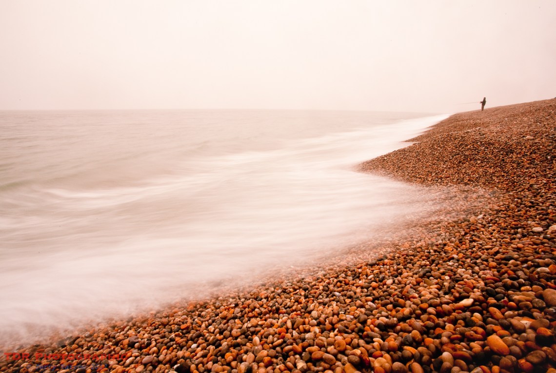
Chesil Beach

Chesil Beach, also known as Chesil Bank, stretches 18 miles from Chiswell at its south eastern end to West Bay at its north western end……..although some would say that it doesn’t actually end there, since the beach continues beyond that point. It takes its name from the old English word for shingle because this is a shingle beach, and a shingle beach of the finest order. It is between 150 and 200 meters wide and between 12-14 meters high, with that height increasing towards the south east, and it is said to comprise some 180 billion pebbles.
It is described as a Tombolo, that is a narrow strip of land that is formed by the tide to join an island, in this case the Isle of Portland, to the mainland. Some would disagree with that description, stating that this is more of a giant sandbank or Barrier Beach because it runs predominantly parallel to the coast rather than perpendicular to it. Either way, this is the largest such feature in the UK, and one of the largest in the world.

Chesil is thought to have its foundations way back at the end of the last ice age when the previously dry English Channel was flooded by melting ice. The gradually rising water level washed sediment towards the land forming a sandbank which increased in height as it moved landwards, eventually rising above sea level, trapping seawater behind it. This trapped water became known as The Fleet, a now brackish lagoon. The ‘sandbank’ was then further increased in size by stones and rock being washed over from the crumbling cliffs along the west shore of Lyme Bay, with these being driven over the top of the sand and silt to create a pebbled shoreline.
One of the interesting features of Chesil Beach is that the size of the pebbles varies along its length, being fist sized at Chiswell but reducing gradually to pea size at West Bay. There are various theories put forward to explain this phenomenon, one being that the predominant tides coming from the southwest hit Portland and then effectively bounce back westward again along the shoreline gradually reducing the size of the pebbles by attrition. Another suggests that in fact the southwesterly winds and tides wash the pebbles eastwards along the shore and that the larger pebbles simply move quicker and override the smaller ones that then get left behind.
Whichever of these theories is correct, it is said that fishermen or smugglers landing on Chesil Beach at night could tell exactly where they were simply by the size of the pebbles.

The bank is not smooth as it appears from a distance but is in fact ‘shelved’ by the action of the sea and weather as you can see in the picture above. The shingle is multi-coloured because of the different types of stone. For centuries, although the shingle beach itself was being eroded, it was being replenished by more debris washing across from the west. However, erosion all along this coast has caused some headlands to become more prominent, effectively blocking this resupply chain. In addition, human interaction has also had an effect since gravel extraction used to take place here.
Interestingly, whist lateral movement has virtually ceased, the shingle bank is still very gradually moving inland and a rate of 15 cm per annum has been suggested at the Portland end. It is probable that some distant day it will either be breached, or it will join the mainland. In fact there have already been occasions when the sea has breached Chesil, notably in 1824 when much of Fleet village was destroyed.
Chesil Beach is a truly amazing place and usually there are many fishermen, especially in the more western parts where it can be reached without too much walking. Swimming, however, is a dangerous occupation all along its length because of the steeply sloping shingle and very strong undertow. The shingle actually continues to drop steeply to some 18 meters below sea level at 300 meters out to sea!
In any event, because this is a conservation area, access is extremely restricted in parts, with no access being permitted at all along great lengths during the nesting season, or along the landward shoreline at any time at any time of year.

The Chesil Beach is a wild and special place that has inspired novels! It is certainly a place that inspires me and one of my ambitions is to walk along its length simply because it is there, and because not many people will have done it. Well, trudging along 18 miles of shingle is not easy, especially when there is an easier path along the mainland shore. Whether I will achieve it or not, time alone will tell 🙂 !
Thanks for stopping by.
Until next time,
Your friend The Dorset Rambler
If you would like to contact me, my email address is terry.yarrow@gmail.com – comments and feedback are always welcomed.
All photographs, poems and words in this blog are the copyright of The Dorset Rambler and must not be reproduced without permission.

1 Comment