

Day 2 – Ennerdale Bridge to Borrowdale – 18 miles
After a very cold night in the tent, I woke at 5.30am to a heavy frost! I was looking forward to the day as it was the first day in the Lake District mountains but I also wondered how I would get on carrying so much weight up over the mountain passes, today’s highest point being 600 meters – in fact, even more weight now as I had to pack away a very wet tent!
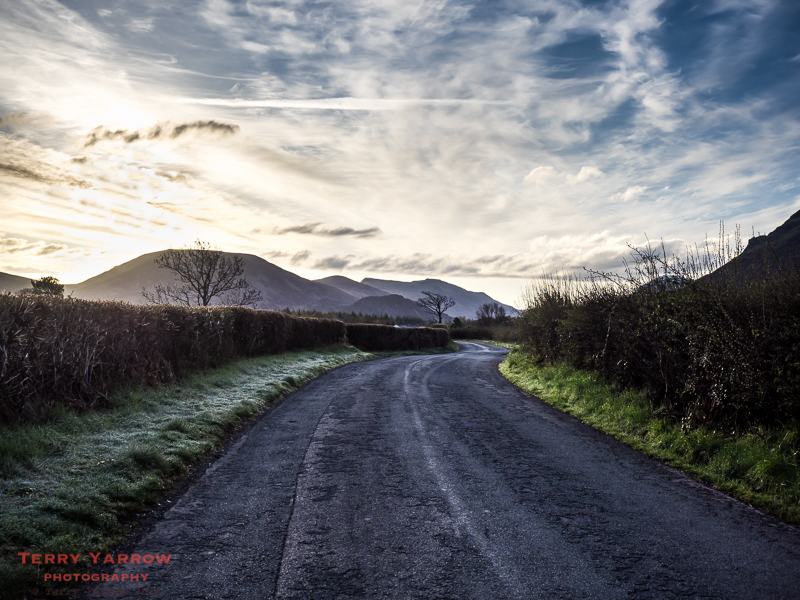
I was out on the road again before 6.30am with the sun making an appearance over the distant Red Pike/Haystacks ridge. It was a stunning morning as I made my way along the road towards Ennerdale Water.
At the lake, you have choices as you can take the path to the North or South of the lake – I chose the latter and made my way along the lake shore in glorious sunshine. The path was lovely and meandered along the shoreline but it was rocky so progress was slow – a twisted ankle at this stage would be disastrous! Having said that, slow is good and I drank in the views and just the early morning atmosphere.

Reaching the head of the lake, I crossed the River Liza that feeds it and stopped for ‘elevenses’ beside the fast flowing stream.

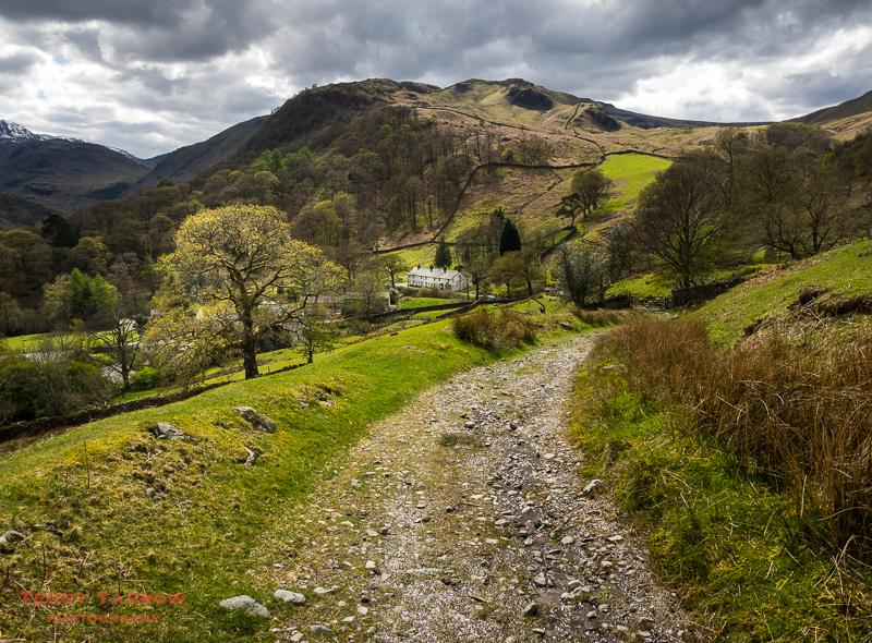
The route from this point follows the forestry road that runs beside the river, climbing slowly up towards the head of the valley. This was easy walking as it was even underfoot and just rose gently as it wound through the trees. With birdsong and the babbling of various rivulets passed along the way, it was a delightful walk. Eventually I came out of the forest and I could see the steep rise ahead of me at the top of the valley. I could also see the Black Sail Hut and I took the opportunity to rest awhile, wishing really that it was later in the day as this would have been a fantastic place to overnight.

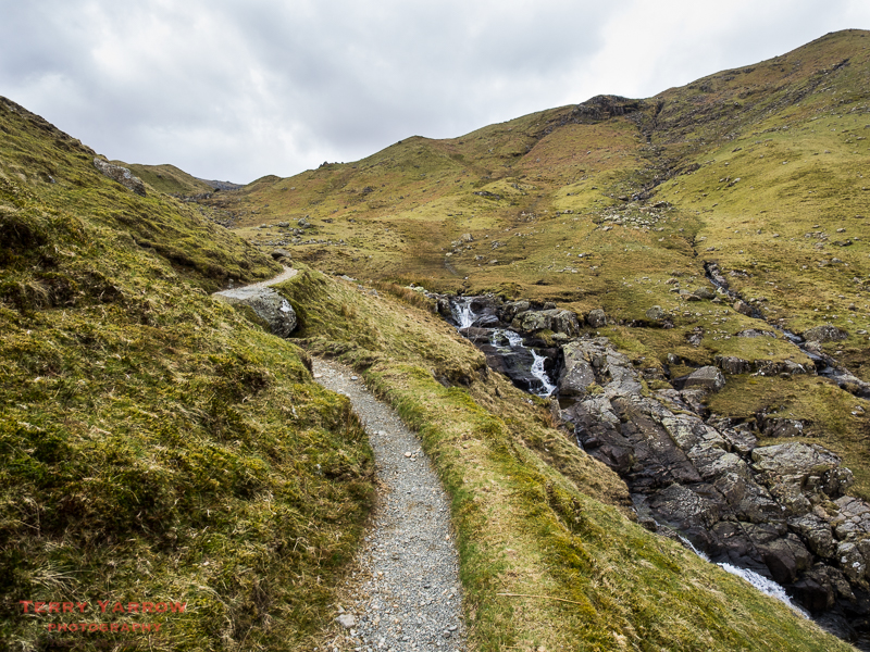
However, I had more walking to do so I continued on my way. Ahead of me I could see the climb that was to come as the path rose steeply beside Loft Beck to reach the summit at Grey Knott.

Now when it comes to climbing, I am a heavy goods vehicle in low gear 🙂 ! On the way up, I was passed by two brothers, one from Coventry and one from Lancashire. We chatted for some time – well it was a good excuse for a rest 🙂 ! We were to meet again later, several times in fact.

They were travelling light and left me behind to continue slowly towards the top of the pass. For anyone thinking of doing this walk, these are hard climbs, especially when carrying a heavy pack, but I cannot emphasise enough the sheer beauty of this area and how fantastic and worthwhile this walk is despite any hardships. In fact the hardships of steep climbs, bad weather etc pale into insignificance against the pleasures of walking this trail.

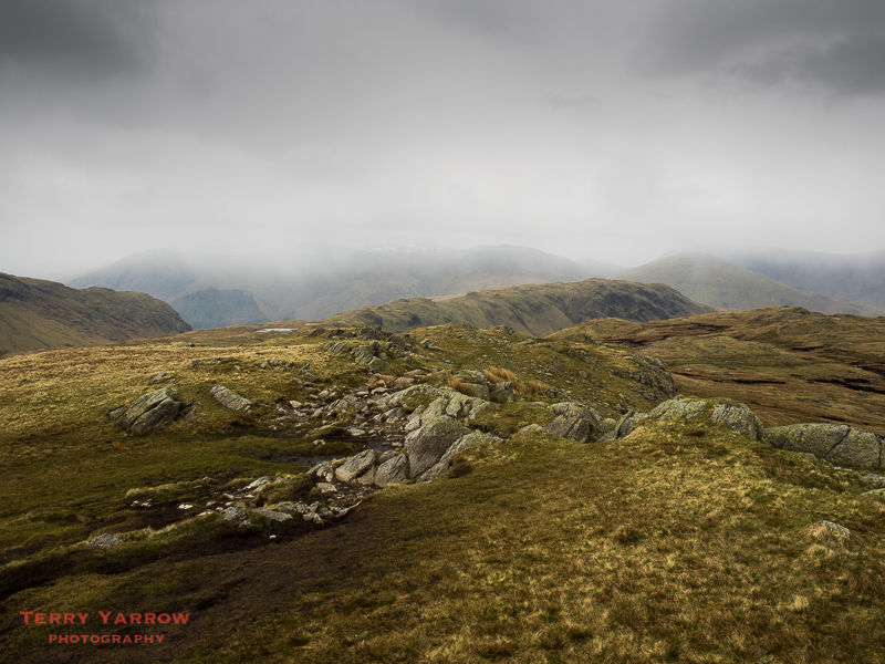
After rock hopping and criss-crossing the beck up the steep slope, I emerged at the top of the climb to amazing views to the surrounding mountains and valleys, including Buttermere in the distance with Haystacks standing proud. While I was standing taking in the views, Stuart, an Australian walker, caught up with me. He had come over especially to do this walk – in fact I was to meet several other Australians as well as Americans and Canadians later. This really is an internationally renowned walk. Stuart and I were to bump into each other a number of times and were to walk together over the coming days.

Despite the sun, it was cold on the fells as the wind continued to whip across the top. It was time to walk on and I crossed the fell top and dropped down the other side to join the disused quarry tramway that once served the Honister mines.

As I walked down the track, I could see the Honister visitor centre below and I knew there was a cafe there – I hoped it would be open 🙂 !

I stopped at the cafe for a well earned cup of tea and bumped into the two brothers again before they headed off towards Borrowdale. A short while later, Stuart joined me and we chatted over tea and cakes – very civilised when you are more used to sandwiches and water on bleak hillsides 🙂 !
Leaving the cafe, I headed down into the lovely valley of Borrowdale, walking on or nearby the steep road that runs up and over the Honister Pass. It reminded me of very pleasant days when I would drive the narrow zig zagging roads over the mountain passes with my son, Paul. We share a mutual love of walking these mountains and driving the narrow, steep passes too, and have spent many happy weeks camping together over the years. The last few miles were all down hill to reach first of all Seatoller, and then on into the three ‘thwaites’ that make up Borrowdale – Longthwaite, Rosthwaite and Stonethwaite.
Stuart and I parted at the youth hostel where he was staying and I immediately bumped into the two brothers again so we walked awhile together before they reached their stopping point. I hadn’t fixed on any particular place to stay so I looked at various options (adding a few miles to the day’s tally in the process) before settling on a farm campsite, the main deciding factor being the fact that it had showers – I hadn’t been able to shower for three days! Fortunately there were enough daylight hours left for the sun to dry out the tent so later that evening I could at least settle into dry accommodation for the night 🙂 !

I lay in my sleeping bag thinking back over a great day – beautiful weather, 18 miles of amazing walking, great views and some good company too. I slept well 🙂 !
Day 3 – Borrowdale to Grasmere – 9 miles
I woke the next day to beautiful sunshine. It wasn’t to last – but at least it had been a milder night with no frost. This was to be a shorter day which would end with a wild camp at Grisedale Tarn but it wasn’t to be!

I left the campsite and retraced my steps through the village to reach the lovely footpath that runs between dry stone walls along the valley. As with yesterday, the path gradually climbed towards the head of the valley, getting ever steeper the further I walked. I stopped and looked back the way I’d come. Could there be a better walk?!

There was a constant accompaniment of the sound of running water with numerous waterfalls along the way. With the sheep and the birds, the sounds were a delight to the ears and made for very pleasant walking.

Not wishing to rush through the day, I stopped often to take in all that was around me and three walkers caught up with me and stopped to chat. Chris and Steve were two Australians over especially to do this walk with another Chris who was from Southampton. The three were doing the Coast to Coast as a charity walk for Dravet Syndrome hoping to raise £500 (in fact they more than doubled that total). Steve had had two replacement knee joints and was also struggling with an ankle problem so kudos to him for even attempting the walk! I was to meet up with these three intrepid walkers often over the next few days.
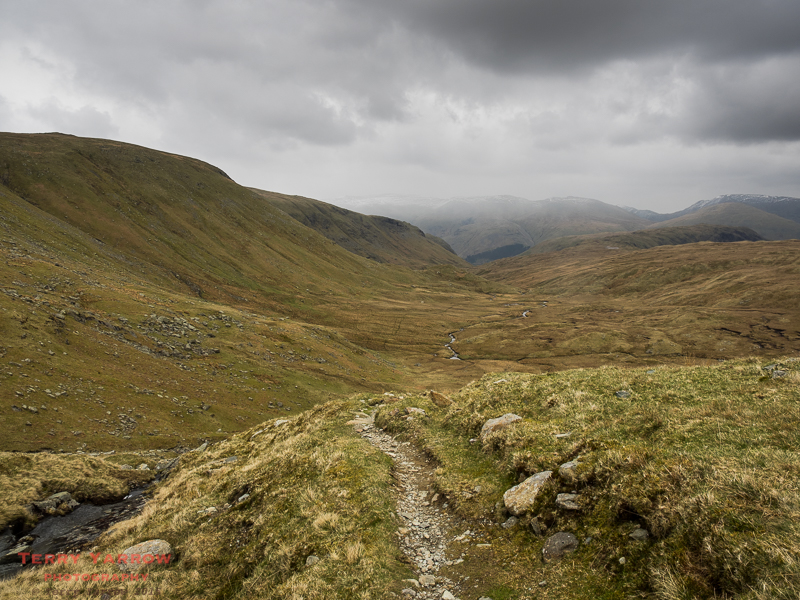
The climb became ever steeper and there was an ever increasing need to stop and admire the views 😉 which were many and great! Ultimately I reached the 600 meter high Greenup Edge, a somewhat boggy plateau. The telltale signs of gathering clouds and stiffening wind had been there on the way up and just as I reached the top, the rain started. It was to last the rest of the day and into tomorrow!

Crossing the boggy plateau was just a question of finding the ‘driest’ route rather than following any particular path and this wasn’t easy as the cold wind was whipping across the top and the rain was getting increasingly heavy. The weather was closing in all around by the time I caught up again with Chris, Chris and Steve.

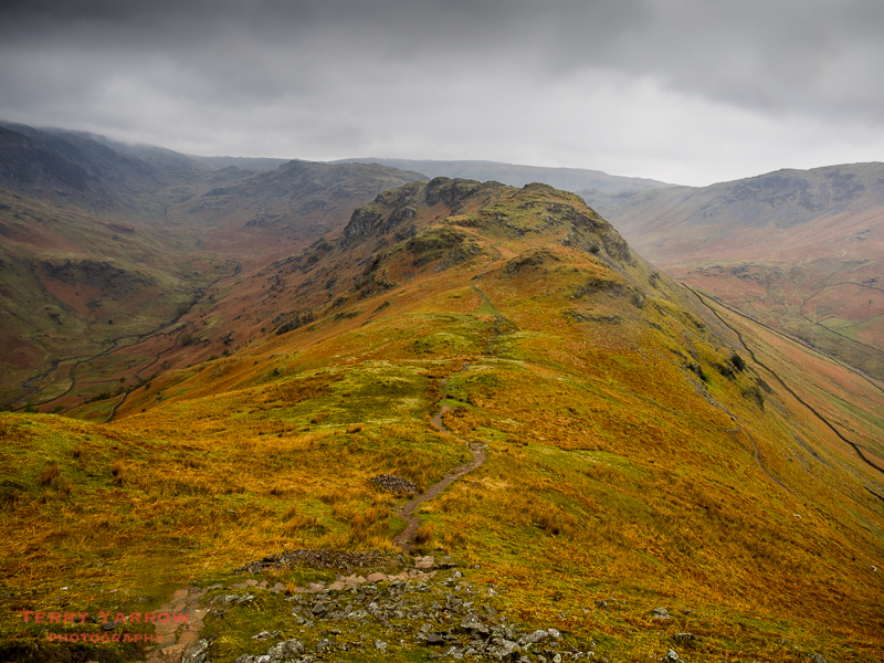
There are two choices at this point, the high level route across the ridge taking in Calf Crag, Pike of Carrs, Gibson Knott and Helm Crag or the low level route down the Easedale valley. The four of us unanimously agreed to take the high level route despite the conditions, and what a great decision it was. Somehow, the bad weather really brings out the character of these mountains and even in bad weather they are great to walk.

In fact, the cloud had descended so much that the higher fells were not even visible any more. Fortunately it was still slightly higher than the fells we were walking – route finding in low cloud and rain is not easy.
We made our way along the ridge, fighting the wind and rain, stopping for lunch on the way. Eventually we came over the top of Gibson Knott and the view below came into sight. The conditions were grey and dark but the hillside in front had the most wonderful warm colours that seemed to glow through the bad visibility. It was amazing and yet again, despite the pouring rain, the camera came out!
It was a steep descent from Helm Crag into Grasmere where we ended the day by walking along Poet’s Walk, the woodland walk where Wordsworth composed much of his poetry, dictating it to his sister who wrote it down. I had decided to stop at Grasmere for the night because of the extremely wet and windy conditions, reckoning that high up beside a flooded Grisedale Tarn the conditions would be untenable. I bade farewell to my three friends – we would meet again in coming days.
Tomorrow would see another day in the high mountains when I hoped to be able to climb Helvellyn, a tough climb at 950 meters. The forecast was not good however! I dropped off wondering what the next day would bring.
Thanks for stopping by.
Until next time,
Your friend The Dorset Rambler.
Comments and feedback on this blog are welcome. If you would like to contact me, my details are on my website which is http://www.yarrowphotography.com.
If you would like to join me on my walks, my Twitter feed is http://twitter.com/adorsetrambler.
All photographs, poems and words in this blog are the copyright of The Dorset Rambler and must not be reproduced without permission.

Hello Terry, we are really enjoying your coast to coast adventure😊 looking forward to part 3 now to see how you cope with Helvellyn. Just wondering if you have to go over Striding Edge? Hope not if we do it!
John & Liz
⛅️☔️☀️
Hi John and Liz
The actual C2C route doesn’t go over Helvellyn, it only goes up as far as Grisedale Tarn at 600 meters and then drops down the valley. Helvellyn is one of two suggested high level alternatives but if you choose to go via that route, you would traverse Striding Edge on the way down. I’ve done Striding Edge a number of times and it is a great walk :)!
I don’t want to spoil Part 3 but unfortunately the next day I couldn’t even see Helvellyn because the cloud was so low and dense :(!
Hope you are both well.
Terry
Hello Terry,
A fabulous and very descriptive account of your C2C walk so far, together with some great photography. I too look forward to your further installments. This is one walk which I hope to complete at some stage in my life but for now I will just settle for a holiday in the area. My husband and are are coming over from Israel at the end of June and are looking forward to some “short / medium” walks and much cooler weather than we are experiencing now. Best wishes, Grainne
Hello Grainne,
Thank you so much for your comment and I am really pleased that you are enjoying my blog. I hope you get some good weather when you are over later this month and that you get to enjoy some great walks. There are many to choose from :)!
Very best wishes
Terry