

Those of you who follow me will know that I put up a post earlier this week about the Kimmeridge Shale Mines and the old mining truck that appeared out of the cliff face a few years back – if you missed it, there is a link below:
The Past Revealed at Kimmeridge
I said in that post that I had old photographs of these mines – well I have managed to locate some of them – they pre-date digital and were taken on print film so these images, apart from the last one below, are all photographs of photographs so not great quality (I really must invest in a scanner so that I can digitise all my old negatives and slides)!
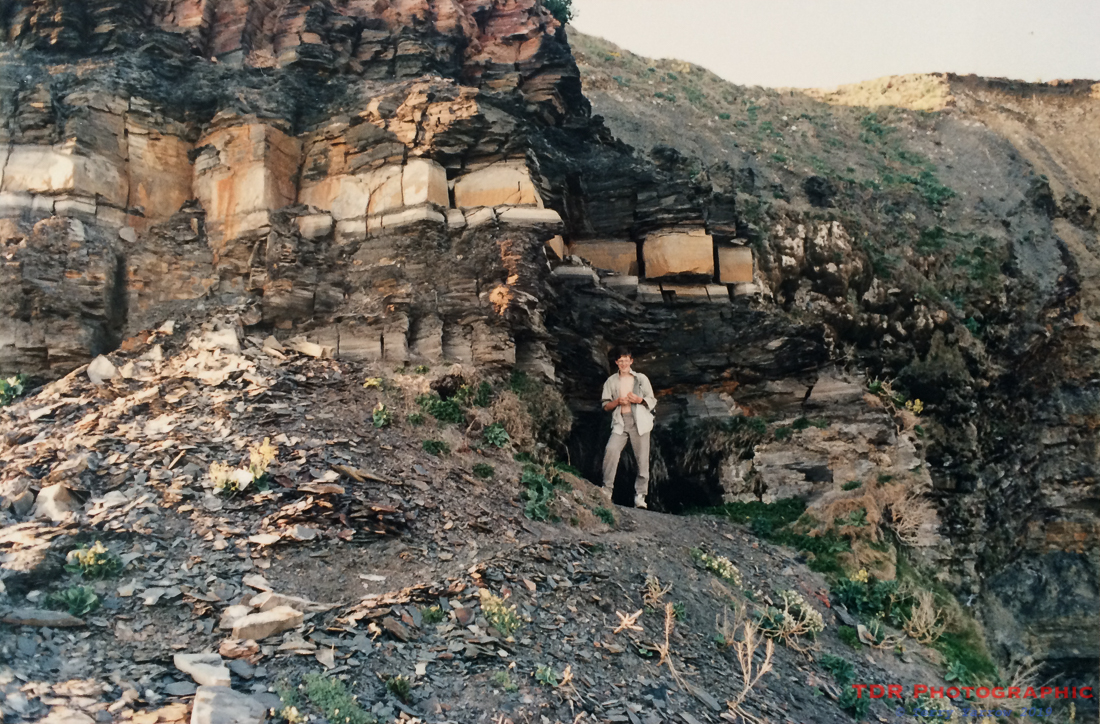
The picture above was taken around 1990 and shows the entrance to No 4 Level which was above the mining ledge at Clavell’s Hard. It had already partially collapsed but you could still enter it although I don’t think I took any pictures of the inside. I can’t remember how far it went in but in any event, it would have been pretty foolish to go there given its crumbly state!
The mine adit would have been around 2 metres square originally and with a tramway to enable the ore to be brought out to the ledge. It went straight into the cliff face and had side tunnels leading off the main shaft.
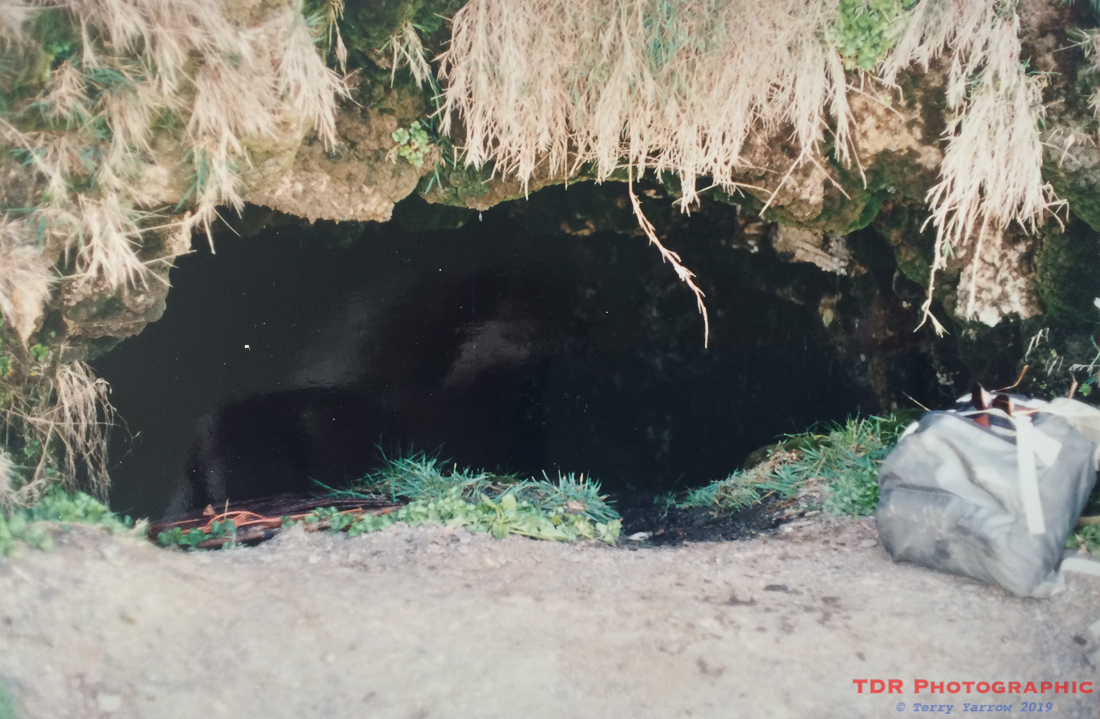
It was in this area that some of the fires occurred and in the picture below, you can see how the stone has turned a reddish colour where the oil has been burned out.
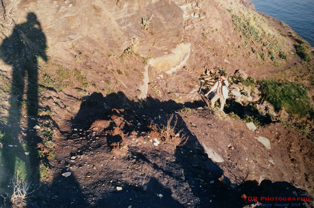
The mine and the ledge were originally accessible from the clifftop above, and from the shore and the picture below shows the route down in 1990, complete with a fixed rope to help. Since this was taken, erosion has wiped out the clifftop access and algae growth has made access from the shoreline all but impossible because the rock face is so slippery. To try to climb up would be dangerous with solid rock below to fall onto when you slip. This means that the mining ledge can no longer be reached from either above or below, unless, as sometimes happens, there is a rope in place. Even then it would not be easy!
Farther along the shore line, there is evidence of one of the lower levels in the form of rails poking out of the cliffs. The mine entrance has long since collapsed but I guess somewhere behind those rails, the tunnels might still exist and who knows, may come to light again one day. The picture below was taken in 2011.

I should add a note of warning – if anyone is inspired by my posts and wishes to explore this shoreline at Kimmeridge, great care is needed because there are ‘pinch points’ at both ends where access is cut off by the incoming tide. It is therefore only possible to walk this shoreline during low tides and it needs to be borne in mind that to walk from one end to the other can take an hour or two. In addition, as mentioned above, there is no longer any access to the clifftop. If you time it wrong, you could find yourself having to spend the night on the beach, not a comfortable proposition with cliffs constantly crumbling, or having to swim round one of the headlands!
Thanks for stopping by and reading my ramblings.
Until next time,
Your friend
The Dorset Rambler
If you would like to contact me, my email address is terry.yarrow@gmail.com – comments and feedback are always welcomed.
All words and pictures in this blog are the copyright of The Dorset Rambler and may not be reproduced without permission.

1 Comment