

As always, I rose at the crack of dawn to another lovely day, although the tent was wet so there must have been some rain overnight and I had slept through it. Because of this, my start to the day’s walking was delayed a little to give the tent time to dry before I packed it away. This was just to help reduce the weight of my pack since naturally a wet tent weighs more than a dry one.
It was still early when I left the campsite though and I made my way along the country lane towards the coast path, passing one of the local characters on the way. He was an older gentleman who was wearing a sombrero and who seemed to be just waving at all the passing motorists. I got the impression from the way they all waved back that this was a regular ritual 🙂 !

It wasn’t the only ritual I witnessed that day! I reached the coast path at what was the very north western tip of Chesil Beach and passed a young early morning dog walker who promptly walked down to the edge of the sea, took her clothes off, and skinny dipped. I had the feeling that that was probably a regular ritual too 🙂 ! The sea actually looked inviting on this already warm morning but I felt I was intruding so I continued on my way without stopping.
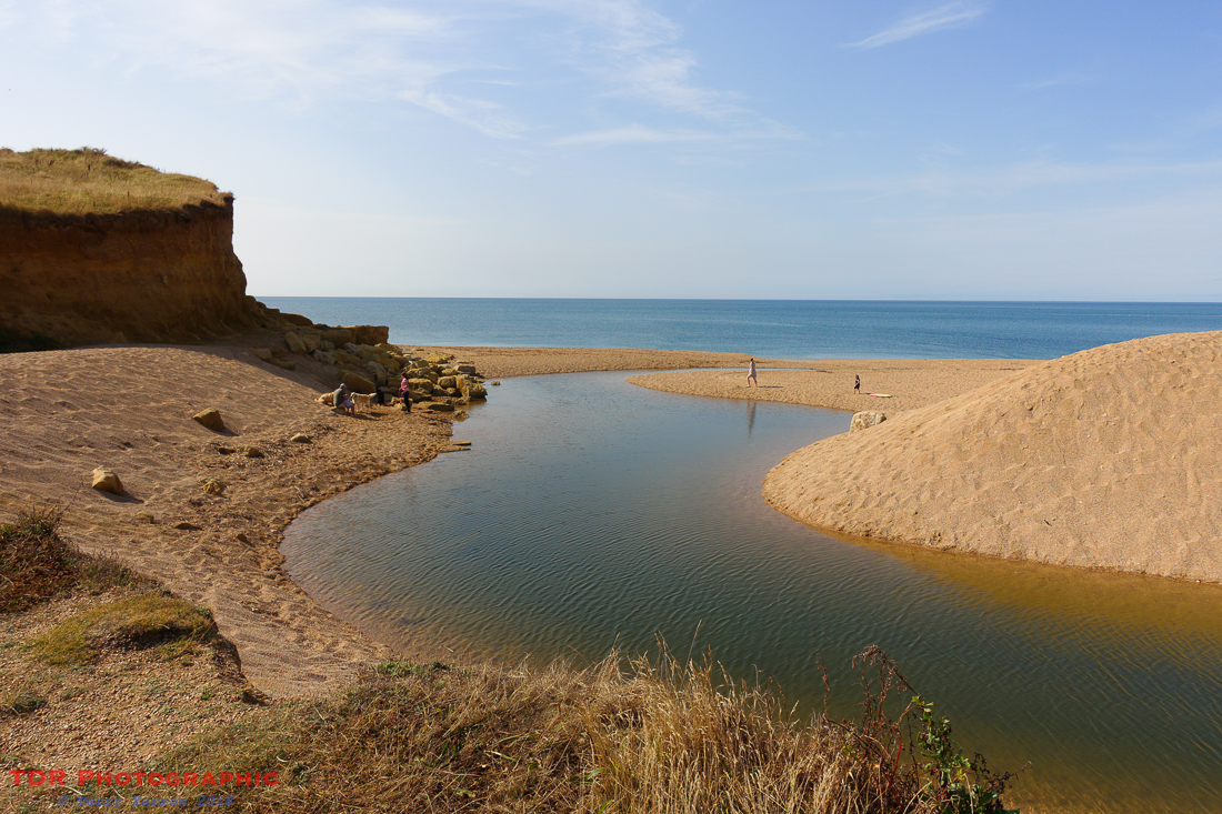
Today was going to be a day of lots of climbs over headlands only to drop down the other side back to sea level again, and I soon came across the first descent as I dropped down into Hive Beach at Burton Bradstock, made just a little bit famous by the Broadchurch drama that appeared on television.
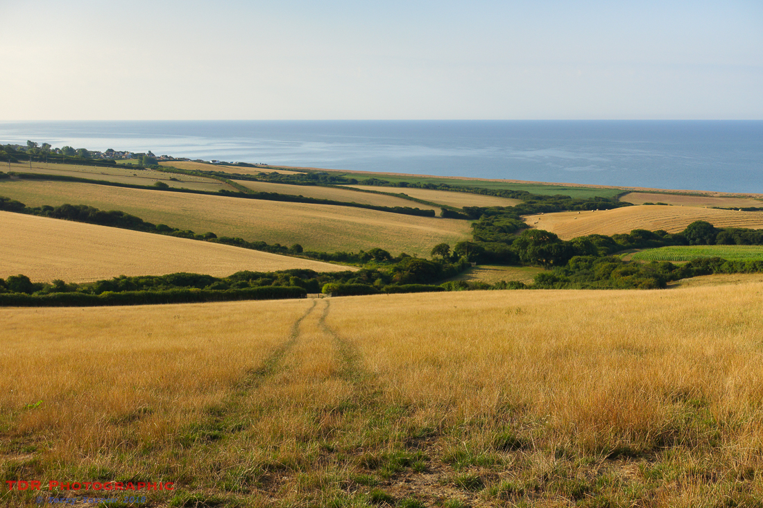
This was quickly followed by another climb and drop, this time into Burton Freshwater where the River Bride meets the sea. At this point a detour took me inland some half a mile in order to reach the nearest bridge, and of course another half a mile back to the sea again – a mile or more walked in order to make about 20 feet 🙂 ! There was of course the option to paddle……
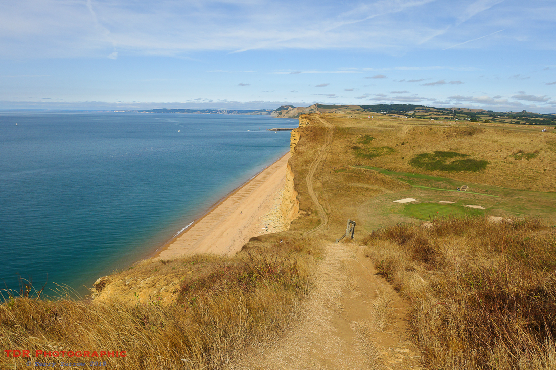
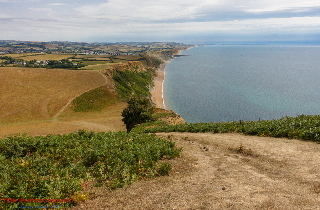
And immediately, another climb and drop, this time into a dip with no access to the sea – the climbs and the drops were getting steeper the farther west I walked! But these were nothing to what was to come. In fact, the dip in the picture above has at the bottom of it a golf hole as it is part of the Bridport Golf Club, the tee being on the top of the headland where I am stood taking the picture. Now, I’m not a golfer but I’d say that must be a difficult hole to play, especially on a windy day!
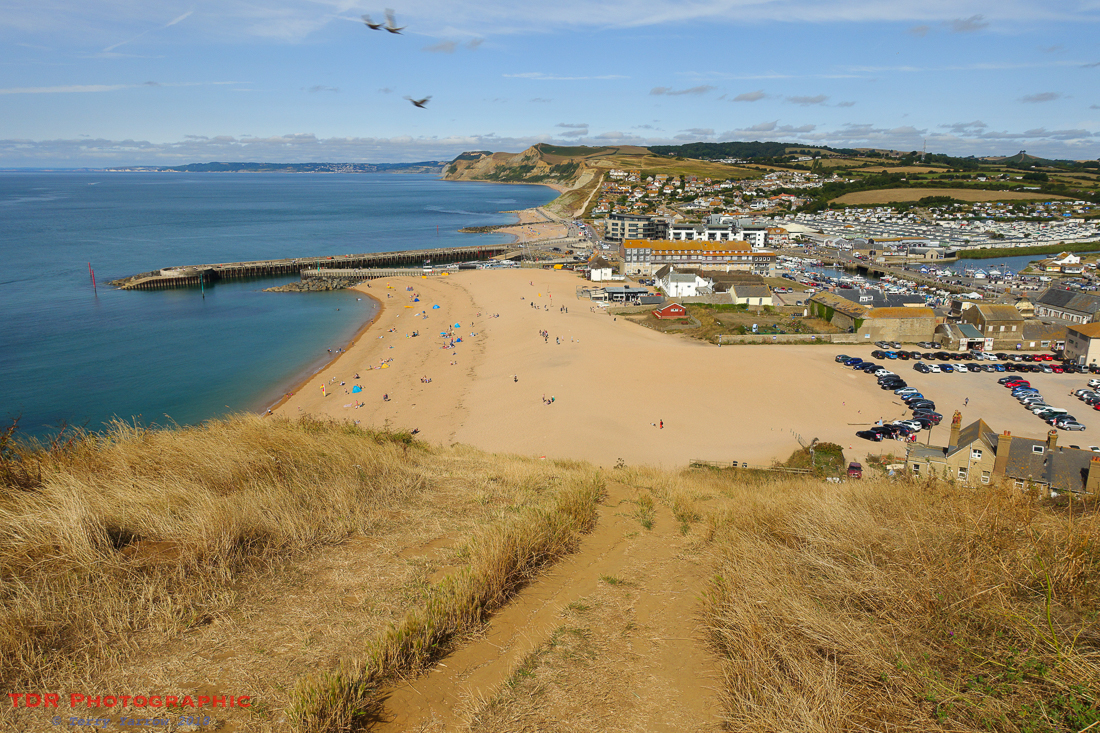
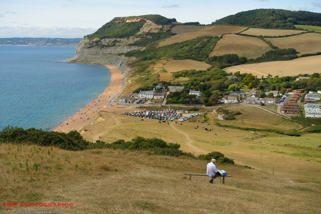
The next dip down to sea level I didn’t mind at all because it led to West Bay and it was getting near lunch time. The link connecting these two statements was that there would be a plentiful supply of food there 🙂 ! I made use of one of the outlets to refuel and top up my water supply as well. West Bay is a popular tourist spot, much more commercialised than I normally like but needs must as they say! It is not only popular with people, but with birds as well, so I ate whilst all the while being eyed up by starlings!

After lunch, the switchback continued with a quick climb out of West Bay, and an equally swift drop down to Eype. Beyond, I could see what would be the second highest climb of the day, Thorncombe Beacon. There are two ways to climb the beacon, a short, sharp, steep route straight up the face, and a more circuitous but gentler climb around an inland semi-circle. I chose the former and headed straight up, stopping near the top to drink in the awesome view.
I really like Thorncombe Beacon, not just for its amazing views but also for the lovely undulating, grassy footpaths on both the climb up and also down the other side. Of course, it was not long before I was dropping down the westward side into Seatown, another popular tourist spot complete with beach and caravan park. This is normally a place where I don’t linger, but there was a shop there so I refreshed my water supply……and bought an ice-cream. Well, I needed the calories to help me up the next climb, the highest of the day, to the top of Golden Cap.
Golden Cap is the highest point on the whole of the south coast of England and it takes its name from its geology as it is formed of sandstone with that distinctive golden colour. It is quite a hard climb but one that is well worth it simply for the awesome views. I stopped often, to admire the views of course, not because I needed to rest 😉 – sometimes being a photographer has off-shoot benefits as you can just pretend to take pictures when you need a rest 🙂 !

The top of the headland was flat for a time, which gave a bit of a break from climbing or descending, and the path was wide and grassy. I made the most of it as it wouldn’t last long. Dropping down off the top all too soon, I began a lower level but none the less of a switchback walk of some three miles to reach Stonebarrow and then dropped down into Charmouth.
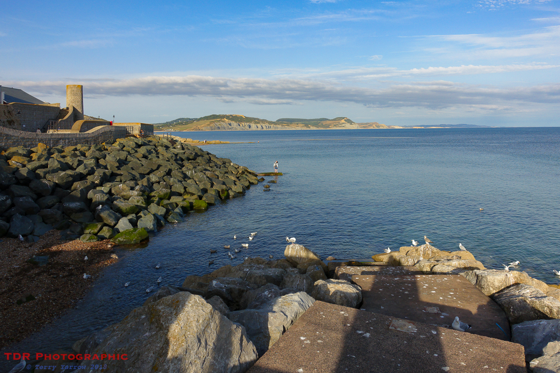
The coast path from Stonebarrow all the way to Lyme Regis is probably the worst part of this day’s walk, because of coastal erosion many years ago that necessitated the re-routing of the path along an A road for much of the time. It is probably three miles that you just want to get through quickly, which I did, arriving in Lyme Regis as the late afternoon sun slanted across the face of the town’s lovely buildings.
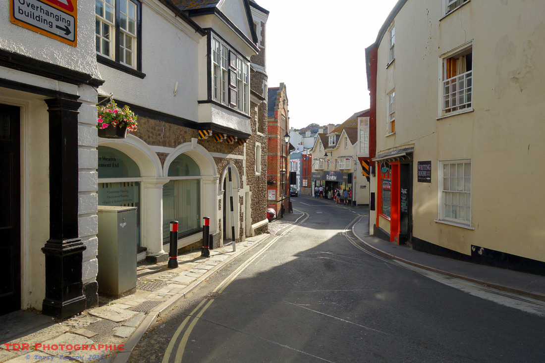
Lyme Regis is a town best visited out of season because it is very popular with good reason. It is famous for its Cobb which has featured in various films, most notably The French Lieutenant’s Woman – I’m sure not many people will have missed the poster with Meryl Streep, or more likely her body double, on the end of the Cobb. It also has a shingle beach and a delightful shoreline – I decided to have a picnic dinner sat on the water’s edge looking back to the coast I had just walked.
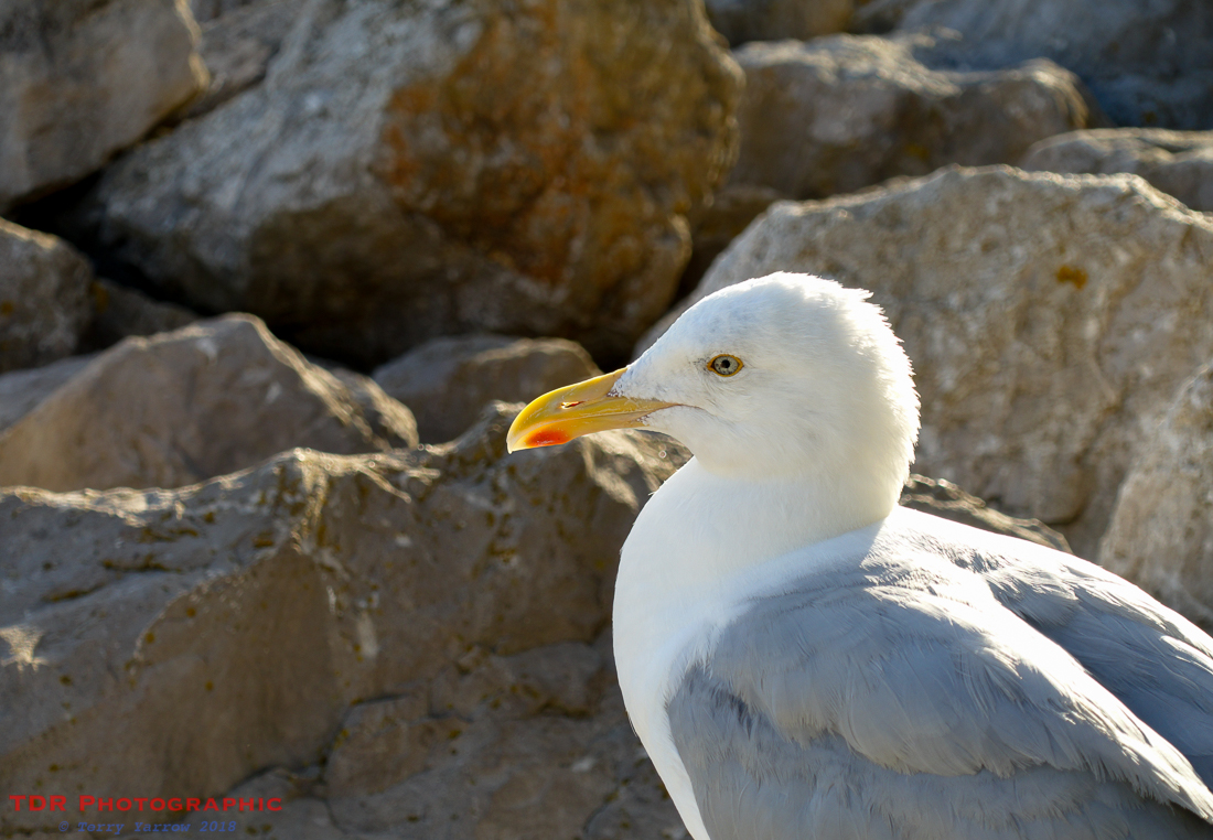
Of course, when you have food on the seafront, you are not alone for long! A seagull joined me, waiting patiently for me to leave so that he could mop up some crumbs 🙂 !
From Lyme Regis, my route once again took me inland as I intended to stop the night at Uplyme. I had good reason for this as we will see later, but a side benefit of taking this route was the delightful walk alongside the River Lim. This was initially almost like walking a causeway as the river splits into two in order to feed the waterwheel that drove, and in fact still drives, the Town Mill in the town itself. My route followed the river all the way up the valley, passing a second mill when it reached Uplyme itself.
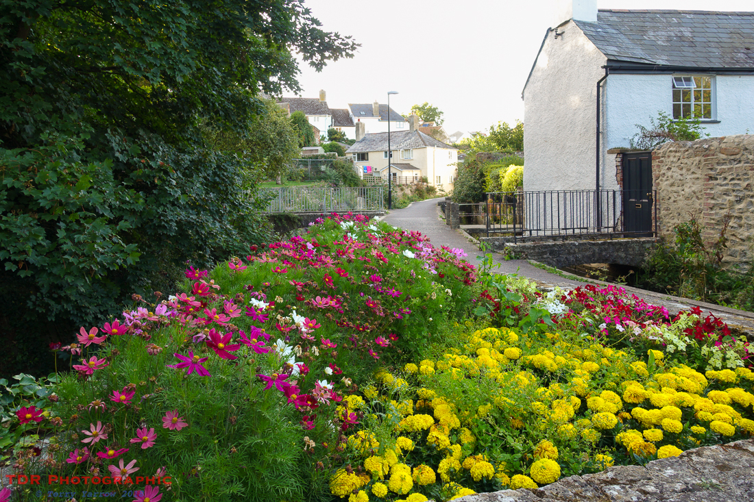
The path from Lyme to Uplyme is only a mile or two but in that short distance it takes in a delightful riverside, some lovely old cottages, some lovely flower beds, passes two mills as well as an ancient well, goes through lovely woodlands, and much more. This was a beautiful way to end my day.
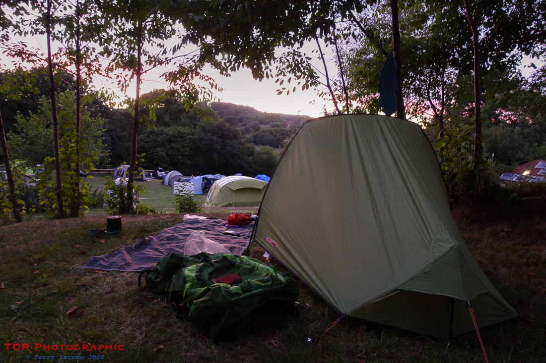
I reached my campsite and set up my tent as the sun was setting. The campsite was quite full as the school holidays were in full swing, but I was allocated a very pleasant spot amongst the trees. After nineteen and a half miles of very up and down walking, I was ready to stop and I enjoyed my cup of tea sat outside my tent watching the last light fade and listening to the late singing of the birds.
I had planned something a little different for tomorrow and I couldn’t wait!
Thanks for stopping by.
Until next time,
Your friend
The Dorset Rambler
If you would like to contact me, my email address is terry.yarrow@gmail.com – comments and feedback are always welcomed.
All words and pictures in this blog are the copyright of The Dorset Rambler and may not be reproduced without permission.

Beautiful photos. 🙂 Thanks for taking us along.
Thanks Lynette 🙂
Fabulous day’s walk. Gorgeous photos.
Thank you, you are very kind 🙂