

– – – Exploring The Countryside and Lanes of Dorset – – –
In my last post, we paid a visit to St Lucas’ Leap, an interestingly named gap off Handfast Point in Purbeck. If you missed it there is a link here. Since we are on the subject of the Old Harry Rocks area, I thought we would continue our visit but this time by another possibly hazardous route so that we can get a slightly different viewpoint.
In my last post we approached Old Harry via the cliff top path but today, we are approaching via the shoreline from Studland Beach. The first thing to say is that in order to take this route, you need to have a knowledge of the tides and to be very aware of the tide times as the headland is normally being lapped by waves. To get out to the base of Old Harry Rocks the tide needs to be out, and not only that but it needs to be a very low spring tide, nothing else will do because with some low tides, you would still need to paddle or swim to reach the point.
Naturally, once you reach the point, you still need to maintain an awareness of the tide because it is all too easy to get engrossed in taking pictures only to find that the tide has crept in behind you and you are stranded. Care is needed on the walk out too, because the shoreline is littered with very slippery seaweed, and it is nearly a mile from the beach to the base of Old Harry.
But despite the hazards, it is a walk that is so well worth doing as you will see the famous Old Harry up close, a view not experienced by many.
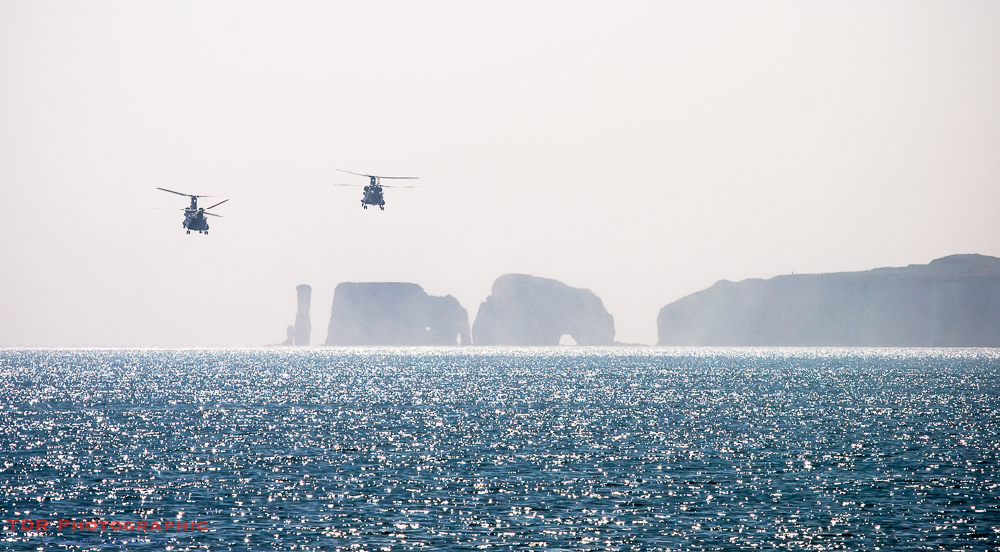
Just to give the global view first, in the picture at the top of this post, you see from left to right (ignoring the Chinooks 🙂 , of which more later), Old Harry and his wife, the two large chunks of No Man’s Land, the gap known as St Lucas’ Leap that featured in my previous post, Handfast Point and to the right, Ballard Down.
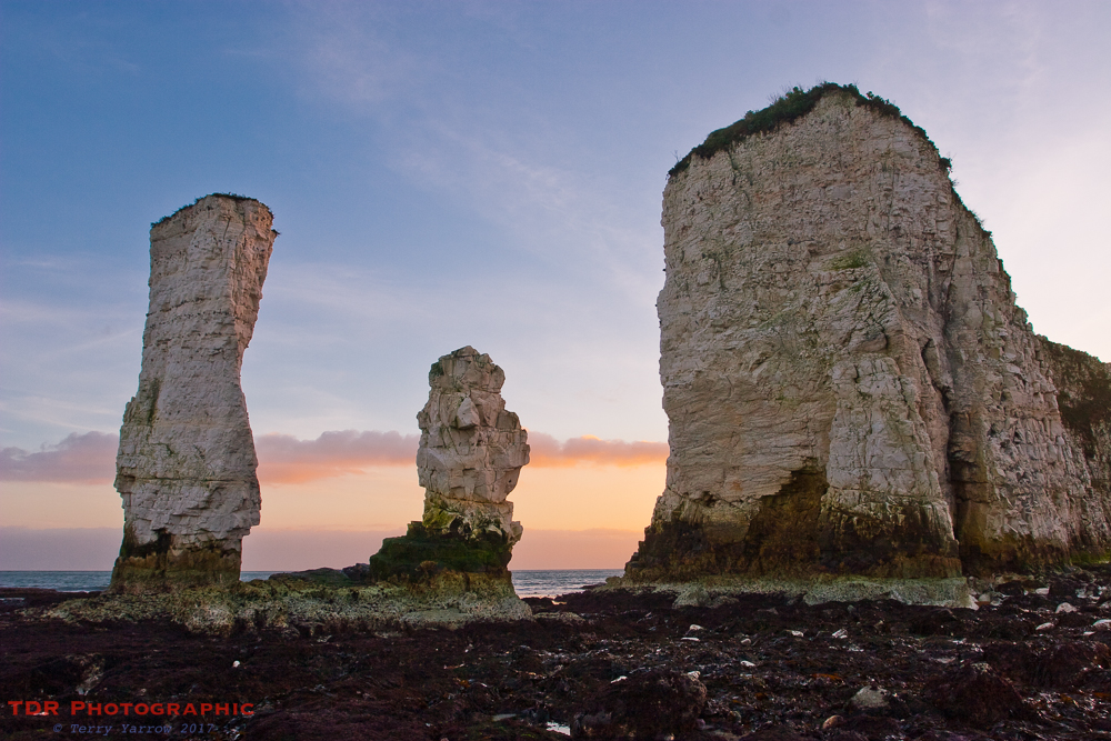
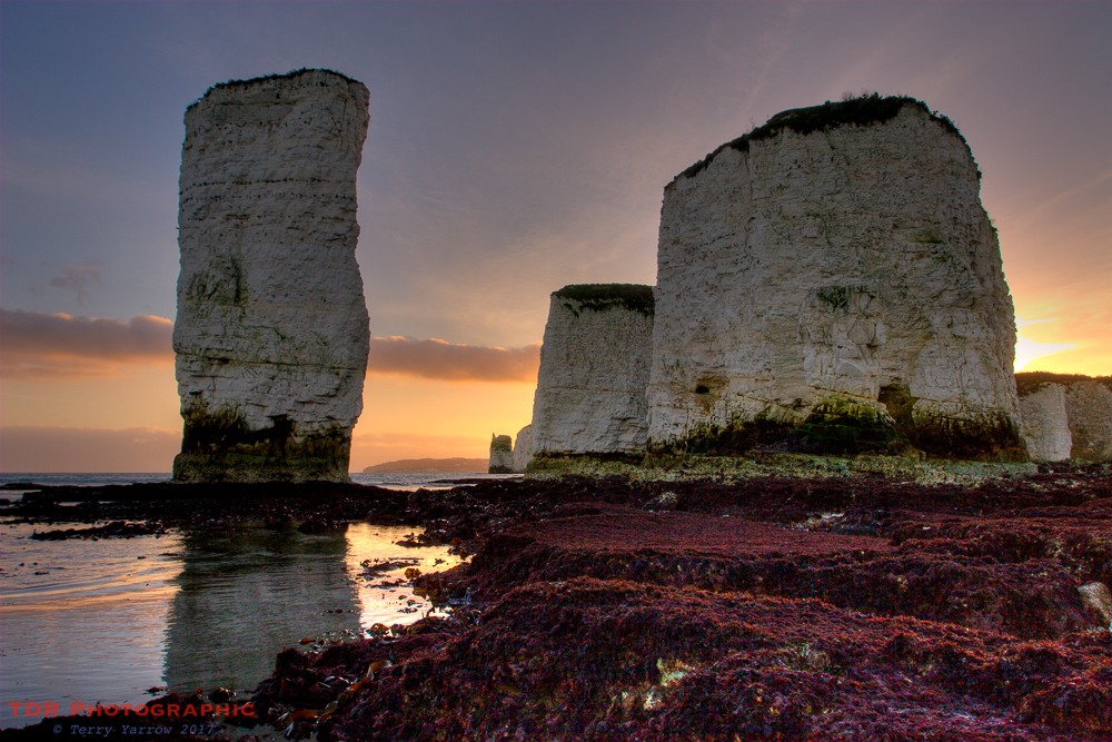
The reason for the numerous stacks is simply the action of the sea; this is an ever changing place. No Man’s Land has already divided into two, and as you can see, there are holes appearing in both parts. These holes will grow as erosion takes its toll and eventually there will be more and smaller stacks. Old Harry, on the left in the picture above, still stands but his wife, on his right, crumbled into the sea in 1896 and she is now a shadow of her former self. Eventually these two will both disappear, to be replaced by a new Harry and wife as No Mans Land erodes further.
These are not the only stacks along this part of the coast. There are two more just a short ‘walk’ away if you dare risk trying to reach them 🙂 ! The first of these is known as the Turf Rickrock or Haystack, the other more pointed stack is known as The Pinnacle. It is fairly obvious where their names come from. The same can’t be said of Old Harry though!
There are various tales of how Harry got his name, and several legends around how he came into being. Some say that he is named after the devil himself who fell asleep on the headland, others say that he is named after a notorious Dorset pirate called Harry Paye, whose vessel is said to have lay in wait for merchant ships, hiding behind the stacks. Yet another tale is that he is in fact a ninth century viking called Earl Harold who drowned in the area and subsequently turned into a pillar of rock.
However it got its name, Old Harry Rocks is an absolute icon of this area and a lovely spot to visit. It is certainly popular with locals and visitors alike.
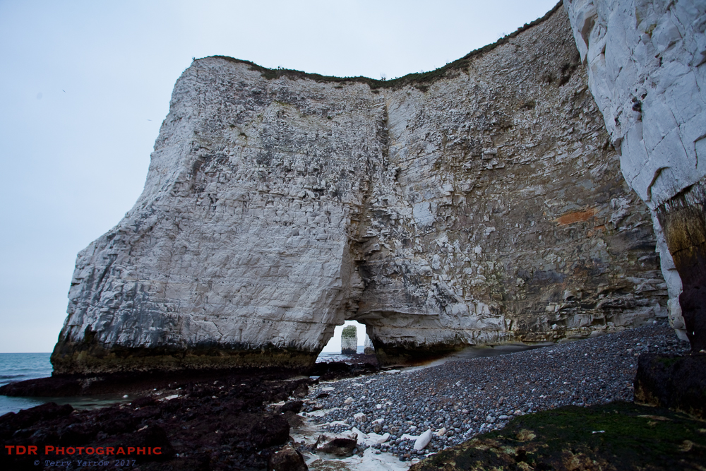
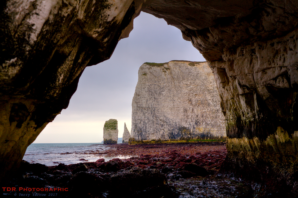
The massive white cliffs are full of caves that have become ‘tunnels’, almost as if some giant creature has burrowed through and come out the other side. In between the various headlands, small coves have been formed with normally unreachable beaches. This feature is nowhere more obvious than along the cliffs as we make our way back towards Studland Beach. This is like a corrugated coastline created by the sea.
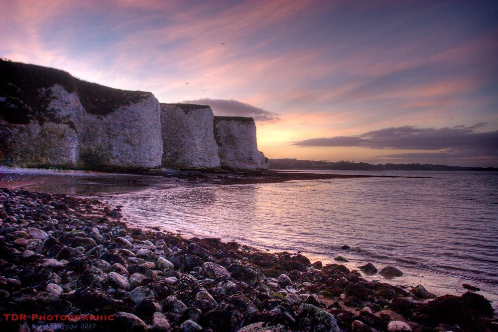
And make our way back we must as the sun is setting, the light is fading and the tide is coming in again. As the saying goes, ‘Time and tide wait for no man’, and that is never more evident than here and now.
But what of those Chinooks? Well this is a regular training area for the military so these helicopters, looking like weird giant insects, often fly out on exercises, sometimes filled with troops, sometimes landing on Ballard Down, sometimes picking up boats off the sea. They might disturb the peace of this area at times but they are awesome to watch.
Any visit to the foot of Old Harry Rocks is by necessity short so time spent there needs to be measured in terms of quality not quantity. It will likely be time that you will spend on your own as not many make the trip on foot. This for me makes it a special place.
Thanks for stopping by.
Until next time,
Your friend The Dorset Rambler
If you would like to contact me, my email address is terry.yarrow@gmail.com – comments and feedback are always welcomed.

Reblogged this on World4Justice : NOW! Lobby Forum..