

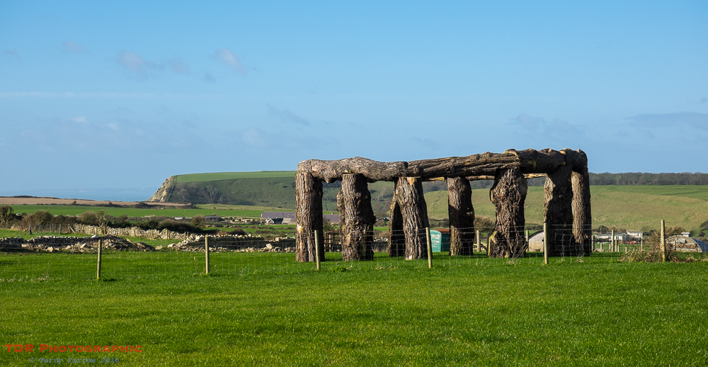
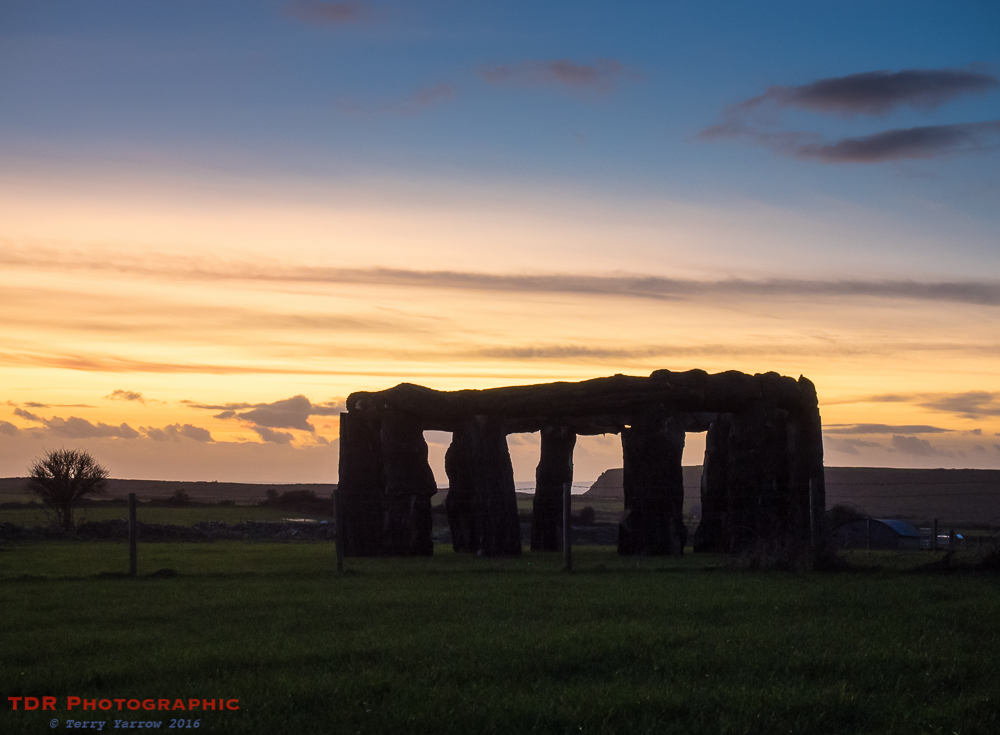
It was another of those rare crisp, cold, clear, Winter days and there was bright sunshine as I parked up near the recently erected landmark, Woodhenge, at Worth Matravers.
This monument was put up on a whim by the landlord of the local pub who had cut down a huge tree but local planners ordered it to be taken down as no planning permission had been granted. In the end, they relented and agreed that it could stay for a few months but such was the level of public support for the monument which has very quickly become a local attraction that planners have now extended this for a further two years. So Woodhenge stays……for the time being at least.
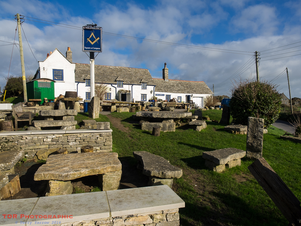
Starting out on my walk, I immediately passed the pub itself, the quirky Square and Compass, probably one of the best pubs in Purbeck, in fact in the whole of Dorset! It started life as a pair of cottages but was converted to an alehouse in the 18th century and specialises in pasties and cider. It also has one of the smallest bars you are likely to see, just a hatch in the corridor! It has an amazing beer garden with views down the valley to the sea and there is nothing better than to sit on a rock seat on a summer evening with drink in hand watching the sun go down.
But this was too early in the day for a drink so I passed swiftly by.
Making my way out of the village along the road, I passed something else that I always think is quirky – a bus stop which is just 2 feet high! It always strikes me as funny – was it designed for short people? 🙂
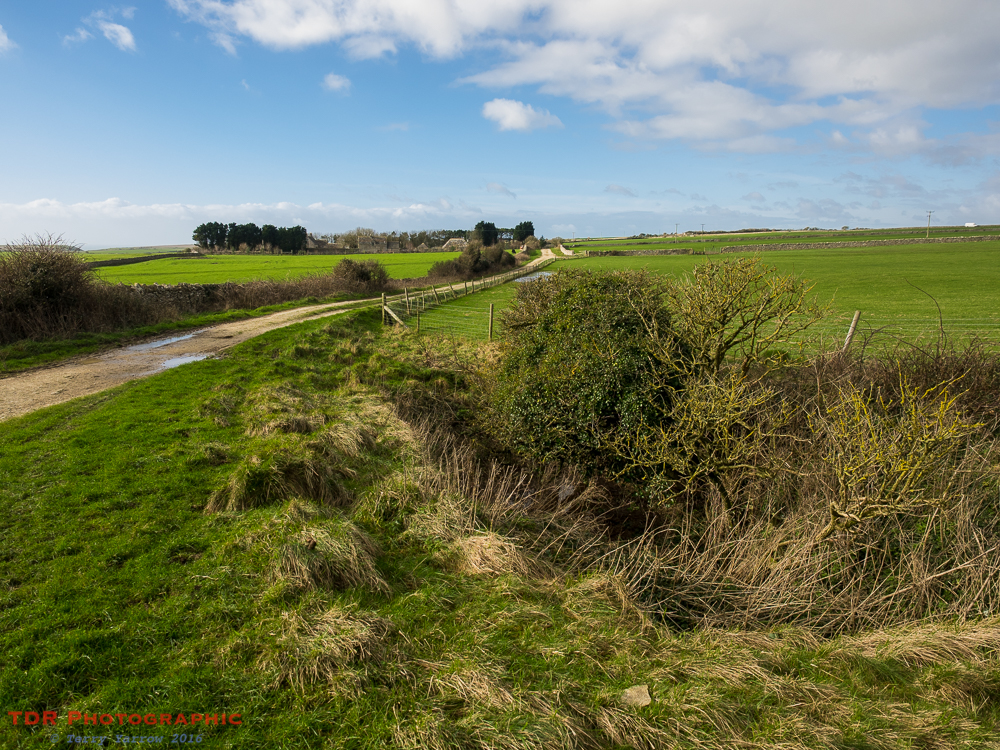
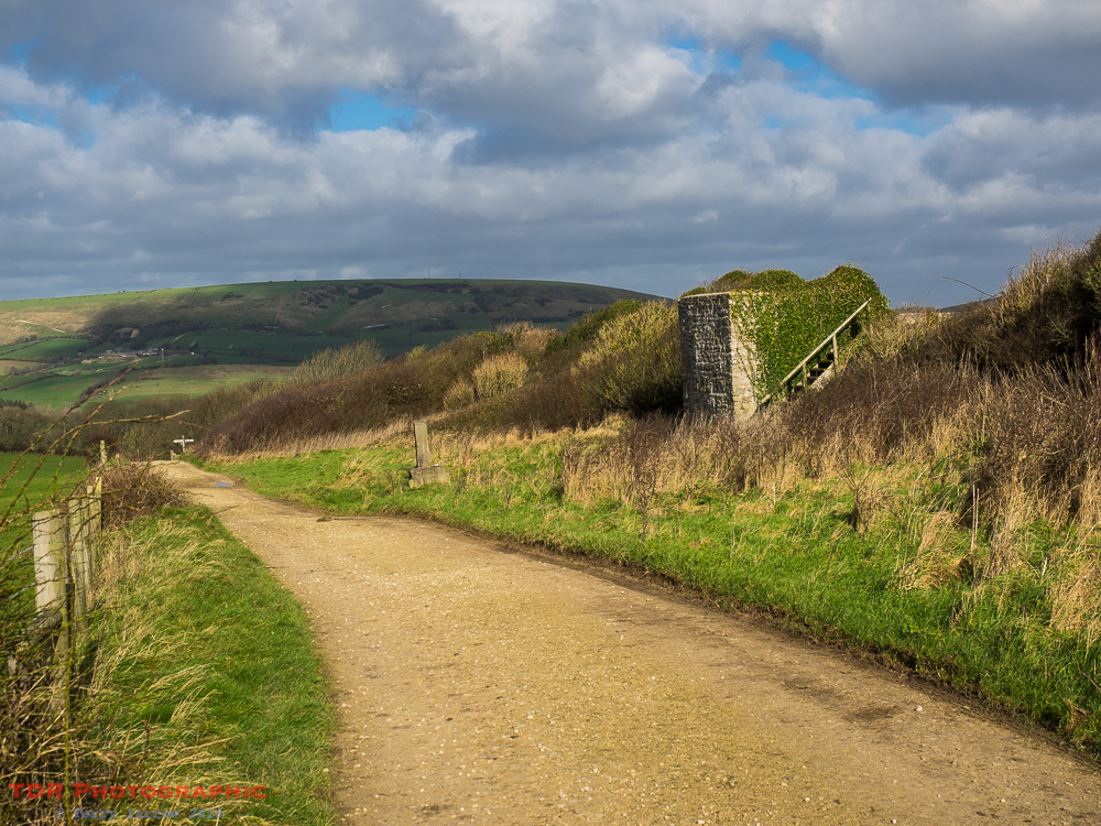
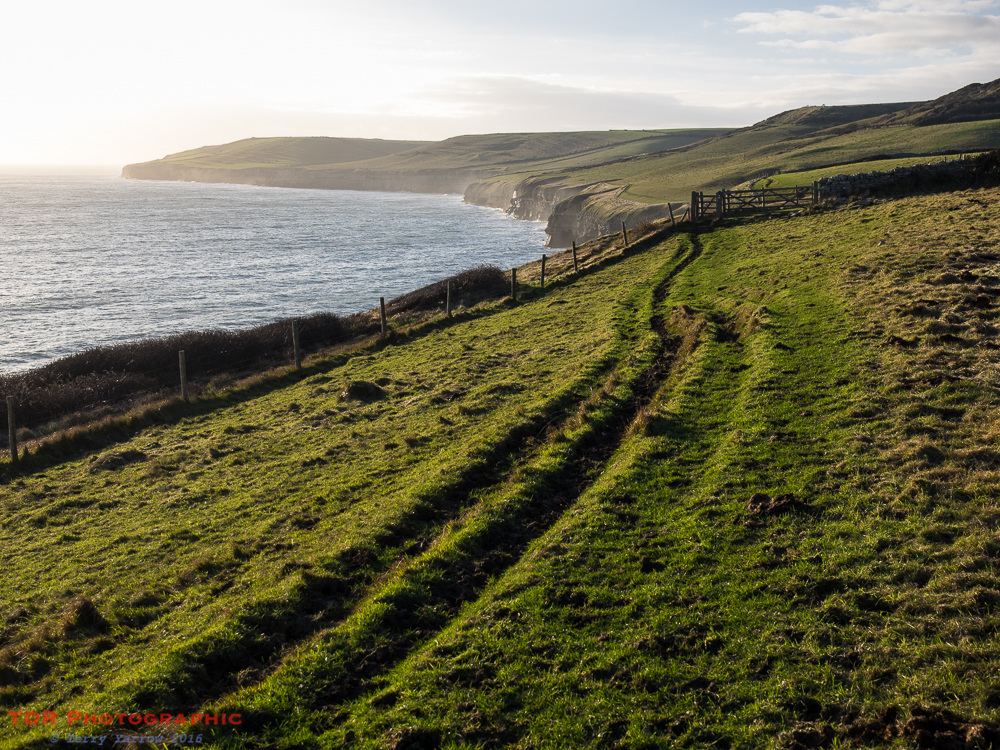
I soon turned off the road and crossed fields, passing a farm drive that I seem to photograph with monotonous regularity – I couldn’t resist another shot with the bright sunlight picking out the straight track against the heavy cloud backdrop. It always reminds me of the album cover on the Best of the Eagles CD – well I always did have a good imagination!

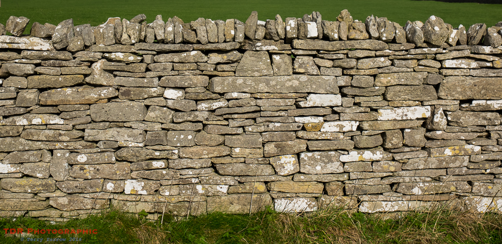
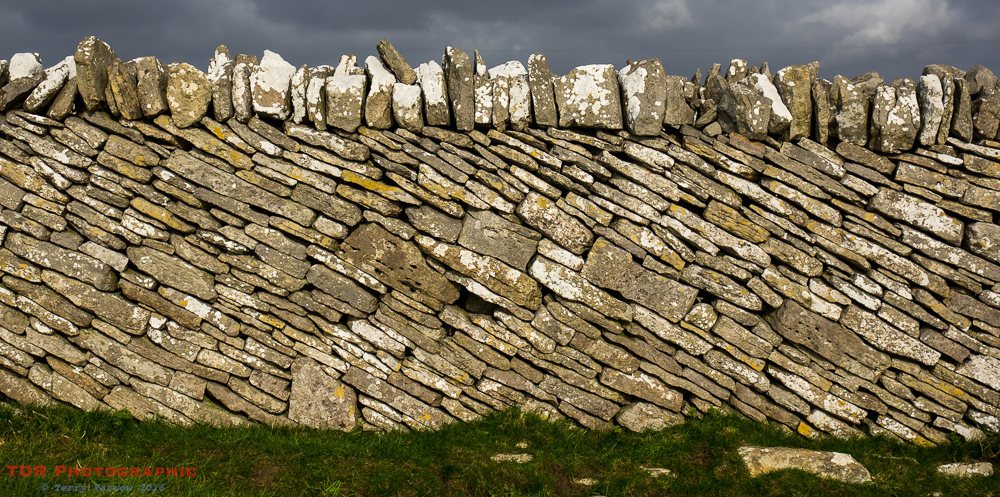
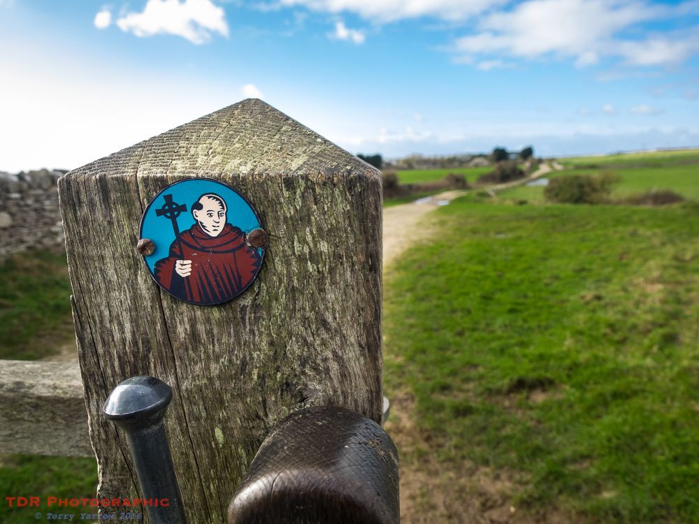
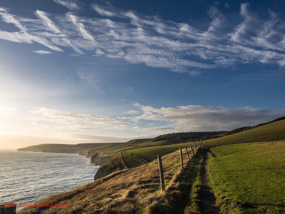
The track I was following is known as The Priests Way and it was bounded on both sides by dry stone walls. It intrigues me how the style of these walls varies – on one side of me the stones were laid flat and on the other side they sloped diagonally. Either way, I think the way these walls stand up using nothing but gravity is testament to the skills of the men who built them. It is a classic example of making use of extremely local materials since they were originally built with stones cleared from the fields when preparing the ground for agriculture. Isn’t that just perfect!
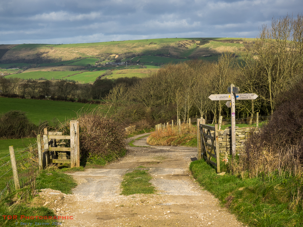
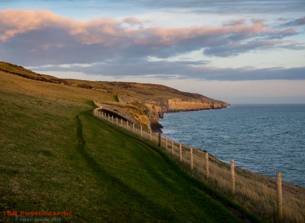
The Priests Way is a track that links the village of Worth Matravers to its larger cousin on the coast, Swanage. It takes its name from the fact that back as far as the 15th century, the priest who oversaw congregations in both localities would ride the route regularly to visit his parishioners or lead services. As you walk the trail which runs along the top of the ridge, you could just imagine raising your cap as the priest passed by, or passing the time of day with him on the road.
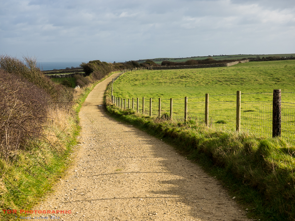
This is now a good route to walk at this time of year after so much rain because thanks to funding from Natural England the path has been improved and resurfaced. The dry and firm footing is welcome and frees you up to look around you as you no longer have to watch every step.
Part way along the track, I passed a hollow in the ground, but this is clearly no ordinary hollow as the sides are supported by dry stone walling. It is overgrown now but at one time this would have been a watering point for livestock using the route.
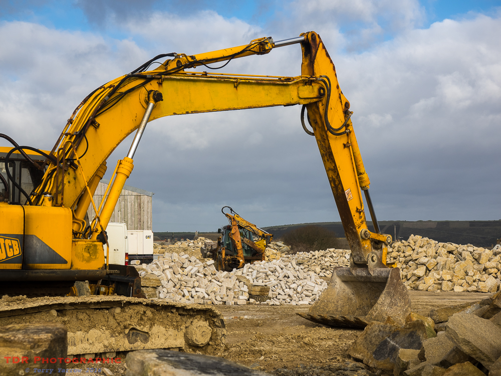
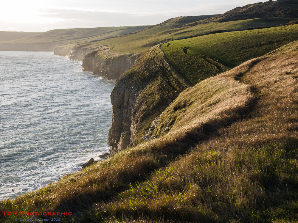
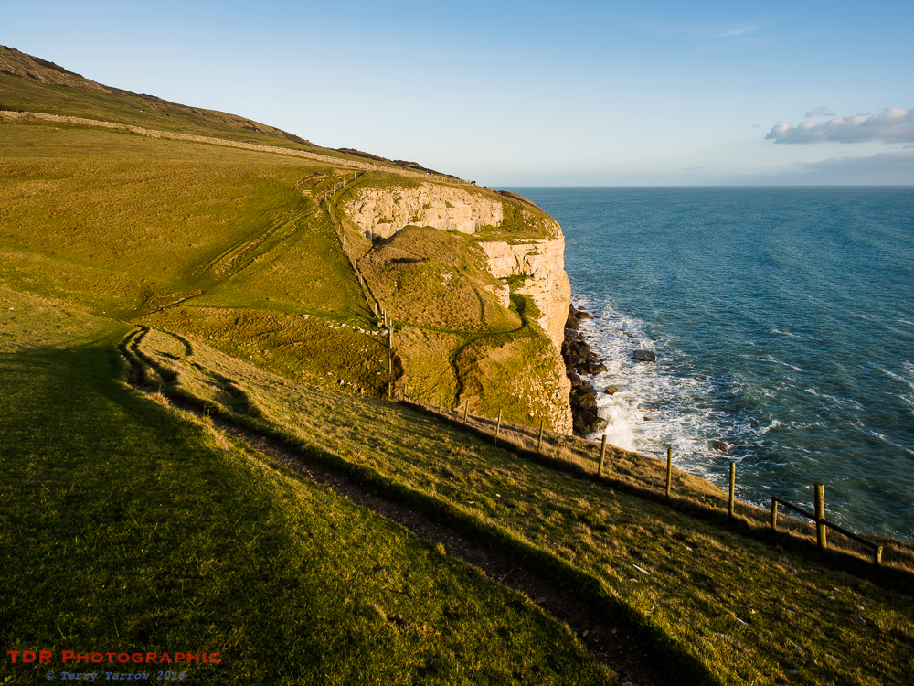
One of the things this area is noted for is its Purbeck and Portland Stone that has been quarried extensively for many years. Most of the quarries have ceased their operations long since but there are still some that continue to work the stone. The path passes by one such quarry and I stopped to watch the heavy machinery doing tasks that were once performed laboriously by many men with simple tools. How times change!
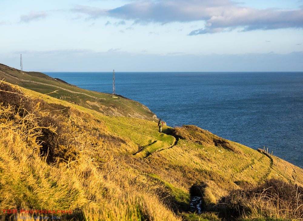
This track really is a delightful route to walk, indeed it is one of my regular walks. The track winds its way towards Swanage with the distant sea becoming ever closer, and with beautiful views across the valley towards the Purbeck Hills.
It passes by a lime kiln, reminding me of another of those ancient occupations, the making of quicklime to spread on the land to reduce acidity, or to make a whitewash for buildings. It could even be used as a disinfectant for cow stalls. These were in their heyday when land was being prepared for agricultural purposes and many farms had kilns of their own, manufacturing quicklime right where it was needed. These days of course it is manufactured by much more efficient methods but it is good to see these ancient relics being preserved for future generations.
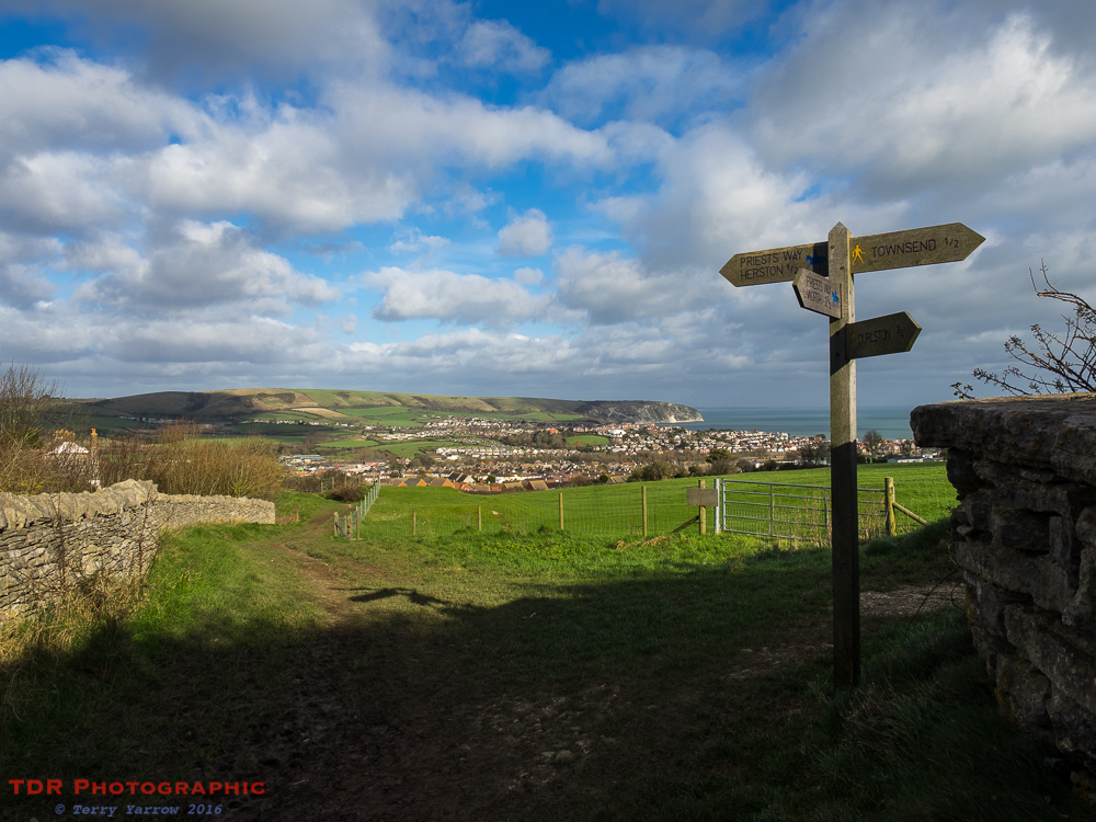
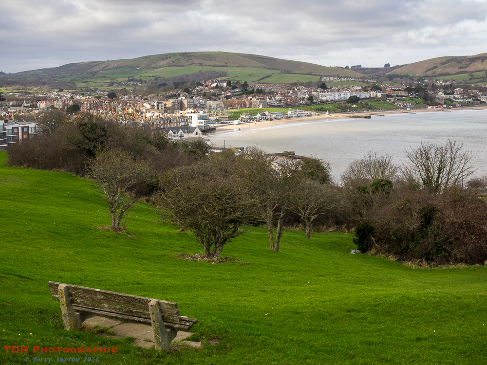
Nearing the end of The Priests Way, I stopped for elevenses overlooking the town of Swanage. This is such a lovely view and it is always a good place to sit. Not only that, but you get serenaded at the same time as behind me stands a metal gatepost with holes in it and when the wind is in the right direction, it plays the gatepost like a flute 🙂 ! I remember the day I first heard this eerie sound – it took me a while to work out where it was coming from.
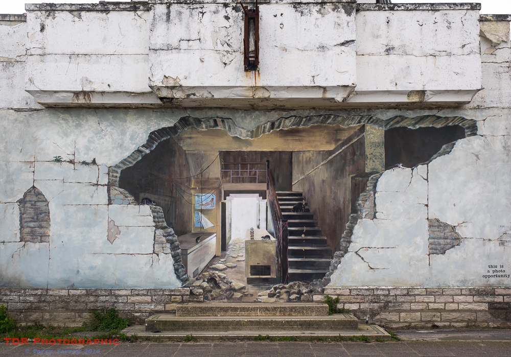
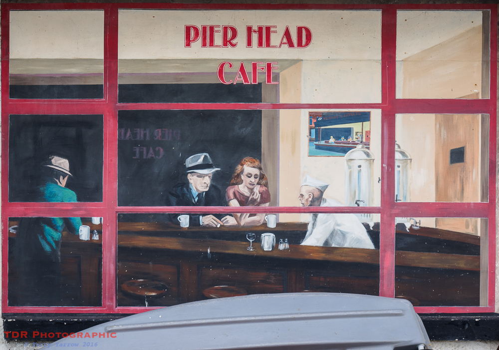
I dropped down into Swanage which I always think is a bit of a ‘Marmite’ town. People either love it or hate it! I really like it and always enjoy wandering through the streets passing some interesting sights like the old and derelict Pier Head Cafe on the sea front. The building was actually erected as a temporary mess hall in the late 1940’s and has had various uses since then, until it was declared unsafe some 50 years later. It is now awaiting redevelopment and arguably has become even more iconic since its closure thanks to the murals that you see below.
The murals were painted by two local artists as part of Purbeck Arts Week in 2007 and are really effective. One thing I particularly like is that the Swanage version of Edward Hopper’s ‘Nighthawk’ has a Simpsons version hanging on the wall in the background 🙂 !
Leaving Swanage, I climbed up the down at the southern end of the town and continued on my way. But not before stopping to look back at the town below.
For many years, the route from here has meant walking along the road before joining the coast path again. This is because the coast path was closed due to landslides. Recently, however, the coast path itself has been reopened so it is possible to take a much improved route.
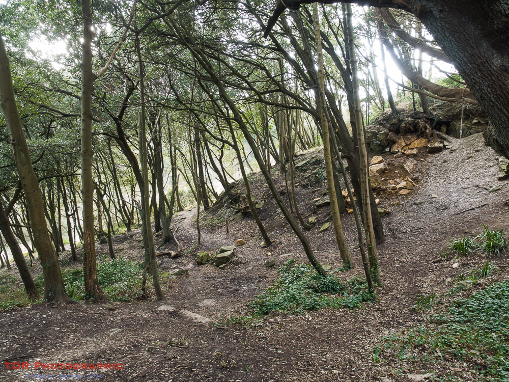
Even now though, the route through the trees and across the foreshore is very muddy and I wonder how long it will be before the route is closed again. However, I made it through ok and continued round the coast below Durlston Castle, looking back to Peverill Point across the bay, with Old Harry Rocks in the distance.
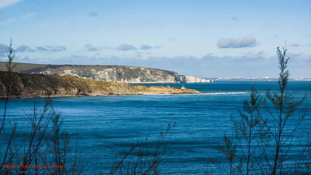
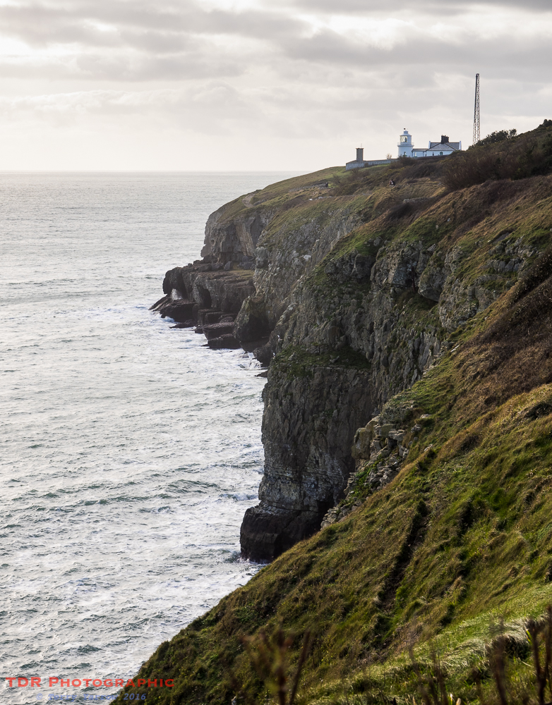
Durlston Castle was never actually a true castle, being built as a restaurant to cater for visitors to the Durlston Estate in the late 19th century. It is now a visitor’s centre for what has become a country park. My route took me below the castle and round the headland to Anvil Point where ahead of me I could see the lighthouse standing proud above the rugged coast. The lighthouse was built in 1881 and is now fully automated, the lighthouse keeper’s accommodation being turned into holiday lets. It must be a great place to stay……provided the foghorn doesn’t go off of course!
Below the lighthouse is the ledge of what was once Tilly Whim Caves. These were originally coastal quarries dating from the 18th century but when quarrying ceased, they were converted to a tourist attraction. From 1887 to 1976 they drew many visitors to the area until a rock fall forced their closure. Now they are home to bats so their usefulness continues, just in a different guise.
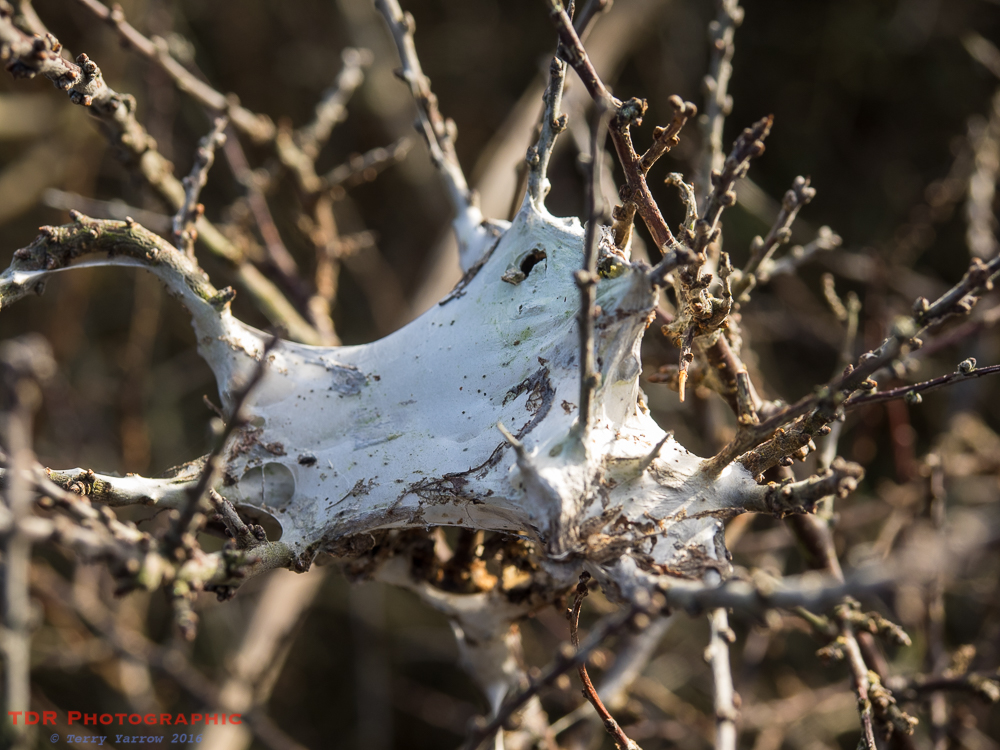
Leaving Anvil Point behind, I entered a stretch of coast that I knew would not be easy to walk. This is ‘muddy mile’, well, several miles actually and in the wet season it is always muddy! I slipped and slid my way along the coast passing spiders’ nests in the shrubbery to the side. Often there are sightings of dolphins, peregrines and many other creatures along this stretch of coast, as well as rare plants.
Along this part of the coast also, there are two sets of ‘mile markers’, posts erected on the cliff top which can be used by ships to test their speed and performance. When viewed from the sea, these indicate a measured mile.
This is a delightful part of the Dorset coast, laden with old and disused quarry workings and normally some lovely grassy paths – when they haven’t been churned up into mud. The views are spectacular and there is much to explore.
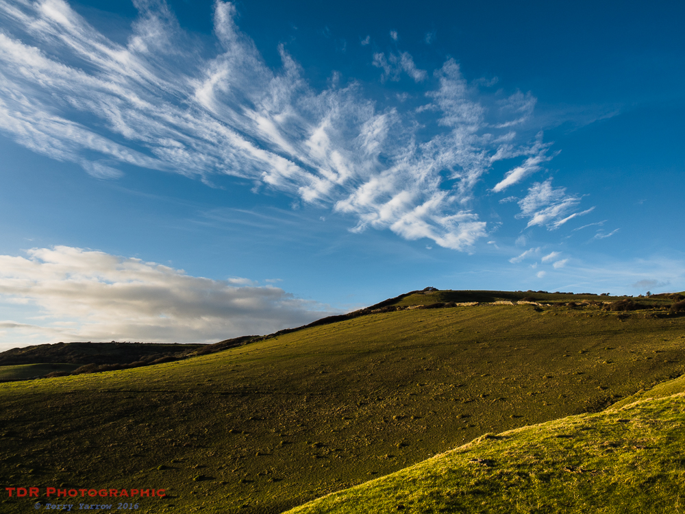
I couldn’t resist taking some cloudscape shots on this glorious day.
One of the smallest quarries is Whiteware Quarry in the picture below. I love to visit this quarry which is partially hidden away. Its diminutive size intrigues me and it is high above the sea, creating a very exposed feeling. The ledge is a great place to just sit and watch the waves crashing onto the rocks 30 metres below.
In total contrast to the Whiteware, the next quarry one of the largest. This is Dancing Ledge, a popular playground of climbers, coasteering groups, walkers and so on. So much so that the National Trust has recently announced that it will be restricting the numbers of commercial groups in order to reduce damage to the area.
There are various theories as to where the name Dancing Ledge came from. Some say that it is because the waves seem to dance across the lower ledge, others say that it takes its name from the fact that the ledge is the same size as a ballroom dance floor. Either way, it is a very appropriate name and a beautiful place to while away a few hours.
It is well know for its amazing wildlife, including a colony of puffins, and for its swimming pool, visible in the picture below. This pool was blasted out of the rock in the early 1900’s so that the children from the local preparatory schools had somewhere safe to swim as the sea itself is far too treacherous. The schools have all now closed but the pool is still used by others and it is a great place to cool off during a hot summer’s walk. But not on this chilly winter’s day!
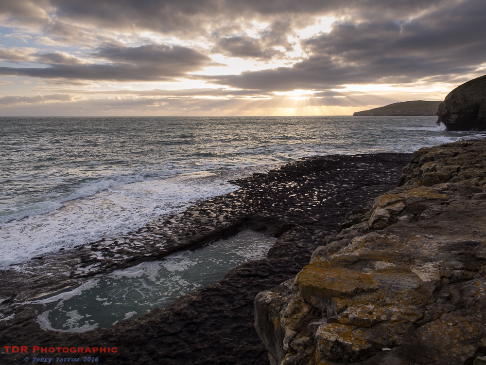
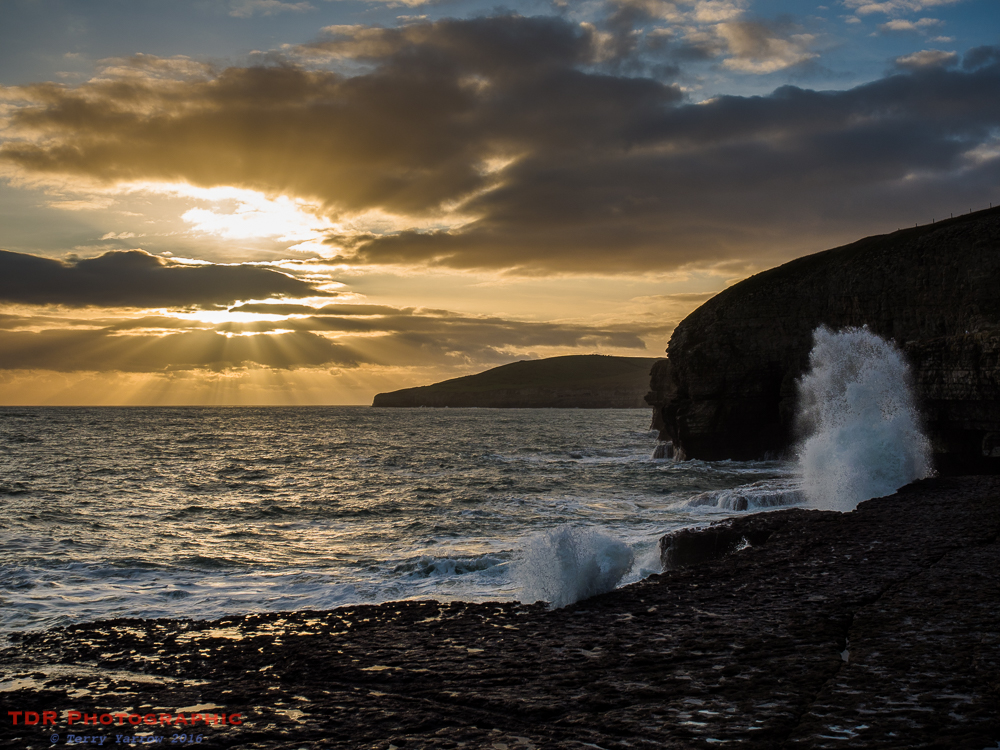
The light was now fading fast but I climbed down to the lower ledge to capture some beautiful crepuscular rays and some great crashing waves. The evening was beautifully atmospheric and it was quite special having the place all to myself and watching the light fade. I could have happily sat and watched the sun disappear but I had further to walk so after some while, I climbed back up to the coast path.
As I made my way towards the next quarry, I looked back the way I’d come, with Anvil Point in the far distance and some subtle pink tones appearing in the sky, the clouds reflecting the light from the setting sun.
The last quarry of the day was to be Seacombe and with the sun disappearing, I climbed up to the ridge above to capture the sunset over the old wartime gun post that once guarded this part of the coast from the enemy. This is an Alan Williams Turret, designed to be operated by one man with a machine gun or anti-tank gun. This rusting hulk is a happy reminder that peace reign’s in our land although it is also a reminder that sadly this is not true for many parts of this world we live in.
I stood looking at this scene with a mix of emotions!

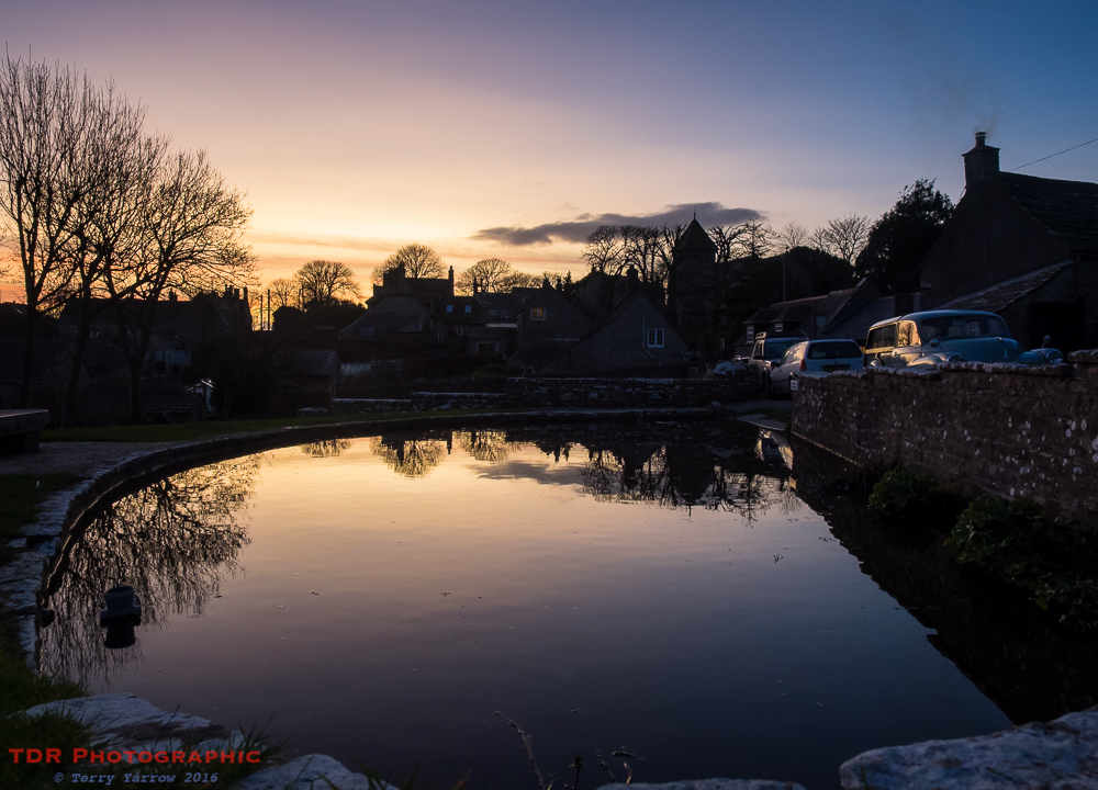
Finally I left the coast behind and with the sound of the waves gradually fading into the distance I made my way up the valley, once again tramping through mud, to reach Worth Matravers. I stopped to capture the last vestige of light across the duck pond that sits on the green in the heart of this picture perfect and unspoilt village. The ducks had long since gone to roost leaving the water like a mirror to reflect the sky, church and cottages, many of which are now second homes. This is another village that has to a large degree lost its working heart but it is beautiful nonetheless.
I made my way back to my starting point and to Woodhenge, now silhouetted against a beautiful late night sky. This was my starting point and it made a fitting end to a glorious day’s walking!
Thanks for joining me on this walk. I hope you have enjoyed the sights and sounds of this wonderful part of Dorset.
Thanks for stopping by.
Until next time,
Your friend The Dorset Rambler
I HAVE NOW SET UP A FACEBOOK PAGE FOR THE DORSET RAMBLER AND THERE IS A LINK ABOVE. THIS IS TO BRING TOGETHER MY THREE PASSIONS OF DORSET, WALKING/THE OUTDOORS, AND PHOTOGRAPHY. IF YOU ARE INTERESTED IN THESE OR YOU ENJOY MY BLOG, PLEASE DO ‘LIKE’ MY FACEBOOK PAGE.
If you would like to contact me, my details are on my website which is http://www.yarrowphotography.com – comments and feedback are welcomed.
All photographs, poems and words in this blog are the copyright of The Dorset Rambler and must not be reproduced without permission.

Nice Dorset blog posts great Dorset photos, I have links to famous Dorset people, but I do not reside there so it is pointless joining. Keep on rambling people, thanks for letting me look.
Hi there,
I am on the hunt for a photograph taken at dancing ledge, Swanage. It was taken on the 6th of September 2017, in the afternoon when my boyfriend and I were swimming in the rock pool by the shore. A man with a camera asked us to face away from him to pose for a photo in the pool. I have since always regretted not asking him for his email to ask him to send this photo. I know its a long shot, but it would mean the world if I could find the photograph and gift to my boyfriend as a present. If this was you, I would be so grateful to be able to buy a print off of you. If not, do you know of anyone else it could be?
Thank you so much for your time.
All the best,
Flora
Hi Flora. Sorry, as much as I would love to be able to help, I’m afraid it wasn’t me. It is a popular area with photographers. You could try the Bournemouth Echo Facebook page. Sorry I can’t help. Terry