

DAY 11 – ANGLE to TREVALLEN – 18 miles
What a difference a day makes! After two days of walking through the industrial hinterland of the Milford Haven inlet, today I walked out onto the coast path proper again – it felt like walking out of a darkened room into bright sunlight! And what a beautiful coast too, much more rugged and up and down than I had expected.
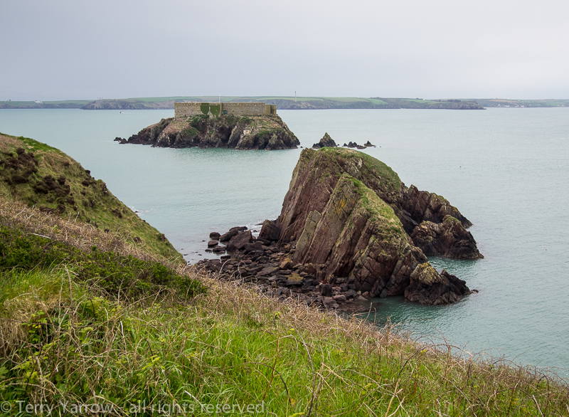
I was up and out on the trail again before 7.00am, walking initially around the Angle headland with Thorn Island just off the coast. Most of this island is taken up by another fort built in the mid 1800’s to protect Milford Haven from the French navy. After the Second World War it was converted to a rather remote hotel, with plans to link it to the mainland by cable car! It has since closed and in fact in recent years the island was put on the market for £750,000. Hmm, now where can I get my hands on three quarters of a million pounds 😉 !

After only a short walk, I dropped down into West Angle Bay on the southern side of the headland where there was one of the few signs of commercialisation in the shape of a caravan park……..but no cafe!

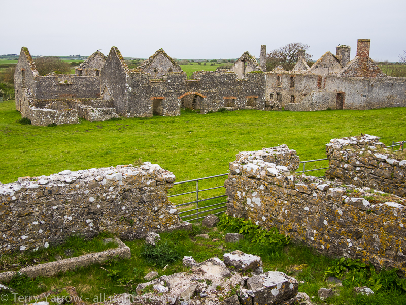
I had expected the coast to level off as I walked further south but in fact it was still very hilly with many steep climbs and descents. There were also many more remains from military activity with various gun posts etc. This just demonstrates how important the Milford Haven and Pembroke Docks area was in the 19th/20th century, and indeed still is albeit for different reasons.

Military remains
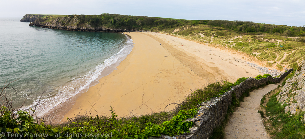
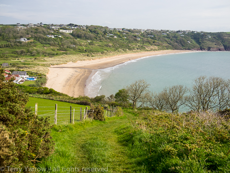
After several miles of delightful coast, I rounded a headland to be greeted by the view below. This was Freshwater West, one of those lovely open, spacious Welsh beaches favoured by surfers, with acres of sand dunes behind.


Freshwater West and the sand dunes
I walked down off the headland, through the sand dunes and out onto the road that runs around the bay and my thoughts turned to bacon sandwiches again! There was some kind of surfer gathering and I passed a busy car park but I could see no facilities……..until I finally spied a trailer cafe hiding at the end of the car park. Needless to say I made use of those facilities, sitting on the edge of the beach with one of the best bacon baps I have tasted and cup of tea 🙂 ! It was still a little overcast and breezy but it was still lovely sat there looking out across the bay.

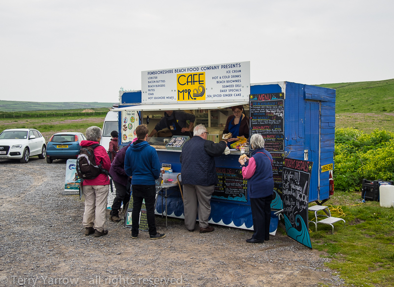
A bacon bap and cuppa at Freshwater West 🙂
Freshwater West sits just north of the Castlemartin Firing Range so permitted footpaths south of here are limited. I followed the road for a couple of miles to reach Castlemartin village where I passed another cafe, this time in a village hall. I stopped for tea and cake………well a man has to have dessert :)! It gave me the opportunity to charge my phone as well. Passing the old circular village pound which has creatively been turned into a roundabout, I continued to walk along the road for a few more miles, passing a girl sat in her car at a layby. She wound down the window to say hi and we got talking – she explained why she was there.
Apparently one year previously she had been walking the Welsh Coast Path and slipped on the wet surface, sliding down the steep slope and only coming to a stop with her legs hanging over the cliffs with a sheer drop below. She managed to scramble out of her precarious situation and was now revisiting the area on the anniversary of what could have been a disastrous event as a kind of thank you for being alive!
We said our goodbyes and I continued on my way through the firing range, heading for the cliff tops again, and I took a short detour to look at the deserted hamlet of Flimston with its preserved church.
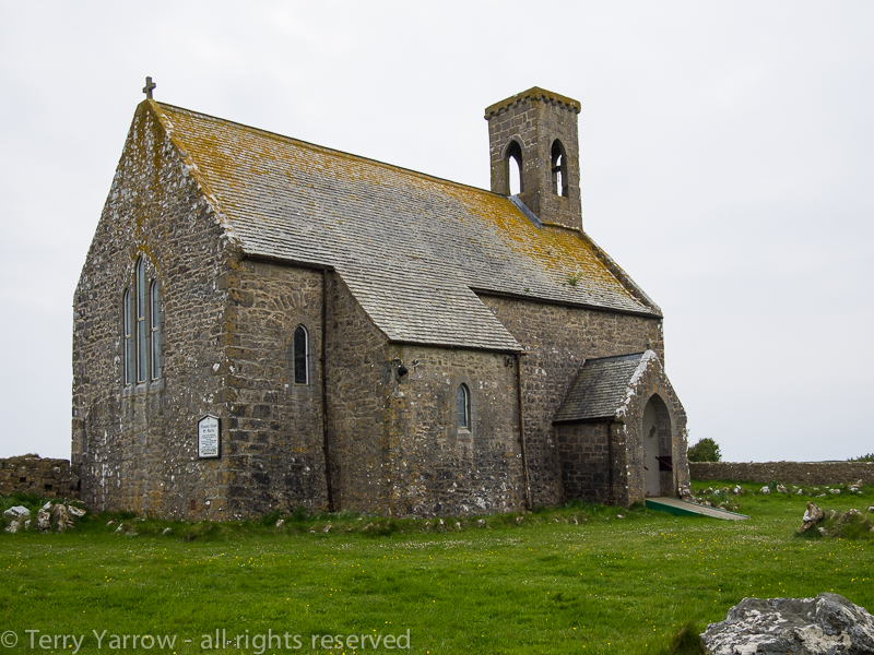
The deserted village of Flimston with its preserved church
Flimston was once a working village with its own community but it became a ghost village when the whole area was taken over by the army to be used as a practice firing range. Today the houses and cottages are all derelict but fortunately the church has been preserved. Occasional services are still held there but disappointingly the church was locked so I was unable to look inside.
Finally, after several miles of road walking, I reached the coast path again at Stack Rocks which as the name suggests are rock stacks standing just off the coast. These were completely covered with nesting guillemots and razor bills making a huge din! I heard them long before I saw them!

Stack Rocks, a haven for Razorbills and Guillemots
Nearby was probably the most photographed feature in Pembrokeshire, The Green Bridge of Wales, a natural limestone arch created by the erosion of the sea. Ultimately, the arch itself will collapse and another ‘Stack Rock’ will result.

The Green Bridge of Wales
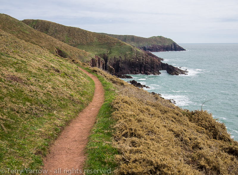
The cliffs along this part of the coast are full of crags, narrow cracks, gullies, caves and inlets so this is a fabulous part to walk as there are so many rock features to admire and explore. In many ways, the army does this coast a favour by helping to preserve the whole area for wildlife, albeit at the expense of human access. This hasn’t always been the case as the cliffs actually provided a dwelling for one famous ancestor. St Govan, born around 500AD, was an Irish monk who lived in a small cave in the cliffs for many years. There are various suggestions as to who he was, and one story suggests that he was being set upon by pirates when a fissure opened up in the cliffs, enabling him to hide and thus escape capture. He then decided to make that fissure his home.
The little chapel in the picture below was built over the fissure in the 13th century and St Govan is said to be buried beneath it. There are all kinds of stories told about the area, such as the number of steps down the cliff face to the chapel varies depending on whether you are going up or down, and that if you tap a certain rock you will hear the chapel bell chime! Just below the chapel is St Govan’s Well, now dried up, and beyond that is the open sea. The history of this place, whether the stories are true or false, is fascinating and it is a very beautiful place that I could have lingered at for a very long time.

St Govan’s Chapel
In fact, when I was planning my walk, I had thought that I might stay overnight in the chapel until I realised it was in the middle of a firing range! Discretion being the better part of valour, I decided instead to stay at a nearby campsite.
What a great day; great walking, fabulous scenery, good weather, some good food……….and dry feet! I haven’t had the last mentioned for some days!
DAY 12 – TREVALLEN to PENALLY – 16 miles
Once again I was up at 5.30 and out on the trail well before 7.00am. It was a cloudy but bright start to the day as I dropped down off the headland to the beautiful Broad Haven beach, looking very unspoilt and untrodden in the early morning light.

Broad Haven with Stackpole Warren beyond
My route took me across the pristine beach and I turned to take a rather cliched picture of my footprints in the sand. Last night’s camp was on the headland in the picture below.

My footprints on Broad Haven beach 🙂
I followed the coast path over Stackpole Warren and round Stackpole Head and very soon dropped down into Barafundle Bay, said to be one of the best beaches in the world, indeed it has been given various accolades over the years. It is totally unspoilt, having no roads and being accessible only on foot. Once the private beach of the Cawdor family of Stackpole Court – you can just imagine the wealthy ladies in their flowing gowns and parasols walking down the steps through the arch at the top, with the servants coming behind carrying the picnic.

The beautiful Barafundle Beach
Continuing round the coast, I reached Stackpole Quay, also built by Lord Cawdor in the 1700’s, and where I knew there was a cafe……..and hopefully breakfast, but I was to be disappointed as it didn’t open till 10.00am! I made do with a chocolate bar and continued on my way!

Stackpole Quay
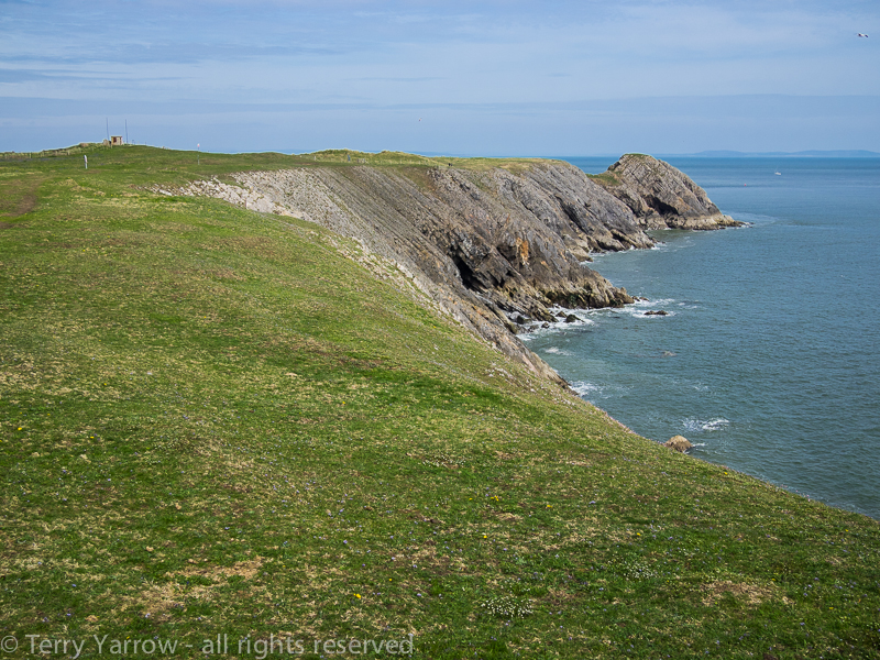
The scenery continued to be awesome as the rock changed from Old Red Sandstone to the Carboniferous Limestone of the south. With the changing colours of the rock and the bright yellow of the rape fields, the coast was too photogenic to miss and I stopped for some more pictures.


The photogenic Pembrokeshire Coast
I continued to Freshwater East, another delightful Pembrokeshire beach, backed by more beautiful sand dunes, and more holiday homes! I walked across the beach and climbed up through the dunes onto the headland beyond.
Freshwater East
The coast path continued to rise and fall constantly around more headlands, beaches and inlets and ultimately I reached Manorbier Bay with its Norman castle standing proud some way inland. I sat on the beach and ate my lunch beside the stream that empties into the bay, serenaded by the trickling water.

Manorbier Bay
Continuing round the next headland, the path once again took a slight detour inland, passing around Manorbier Camp, another firing range. In some ways, this was a welcome detour as the path across the headland was at least a bit flatter than the coast path had been. The coast here was amazing, with a lovely path to walk and fantastic vertical rock strata. It was just beautiful!

A beautiful path and amazing rock strata
Having circumvented the firing range, I returned to the cliff tops and very soon found myself at Lydstep Haven, one of the few commercialised parts of the coast path with a massive holiday park along the coast above the beach. I didn’t linger, although I did make use of the camp shop to stock up on food.
From Lydstep, the walk became a little easier, but also posed one of those conundrums as there are two routes into Penally, my stopping point for the night. The direct path would take me just a short distance into the town, but the ‘true’ coast path would take me an extra two miles round the tip of the Giltar Point headland – being a purist, I chose the latter.
Giltar Point
After nearly 17 miles, it was a relief to walk the downhill path into Penally where I found my campsite. It was a relief too to find out that they had showers (well one shower actually) – my last two camps had none! After ‘freshening up’ I felt more human and I walked to the local pub to recharge my battery, and also my mobile phone battery that had died during the day.
That night I lay in my tent with a feeling of great satisfaction. I had now walked some 180 miles and tomorrow, a short walk of 10 miles would bring me to the finishing point of the walk at Amroth. I dropped off to sleep wondering how I would feel as walked that final leg with the finish in sight!
Thanks for stopping by.
Until next time,
Your friend
The Dorset Rambler.
If you would like to contact me, my details are on my website which is http://www.yarrowphotography.com – comments and feedback are welcomed.
All photographs, poems and words in this blog are the copyright of The Dorset Rambler and must not be reproduced without permission.

This is a great blog with lovely pictures but the section between Angle and Castlemartin is wrongly referred to as Freshwater East. The latter is correctly referred to later on between Stackpole and Manorbier but the beach and dunes between Angle and Castlemartin are at Freshwater West.
Thanks John, you are quite right, I have misquoted. I’ve corrected my blog. Well spotted.